1. Legal Services – Mayor Pro Tem Dyer . a) Interview with Interested Firm . b) Discussion and Possible Direction
Previously reported – May 2026 The RFQ for our Town Attorney had only one response.
Previously reported – March 2026 ISSUE/ACTION REQUESTED: Discussion and Possible Action on Legal Services
BACKGROUND/PURPOSE OF REQUEST: Attorney Moore submitted her resignation effective May 1st. In order to solicit new legal counsel, the Board would need to accept the resignation and determine the process for selection of the new attorney/firm. Staff recommends the Board direct staff to issue a Request for Proposals for Legal Services unless a different method is preferred to move forward.
The Board accepted attorney Moore’s resignation A decision was made – Approved unanimously
Previously reported – June 2025 ISSUE/ ACTION REQUESTED: Discussion and Possible Selection of Town Attorney
BACKGROUND/PURPOSE OF REQUEST: Three firms applied to provide legal services to the Town. All the firms have been interviewed
They interviewed three (3) law firms and chose to select the Town Attorney by ballot. They selected Moore Law firm was selected to provide legal services to the Town. Sydnee Moore our interim Town Attorney will remain as the Town Attorney.
Update – The Board interviewed Brough Law Firm to review its proposal for legal services. During the discussion, it was noted that the firm had also interviewed with the Board approximately two years earlier. The firm stated that it currently represents Southport and Oak Island and expressed the view that those representations would not create a conflict of interest. Brough Law Firm emphasized that it would provide access to a team of attorneys, offering the Board a broader range of legal support and availability. It was also encouraging that all Board members participated in the discussion. By consensus, the Board directed staff to bring back a letter of engagement for consideration at the next regular meeting.
BOC’s Special Meeting 06/04/26
Board of Commissioners’ Agenda Packet » click here
Proposed Budget by Fund 2023 2024 2025 2026 General $5,169,737 $4,736,246 $4,802,398 $6,350,726 Water & Sewer $8,007,682 $7,665,209 $2,873,651 $2,929,275 Water & Sewer Capital Charge NA $1,482,145 $1,352,662 $3,529,111 BPART $6,274,144 $6,239,679 $5,757,489 $5,079,590 Canal Dredging $3,370,912 $3,553,603 $4,889,843 $5,252,474 FEMA Capital Projects Fund $73,644,019 NA NA NA Water Capital Reserve Fund $212,571 $244,674 $303,056 $363,056 Sewer Capital Reserve Fund $358,063 $579,461 $675,440 $805,440 Beach & Inlet Reserve Fund $1,375,110 $1,744,053 $6,507,152 $9,456,538 Capital Project NA NA $4,581,336 NA Total All Funds $98,412,238 $26,245,070 $31,743,027 $33,766,210
The General Fund budget serves to fund daily and long-term operations and infrastructure of the town. This includes administration, police department, building and inspections as well as sanitation and streets.
The Water and Sewer Fund is an Enterprise (business type) fund that finances the daily administration and operations of the water and sewer department.
The Beach, Parks, Access and Recreation Tourism Fund (BPART) is a special revenue fund enabled by local legislation for the purpose of providing for beach nourishment and tourism related expenses.
The Canal Dredging Fund is also a special revenue fund authorized by local legislation. Its purpose is to maintain navigability of the islands’ twenty-five thousand linear feet of canals
The FEMA Capital Projects Fund serves to provide pass through federal grant reimbursements for debt service on storm damage repairs performed during the winter of 2021/2022 along the central portion of the island’s beach
The Water Capital Reserve and the Sewer Capital Reserve Funds were established in accordance with the Water and Sewer System Development Fee Act of2017 as amended and will be used to fund capital improvements to the Town’s water /sewer infrastructure in the coming years.
The Beach Re-nourishment and Inlet Management Capital Reserve Fund provides funding for future year beach and inlet maintenance projects.
The Capital Project Fund/Sewer Lift Station Project Fund is required to be established by the grants that will remain open across budget years until the project is complete.
Main Points
The total budget is $33,766,210 and provides for the following initiatives to improve or maintain service delivery:
Proposed tax rate is fourteen cents: no change from prior year
Satisfies all debt service and capital obligations
Focuses on high quality infrastructure
Continues the annual streets resurfacing program
Plans for a canal dredging event
Allocates 3% COLA/2.5% merit for personnel
The proposed budget sets forth four main governmental funds (General; Water & Sewer; Beach, Parks, Access, and Recreation Tourism (BPART); and Canal Dredging). Additionally, it outlines three Capital Reserve Funds and one Capital Project Fund. Each fund is represented in the following pages with detailed revenues and expenditures proposed for the upcoming fiscal year.
The following document presents the proposed annual budget for the upcoming fiscal year beginning July 1, 2026 and ending June 30, 2027, in accordance with the Local Government Budget and Fiscal Control Act. The document shows a balanced budget that totals $33,766,210. It is meant to serve the public in understanding the Town’s spending plan for next fiscal year and the process by which it was developed.
Conclusion
The proposed budget is the Town’s spending plan for the next fiscal year that specifically aligns with the targeted budget priority areas outlined earlier in this document and with the commissioners’ stated Goals and Objectives for the fiscal year. It requires collaboration and open communication between staff, elected officials, and the public. The plan positions us to face the unknown challenges that come from market variability. The budget is balanced with revenues equaling expenditures as required by the Local Government Budget and Fiscal Control Act and focuses on meeting obligations while advancing goals. Administration thanks all involved in its preparation and looks forward to moving toward adoption.
Update – The Board reviewed and reached agreement on the submitted budget. The next step is the Public Hearing.
Editor’s note –
Part-Time Police Officer Positions
The proposed budget would add four part-time police officer positions at no additional cost by shifting funds from overtime.
Holden Beach is an approximately 8-mile barrier island with about 2,486 housing units and 917 permanent residents. Its Police Department is staffed with 12 full-time officers, no part-time officers, and 7 beach rangers.
Ocean Isle Beach is an approximately 7- to 8-mile barrier island with about 3,200 housing units and 903 permanent residents. Its Police Department has a stronger staffing model, with 16 full-time officers, 3 part-time officers, and more than 10 seasonal beach patrol officers, giving it broader coverage and greater flexibility to serve residents and visitors.
Given these differences in staffing and coverage, which department appears better equipped to provide the safest and most welcoming environment for everyone?
For those keeping score at home,
HB has 19 staff members, while OIB takes the lead with 29.
Holden Beach maintains tax rate in proposed budget The town of Holden Beach has set a public hearing date of June 16 at 5 p.m. for its proposed $33,766,210 fiscal year 2026-2027 budget, which will keep the property tax rate at $.14 per $100 value and increase the base rate for water usage by $3.50.The Holden Beach Board of Commissioners met for budget workshops four times this spring to determine goals, objectives, revenues and expenditures. During its June 4 special meeting, Town Manager Bryan Chadwick presented the budget message. “Your goals are to address Block Q area planning and construction,” Chadwick said, “to evaluate parking options, to further explore stormwater project construction, to explore future capital improvement spending and to focus on employee retention. The budget priority areas were high-quality infrastructure, community improvements, accessibility and strategic capital investment.” The proposed FY 26-27 budget includes, among other expenditures, a new part-time police officer program, funding for pier property planning and a 3% cost of living adjustment (COLA) for town employees. The town’s general fund revenue for the next fiscal year is expected to match general fund expenditures at $6,350,726, which is $1,548,328 more than in the fiscal year 2025-2026. Of that revenue, $3,421,653 is projected to come from ad valorem (property) taxes, an $86,375 increase from the FY 25-26 budget. The largest chunk of the town’s general fund expenditures, $2,199,323, is allocated for public works. The department has allocated $1.5 million for a phased stormwater initiative. The federal government will cover 75% of that project’s cost through a grant. This $1,125,000 in revenue from the federal government accounts for the majority of the increase in the general fund revenue compared to FY 25-26. The second largest general fund expenditure, $1,840,965, is for the police department. The proposed budget adds four part-time police officer positions, which Police Chief Steven Barger said would help cover special events, holidays and staffing shortages without relying as heavily on overtime. Chadwick said the positions can be funded within the department’s existing budget by shifting funding from overtime. The proposed FY 26-27 budget allocates $65,000 for overtime pay, down from $105,951 in FY 25-26. “All of our folks who were supposed to be off were forced to work the [NC Festival by the Sea],” Barger said, “because we had a couple thousand extra people here. It’s creating burnout.” Barger said the part-time officers would provide additional staffing during busy periods like festivals and holiday weekends, helping reduce employee burnout and allowing the department to maintain coverage when officers are on leave. The proposed budget also accounts for a reduction in parking revenue compared to the current fiscal year. The board came to the consensus that the town will not charge for parking during the months of November and December, resulting in an $89,755 projected decrease in revenue. Revenue from paid parking goes to the beach, parks, access and recreation tourism (BPART) fund. BPART fund revenues, designated for beach preservation and tourism related expenses, are projected to match expenditures at $5,079,590. The projected FY 26-27 BPART revenue is $677,908 less than last fiscal year’s total of $5,757,489. Projected BPART expenditures include $308,000 for operations, maintenance and repair of the Tri-Beach Fire Department substation on Starfish Drive. It also includes a $500,000 transfer to the beach and inlet capital reserve fund, and $85,000 for Block Q projects and professional services. Finance Director Daniel McRainey said the town currently owes roughly $2.8 million in total debt service on the pier property. The board decided to allocate $250,000 in the FY 26-27 budget for pier-related professional services. The town recently issued a request for proposals to conduct an underwater study of the pier structure. With a due date of June 10, the board will likely review the proposals and approve a contract soon after. The $250,000 will cover the underwater study and any future work stemming from its findings, Assistant Town Manager Christy Ferguson said. Planning and inspections department expenditures, $529,757, are projected to increase $21,271 from last fiscal year’s total of $508,489. This is due to incentive increases for achieving training certificate levels and an increase in the gas, oil and tires line to account for market fluctuations, the budget message states. Sanitation expenses are projected to cost $242,147 in FY 26-27, a $5,305 increase from FY 25-26’s projected cost of $236,842. The base rate for monthly water usage will increase from $26.62 in FY 25-26 to $30.12 in FY 26-27. Read more » click here
BOC’s Public Hearing / Regular Meeting 06/16/26
Board of Commissioners’ Agenda Packet » click here
THB Newsletter (05/29/26) TOWN OF HOLDEN BEACH OFFICIAL NOTICE FY – 2026/2027 BUDGET / JUNE 16, 2026
Notice is hereby given that the Budget proposed for the Fiscal Year beginning July 1, 2026 and ending June 30, 2027, has been submitted to the Board of Commissioners and is available for public inspection online at https://hbtownhall.com/.
A public hearing on the proposed Budget will be held by the Board of Commissioners at 5:00 p.m. or shortly thereafter on Tuesday, June 16, 2026 in the Holden Beach Town Hall Public Assembly, 110 Rothschild Street. Oral and written comments will be received at the hearing from any interested person.
The Town of Holden Beach does not discriminate on the basis of disability. If you need an auxiliary aid or service or other accommodation in order to attend or fully participate at this meeting, please contact the Town Hall as far in advance of the meeting as is possible so that your request may be considered.
A public hearing on the proposed budget for 2026 – 2027 was held. Highlights include: maintaining the current tax rate of 14 cents per $100; purchasing three patrol vehicles for the Police Department and one vehicle for the Water/Sewer Department; funding for 3% cost of living adjustment and 2.5% merit pool for personnel; plans for a canal dredging event; engineering designs and construction for a phased stormwater initiative; a base rate increase on the water side of $3.50 for future capital project spending; and funding to begin design of a fire department and work at the pier property.
Update – The Board is required to hold a Public Hearing prior to adopting the budget. The $33.8million dollar budget as presented reflects budget meeting dialogues, is balanced as required by the Local Government Budget & Fiscal Control Act and is scheduled to be considered by the BOC’s later on tonight’s agenda. Town Manager Chadwick briefly presented the highlights of the proposed budget and is scheduled to be considered by the BOC’s later on tonight’s agenda.. The public was given an opportunity to comment but there were no comments made.
2. Discussion and Possible Action on Ordinance 26-03, The Revenues and Appropriations Ordinance for Fiscal Year 2026 – 2027 – Town Manager Chadwick
Agenda Packet – pages27 – 56
ISSUE/ACTION REQUESTED: Discussion and Possible Approval of Ordinance 26-03, The Revenues and Appropriations Ordinance for Fiscal Year 2026- 2027
BACKGROUND/PURPOSE OF REQUEST: Ordinance 26-03 is presented for the Board’s consideration. Highlights of the proposed budget include an ad valorem tax rate of fourteen cents per one hundred dollars; a part time officer program for the Police Department; and a $3.50 increase on the water base rate to plan for future needs. The budget also takes into account a reduction in parking revenue predicated on the Board’s discussion of allowing two months of free parking . An amendment to the fee schedule and a contract amendment with Otto Connect will be presented at a future meeting for the Board’s consideration.
Update – The Board is required to hold a Public Hearing prior to adopting the budget. A public hearing on the budget for fiscal year 2026 – 2027 was held prior to the BOC’s Regular Meeting. State law defines an annual budget as “a proposed plan for raising and spending money for specified programs, functions, activities or objectives during a fiscal year.” Local governments must balance their budget. Ensuring that government commitments are in line with available resources is an essential element of good governance. The proposed budget balanced with revenues equaling expenses. Commissioners must adopt the budget no later than July 1st for the next fiscal year. Adopting the annual budget is a primary responsibility of the Board. BOC’s approved the amended town’s budget ordinance for the upcoming fiscal year. The BOC’s approved the town’s $33,766,210 budget ordinance as submitted for the upcoming fiscal year.
A decision was made – Approved (4-1) Commissioner Myers opposed the motion
The average Cost-of-Living Adjustment (COLA) for North Carolina municipal and local government employees is 2.9% for the 2026-2027 fiscal year. This figure represents a slight decrease from previous years, continuing a downward trend toward pre-pandemic norms. Additionally, only 41.7% of the municipalities plan to offer both a COLA and merit increases, with a combined total average of 6.06%.
Holden Beach budgeted for a 4% COLA and a 2.5% merit increase for a total of6.5%
Following discussion regarding the need to recognize the approximately $1.2 million expected to be returned by Brunswick County for Central Reach during the fiscal year, Commissioner Myers expressed concern that the proposed budget did not account for those funds. Commissioner Myers, a retired CPA, stated that he could not support a budget that knowingly omits the anticipated return of the Central Reach Interlocal Agreement deposit, which he believed should be reflected in the Town’s FY 2026/27 budget. He considered the intentional omission of more than $1 million, together with the apparent disregard for North Carolina’s Local Government Budget and Fiscal Control Act, to be a serious concern that could place his CPA license at risk—a risk he was unwilling to accept. Since he is the only financial professional on the Board, it was disappointing that the Board did not give greater weight to his concerns.
Budget Treatment of Central Reach Interlocal Agreement Deposit The anticipated return of the Central Reach Interlocal Agreement deposit from Brunswick County should have been included in the Town’s FY 2026/27 budget. In 2016, the Town borrowed approximately $12 million to help fund the Central Reach beach nourishment project. Because the project involved placing sand on the beach, there was no traditional physical collateral for the loan. To support the financing, Brunswick County agreed under an Interlocal Agreement to guarantee the Town’s annual debt service. In return, the Town deposited $1,461,600 with the County, an amount equal to the largest single year’s debt service payment, to be held as security in the event of a missed payment. The money has remained a Town asset and has been reported in audited financial statements as “Deposit – Brunswick County Interlocal Agreement.” As the debt has been paid down, the County has returned excess amounts to the Town. The current remaining balance is approximately $1.18 million. The final debt payment is due in October 2026. Once that payment is made, the loan will be retired, the County’s guarantee obligation will end, and the remaining reserve will be contractually required to be returned to the Town under the Interlocal Agreement. The Interlocal Agreement Section 4.3 states: Any of the Reserve Amount remaining on the date that the Town is required to make the final payment on the Special Obligation Bonds will be returned by the County to the Town for the Town’s use in making such a final payment. Brunswick County has approved this payment in their 2026-27 budget, adding even more certainty that the money will be sent to the Town. The Holden Beach FY 2026/27 budget does not reflect receipt of these funds. That omission is difficult to justify because the funds are the Town’s own money, are already identified in audited financial statements, and are expected to become available during the fiscal year. The receipt is also more certain than grant revenues already included in the budget. Under North Carolina’s Local Government Budget and Fiscal Control Act (G.S. Chapter 159), the budget ordinance must include all anticipated revenues and appropriations for the fiscal year.Excluding a known, material receipt creates a transparency concern, particularly when less certain grant revenues are already included in the budget. A budget that knowingly omits a near-certain, material cash receipt, one that is already an identified asset on our audited balance sheet, is an incomplete budget. The Town can address this issue by including the anticipated return of the deposit in the FY 2026/27 budget as a revenue line, such as “Return of Restricted Deposit – Central Reach Interlocal Agreement.” A corresponding appropriation should also show how the Board intends to use the funds. The Capital Improvement Plan already identifies these funds for the Beach and Inlet Reserve Fund in FY 2027/28. Because the receipt is expected in FY 2026/27, the related revenue and appropriation should be moved into the FY 2026/27 budget. If timing changes, the budget can be amended accordingly. Including the anticipated return of the Central Reach deposit would provide the public and the Board with a complete view of expected resources and ensure the budget accurately reflects the Town’s financial position.
3. Discussion and Possible Approval of Resolution 26-06, Resolution Amending the Town of Holden Beach Fee Schedule– Town Clerk Finnell
ISSUE/ACTION REQUESTED: Discussion and Possible Approval of Resolution 26-06, Resolution Amending the Holden Beach Fee Schedule (Water Base Rate and other fees)
BACKGROUND/PURPOSE OF REQUEST: Increased water revenues are needed to offset increased expenses. Based on research, comparative analysis of neighboring municipalities and feedback from the Board, an increase of $3.50 is proposed, increasing the water base charge to $26.22 per month. Other service fees as attached are proposed to be amended. The Holden Beach Fee Schedule needs to be updated to reflect the proposed changes.
Update – The Resolution updates the Holden Beach Fee Schedule to reflect the new water base rate charge. The increase in the water base rate charge was approved as submitted.
A decision was made – Approved unanimously
4. Discussion and Possible Approval of Ordinance 26-04, An Ordinance Amending the Holden Beach Code of Ordinances, Title VII: Traffic Code – Town Manager Chadwick
ISSUE/ACTION REQUESTED: Discussion and Possible Approval of Ordinance 26-04, An Ordinance Amending the Holden Beach Code of Ordinances, Title VII: Traffic Code
BACKGROUND/PURPOSE OF REQUEST:
To address concerns received from Otto Connect and observed by the police department about individuals taking advantage of the new parking spaces at the Block Q restroom for beach
To make a change in the ordinance to accommodate Board of Commissioners’ future actions on when paid parking is required, based on an annual
In preparing this update, additional items where identified that should also be updated. Explanations are included in line with each recommendation.
SHORT-TERM PARKING AREA. A parking lot, space or other area designated by the Town as a location for short-term fee free parking. A designation for these purposes shall be indicated with installation of official signage indicating the allowed term and/or time restriction.(Allows designation of parking areas fee free for restroom facilities, etc.)
Update – The proposed changes primarily address the short-term parking spaces at the Block Q restroom facility. Additional wording was also cleaned up and modified for clarity. Overall, this is primarily a housekeeping item. The Board approved the item as submitted.
A decision was made – Approved unanimously
5. Discussion and Possible Scheduling of a Date to Hold Interviews for Vacancies on Town Boards – Town Clerk Finnell
Agenda Packet – pages69 – 73
ISSUE/ACTION REQUESTED: Discussion and Possible Scheduling of a Date to Hold Interviews for Town Boards
BACKGROUND/PURPOSE OF REQUEST: There are terms expiring on Town boards in July, I recommend the Board hold interviews on Tuesday, July 21st at 4:45 p.m. for people interested in filling the vacant terms. Attached are the lists of current members and their terms.
Update – Heather indicated that some Boards would have vacancies and they will need to hold interviews. The Board agreed by consensus to hold interviews to fill the vacancies before the next BOC’s Regular July meeting.
A decision was made – Approved unanimously
Volunteers needed Are you interested in serving on a Town board? The Town has vacancies on the Board of Adjustment, Planning & Zoning Board, the Parks & Recreation Advisory Board and the Audit Committee. Click here to view information on these boards.
Interviews for vacancies will be held on Tuesday, July 21st at 4:45 p.m. Click here to access an application if you are interested in applying to serve. Completed applications can be emailed to heather@hbtownhall.com or dropped off at Town Hall prior to July 10th.
6. Discussion and Possible Approval of Memorandum of Understanding Between the Town and Brough Law Firm – Town Clerk Finnell
Agenda Packet – pages74 – 79
ISSUE/ACTION REQUESTED: Discussion and Possible Approval of Memorandum of Understanding Between the Town and Brough Law Firm
BACKGROUND/PURPOSE OF REQUEST: The Brough Law Firm has provided a Memorandum of Understanding as a result of their interview with the Board at the June 4th meeting. They are proposing that Brady Herman will serve as Deputy Town Attorney, rather than Bob Hornik, who was originally identified as the Deputy Town Attorney in their initial RFP response. If the Board would like to select the Brough Law Firm as the Town’s attorney, the suggested motion is to approve the Memorandum of Understanding.
Update – Approval of the Memorandum of Understanding between the Town and Brough Law Firm. Town Manager Chadwick requested that we retain our current Town Attorney until several loose ends have been resolved.
A decision was made – Approved unanimously
This Board pushed out Town Attorney Sydnee Moore because she did not give them the answers they wanted. With only one interested law firm, the Town will move from paying $250 per hour to $1,350 per meeting. Therefore, we will be raising our annual professional services costs by roughly $10,000.Brilliant!
7. Discussion and Possible Action on Responses for an Engineering Firm to Perform an Underwater Study for the Holden Beach Pier – Town Manager Chadwick
ISSUE/ACTION REQUESTED: Discussion and possible action on responses for an engineering firm to perform an underwater study for the pier.
BACKGROUND/PURPOSE OF REQUEST: The Town issued an RFQ for engineering services to perform an underwater inspection of the below substructure elements of the Town pier. The RFQs were submitted on June I 0, 2026 and are included with the agenda packet. Staff will review and have a recommendation at the meeting.
Previously reported – March 2025 HDR Executive Summary » click here
Previously reported – April 2025 HDR Condition Assessment » click here
Update – After reviewing the qualifications, the Board selected MidAtlantic Engineering Firm to assess the underwater structure, including the pilings, of the pier. Commissioner Myers noted that this represents a shift from the previous plan to build a new pier to repairing the existing pier. He reminded the Board that HDR Engineering Firm had previously advised that, over the long term, repairs could be more costly. Commissioner Smith stated that the objective is to determine the condition of the pier pilings and the estimated cost of repairs so the Board can decide how to proceed.
A decision was made – Approved (4-1) Commissioner Myers opposed the motion
Editor’s note – A Request for Qualifications (RFQ) is a document that asks potential suppliers or vendors to detail their background and experience providing a specific good or service. In this case, the buyer is only concerned about the vendor’s skills and experience. Professionals responding will be selected solely based on their qualifications and not on price. Once a firm is selected the Town will negotiate a contract for the desired services. Therefore, the response is not a bid.
The HDR report clearly concludes that repairing the existing pier is not cost-effective. The structure has reached the end of its useful life, so any repairs would be temporary while still requiring substantial upfront and ongoing maintenance costs. From a fiscal responsibility standpoint, investing significant funds in a structure that will need continual repairs and eventual replacement is difficult to justify and risks throwing good money after bad. HDR made a strong effort to explain to the Board why repairs are not in the Town’s best interest. This is not only a financial issue: on five separate occasions, public input has shown insufficient support for a pier. Ignoring both the financial realities and repeated public feedback raises serious concerns about priorities and decision-making. Although other funding sources continue to be discussed, no funding has been identified to repair or replace the pier under either option.
Holden Beach solicits underwater pier study The Holden Beach Board of Commissioners is taking another step in evaluating the future of the town pier, voting April 21 to move forward with an underwater study of the structure’s pilings. The pier property has been one of if not the most contentious topic of debate in town hall since the town bought it in 2022. It currently sits bare of any building, and the pier is closed to the public because of its instability. While some residents want to have a functioning pier back at all costs, others would rather focus on public safety and infrastructure projects, like building a fire station on the island. The current board is now tasked with navigating those competing priorities while trying to determine what is both financially and structurally feasible. The board during its April 10 special meeting discussed the project with staff, HDR Senior Engineer Bill Kincannon and HDR Project Manager Will Fuller. Some commissioners expressed desire to solicit realistic cost estimates of both repair and replacement options. HDR had been contracted in early 2025 to evaluate both repair and reconstruction options, including preliminary designs and cost estimates. However, after an initial structural inspection, the firm recommended against pursuing repairs, stating they were unlikely to be cost-effective compared to rebuilding, Fuller said. “Not that it is not possible,” Fuller said, “but it is not going to be cost-effective.” That recommendation led the town to halt further repair analysis at the time and focus instead on reconstruction concepts. It asked HDR to give a not-to-exceed cost estimate for the purpose of a referendum, which came out to $7.3 million. However, the engineers cautioned that the not-to-exceed estimate was partially based on speculation because of several unknowns that remain. Typically, those estimates are made much further along in the design process. Most importantly, the town has no credible study that tells what type of wood the pilings are made of, or what the condition the existing pilings are in. “You’re not really going to have a good handle on your final design until we have the underwater testing done,” Kincannon said, “and until we’ve validated the material that is out there.” Kincannon noted that even details such as how deep the pilings were driven during past repairs are unclear, which raises concerns about their structural reliability. Without that information, engineers cannot determine how much of the pier could realistically be reused or what additional work would be required, he said. Commissioner Keith Smith said that he senses an unequivocal desire for a fishing pier in the town. He wants to find out what it would cost the town for a repair and compare it to what it would realistically cost the town to replace, he said. “Until we know what the repair number is,” Smith said, “we can’t really make an educated decision that repair is better than rebuild.” Inspections Director Tim Evans echoed that concern, pointing to the possibility that some pilings could be made of green heart wood, a highly durable material commonly used in marine construction. However, he said that cannot be confirmed without testing. “Without the actual testing of the piles,” Evans said, “without us actually knowing what’s there, I think the town is risking too much.” He added that the condition of the underwater foundation is likely to be the most significant factor in determining the overall project cost. Following that discussion, the board on April 21 considered how to best obtain that information. Town Manager Bryan Chadwick presented two options: re-engaging HDR under a new contract that would include the underwater study as part of the broader scope or issuing a separate request for qualifications (RFQ) to hire an engineering firm directly for the inspection. Chadwick said using HDR would involve subcontracting the work, which could add 5% to 10% in administrative costs. Issuing an independent RFQ, he said, would allow the town to obtain the study more directly and potentially move faster. “My recommendation would be to go with the second one,” Chadwick said. Smith agreed, saying pursuing the study independently would allow the town to determine whether repairs are even feasible before committing to additional engineering work. Commissioner Tom Myers raised concerns about costs even if the pilings are found to be in good condition, noting that bringing the pier up to code could still require significant investment. “If the piles are bad, it’s no go,” Myers said. “But if piles are good, I’m still not convinced we don’t have a lot more costs involved to do all the hardware repairs and build it to code.” Ultimately, Smith made a motion to issue the RFQ for an underwater study. The motion passed by a 3-1 vote, with Myers opposed. Read more » click here
8. Discussion and Possible Approval of Resolution 26-07, Resolution Approving Conveyance of Personal Property to a Nonprofit Organization Pursuant to North Carolina General Statute 160A-280 – Town Manager Chadwick
ISSUE/ACTION REQUESTED: Discussion and Possible Approval of Resolution 26-07, Resolution Approving Conveyance of Personal Property to a Nonprofit Organization Pursuant to North Carolina General Statute 160A-280.
BACKGROUND/PURPOSE OF REQUEST: The Town would like to donate a 2014 Dodge Ram 1500 truck and a Coleman light tower that are no longer in use to the Tri-Beach Fire Department. The fire department will use the items to further their response capabilities for beach rescue and other emergency operations. The donation is allowed per NCGS 160A-280.
G.S. 160A-280 — Donations of Personal Property to Other Governmental Units Authorizes certain North Carolina cities to donate surplus, obsolete, or unused personal property to other governmental units, sister cities, or qualifying nonprofit organizations.
Update – A motion was made to donate a truck and other equipment to the Tri-Beach Fire Department for use in enhancing its beach rescue response capabilities and other emergency operations.
A decision was made – Approved unanimously
9. Town Manager Report – Town Manager Chadwick
Agenda Packet – background information was not provided
July is Parks & Recreation Month Check social media for activities scheduled throughout the month
Ocean Boulevard Stormwater McGill has finalized exiting condition survey Hydraulic modeling information and base stormwater assessment have been completed They have also done a preliminary evaluation of outlet structures
Previously reported – May 2026 Meeting is being coordinated with McGill, the USACE, and the Town
Previously reported – February 2026 Contract is included in February agenda packet
Previously reported – June 2025 The Town was awarded $2.2Min Environmental Infrastructure Disaster Relief Funding for stormwater projects. To get started USACE requires the execution of the Project Partnership Agreement. The Town portion of the 2.2 million dollar project is 25%, which would cost us $550,000. The motion was made to approve the project partnership agreement with the USACE and have the town staff execute the paperwork.
Block Q Restrooms & Parking There will be short-term free parking there Changes to parking Ordinance on agenda tonight
Previously reported – May 2026 Restrooms are finally open
Previously reported – April 2026 Certificate of Compliance has been issued
Previously reported – November 2025 Grant extension was applied for with the state and timeline has been extended
Block Q Master Plan RFQ Held kickoff meeting yesterday, June 15th Survey, stakeholder meeting, and BOC’s focus group are all scheduled
At the BOC’s September work session they will be presented with two options
Previously reported – May 2026 Contract with McGill in agenda packet, contract approved tonight
Previously reported – April 2026 Draft contract with McGill in agenda packet
Previously reported – March 2026 Staff met with McGill to narrow the scope for inclusion in contract
Previously reported – February 2026 Discussion and recommendation for a firm on agenda
Block Q Stage Area Construction in progress
Previously reported – April 2026 Work started last week on the site
Previously reported – March 2026 Request for Proposals are out for bid Bids will be returned to staff with a recommendation for approval by commissioners
Previously reported – February 2026 Final specs are completed for distribution in Request for Proposals Bids will be returned to staff with a recommendation for approval by commissioners
Resilient Coastal Communities Program (RCCP) We are in Phase 2 which includes the following: Planning, Project Identification, and Prioritization
Previously reported – May 2026 Survey is on the Town website to help identify potential projects
The Town is currently participating in the 2025 – 2026 cycle of the North Carolina Resilient Coastal Communities Program (RCCP). The RCCP is a community-based initiative that greatly benefits from involvement, engagement and feedback among local stakeholders. Click here to view details on the program.
Previously reported – April 2025 ISSUE/ACTION REQUESTED: Discussion and Possible Action regarding an application to the N.C. Resilient Coastal Communities Program for Phases 1 and 2.
Possible Action: Direct town staff to complete and submit an application for Phases 1 and 2.
BACKGROUND/PURPOSE OF REQUEST: The Resilient Coastal Communities Program (RCCP) is a component of the North Carolina Resilient Communities Program, developed through the 2020 North Carolina Climate Risk Assessment and Resilience Plan. The North Carolina Division of Coastal Management (DCM) administers the RCCP with funding from the NC State Legislature and the National Fish and Wildlife Foundation (NFWF).
DCM is accepting applications from eligible communities for no-cost technical assistance to complete Phases I and 2 of the RCCP.
Phase 1: Community Engagement and Risk & Vulnerability Assessment
Phase 2: Planning, Project Identification, and Prioritization
There is no cash or in-kind match requirement from community applicants. DCM will contract directly with third-party contractors to assist communities in completing Phases 1 and 2.
The application involves responses to 14 questions. Applications are due at 5PM on April 25th,
N.C. Resilient Coastal Communities Program »click here
The RCCP is a four-phase program designed to:
Address local barriers to coastal resilience, including limited capacity, economic constraints, and social inequities .
Assist communities in conducting risk and vulnerability assessments to create a prioritized portfolio of resilience
Advance coastal resilience projects through engineering and design to achieve shovel ready
Link communities with funding sources for project
The four phases are :
Phase 1: Community Engagement and Risk & Vulnerability Assessment
Phase 2: Planning, Project Identification, and Prioritization
Phase 3: Engineering and Design
Phase 4: Project Implementation
Update – North Carolina Division of Coastal Management is accepting applications from eligible communities for no-cost technical assistance to complete Phases I and 2 of the Resilient Coastal Communities Program. The motion was made to complete an application to Resilient Coastal Communities Program by the deadline of April 25th, if it is at all possible. A decision was made – Approved unanimously
Canal Dredging No change, still working
Previously reported – April 2026 Staff is actively working with the Corps on the cost of Dredge spoils disposal
Previously reported – March 2026 Plans are being made to dredge canals next winter
Pier Property Site RFQ responses on agenda tonight
Previously reported – May 2026 RFQ will be coming out shortly
Previously reported – April 2026 BOC at the Special Meeting asked him to review the HDR contract and see if it covers them evaluating the condition of the pilings. Bryan presented them with two options to move forward. This is a necessary step if the piles are bad the entire project would be a NO GO. The Board voted to have the Town rather than HDR send out a Request for Qualifications for an underwater engineering study of the pier pilings. A decision was made – Approved (3-1) Commissioner Myers opposed the motion
Editor’s note – A Request for Qualifications (RFQ) is a document that asks potential suppliers or vendors to detail their background and experience providing a specific good or service. In this case, the buyer is only concerned about the vendor’s skills and experience. Professionals responding will be selected solely based on their qualifications and not on price. Once a firm is selected the Town will negotiate a contract for the desired services. Therefore, the response is not a bid.
Inlet Hazard Area Staff will be attending another Coastal Resources Commission (CRC) meeting this week
Inlet Hazard Area changes is on the agenda
Previously reported – April 2026 Staff attended the recent Coastal Resources Commission (CRC) meeting and are actively involved in the discussion of possible changes to the Inlet Hazard Area
Hot Button Items / Inlet Hazard Areas For more information » click here
Dredging Area Maintenance The Corps is conducting maintenance at DA293 which is off Sailfish. Please be aware there may be work occurring in this dredge spoil area.
Previously reported – March 2026 USACE maintenance work in the inlets utilizing dredge spoil area on Sailfish
Restroom Maintenance and Cleaning Staff continues to monitor and implement changes as necessary
Previously reported – May 2026 Analyzing, trying to work it out
Previously reported – April 2026 Staff is making changes and proposing other changes to help mitigate damages and maintenance of restroom facilities
Unattended Beach Equipment Items are being left on beach strand overnight. Staff is contacting the rental property companies requesting that they educate their guests about the Ordinance.
Chapter 94 / Beach Regulations / §94.06 / Placing obstructions on the beach strand
All unattended beach equipment must be removed from the beach on a daily basis between the hours of 6:00 p.m. and 7:00 a.m.
Here’s a crazy idea –
Why don’t we try enforcement of our existing Ordinance?
Tax Laws Monitoring the proposed changes, letter sent to our representatives
Previously reported – April 2026 Staff was directed to draft a letter opposing proposed changes to property tax laws at the state level
Town Attorney Engagement letter on agenda tonight
Previously reported – May 2026 The RFQ for our Town Attorney had only one response.
Employee Updates Alyse Wade is now a Senior Patrol Officer
Public Safety Center Some Town staff attended the Alan Holden Public Safety Center dedication ceremony at Brunswick Community College
In Case You Missed It
THB Newsletter (06/18/26) OttoView by Otto Connect Just in time for peak beach season, Otto Connect, Inc. has launched a new feature designed to make parking along the coast easier and less stressful for visitors and residents alike. “OttoView by Otto Connect,” is part of the SurfCAST parking system and allows users to check parking availability in real time before heading to the beach. The feature is now available in Holden Beach. For many drivers, finding parking during busy summer weekends can be one of the most frustrating parts of a beach trip. OttoView aims to reduce congestion and save time by showing which lots have open spaces—and which do not—before users arrive. “Instead of circling for a spot, people can now see their options ahead of time and go directly to available parking,” Jim Varner (CEO) said in a statement.
Know before you go: OttoView can be accessed through the SurfCAST website
(https://park.surfcast.ottoconnect.us/), the QRcode link, and will be available soon via mobile app update (“SurfCAST by Otto”) making it easy for visitors to plan from home or on the go.
What OttoView Shows:
A map of the area and locations of all parking lots
Real-time parking availability by location
Estimated availability based on permit turnover
Directions to nearby parking areas
Filters for amenities such as restrooms, handicap spaces, and LSV parking
OttoView is fully integrated into the SurfCAST system and is available at no additional cost.
National Flood Insurance Program: Reauthorization Congress must periodically renew the NFIP’s statutory authority to operate. On February 3, 2026, the president signed legislation passed by Congress that extends the National Flood Insurance Program’s (NFIP’s) authorization to September 30, 2026.
News from Town of Holden Beach The town sends out emails of events, news, agendas, notifications and emergency information. If you would like to be added to their mailing list, please go to their web site to complete your subscription to the Holden Beach E-Newsletter. For more information » click here
What He Did Not Say
It’s the beginning of the busy season on Holden Beach
Memorial Day is the official kickoff for the 100 fun days of summer
Memorial Day is the unofficial start to summer and Labor Day is the unofficial end, from May 25th to September 7th, this year delivers the earliest and latest possible dates for both holidays.
Remind everyone it’s Hurricane Season – be prepared, have a plan!
Public Service Announcements
Remember that parking ordinances are strictly enforced, including pay-to-park requirements. Do not block the emergency beach accesses located on the far east end, at the pier, the 500 block or the 800 block. These accesses are for emergency response access, not temporary parking to unload passengers or beach equipment. Blocking accesses creates a life threatening time delay to emergency response.
The bike lines are for bikes, not Low Speed Vehicles (LSV) and not for parking. Bicyclists under the age of 16 are required to wear a helmet.
LSVs are still required to follow the same traffic laws as every other motor vehicle, including travel lane regulations and very importantly seat belt and child restraint regulations.
Pets are required to be on a leash at all times when off of your property, and no pets are allowed on the beach strand from 9:00 a.m. – 5:00 p.m.
Beach equipment must be removed daily and cannot be left overnight. Storage of beach equipment on the frontal dunes is also restricted. Items left unattended will be removed and discarded as trash.
Fireworks and pyrotechnics create a safety risk to the operator and bystanders as well as a fire hazard to the dune vegetation and houses. Fireworks are illegal on the island; possession of fireworks is a Class 2 misdemeanor which carries a maximum penalty of 60 days in jail and a $1,000 fine. If you light it, we write it.
If you know something, hear something, or see something – call 911 and let the police deal with it.
A reminder of the Town’s beach strand ordinances: …..1) Chapter 90 / Animals / §90.20 / Responsibilities of owners …….a) pets are not allowed on the beach strand except between 5p.m. and 9a.m. daily …….b) dog’s must be on a leash at all times …….c) owner’s need to clean up after their animals …..2) Chapter 94 / Beach regulations / §94.05 / Digging of holes on beach strand …….a) digging holes greater than 12 inches deep without responsible person there …….b) holes shall be filled in prior to leaving …..3) Chapter 94 / Beach regulations / §94.06 / Placing obstructions on the beach strand …….a) all unattended beach equipment must be removed daily by 6:00pm
2026 Concert Schedule The 2026 concert schedule is now available. Enjoy the sounds of summer at our FREE concert series. Concerts are held on Sundays at 6:30 p.m. throughout the summer.
Beginning May 24th and continuing through September 6th
Tide Dyed Program The Tide Dye program will be held on Tuesdays between 1:00 to 2:30 p.m. at Bridgeview Park picnic pavilion. Participants must be in line by 2:00 p.m. to participate because the process takes approximately 30 minutes to complete. Fee is $7 per shirt for youth sizes through Adult XL and $10 per shirt for 2XL. Payment via cash or check only.
.Beginning June 9th and continuing through August 11th
Turtle Talk Two programs both are held every Wednesday during the summer at the Holden Beach Chapel. Children’s Turtle Time is at 4:00 p.m. with crafts, stories and activities for children ages 3 – 6. All children must be accompanied by an adult. Turtle Talk is an educational program at 7:00 p.m. for everyone else.
Beginning June 24th and continuing through August 12th
10. Mayor’s Comments
From the Mayor’s Desk (06/01/26) Hurricane Season June 1st is the official start to the hurricane season in the Atlantic. Would your family be prepared in the event of a hurricane? Click here to visit the Emergency Information section of our website. You will find helpful tips to implement now, before the threat of a storm. Please make sure you have your vehicle decals in place now. Do not wait! These decals are necessary for re-entry to the island in the event of an emergency situation that restricts access to the island. Click here for more information on decals.
Building Numbers Safety issue Building Numbers Ordinance needs to be enforced
Alan stated that there are oceanfront homes without the required house numbers visible from the beach strand. Ocean front homes are required to have house numbers visible from the beach strand.
§157.087 BUILDING NUMBERS.
(A) The correct street number shall be clearly visible from the street on all buildings. Numbers shall be block letters, not script, and of a color clearly in contrast with that of the building and shall be a minimum of six inches in height.
(B) Beach front buildings will also have clearly visible house numbers from the strand side meeting the above criteria on size, contrast, etc. Placement shall be on vertical column supporting deck(s) or deck roof on the primary structure. For buildings with a setback of over 300 feet from the first dune line, a vertical post shall be erected aside the walkway with house numbers affixed. In all cases the numbers must be clearly visible from the strand. Other placements may be acceptable with approval of the Building Inspector.
Beach Strand Trash Receptacles Alan stated that trash on the beach strand was the WORST he had ever seen. His disappointment is understandable, but the outcome was predictable after trash cans were removed from the beach strand. The Town should reconsider this policy and restore trash cans to help keep the beach clean.
Previously reported – April 2026 Staff will be moving receptacles to the roadside of the beach accesses.This will be easier to maintain even in the middle of the day when beach access is difficult. Despite objections from Commissioner Myers the majority of the Board decided to allow them to try this.
The beaches are the economic engine of our tourism-based economy.
I strongly oppose this decision. I walk the beach strand four days a week and routinely pick up trash. Even though trash cans are out there, I typically pick up one to two bags per day this time of year, and more than three bags daily during peak tourist season. Based on this firsthand experience, I can say with confidence that reducing or removing trash cans will make an existing problem significantly worse. When trash cans are full, people leave their garbage next to them. When cans are removed, due to storm events, people continue to leave trash where the cans used to be. This behavior is consistent and predictable, and it is unlikely to change. Expecting the public to walk off the strand and up to street-level disposal points is unrealistic—they simply don’t or won’t do it. If anything, we should be making disposal easier, not more difficult. The practical solution is clear: more trash cans and more frequent pickups, especially during peak seasons. This service is currently funded through the BPART account, so cost should not be a barrier to maintaining or improving it. There are also logistical inconsistencies that need to be addressed. For example, some trash cans on the strand are located in front of oceanfront homes where there is no public beach access. What is the plan for locations like this? As it stands, this approach gives the impression that operational convenience is being prioritized over maintaining a clean and safe public environment. Additionally, the suggestion that mid-day pickups are too difficult does not reflect operational reality. Trash collection should occur early each morning on a daily basis to prevent overflow issues. With proper enforcement of ordinance (§94.06), including maintaining the required ten-foot corridor adjacent to the dunes, there should be adequate access for collection vehicles—even if a mid-day schedule is required. In short, reducing or removing trash cans will result in more trash on our beach.
Editor’s note – If you would like to share your perspective on this matter, I encourage you to reach out to the Town Manager and the Board of Commissioners. Your input is valuable and can help inform their decisions.
BOC’s Meeting The Board of Commissioners’ next Regular Meetingis scheduled on the third Tuesday of the month, July 21st
Budget Calendar The Town Manager’s proposed budget is due by June 1st Commissioners must adopt budget no later than June 30th for the next fiscal year Adopting the annual budget is a primary responsibility of the Board.
It’s not like they don’t have anything to work on …
The following five (5) items are what’s In the Works/Loose Endsqueue:
2019 – Dog Park
2021 – Pier Properties Project
2021 – Rights-of-Way
2021 – Block Q Project/Carolina Avenue
2023 – Fire Station Project
The definition of loose ends is a fragment of unfinished business or a detail that is not yet settled or explained, which is the current status of these items. All of these items were started and then put on hold, and they were never put back in the queue. This Board needs to continue working on them and move these items to closure.
.
Lost in the Sauce
.
From 2024 / Emergency Beach Access
BACKGROUND/PURPOSE OF REQUEST: Chief Todd (Tri-Beach Fire) & Chief Dixon have observed emergency access issues
Over the last couple of summers, emergency responders have noticed an increase in people using the areas around the emergency accesses for their beach equipment. More and more often we are seeing canopies, tents, towels, volleyball nets, surfboards, and other beach related equipment directly surrounding the emergency access points. This causes significant emergency response delays. During certain situations, it is not uncommon for some beach equipment to be run over by emergency vehicles as moving the equipment takes too long and no alternate routes are available. This not only increases emergency response times, but it also threatens damage to personal beach equipment and threatens damage to emergency vehicles. We are asking that the Board of Commissioners consider discussing the possibility of enacting ordinances that either prevent beach equipment within a certain distance of emergency access points, and/or ordinances which create emergency vehicle lanes on the beach strand.
Update – They were here tonight presenting an issue that needs to be addressed by the Board. They would like to prohibit blocking emergency access points by not allowing any obstructions there. In addition, they would like to have a travel lane for emergency vehicles on the beach strand. They discussed the issue and decided to benchmark off the surrounding islands policies and have the staff bring back a proposal at the next scheduled Regular Meeting.
We already have verbiage in Ordinance §94.06 that you can’t place items within ten (10) feet of the dunes. That ten (10) feet gives emergency responders a clear path along the dune line for them to go up and down the beach strand. We would just need to modify the Ordinance to prohibit blocking emergency access points.
§94.06 PLACING OBSTRUCTIONS ON THE BEACH. (A) All beach equipment must be removed from the beach by its owner or permitted user on a daily basis. All personal items and beach equipment unattended and remaining on the beach between the hours of 6:00 p.m. and 7:00 a.m. will be classified as abandoned property and shall be removed and disposed of by the town. (B) All beach equipment shall be set at least ten feet from any sea turtle nest or dune vegetation
Hurricane Season For more information » click here.
Be prepared – have a plan!
No matter what a storm outlook is for a given year, vigilance and preparedness is urged.
Prepare now as hurricane season begins, NC officials urge With this year’s Atlantic hurricane season beginning Monday, which is forecast to have below-normal activity, state officials are urging residents to prepare now for tropical weather impacts because “North Carolinians know that it takes only one storm to affect communities statewide.” Gov. Josh Stein said Monday in a press release marking the start of hurricane season that this time of year brings uncertainty for families across the state. “I encourage all North Carolinians to make a plan now to keep themselves and their families safe in case of a storm,” he explained. “Just as you prepare your family for hurricane season, the state emergency management team is preparing by closely monitoring forecasts, updating response plans, and coordinating with federal and local partners.” TheState Emergency Response Team has been preparing for the hurricane season that ends Nov. 30 by reviewing lessons learned from past storms, updating response procedures, meeting with all levels of government, coordinating with the private sector and nonprofit organizations, and conducting exercises. “Preparation is the key to resilience during hurricane season. We encourage all North Carolinians to take time to develop plans and take proactive steps with their loved ones before a storm impacts our state,” N.C. Emergency Management Director Will Ray said Monday. Ray added that preparation includes “creating evacuation plans in case you must leave your home, securing all important documentation in a waterproof container, and checking your insurance policies to make sure you are properly covered. Home and flood insurance are especially important resources in returning to normalcy after a disaster.”
Officials recommend taking the following steps to be prepared before disaster strikes:
Put together an emergency kit with up to a week’s supply of nonperishable food, including one gallon of water per person per day, and prescription and over-the-counter medication.
Be aware of any unique needs for babies, elderly, or disabled members of the household, as well as pets.
Have multiple ways to receive severe weather warnings such as a weather alert app on your phone, a battery-powered or hand-crank radio or other device and extra batteries to listen to NOAA Weather Radio, or app or radio access to local news outlets.
If you live along the coast or are planning to visit the beach this season, Know Your Zone! This is how local governments order evacuations along the coast when storm surge is a threat. Visit KnowYourZone.NC.Gov to search by address.
Establish an emergency evacuation plan and meeting point if your group becomes separated.
Have a printed list of family member’s phone numbers, social media handles, email addresses, and medical information in case mobile devices lose power or otherwise become disabled.
Have copies of important papers such as birth and adoption certificates, driver licenses, or military IDs.
Meet with your insurance agent so you know what is covered should a storm affect your neighborhood.
Prepare a full list of personal items, along with photos and videos of every room in your home, to help with insurance settlements or tax deductions.
Be sure you know how to shut off your utilities safely. Water, electricity, and gas are key services that can also cause special problems during an emergency. Do not try to turn the gas back on yourself. Call a trained expert.
The N.C. Flood Inundation Mapping and Alert Network, or FIMAN, features access over 700 flood gauges across the state. Visit Fiman.NC.Gov to search for the flood gauges closest to your home and to sign up for alerts.
To become involved in preparedness efforts where you live, officials recommend learning about schools, workplace, and neighborhood emergency plans and join in preparedness exercises and drills. Other ways include volunteering with a Community Emergency Response Team, or CERT, to learn about disaster preparedness and receive training in basic disaster response skills or contacting N.C. Volunteer Organizations Active in Disaster at ncvoad.org for more ways to help.
For more information on how to prepare for hurricane season, visit ReadyNC.Gov. Read more » click here
Brunswick County reminds community to prepare for 2026 Atlantic hurricane season June marks the start of the Atlantic hurricane season, which runs from June 1 through Nov. 30, and the National Oceanic and Atmospheric Administration (NOAA) predicts below-normal hurricane activity in the Atlantic basin this year. Brunswick County encourages all community members to start preparing now. For the 2026 Atlantic hurricane season, NOAA is forecasting a range of 8 to 14 total named storms (winds of 39 mph or higher). Of those, three to six are forecast to become hurricanes (winds of 74 mph or higher), including one to three major hurricanes (category 3, 4 or 5; with winds of 111 mph or higher). NOAA has a 70% confidence in these ranges. An average season has 14 named storms with seven hurricanes, including three major hurricanes. The alphabetical list of 2026 Atlantic hurricane names can be found at hurricanes.gov/aboutnames.shtml#atl.
Prepare for Hurricane Season with Brunswick County
To be ReadyBrunswick is to be responsible for your personal and household preparedness efforts, and to stay alert for any events that could impact you and your loved ones. During the month of June, Brunswick County will be doing a weekly countdown for hurricane preparedness. Each week will focus on different actions you and your household can take to prepare for any tropical activity that may impact the area.
Week 1 (June 7-13): Make a plan. Create and practice a Family Emergency Communication Plan that includes all members of your household and pets. Discuss your household evacuation plan for every member of the household and pets. Review your insurance policies (including flood insurance) to ensure your property is covered for any flooding or natural disasters that could occur.
Week 2 (June 14-20): Build a kit. An emergency kit is vital for your survival in situations where help might not be easily accessible due to power outages and road damage. When preparing an emergency kit, it is recommended to prepare three to seven days’ worth of medicine, water, and non-perishable food for each person and pet in your home. Make sure you store important documents physically and digitally in secure locations.
Week 3 (June 21-27): Stay informed. It’s important to plan for multiple ways you will receive credible and accurate information before, during, and after a tropical event. To get updates from Brunswick County, sign up for the ReadyBrunswick Emergency Notification System and follow Brunswick County on social media. Know the terms and categories used by weather professionals and public safety officials for tropical cyclones.
Week 4 (June 28-July 4): Practice resilience. Take time to learn how to prepare your home/property before, during, and after a storm. Know who maintains roads and how residents play a part. Practice home safety skills to protect your family and property.
For more hurricane preparedness tips from Brunswick County, visit BrunswickCountyNC.gov/hurricanes. Find information on emergency planning and hurricane safety online at ReadyNC.gov or Ready.gov. View updates from the National Hurricane Center, a real-time emergency weather map, and additional online resources at nhc.noaa.gov. Read more » click here
Brunswick County – Hurricanes Overview Hurricanes are tropical cyclones that rotate counterclockwise with wind speeds in excess of 74 mph. Most hurricanes form over warm seas near the equator. They are created when the sun heats the ocean surface, causing heated water vapor to rise, condense, and form clouds. These clouds begin to spiral as the earth rotates. More air is pulled underneath and a large vortex is formed.
On average, six Atlantic hurricanes develop each year. When a hurricane moves toward coastal areas it often causes severe damage. Strong winds create storm surges, floods, rip tides, and can even spawn tornadoes. As the hurricane moves forward, its right front quadrant is typically where the most devastation occurs.
Hurricane season begins June 1 and continues through November 30. Be sure to practice hurricane preparedness and learn about hurricane safety and survival.
To assist in being prepared before, during, and after a storm, review the following links for helpful information.
Hurricane Preparedness Tips We would like to encourage you to start preparing for emergencies and stay #ReadyBrunswick by reviewing the following tips.
NOAA predicts below-normal 2026 Atlantic hurricane season Early preparation essential to staying safe all season Forecasters with NOAA’s National Weather Service are predicting a below-normal hurricane season for the Atlantic basin this year. NOAA’s outlook for the 2026 Atlantic hurricane season, which runs June 1 to November 30, predicts a 35% chance of a near-normal season, a 10% chance of an above-normal season, and a 55% chance of a below-normal season. The agency is forecasting a total of 8-14 named storms (winds of 39 mph or higher). Of those, 3-6 are forecast to become hurricanes (winds of 74 mph or higher), including 1-3 major hurricanes (category 3, 4 or 5 with winds of 111 mph or higher). NOAA has a 70% confidence in these ranges. An average season has 14 named storms with seven hurricanes, including three major hurricanes.
“With the most advanced forecast modeling and hurricane tracking technologies, NOAA and the National Weather Service are prepared to deliver real-time storm forecasts and warnings,” said Commerce Secretary Howard Lutnick. “Our experts are integrating cutting-edge tools to ensure communities in the path of storms receive the earliest, most accurate information possible.” “NOAA’s rapid integration of advanced technology, including AI-based weather models, drones, and next-generation satellite data will deliver actionable science to safeguard the lives and livelihoods of the American people,” said NOAA Administrator Neil Jacobs, Ph.D. “These new capabilities, combined with the unmatched expertise of our National Weather Service forecasters, will produce the most accurate forecasts possible to protect communities in harm’s way.”
Key factors driving NOAA’s forecast The Atlantic season is expected to be below-normal due to competing factors. El Niño is expected to develop and intensify during the hurricane season, while ocean temperatures in the Atlantic are expected to be slightly warmer than normal and trade winds are likely weaker than average. El Niño conditions tend to support less tropical storms and hurricanes, while warmer ocean temperatures and low winds support a more active year.
“Although El Niño’s impact in the Atlantic Basin can often suppress hurricane development, there is still uncertainty in how each season will unfold,” said NOAA’s National Weather Service Director Ken Graham. “That is why it’s essential to review your hurricane preparedness plan now. It only takes one storm to make for a very bad season.” NOAA’s outlook is for overall seasonal activity based on large-scale weather and climate patterns. It does not indicate where or when any storms may affect land as that is determined by short-term and variable weather patterns is not a landfall forecast. “Preparing now for hurricane season — and not waiting for a storm to threaten — is essential for staying ahead of any storm. Visit weather.gov/safety and Ready.gov for important preparedness information,” added Graham.
New and enhanced communication products this season
NOAA’s National Hurricane Center (NHC) will implement an improved version of the tropical cyclone forecast cone graphic that will now include tropical storm and hurricane watches and warnings for inland areas for the continental United States, Hawaii, Puerto Rico and the U.S. Virgin Islands.
NHC will begin testing an experimental version of the tropical cyclone track forecast cone that will capture a greater range of possibilities for the track of the storm by incorporating uncertainties for both direction of movement and timing.
NHC will provide new products and services for the Hawaiian Islands to include storm surge watches and warnings, and a peak storm surge graphic. These will be publicly available for the main Hawaiian Islands on gov.
Advancements to hurricane analysis and forecasts
NOAA, in collaboration with the Unified Forecast System community, is testing an experimental high-resolution Seasonal Forecast System that utilizes the latest modeling technology and new methods to assess the evolution of the global ocean-atmosphere system. The system is helping forecasters better simulate tropical storms and hurricanes, and more effectively predict the number of hurricanes and major hurricanes.
NOAA’s Atlantic Oceanographic and Meteorological Laboratory (AOML) is using machine learning to quality-control data collected from tail Doppler radar — a specialized radar system mounted on the back of NOAA’s “Hurricane Hunter” aircraft. This new method gathers more than 25% more meteorological data than the current method and leads to more high-quality data to support structure and wind analysis by forecasters.
Innovative technologies for this year
NOAA’s Office of Water Prediction high-resolution Flood Inundation Mapping (FIM) services provide emergency managers visualizations of those streets and neighborhoods likely to go underwater. FIM covers 60% of the U.S. population and will expand to nearly 100% by late September 2026.
Don’t get complacent with tropical outlook; ‘it only takes one’ The below-normal activity predicted for the 2026 Atlantic hurricane season doesn’t give North Carolinians a pass on preparation this year. “For the Atlantic hurricane season, NOAA is predicting a below-normal season for 2026, with roughly a 55% chance of being below normal, a 35% chance of near normal, and a 10% chance of above normal,” National Oceanic and Atmospheric Association Administrator Dr. Neil Jacobs said during a media conference Thursday morning from NOAA’s Aircraft Operations Center at Lakeland Linder International Airport in Lakeland, Florida. “This equates to eight to 14 named storms with winds at or above 39 miles an hour. Of these, three to six hurricanes with winds at or above 74 miles an hour, and one to three major hurricanes, that’s your Category 3 to 5 with winds at or above 111 miles an hour,” he added. Jacobs is referring to the Saffir-Simpson hurricane wind scale, which categorizes maximum sustained wind speeds for tropical storms. Categories 1 and 2 are windspeeds between 74 and 110 mph, categories 3 to 5 are major hurricanes with speeds from 111 to 157 or higher, according to NOAA. Hurricane season begins Monday, June 1, and ends Nov. 30. “Even though we’re expecting a below-average season in the Atlantic, it’s very important to understand that it only takes one,” Jacobs said, adding there have been Category 5s that made landfall in the past during below-average seasons. During the news conference Thursday morning, Jacobs said that “what’s driving this forecast is largely an El Niño event. There’s a 98% chance of El Niño conditions occurring later this season, and an 80% chance that this El Niño will be moderate to strong.” NOAA National Weather Service Director Ken Graham, who spoke after Jacobs, reiterated that “it just takes one,” and urged the public during the press conference not to “let words like ‘below average’” change the way you prepare.“Now’s the time to start thinking about your hurricane preparedness,” Graham said. “Early preparedness is absolutely everything. Period. End of story. The actions that you take today really get you ready for the hurricane season.” Especially a season like this, “there’ll never be a Hurricane Just-a. We’ll never make that a name. There’s no such thing as just a Cat 1, just a tropical storm, just a Cat 2. That is absolutely not the case,” Graham said. “It doesn’t matter what it is, you got to look at the size, the forward motion, little wiggles matter on the impacts. Even the smallest storm, if it’s slow enough and big enough, it’s going to create catastrophic flooding and storm surge.” Graham said that the public needs to pay attention to every single one of the storm “systems, and the actual impacts, not the category, not the name, but the actual impacts associated with that storm, and that includes the tornadoes, heavy rain, damaging winds, even the high surf and rip currents, as well, including storm surge.” Erik Heden, warning coordination meteorologist in the National Weather Service’s Newport office, said in an interview with Coastal Review that just because the forecast calls for a below-normal season, residents shouldn’t let their guard down. “Just because the outlook says it’s going to be a low year doesn’t mean we won’t be impacted,” he said, adding “It just takes one storm. The graphic says a 55% chance below-normal year, but if we get one storm, it really doesn’t matter what the prediction was, it could be a big deal for us.” Heden also warned in the interview against making decisions based on the category of the storm. “Categories are only wind,” he said. Wind is to be respected, but the other storm impacts are more likely to be more frequent in terms of issues in our area. “Water is what kills people. About 85% of people that die in hurricanes, it’s water related — nothing to do with the wind. but it’s, it’s things like rip currents, storm surge, and flooding. Those are the three things that would get us if we get a storm.” Two years ago, the Southeast faced a potential tropical cyclone that didn’t have a name. No. 8 resulted in almost 20 inches of rain in the Wilmington area, and last year Tropical Storm Chantal produced six to 10 inches of rain in Raleigh. Steven Pfaff, meteorologist-in-charge for the National Weather Service’s Wilmington office, in an email to media partners Thursday morning, also expressed concern that the forecast for below-normal activity can cause messaging challenges because people may misinterpret what it means for any potential local impacts. “All it takes is one storm to define a hurricane season regardless of the outlook,” his emphasis, “Given southeast NC’s and northeast SC’s hurricane history our communities must prepare the same way every year,” Pfaff continued. “Now is the time to prepare for hurricane season and remain vigilant this summer and fall.” Jacobs said during the press conference that for official forecast guidance, go to hurricanes.gov. “June 1 is almost here. Be ready, have a plan, listen to your state and local emergency managers. Preparation is essential. You can learn more at ready.gov,” Jacobs added. Heden told Coastal Review that the best way to stay informed in eastern North Carolina is to remember “if it’s the weather you love, it’s weather.gov,” where there’s up-to-date information, as well as on the office’s website, Facebook or X. Read more » click here
Do you enjoy this newsletter?
Then please forward it to a friend!
Lou’s Views . HBPOIN
. • Gather and disseminate information . • Identify the issues and determine how they affect you . • Act as a watchdog . • Grass roots monthly newsletter since 2008
Held along the Waccamaw River in downtown Conway the festival celebrates Independence Day since 1980 with music and events for the entire family. For more information »click here
N.C. 4th of July Festival July 4th
Southport
The patriotic spirit of America is alive and well in the City of Southport. For over 200 years this small maritime community has celebrated our nation’s independence in a big way. Incorporated as the N.C. 4th of July Festival in 1972 the festival committee strives to keep the focus of the festival on honoring our nation’s birthday with a little fun thrownin.
For more information » click here
Battleship Blast4th of July Celebration July 4th Wilmington
. . Annual 4th of July Celebration at Riverfront Park in downtown Wilmington since 1981. Featured entertainment will perform from 6:00 PM to 9:00 PM, followed by fireworks at 9:05 PM launched from a barge in the Cape Fear River adjacent to the USS North Carolina Battleship. The only place you need to be this holiday is downtown Wilmington for the best view of fireworks. For more information » click here
Discover a wide range of things to do in the Brunswick Islands for an experience that goes beyond the beach. For more information » click here.
Calendar of Events Island
Concerts on the Coast Series The Town’s summer concert series calendar has been released! Live performances featuring local musical groups will be held at the Bridgeview Park picnic pavilion across from Town Hall. It will be on Sunday evenings at 6:30pm from May 24th to September 6th. The concerts are FREE of charge.
Beginning May 24th and continuing through September 6th
The park will be blocked from vehicular access beginning Saturday evening. The splash pad will be closed on Sundays and the multipurpose court will close at 3:00 p.m. each Sunday. No seating will be provided so everyone should bring their own chair for the event.
Meet the Holden Beach Police Dept. and the Tri-Beach Fire Dept. before the concert.
Tide Dye Tuesday Program The Tide Dye program will be held on Tuesdays between 1:00 to 2:30 p.m. at Bridgeview Park picnic pavilion. Participants must be in line by 2:00 p.m. to participatebecause the process takes approximately 30 minutes to complete. The fee is $7 per shirt for youth sizes through Adult XL and $10 per shirt for 2XL. Payment via cash or check only.
Please check Facebook on the day of the event for any inclement weather updates
Beginning June 9th and continuing through August 11th
Turtle Talk Two programs both are held every Wednesday during the summer at the Holden Beach Chapel. Children’s Turtle Time is at 4:00 p.m. with crafts, stories and activities for children ages 3 – 6. All children must be accompanied by an adult. Turtle Talk is an educational program at 7:00 p.m. for everyone else.
Beginning June 24th and continuing through August 12th
Parks & Recreation / Programs & Events For more information » click here
Pets are not allowed on the beach strand during the hours of 9am through 5pm
Dog’s need to be on a leash
Owner’s need to clean up after their animals
Bird Nesting Area NC Wildlife Commission has posted signs that say – Bird Nesting Area The signs are posted on the west end beach strand around 1335 OBW. People and dogs are supposed tostay out of the area from April through November . 1) It’s a Plover nesting area . 2) Allows migrating birds a place to land and rest without being disturbed
A Second Helping
.
Program to collect food Saturday mornings(8:00am to 10:30am) during the summer at the Beach Mart on the Causeway. . 1) Twenty-second year of the program . 2) Food collections have now exceeded 317,000 pounds . 3) Collections will begin on Memorial Day weekend . 4) Food is distributed to the needy in Brunswick County For more information »click here . Hunger exists everywhere in this country; join them in the fight to help end hunger in Brunswick County. Cash donations are gratefully accepted. One hundred percent (100%)of these cash donations are used to buy more food. You can be assured that the money will be very well spent.
Mail Donations to: A Second Helping
% Sharon United Methodist Church 2030 Holden Beach Road
Supply, NC 28462
News from Town of Holden Beach
The town sends out emails of events, news, agendas, notifications, and emergency information. If you would like to be added to their mailing list, please go to their web site to complete your subscription to the Holden Beach E-Newsletter. For more information » click here
Paid Parking
Paid parking in Holden Beach Paid parking will be enforced from 9:00 a.m. to 5:00 p.m. daily with free parking before and after that time. All parking will use license plates for verification.
Rates Parking rates for a single vehicle in all designated areas will be:
$5 per hour for up to four hours $20 per day for any duration greater than four hours $80 per week for seven consecutive days
Handicap Parking A vehicle displaying a handicap license plate and/or hang tag parked in a designated handicap space is free. Any other parking space will require a parking permit via the app.
Annual Passes Annual permits for the calendar year allow vehicles (this includes low-speed vehicles and trailers) access to designated parking.
$175 for a single vehicle
Passes can be purchased via the app, website or by telephone.
Where to Park Per ordinance, there is no parking on the streets or rights-of-way except in designated parking spaces identified by Pay-to-Park signs. Click here to view an interactive map. The table with authorized parking can be viewed below.
Citations will be issued for:
Parking without an active paid permit in a designated parking area
Parking within 40 feet of a street intersection
Parking in a crosswalk, sidewalk, or pedestrian access ways
Parking blocking a driveway or mailbox
Parking facing opposing traffic
Parking in a no parking zone, or within right-of-way
Parking on any portion of the roadway or travel lane
Parking a non-LSV vehicle in an authorized LSV location
How Do I Pay to Park The Town uses the SurfCAST by Otto Connect Mobile Solution. This is a mobile app downloadable for Apple and Android devices. Download the app today. Users will setup their account, enter their license plate details and pay for parking directly on the app. Alternatively, users can scan the QR Code located on the parking signs to access a secure website.
The Otto Connect customer service team will be available to help via phone and email.
THB Newsletter (06/18/26) OttoView by Otto Connect Just in time for peak beach season, Otto Connect, Inc. has launched a new feature designed to make parking along the coast easier and less stressful for visitors and residents alike. “OttoView by Otto Connect,” is part of the SurfCAST parking system and allows users to check parking availability in real time before heading to the beach. The feature is now available in Holden Beach. For many drivers, finding parking during busy summer weekends can be one of the most frustrating parts of a beach trip. OttoView aims to reduce congestion and save time by showing which lots have open spaces—and which do not—before users arrive. “Instead of circling for a spot, people can now see their options ahead of time and go directly to available parking,” Jim Varner (CEO) said in a statement.
Know before you go: OttoView can be accessed through the SurfCAST website
(https://park.surfcast.ottoconnect.us/), the QRcode link, and will be available soon via mobile app update (“SurfCAST by Otto”) making it easy for visitors to plan from home or on the go.
What OttoView Shows:
A map of the area and locations of all parking lots
Real-time parking availability by location
Estimated availability based on permit turnover
Directions to nearby parking areas
Filters for amenities such as restrooms, handicap spaces, and LSV parking
OttoView is fully integrated into the SurfCAST system and is available at no additional cost.
Solid Waste Pickup Schedule GFL Environmental change in service, the Saturday before Memorial Day till the end of September, trash pickup will be twice a week.
Please note:
Trash carts must be at the street by 6:00 a.m. on the pickup day BAG the trash before putting it in the cart Carts will be rolled back to the front of the house
GFL Refuse Collection Policy GFL has recently notified all Brunswick County residents that they will no longer accept extra bags of refuse outside of the collection cart. This is not a new policy but is stricter enforcement of an existing policy. While in the past GFL drivers would at times make exceptions and take additional bags of refuse, the tremendous growth in housing within Brunswick County makes this practice cost prohibitive and causes drivers to fall behind schedule.
Solid Waste PickupSchedule
starting the Saturday before Memorial Day (May 23rd)twice a week
Recycling
starting after Memorial Day (June 2nd) weekly pick-up
Curbside Recycling – 2026 GFL Environmental is now offering curbside recycling for Town properties that desire to participate in the service. The service cost per cart is $122.93 annually paid in advance to the Town of Holden Beach. The service consists of a ninety-six (96) gallon cart that is emptied every other week during the months of October – May and weekly during the months of June – September. Curbside Recycling Application » click here Curbside Recycling Calendar »click here
Trash Can Requirements – Rental Properties GFL Environmental – trash can requirements Ordinance 07-13, Section 50.08
Rental properties have specific number of trashcans based on number of bedrooms.
*One extra trash can per every 2 bedrooms ..
§ 50.08 RENTAL HOMES. (A) Rental homes, as defined in Chapter 157, that are rented as part of the summer rental season, are subject to high numbers of guests, resulting in abnormally large volumes of trash. This type of occupancy use presents a significantly higher impact than homes not used for summer rentals. In interest of public health and sanitation and environmental concerns, all rental home shall have a minimum of one trash can per two bedrooms. Homes with an odd number of bedrooms shall round up (for examples one to two bedrooms – one trash can; three to four bedrooms – two trash cans; five – six bedrooms – three trash cans, and the like).
Upon Further Review
Fire Service Funding
Brunswick County to form fire service committee The Brunswick County Board of Commissioners on June 1 voted unanimously to form a committee to review the fire service situation in Brunswick County and work to develop a path forward for a new fire service funding mechanism. Commissioner Frank Williams made the recommendation for the establishment of the committee, first proposed earlier this spring by Brunswick County Fire Chief’s Association President Charles Drew, who is also the Southport Fire Department Chief. Drew on April 20 asked the commissioners to form a committee including fire chiefs, county commissioners, mayors and citizens to study a new funding fire service mechanism to be established in Brunswick County by the 2027-28 fiscal year, beginning July 1, 2027. Williams on June 1 noted Drew’s recommendation was for the proposed committee “to review the fire situation and, specifically, to help develop a path forward for a new funding mechanism, review and agree on a contract, and possibly discuss capital oversight.” “[Drew’s] proposed structure was two commissioners, two chiefs (one from a municipal and one from a nonprofit department), two mayors (one a town with a municipal department, one from a town without), and two citizen members,” Commissioner Williams said last week. “I would like to see us form a committee, but with a couple of additional people on it. One being the county fire administrator, one being a member of our county management team, and then other county staff, whether it be finance or legal, in an advisory capacity as needed.” The board of commissioners unanimously agreed with Williams’ recommendation and instructed county staff to add the official creation of the committee as an item on the board of commissioners’ June 15 meeting agenda. Brunswick County for over a year has been exploring moving away from its current fire fee funding model that both county and fire service leadership have called inadequate at meeting the needs of the growing county. Fire fees are imposed by the county on real property owners to fund the furnishing of fire protection services, per state law. Fire fees for improved properties are calculated based on a building’s heated square footage; fire fees for vacant land are calculated based on property acreage. Fire fees are not based on tax value. A funding model change is not planned for fiscal year 2026-2027 that begins July 1, though county officials have previously said they are working towards enacting a change in FY 2027-2028 that starts next July 1. Primary fire service in Brunswick County jurisdiction is typically provided by nonprofit volunteer fire departments — most of which now are primarily staffed by paid firefighters — with nearby municipal fire departments, and other nonprofit departments, providing secondary response. Municipal departments also often cover areas in county jurisdiction within their respective fire districts that also include areas within municipal jurisdiction. Many local nonprofit departments, which operate entirely on fire fees and grants, fundraising and donations, are facing challenges stemming from exploding call volume, declining volunteer firefighter numbers, increasing costs for fire apparatus and other equipment and the need for new or updated facilities due to ongoing growth. Some municipal departments, funded partly by fire fees supplemented by property taxes collected by their respective municipalities, are facing similar struggles related to growth and increased costs. In lieu of a funding mechanism change in FY 26-27, the Brunswick County Board of Commissioners on May 4 voted to ratify a resolution requesting the North Carolina General Assembly amend local fire fee legislation to increase fire fee caps by 50% total over the next two fiscal years. The cap increase, originally requested by local fire departments through the Brunswick County Fire Chiefs’ Association, would allow fire departments to increase maximum collectable fire fee amounts by a total of 50% by fiscal year 2027-2028, with a maximum 25% cap increase in FY 2026-2027 beginning July 1. The cap increase would not require local fire departments to increase fire fee rates but rather will allow them to do so if demand requires it. This is a developing story. The Brunswick Beacon will continue reporting updates on this situation as it progresses. Read more » click here
Brunswick County formally requests fire fee cap increase The Brunswick County Board of Commissioners on May 4 voted to ratify a resolution requesting the North Carolina General Assembly amend local fire fee legislation to increase fire fee caps by 50% total over the next two fiscal years. Fire fees are imposed by the county on real property owners to fund the furnishing of fire protection services, per state law. Fire fees for improved properties are calculated based on a building’s heated square footage; fire fees for vacant land are calculated based on property acreage. Fire fees are not based on tax value. The cap increase, originally requested by local fire departments through the Brunswick County Fire Chiefs’ Association, would allow fire departments to increase maximum collectable fire fee amounts by a total of 50% by fiscal year 2027-2028, with a maximum 25% cap increase in FY 2026-2027 beginning July 1. The requested cap increase, if approved, will not require local fire departments to increase fire fee rates, but rather will allow them to do so if demand requires it. For example, Calabash Fire Department in a social media statement last week said it does not plan to raise fire fees in FY 2026-27. Primary fire service in Brunswick County jurisdiction is typically provided by nonprofit volunteer fire departments — most of which now are primarily staffed by paid firefighters — with nearby municipal fire departments, and other nonprofit departments, providing secondary response. Municipal departments also often cover areas in county jurisdiction within their respective fire districts that also include areas within municipal jurisdiction. Many local nonprofit departments, which operate entirely on fire fees and grants, fundraising and donations, are facing challenges stemming from exploding call volume, declining volunteer firefighter numbers, increasing costs for fire apparatus and other equipment and the need for new or updated facilities due to ongoing growth. Some municipal departments, funded partly by fire fees supplemented by property taxes collected by their respective municipalities, are facing similar struggles related to growth and increased costs. The current fire fee schedule was last adjusted in 2017, and the resolution notes in-county growth and fire service demand has necessitated another adjustment. The existing fee schedule, the resolution states, has “become further outdated” and is “insufficient to keep up with inflation as well as the growing population and needs of Brunswick County.” The resolution asserts that the requested cap increase will “enhance the ability of Brunswick County to meet the fire protection needs of its citizens.” During the May 4 meeting, Calabash Fire Department Chief and Fire Chiefs’ Association Vice President Keith McGee requested commissioners support for the resolution. Read more » click here
Previously reported – February 2026 County proposes new fire service contract focused on performance, accountability While Brunswick County continues working out how it will fund local fire service in the future, county commissioners on Jan. 20 were presented with an updated fire services agreement draft aimed at establishing performance standards and improving financial reporting standards for local nonprofit fire departments. The board did not vote on adopting the updated agreement on Jan. 20, instead providing county administration with feedback on the proposed changes. The primary changes outlined in the updated service contracts related to establishing performance standards for local fire departments and increasing financial accountability for departments that plan to accept additional funding the county plans to provide in the upcoming fiscal year, county staff explained. For over a year, Brunswick County has been investigating how to sufficiently fund in-county fire service following concerns about the existing fire fee funding model adequacy. Fire fees are imposed by the county on real property owners to fund the furnishing of fire protection services, per state law. Fire fees for improved properties are calculated based on a building’s heated square footage; fire fees for vacant land are calculated based on property acreage. Fire fees are not based on tax value. Many local nonprofit departments are facing challenges stemming from declining volunteer numbers necessitating most departments to hire paid staff, increasing costs and delivery time for fire apparatus and equipment, increased call volume and the need for new or updated facilities due to growth. These departments operate entirely on fire fees, grants, fundraising and private donations. Municipal departments are facing similar struggles related to growth and increased costs. These departments are funded partly by fire fees supplemented by ad valorem (property) taxes collected by each department’s municipality. As a potential solution, the county has been exploring moving away from its fire fee funding model to a fire tax funding model. With a fire tax model, counties can charge a 10-cent fire tax per $100 property value in each fire district or between 11- and 15-cents per $100 value with a voter-approved referendum. If the county moves to a fire tax system, citizens would no longer pay fire fees. Though this change is not planned for fiscal year 2026-2027, which begins July 1, county officials are working to prepare for a possible change in FY 2027-2028. In lieu of the funding model switch in FY 26-27, County Manager Steve Stone in November recommended the county revise its fire service funding contracts with local nonprofit departments to clarify its service expectations and require more financial accountability aimed at improving service across the county. The county is also considering providing between $10 million and $12 million in one-time supplemental funding to local departments to help meet service demands while a permanent solution is worked out. Stone said the $10-$12 million estimate is based on funding needed for minimum staffing levels at each department. The final subsidy funding figure will be calculated as part of the FY 26-27 budget process, he added. “It could be more. It could be less.” The county manager also explained fire departments would need to sign the finalized new services agreement “to be eligible to receive supplemental funding.” Brunswick County Spokesperson Meagan Kascsak said the current agreements between local fire departments and the county do not expire for another two fiscal years, and departments can continue operating under those agreements if they so choose. “However, if a department chooses this route, they will not be able to request subsidized funding for particular projects or purchases that their current fire fee allotment may not be able to cover,” Kascsak said. The new agreement contains a proposed stipulation requiring any equipment fire departments purchase with county-subsidized funds to be titled to Brunswick County and leased to respective fire departments, Kascsak confirmed. “Any existing equipment a fire department owns that was purchased in the past from their general fund/fire fees allocation, grant funding, donations, etc. will continue to belong to that fire department and will not be titled to the county,” she added. County staff has met with the Brunswick County Fire Chief’s Association to discuss the updated agreement and its provisions, Stone said. County officials following the Jan. 20 meeting were also set to meet with the municipal fire departments, he added, though these departments’ contracts differ and will apply to areas outside municipal fire departments’ corporate limits. The county manager during the Jan. 20 meeting explained the major changes in the proposed new agreement. “What we have here essentially are for the really the first time in the past 26 or 27 years or more, whereby we have some specific department performance standards which are based on national standards from the National Fire Protection Association for rural areas,” Stone said. “We also are moving towards more financial accountability with this agreement, but we would not really require additional financial work on the part of the departments. The additional auditing, we would propose that the county actually engage an auditor to do that work.” The proposed agreement also adds requirements related to response times, staffing, operational capabilities, required data collection and reporting that data to the county Fire Oversight Committee. Concerning response times, the proposed agreement requires fire departments to “make reasonable efforts to deliver the first-arriving unit and the minimum Effective Response Force (ERF) to emergency incidents within” 14 minutes or less from dispatch to arrival on-scene for structural fire suppression, and eight minutes or less from dispatch to arrival on-scene for single unit response. Departments would be expected to achieve these response times in “at least 80% of all emergency incidents occurring within the contract service area, measured annually.” If a department’s performance falls below the outlined 80% threshold, it would be required to: conduct a root-cause analysis with the county fire administrator and submit a written corrective action plan within 60 days identifying the deficiency and outlining corrective measures. Regarding response staffing, the proposed agreement would require a total of six “qualified firefighters” on the scene for fire suppression incidents requiring an initial attack capability within the required response times. Four of the six qualified firefighters would be required to be from the primary responding department. The proposed agreement defines “qualified firefighters” as “individuals of the department who meet the training and certification standards recognized by the department and applicable state and federal regulations for their assigned role.” Additionally, each department would be required to maintain records of dispatch times, turnout times, travel times, personnel counts upon arrival on scene, incident types and locations and any factors resulting in delayed or impaired response. Departments would also need to submit quarterly performance reports to the Brunswick County Fire Oversight Committee. Information contained in those reports include the percentage of incidents in which the departments met the 14-minute performance objective, staffing compliance data, analysis of deficiencies and contributing factors and performance improvement recommendations. The county would provide the software to each department for aforementioned data and records collection, Stone told the board. Brunswick County Fire Chiefs Association Vice President Keith McGee, who is also the Calabash Fire Department Chief, said the proposed agreement “represents several fundamental shifts in how fire service governance, performance expectations, and accountability are structured in Brunswick County,” noting the chief’s association is “not at this time expressing agreement with the contract as currently written.” McGee asked the county to continue conservation and collaboration with local fire departments and allow departments more time to review the agreement before bringing it to a vote. “We believe that this approach will help ensure a final agreement that is clear, workable, and supported by both the county and the fire departments that are responsible for delivering emergency services to our citizens,” he said. County administration is expected to bring an updated draft, incorporating board feedback and additional feedback from local fire departments to the board of commissioners during its Monday, Feb. 16 meeting at 6 p.m. Read more » click here
Corrections & Amplifications
Ocean Isle Beach Terminal Groin
Ocean Isle Beach completed construction of a terminal groin on its east end in April 2022 to help protect the beach immediately behind it. However, this structure has contributed to significant erosion at the east end near Shallotte Inlet by interrupting natural longshore drift, prompting ongoing efforts such as sandbag use to prevent ocean encroachment on properties in that area.
On Holden Beach, the recent volume change rates (May 2024 to November 2024) along the oceanfront shoreline indicated erosion at 12 of the 21 monitoring stations. Similarly, the MHW shoreline change rates indicated a shoreline retreat at 15 of the 21 monitoring stations. The long-term post-construction linear shoreline changes along the Holden Beach oceanfront shoreline indicated landward retreat. However, volumetric changes indicated slight accretion (0.2 cy/ft./yr.) within this area over the long-term period. The shoreline threshold analysis results along the Holden Beach oceanfront shoreline show that the post-construction shoreline change threshold was exceeded at only one monitoring station. This is the first time a threshold has been exceeded at Holden Beach since this annual analysis started in 2022. In addition, the analysis of May 2024 aerial imagery-derived wet/dry line revealed an 885 ft. section of Holden Beach’s inlet shoreline that exceeded the inlet shoreline threshold by a maximum distance of 100 feet. The inlet shoreline threshold on Holden Beach was also exceeded in Year-2. This marks two straight years where this threshold was exceeded.The inlet shoreline recession is believed to likely be attributed to a combination of morphological changes within Shallotte Inlet including the position and orientation of the main channel through Shallotte Inlet and the formation of a flood channel on the inlet shoulder of Holden Beach. Regardless, as stated in the Plan, because the shoreline changes in this area exceeded the threshold over the entire 2-year confirmation period, an assessment of the proper responsive measures will be made through coordination with State and Federal regulatory officials.
East End/Terminal Groin Short Term Mitigation As required by State and Federal permits associated with the Town’s Shoreline and Inlet Management Plan, annual shoreline monitoring identified erosion east of the terminal groin that exceeded established management thresholds. To maintain permit compliance and address localized erosion concerns, the Town implemented a short-term mitigation project consisting of targeted beach nourishment east of the terminal groin.
Project Update
Project completed: May 24, 2026
Sand placed: Approximately 45,000 c/y
Engineer: Coastal Protection Engineering
Contractor: Southwind Construction
Total project cost: $667,696.61
This project, along with the US Army Corps of Engineers – Shallotte Inlet Crossing & Widener Project, placed 70,000 cy of sand east of the terminal groin with another 35,000 cy west of the terminal groin. With this short-term mitigation measure in place, the Town has engaged with Coastal Protection Engineering (CPE) to investigate long-term mitigation plans to prevent any further erosion adjacent to the terminal groin.
After nourishment, NC beach towns face rising risks and costs Many Wilmington-area beaches are seeing fresh injections of sand. But as nourishment costs rise, is that a long-term answer to growing erosion challenges? Bill Franklin marched up to the sand crossover pushed up and over the rusty-colored pipe carrying sand from Carolina Beach Inlet to near the southern end of Kure Beach and paused. “It’s nice to see the wide beach back,” said the Kentucky tourist and frequent visitor to Pleasure Island. “We needed the fresh sand after all those storms.” While Southeastern North Carolina hasn’t seen a direct hurricane strike in several years, Mother Nature hasn’t let folks forget Wilmington is located along the coast. No-named storms, passing strikes by systems like Hurricanes Chantal and Helene, and general nasty nor’easters have chewed up the region’s beaches over the years. The erosion woes in Carolina and Kure beaches were compounded by a year delay in the towns’ federal nourishment project due to sky high bids. But with the latest nourishment of Pleasure Island this spring, officials feel confident they are well placed to weather whatever Mother Nature has planned for the region. Still, they also know the new sand won’t last − nor will the sense of security that comes with it. So is periodically pumping new material onto a beach the best solution to long-term questions about erosion and impacts like sea-level rise from climate change? Like many things, it depends where you are talking about and how it’s funded.
Pumping sand The two New Hanover County towns weren’t the only Wilmington-area beach towns to see a fresh injection of sand during the 2025-26 winter dredging window. In Brunswick County, Oak Island saw a series of projects add sand to most of the town’s 10 miles of oceanfront. According to the town’s website, the placement of the nearly 2 million cubic yards of sand is the largest non-emergency nourishment project in more than 25 years. Caswell Beach, which occupies the east end of Oak Island, also saw fresh sand as part of the Army Corps of Engineers’ dredging of part of the Cape Fear River shipping channel. In Pender County, Surf City saw fresh sand added to its beach as part of a $19.3 million project during the 2024-25 dredging window. The pumping of sand and dredging of inlets is generally only allowed during the fall and winter months to limit impacts on nesting sea turtles, shorebirds and other marine life. A year before that, Topsail Beach at the southern tip of Topsail Island saw new sand put on its beach. But all of those projects had one glaring difference than the Pleasure Island nourishment: how they were funded.
‘Really no long-term solution’ While the Outer Banks have become North Carolina’s poster child in recent years for collapsing homes and the inevitability of Mother Nature winning the oceanfront battle as seas continue to rise and climate change fuels bigger and stronger storms, a beach town closer to the Cape Fear region shows how difficult it could soon be for many coastal areas to keep battling the encroaching sea. Thanks in large part to the adjacent New River Inlet and a flat topography, the north end of North Topsail Beach has been an erosion hot spot for decades. “No, there really is no long-term solution that will bring the beach back,” said Dr. Robert Young, director of the Program for the Study of Developed Shorelines at Western Carolina University, told the StarNews in November 2024. “These areas near inlets are the most dynamic areas along barrier islands, and unfortunately that’s what we’re seeing and have been seeing in North Topsail Beach.” Sandbags now protect dozens of homes near the town’s northern tip. And while sand is often dumped onto the beach by the Army Corps when it dredges the nearby inlet, it doesn’t last very long. Other parts of the town’s 11 miles of beach also are dealing with erosion woes. That’s prompted North Topsail Beach to aggressively move to shore up its beachfront with several different nourishment projects. But a big chunk of the town is in a Coastal Barrier Resources Act (CBRA) zone, a classification that prevents the expenditure of federal dollars on projects − including beach nourishment − in hazardous coastal areas. That means the town has to ask Onslow County for help, dip into its own budget to fund the work, or seek aid from the state. But there’s only so much money to go around. Those budgetary pressures played a large role in the town withdrawing from Surf City’s federal nourishment project, which originally was supposed to also include nourishing 4 miles of beach in North Topsail. Town officials said the price tag of North Topsail’s portion jumped nearly 200% between 2012 and 2021 to almost $34 million. Surf City is now pushing for its own federal nourishment project, with local officials traveling to Washington, D.C., in late April 2026 to reaffirm the town’s commitment to the 50-year project that could cost nearly $187 million over its lifetime. Dare County, which includes the Outer Banks, also is facing the reality that it simply doesn’t have the funds to protect all of its beach areas. County officials have told residents in Rodanthe, an unincorporated village where more than 10 oceanfront homes have washed away since 2020, that a one-time beach nourishment could cost as much as $40 million. Maintaining the village’s beach over 30 years, where sand is washing away upwards of 20 feet a year in places, would cost more than $175 million − money the county simply doesn’t have as it works to reinforce beaches in Avon, Buxton, Kitty Hawk, Nags Head and other parts of the popular tourism destination. The state also is reviewing its strategies for living with Mother Nature at the coast. The N.C. Department of Transportation has started a public engagement study to see whether trying to maintain a fixed road − N.C. 12 − on the Outer Banks that’s constantly threatened by blowing sand and tidal flooding is beneficial to local communities and the environment, guarantees the best form of connectivity, and is the smartest way to use limited taxpayer funds.
Rising costs and rising risks Since 1964 when the first federal nourishment project pumped sand onto Carolina Beach’s eroded beach, mining offshore sand to rebuild battered beaches has been North Carolina’s go-to to keep its sandy strips plump for tourists and to protect pricey oceanfront property. But pumping sand isn’t practical for all parts of the coast and is increasingly becoming more challenging, partly to a declining supply of compatible sand to meet all the demands. An even bigger issue staring beach towns in the face, however, is the rising costs of nourishment projects. The cost of beach-building projects has been increasingly rapidly in recent years. Factors that are helping send the cost of beach nourishment surging is the high demand for projects to rebuild beaches all along the Gulf and East coasts battered by recent hurricanes and the few number of American companies out there in the dredging business. The just completed Pleasure Island beach project, for example, was delayed for a year after bids came in well above the corps’ estimate. According to a review of 2020 imagery by the N.C. Division of Coastal Management, more than 750 of the state’s 8,777 oceanfront structures were considered at risk from oceanfront erosion, with no dune or vegetation between them and the Atlantic. That number has likely gone up in recent years. But what to do about disappearing beaches often divides communities, with no easy answers. Getting the federal government to agree to largely fund a periodic nourishment, with Washington generally picking up 65% of the cost and local/state governments funding the remaining 35%, is the optimum solution for the state’s beach communities. But only four North Carolina towns have federal nourishment projects − Wrightsville, Carolina and Kure beaches in New Hanover County and Ocean Isle Beach in Brunswick County. That leaves communities without guaranteed federal funding either relying on help from the state, their counties, or leaning on local revenue sources to help finance nourishments. Both the biggest part of the Oak Island nourishment and last season’s Surf City project were partly funded by one-time state grants. But funding for beach building could become a heated issue in a world of tighter budgets in both Washington and Raleigh when many see nourishment projects as only benefiting oceanfront property owners and that the work needs to be done every several years to be truly effective. That’s led some environmentalists and others to push managed retreat, in effect surrendering the most vulnerable areas of the coast where fighting the waves is expensive and has only questionable benefits and long-term chance of succeeding. A study by Young’s group at Western Carolina, for example, found a buyout of Rodanthe’s most threatened structures would require significant upfront costs, but would give the village a viable beach for 15-25 years versus the five years or less a nourishment project would guarantee. Young’s team proposed something similar for North Topsail Beach in 2019. Instead of simply throwing good money − or sand − after bad money, their report suggested that instead of spending those resources on 7% of the town’s tax base that is seriously at-risk, dedicate them to the 93% of the town’s tax base that is sustainable over the next 30 years. So far, that approach has proven largely politically and economically unpalatable to coastal officials and residents. Yet local officials admit just letting their beaches wash away isn’t a viable option, either. Beaches draw visitors, prime the local economy, and keep real estate values high. And for communities that have few sources of income and jobs other than tourism, sand is the only game in town.
‘It’s that simple’ Back at Kure Beach, the new-and-improved beach was slowly filling up on the mild mid-April afternoon, even if heavy equipment associated with the nourishment still littered parts of the beach as the demobilization process was still underway. Franklin, the visitor from Kentucky, said he didn’t know what the answer was for keeping the beaches that drive the economies of places like Pleasure Island plump and attractive to tourists and second-home buyers in place. But he said he had no doubt an eroded or damaged beach would impact tourism. “People aren’t coming here to see the seagulls or eat flounder,” Franklin said. “It’s that simple.” Read more » click here
Odds & Ends
This beach ranks No. 1 in NC. Here’s what makes it an ‘idyllic’ getaway spot A coastal destination has a peaceful setting — and was named the best beach in North Carolina. Holden Beach ranks No. 1 on a list of the state’s top places for sun and surf. And in a state that boasts hundreds of miles of coastline, plenty of popular beach destinations earned spots in the top 10. “Sandy expanses in the Tar Heel State are often remote and rarely crowded, and a charming Southern coastal town is seldom far away,” USA Today’s 10Best wrote in its May 27 report. To create the list, 10Best said it asked travel experts to nominate top-notch beaches across the state. Editors narrowed down the list of nominations before readers could spend a month voting on their favorites.
What makes Holden Beach special? On the resulting list of readers’ choice award winners, Holden Beach rose to the top. The town is in Brunswick County, near the South Carolina border and a roughly 40-mile drive from Wilmington. “With a particularly idyllic atmosphere thanks to its low population, Holden Beach is perfect for a relaxed seaside getaway,” 10Best wrote in its report. “Golfing is a popular hobby across the area, while visitors gather along the town’s shores to scour the tide for shells and even watch hatching sea turtles during the summer months.” Holden Beach has fewer than 1,000 year-round residents but can swell with tourists. The town boasts roughly 8 miles of beachfront and calls itself a family-friendly destination, according to its website and the holdenbeachnc.com tourism guide. “Holden Beach is proud of what we do not have,” the town wrote. “We are primarily a residential community, with a small commercial area. Holden Beach is a great place to relax, enjoy the beach and the natural wildlife that surrounds us.”
Which other NC beaches rank high?
Here are the other North Carolina destinations that earned spots on the 10Best list:
Surf City at No. 2
Atlantic Beach at No. 3
Topsail Beach at No. 4
Carolina Beach at No. 5
Cape Lookout National Seashore at No. 6
Corolla at No. 7
Indian Beach at No. 8
Wrightsville Beach at No. 9
Kure Beach at No. 10
Holden Beach was crowned the winner after it landed at No. 3 in last year’s rankings. More recently, other North Carolina getaway spots have surged into the spotlight. The Outer Banks barrier islands ranked among the nation’s best places for family vacations. And the town of Beaufort was named a fan-favorite coastal destination, The Charlotte Observer and The News & Observer previously reported. In the past, 10Best has told The N&O it doesn’t share the number of people who vote in its contests. Read more » click here
This Brunswick County beach is a top summer ‘playcation’ destination A Brunswick County beach is emerging as a popular vacation destination this summer, according to Airbnb. The rental agency says several North Carolina coastal towns are seeing an increase in summer travel, exemplifying a growing vacation trend across the country. Airbnb released a report on May 8, 2026, that revealed how people in the United States are traveling this summer. The report says that Airbnb has seen a noticeable increase in domestic travel so far. It also highlighted several trends, including a rise in what Airbnb calls “playcations.” Airbnb says that Holden Beach has been swept up in this trend as the town is shaping up to be one of the top destinations for summer.
What is a playcation? True to its name, a playcation is a vacation centered around play. According to Airbnb, “Action-packed adult ‘playcations’ are defining summer travel in the US, with travelers seeking out nearby destinations to partake in their favorite activities.” As a result, Airbnb said that listings near golf courses, lakefronts, and surf spots have seen some of the highest booking growth for this summer. Simply put, Airbnb says that adults are traveling to places with lots of activities available. As far as Holden Beach goes, Airbnb says “mellow surfing conditions and a laid-back vibe” are putting the town on the map for travelers. And while Airbnb didn’t specifically take note of it, Holden Beach is also in close proximity to several golf courses, another popular element of playcations. Two other coastal towns in North Carolina — Kill Devil Hills and Nags Head — were also highlighted in Airbnb’s summer trends report.
Things to do in Holden Beach
Even if you aren’t surfing, there’s plenty to do in and around Holden Beach.
Olden Holden Bike Tour: Learn a bit about the island’s history and take in the natural beauty with this bike tour. Visit the town’s parks and recreation webpage for a downloadable map.
Magic Mountain Fun Park: Kids and adults can cool off on the water slides. Open from 10 a.m. to 5 p.m. from Memorial Day to Labor Day, 3399 Holden Beach Road S.W., 910-842-2727.
Treasure Island Mini Golf and Arcade: A miniature golf course, an indoor arcade, and more than 30 flavors of ice cream await. Open from 5 p.m. to 10 p.m., 3445 Holden Beach Road SW, 910-212-6838.
Despite not having a pier we still managed to be a top summer destination
Hmm!
The beaches are the economic engine of our tourism-based economy.
Beach Access Trash Receptacles
Previously reported – April 2026 Staff will be moving receptacles to the roadside of the beach accesses. This will be easier to maintain even in the middle of the day when beach access is difficult. Despite objections from Commissioner Myers the majority of the Board decided to allow them to try this.
I strongly oppose this decision. I walk the beach strand four days a week and routinely pick up trash. Even though trash cans are out there, I typically pick up one to two bags per day this time of year, and more than three bags daily during peak tourist season. Based on this firsthand experience, I can say with confidence that reducing or removing trash cans will make an existing problem significantly worse.When trash cans are full, people leave their garbage next to them. When cans are removed, due to storm events, people continue to leave trash where the cans used to be. This behavior is consistent and predictable, and it is unlikely to change. Expecting the public to walk off the strand and up to street-level disposal points is unrealistic—they simply don’t or won’t do it. If anything, we should be making disposal easier, not more difficult. The practical solution is clear: more trash cans and more frequent pickups, especially during peak seasons. This service is currently funded through the BPART account, so cost should not be a barrier to maintaining or improving it. There are also logistical inconsistencies that need to be addressed. For example, some trash cans on the strand are located in front of oceanfront homes where there is no public beach access. What is the plan for locations like this? As it stands, this approach gives the impression that operational convenience is being prioritized over maintaining a clean and safe public environment. Additionally, the suggestion that mid-day pickups are too difficult does not reflect operational reality. Trash collection should occur early each morning on a daily basis to prevent overflow issues. With proper enforcement of ordinance (§94.06), including maintaining the required ten-foot corridor adjacent to the dunes, there should be adequate access for collection vehicles—even if a mid-day schedule is required. In short, reducing or removing trash cans will result in more trash on our beach.
Editor’s note – If you would like to share your perspective on this matter, I encourage you to reach out to the Town Manager and the Board of Commissioners. Your input is valuable and can help inform their decisions.
Holden Beach concert stage construction underway Holden Beach Residents and visitors will be able to enjoy a new concert stage and dance floor this summer if all goes to plan. Construction is underway on Block Q, the town-owned lot near the bridge, and the contractor is expected to finish work by June 30 at the latest. The town is also currently working with an engineering firm to create a comprehensive master plan for Block Q and the surrounding area.
Concert stage, dance floor The Holden Beach Board of Commissioners, during an April 10 special meeting, unanimously approved a contract with A. W. Babson Construction, a local builder, for construction of the stage. The project will cost the town $349,154, per the contract. “This contractor has a very good work history with the town,” Assistant Town Manager Christy Ferguson said. “They’re currently working on Halstead [Park], they’ve done several of our walkways … I feel that they will meet the timeline that they laid out.” Until that construction is completed, the town’s scheduled concerts will be held at Bridgeview Park. The concert season will kick off on May 24 with a performance from Special Occasion Band. All concerts are free and will continue throughout the summer. Holden Beach has been without a concert stage since 2024 when the previous board voted to tear down the old pavilion due to safety concerns. Concert-goers will also be able to use the newly opened restroom building on Block Q. That project, completed by a different builder, took much longer to complete than was expected. The original contract had a completion date in July 2025, The Brunswick Beacon reported. The bathroom project had been delayed because a subcontractor performed work incorrectly, necessitating the contractor, Caleb Chavis, to redo a portion of the project. To mitigate delays in the stage’s construction, town staff will meet with A. W. Babson every other week, Town Manager Bryan Chadwick said. Both the pavilion and concrete dance floor will be 40-foot by 40-foot, with the front of the pavilion facing the Intracoastal Waterway. The stage will be raised two feet off the ground and the pavilion roof will feature a cupola, Inspections Director Tim Evans said in January. Four parking spaces included behind the pavilion along Brunswick Avenue East will be designated for the entertainers. The portion of Carolina Avenue between South Shore Drive and Quinton Street will be removed, Evans said.
Comprehensive master plan During its April 21 meeting, the board of commissioners unanimously approved a draft contract with McGill Associates for the completion of a master plan for the area surrounding Block Q and Jordan Boulevard. The draft contract does not yet include a total cost for the project, but the board will consider a formal contract with a price tag during its next meeting, Chadwick said. The town had previously issued a request for qualifications (RFQ) for services to complete a master plan, and the board selected McGill for the project in February. As there have been several sharp turns in the town’s vision for this project, Chadwick brought the draft contract in front of the board April 21 to make sure that the commissioners agreed to the scope before moving toward a formal contract, he said. The draft contract states that McGill will create a comprehensive design plan for the Jordan Boulevard, Block Q, and bridge area. The scope of services includes a kick-off meeting, site assessment and public engagement. Among other plans, it recommends a community workshop, two work sessions and a final, public presentation of the plan to the board. Read more » click here
New concert venue to open soon in this Brunswick beach town After knocking down a former concert venue, a Brunswick beach town expects to have its new facility completed in time for summer. The town of Holden Beach is preparing for completion of its new stage and dance floor as town officials still mull over what to do with the rest of Block Q. The town purchased the 1.79-acre lot between Shore Drive and Brunswick Avenue, commonly known as Block Q, for $2 million in early 2022. Town officials have gone back and forth on plans for Block Q since, countering a variety of property uses, including recreational activity space, parking, boat parking, and leaving it open. Well over four years later, the town is taken a few steps forward with plans to transform the space and create more than just a parking lot.
Performance and dance space The former pavilion was built in 2010 underneath the Holden Beach Bridge and served as a homebase for summer concerts, festivals and town events. After a slew of public safety concerns and discussions about whether the pavilion was worth saving, the town ultimately voted to both close and demolish the pavilion in 2024. Work has begun on the town’s new open-air pavilion and dance floor. Town commissioners decided to build the stage on Block Q, facing the Intracoastal Waterway, instead of rebuilding it on the former pavilion site. The project is located at the intersection of Brunswick Avenue East, Quinton Street, and Jordan Boulevard in Block Q. The town expects the new concert venue to be up and running by June 30, a month into the roughly 16-week long summer concert series. The facilities are expected to be used during festivals as well.
ADA bathrooms Despite several delays, the Americans with Disabilities Act-compliant restroom facility and associated parking at Block Q is completed. The project is part of a grant through the North Carolina Public Beach and Coastal Waterfront Access Program, a program to help local governments fund projects that improve pedestrian access to beaches and waterways.
Next steps Commissioners in April unanimously approved a draft engineering services contract between the town and McGill & Associates for the Block Q/Jordan Boulevard Master Plan, which includes the old pavilion area. McGill & Associates also constructed a parks and recreational master plan for the town in 2021. A formal contract and estimated price tag is to be presented to the town in May. Prior board discussions and ideas for the property on Jordon Boulevard revolved around bathrooms, pickleball courts, concerts and boat parking. Now, McGill & Associates are to look at what the town needs are today, and how the site can be used to best address those needs. In McGill & Associates’ statement for qualification, it stated the process will take about eight months for engineers to present a final comprehensive, conceptual design plan. During those eight months, engineers will analyze the site and engage with both the town and public. Read more » click here
Previously reported – April 2026 Project Overview the Town of Holden Beach is seeking sealed bids from qualified general contractors for the complete construction of the Holden Beach Pavilion in accordance with the provided plans and specifications. The project is located at the intersection of Brunswick Avenue East, Quinton Street, and Jordan Boulevard in Block Q, Holden Beach, NC (part of Carolina Avenue Park). It involves a 40′ x 40’open-air pavilion structure stage and 40′ x 40′ Dance Floor designed for coastal conditions, with associated site improvements including stormwater management.
The low bid was from A.W. Babson at a cost of $349,150, which does not include the bid bond which is required. The BOC’s decided to move forward including the cost of the bid bond awarding the contract to A.W Babson. A decision was made – Approved unanimously
This and That
Water Alert
Brunswick County urges water conservation as demand rises over capacity Brunswick County is urging residents to cut back on water use after demand climbed above 80% of the system’s capacity. “This time of year leading up to Fourth of July is usually when we hit our peak season, so we’re just trying to take some proactive measures now in the weeks leading before that,” said Meagan Kascsak with Brunswick County. The alert applies to customers of Brunswick County Public Utilities and the water systems on Bald Head Island, Holden Beach, Oak Island, and Ocean Isle Beach, which receive water from Brunswick County. Officials are asking for voluntary reductions, especially limiting irrigation, to cut peak demand and avoid mandatory restrictions.
Here are some tips from the county:
Adjust your irrigation schedule: don’t irrigate 5 a.m.–11 a.m.
Follow the odd/even schedule:
Odd addresses: Tue / Thu / Sat
Even addresses: Wed / Fri / Sun
No one irrigates Monday
Water overnight if you must
Don’t overwater: save water (and money) and reduce plant stress
“1-inch rule:” about 1 inch/week for most summer lawns
Plant drought-tolerant landscaping: grasses, trees, plants (Cooperative Extension has suggestions)
Don’t water pavement
Maintain your yard to hold moisture: refresh mulch, pull weeds/thatch, aerate soil
Cut back on laundry/dishes: run full loads; avoid washers 5 a.m.–11 a.m.
Scrape plates first: keep food out of sinks/dishwashers
Don’t let faucets run: brushing teeth, shaving, rinsing, prepping food
Keep drinking water in the fridge: don’t run tap to cool it
Swap to water-efficient fixtures/appliances: showerheads, toilets, faucets
Take showers not baths: aim for 5 minutes or less
Clean showerheads and faucets regularly
Fix leaking toilets
“We don’t want to go to any higher level, higher stage, or anything like that that’s not you know ideal,” Kascsak with Brunswick County. For questions, contact your provider or Brunswick County Public Utilities at 910-253-2657 or utilityadmin@brunswickcountync.gov. Read more » click here
Property Tax Cap
North Carolina is advancing a proposed constitutional amendment (House Bill 1089) that would require the General Assemblyto limit how much local governments can increase property tax collections.If passed by the legislature, voters will decide whether to implement these levy limits on the November 3, 2026 ballot.
Current Tax Caps Under current state law, North Carolina caps the maximum property tax rate that local governments can levy at $1.50 per $100 of assessed property value, though no county currently reaches this symbolic limit.
Proposed Constitutional Amendment (2026)
What it does: Instead of capping the tax rate, the proposed “levy limits” would cap the total revenue (levy) a municipality or county can collect, protecting homeowners from surging tax bills caused by skyrocketing property valuations.
The unknown variables: The exact limit (e.g., whether it will be tied to inflation, population growth, or a set percentage) and any specific exceptions are not defined in the amendment itself. Those details will be determined by follow-up legislation if the amendment is enacted.
NC lawmakers advance proposed property tax cap, affordable housing exemption The state House of Representatives’ Finance Committee on Tuesday voted to advance a proposed state constitutional amendment restricting how much city and county governments could raise property taxes each year. State lawmakers on Tuesday advanced a proposal to limit property tax increases — putting the idea one step closer to a ballot referendum in November. The state House of Representatives’ Finance Committee on Tuesday gave a favorable report to a proposed state constitutional amendment restricting how much city and county governments could raise property taxes each year. The bill goes next to the House Rules Committee. Amendments to the state Constitution must be approved by North Carolina voters. If the idea is approved by a supermajority of legislators, North Carolinians would be asked to decide the issue through a ballot vote, likely in November. Legislative leaders said Tuesday they plan to adopt the proposal. “Both chambers want to deliver additional tax relief to the citizens of North Carolina,” Senate leader Phil Berger said when announcing that he and House Speaker Destin Hall had reached agreements on key details of a state budget. The legislation, House Bill 1089, doesn’t outline a limit for property tax increases. It calls on state lawmakers to come up with specific restrictions at a later date — if the referendum is approved by voters. The bill enjoyed bipartisan support among committee members, with Republicans and Democrats disagreeing over why the amendment is needed. Republicans accused city and county governments of raising taxes to pay for frivolous projects. “We don’t have a taxing problem, we have a spending problem,” said Rep. Keith Kidwell, R-Beaufort. Democrats said many municipalities are raising taxes to fill budget holes created by a lapse in state funding, specifically for education. Legislative leaders failed to adopt a comprehensive state budget for the current fiscal year. “When you squeeze the balloon up top, that balloon is gonna pop out somewhere else,” said Rep. Eric Ager, D-Buncombe. The proposed constitutional amendment is part of a broader push by legislators in the Republican-controlled General Assembly to address affordability issues ahead of the midterm elections. Republicans in the state Senate last week approved a bill that would temporarily block county governments from applying appraisals conducted during this calendar year to property tax bills. Reappraisals often lead to higher property tax bills. Republican Senate leader Phil Berger has referred to that proposal as a “moratorium” that could bring temporary relief to taxpayers in a number of counties scheduled to reappraise properties this year — including Guilford and Harnett. Berger has framed the idea as simply buying time for the legislature to come up with more sweeping reforms. The proposed constitutional amendment could serve as that more sweeping idea, although it’s unclear if the Senate will go along if the idea passes the House. Tax reduction has been a stated goal of Republican lawmakers for decades, but the proposed reappraisal moratorium and constitutional amendment are not guaranteed to pass. Neither Berger nor House Speaker Destin Hall has committed to supporting the other chamber’s idea for addressing rising property taxes. Democrats have expressed skepticism over both plans. Senate Minority Leader Sydney Batch, D-Wake, chided Senate Republicans last week for failing to take up an amendment to Berger’s bill that would have lowered the state’s income threshold to qualify for property tax exceptions. Rep. Lindsey Prather, D-Buncombe, said Monday — during a press conference calling for higher taxes on millionaires — that the property tax changes being proposed by GOP lawmakers seemed aimed more at gathering political credit than solving a problem. “We can be the quote-unquote ‘good guys’ down here in Raleigh and say we’re going to lower your property taxes,” Prather said. “But all that means is that the local governments are going to have to be the ‘bad guys’ to raise revenue in other ways.”
Closing a loophole The House Finance committee on Tuesday also advanced a proposal that could help municipal governments recoup more property tax revenue. The committee gave a favorable report to House Bill 1042, which would tighten rules for nonprofit organizations that receive property tax exemptions. The bill goes next to the House Rules Committee. The state currently allows certain organizations to avoid paying property taxes if they use their property entirely for charitable purposes and are not run for profit. However, some developers have identified a loophole in the law that allows them to build housing with a minimal number of affordable units. State Rep. Erin Pare, R-Wake, said the loophole enabled developers to keep nearly $750 million worth of property out of Wake County’s tax base in 2025. The proposed change seeks to winnow down the list of who qualifies, especially nonprofits that provide affordable housing for low- or moderate-income people. “The intent of this work is to preserve the affordable housing exemption … and to sure there is a public benefit to providing this exemption,” Pare told the committee. Read more » click here
Turtle Watch Program –
Turtle Watch Program – 2026
. .
The first nest of the 2025 season was on May 21st
Average annual number of nests is 45
Current nest count –(32) as of 06/20/26
Members of the patrol started riding the beach every morning on May 1 and will do so through October looking for signs of turtle nests. For more information » click here.
.Turtle Talks The Holden Beach Turtle Watch Program conducts weekly educational programs on selected Wednesday evenings in June, July and August. Please check our Events Calendar for details on dates, times and locations. Seating is limited.
Children’s Turtle Time Special programs for younger turtle enthusiasts are held at 4 p.m. on Wednesday afternoons in June, July and August on select dates.
Both programs arefree of charge and will be held at the Holden Beach Chapel.
How you can protect sea turtles at NC beaches during nesting season People aren’t the only folks flocking to North Carolina’s beaches as the weather warms up. In the coming weeks, beachgoers could find themselves sharing the sand with mamma sea turtles and shorebirds looking for a spot to start a new family. Already, skimmers, oystercatchers and other birds are vying for space on the sandy spits at the tips of barrier islands like Wrightsville Beach, and North Carolina has already seen one false crawl by a sea turtle even though sea turtle nesting season doesn’t generally start until May 1, according to the N.C. Wildlife Resources Commission. But sharing the beach can be a challenge, with the deck largely stacked against coastal wildlife as the lure of sand and the ocean keeps attracting more and more people to the N.C. coast − never mind the other challenges the animals face in the wild off the beach. Still, officials say following a few simple rules can give the critters a flipper and wing up during their beach visit. “Seeing a sea turtle on the beach is a wonderful, rare experience,” said Terry Meyer, deputy and conservation director at the Karen Beasley Rescue and Rehabilitation Center in Surf City. “But just keep a respectful distance while enjoying it.”
One in 1,000 Sea turtle nesting season in North Carolina occurs from May through September. Female sea turtles emerge from the ocean at night, and using their flippers, dig an 18-inch-deep hole that will serve as the nest where she will deposit 80 to 120 eggs. After laying the eggs, she covers the nest and returns to sea. After about a 60-day incubation period, the hatchlings emerge and make their way to the ocean. Only about one in 1,000 hatchlings will live to reproduce. In 2025 North Carolina recorded 1,088 nests, with the first one recorded on Topsail Island on May 8, 2025. The first nest to emerge was a Kemp’s Ridley nest on Ocean Isle Beach on July 10, 2025. The vast majority of North Carolina nests were laid by loggerheads. Green sea turtle nest numbers are slowly increasing in the state, with Tar Heel beaches seeing 58 last year. There also were 10 Kemp’s Ridley nests.
Range of threats Both in the water and on land, sea turtles face a range of threats. In the ocean, dangers range from entanglement in fishing gear to boat strikes to ingesting plastics and other trash. But that’s if the hatchlings even make it off the beach to have a life at sea. “Our No. 1 greatest threat by far is artificial lighting,” Meyer said. She said it’s the biggest concern because the lights can not only disorientate the nesting female as she comes ashore, but also hatchlings as they move toward the brightest light they see when they come out of their nest. In a perfect world, that’s the moon or the stars as they make their way toward the ocean. And it isn’t just exterior lighting that is a problem. Meyer said a recent study found 57% of the light pollution along the Topsail Island beachfront was from interior lights − a major concern since many oceanfront homes don’t have shades or curtains on their ocean-facing windows. Factor in a rotating mix of residents as vacationers cycle on and off the island almost weekly and it’s a constant battle for the turtle volunteers and others to get the message about lighting out there. “We just can’t stay ahead of the light situation,” Meyer said, noting volunteers hand out door hangers warning about the danger of keeping lights on at night and promote the use of turtle-friendly ambient light bulbs for exterior uses instead of traditional bulbs. “It’s definitely a challenge.” Predators like foxes and raccoons along with overanxious tourists eager to see and get selfies with a giant marine reptile that predates the dinosaurs are other challenges nesting sea turtles and their hatchlings can face. Climate change also is a growing concern. On the beach, the warming weather is increasing sand temperatures, which helps determine the sex of hatchlings as the buried eggs incubate. If the beach is warmer than 89 degrees, most of the hatchlings will be female; if it’s cooler more will be male. For a long time, researchers have believed that the cooler beaches in the Carolinas produced males to mate with the female-heavy hatchlings produced by the warmer beaches in Florida and along the Gulf Coast. But what will happen if all the country’s beaches get so warm that the vast majority of hatchlings are female? A warming climate, which scientists are predicting for North Carolina in the coming years, also could impact when sea turtles nest, prompting turtles to lumber ashore earlier than the traditional May start date.
‘Fill in those holes’ The Topsail Turtle Project, run by the sea turtle hospital, monitors the beaches in Topsail Beach, Surf City and North Topsail Beach. With volunteer groups in other beach towns along with federal and state agencies, officials monitor all 330 miles of ocean-facing sandy beaches in N.C. for sea turtle nests, stranded animals and even signs of false crawls. “We want them all counted, all documented,” Meyer said. “We want to know how many turtles we have.” If an injured or stressed sea turtle is found, it often ends up at the sea turtle hospital. As of April 21, the turtle hospital was treating 45 patients − most cold-stun victims from this winter that were slowly being nursed back to health. Kathy Zagzebski, the hospital’s executive director, said during the busy fall and winter season the facility sometimes deals with more than 100 turtles at a time, many cold-stunned animals brought down from New England for treatment. Recovery times can often take several months per turtle. As the weather warms up, the hospital sees fewer turtles being brought in suffering from hypothermia or other temperature-related issues. But the animals that are brought in are often those that have been accidently hooked by a fishermen or hit by a boat. “We usually see fewer turtles, but those that we do see probably require more treatment,” Kathy said. Like Meyer, Zagzebski said just taking a few steps and being considerate can help people and sea turtles better share the state’s coastal environment. “And fill in those holes,” she said, noting that holes dug on the beach can deter mother sea turtles from nesting and prevent hatchlings from reaching the ocean after they emerge from the nest. Read more » click here
The N.C. Sea Turtle Project works with 20 different volunteer groups. Contact information for each is available at nc-wild.org/seaturtles/contacts, or call the statewide sea turtle hotline at 252-241-7367.
North Carolina Extension Gardener Plant Toolbox » click here
Fauna & Flora » click here Holden Beach recommended plant list – deer resistant & salt tolerant
Factoid That May Interest Only Me
The simple trick that can stop a mosquito bite from itching The application of heat or cold can be an easy way to curb the urge to scratch.
It’s hard to think about much else when you have a fresh mosquito bite you’re desperate to scratch. The insatiable itch, the swollen red bump — it can even be uncomfortable enough to keep you up at night. While you can’t do much to make the bite go away faster, there are ways to relieve itch in the meantime — and prevent you from scratching so hard that you break the skin and risk an infection. One unexpected method: applying concentrated (though not too hot) heat or something cold on your mosquito bite, a technique that “could inhibit the feeling of itch,” said Gil Yosipovitch, a professor and director of the Miami Itch Center at the University of Miami.
How heat and cold relieve mosquito bite itch When a mosquito pierces the skin, it injects saliva, which contains proteins that prevent blood clotting, said Shawn Kwatra, chair in the department of dermatology at the University of Maryland School of Medicine and director of the Maryland Itch Center. “It’s these saliva proteins that trigger a reaction,” he explained. “Within the first hour of the bite, the area may become more swollen, red, warm and itchier.” For some people, this reaction can be even more dramatic. “In highly sensitive people, the system recognizes those proteins more strongly and releases larger amounts of histamine and other inflammatory chemicals,” resulting in more significant swelling and redness, said Kwatra. But even mild reactions can be uncomfortably itchy as they heal, which can take anywhere from hours to days. Heat might help relieve mosquito bite itch because it’s essentially a distraction, said Ethan Lerner, an associate professor of dermatology at Harvard Medical School. The theory explained Kwatra, is that a change in temperature may help interrupt nerve and inflammation signals that cause that itchy feeling. “Heat activates temperature-sensitive receptors in the skin,” he said. “Stimulating these pathways may temporarily override or dampen each signal similarly to how rubbing a bump can briefly distract from itch.” In other words: “It’s kind of averting the nervous system from one sensation to another,” said Yosipovitch. Applying something cold may relieve itch using a similar process, experts said, and cold temperatures also have the benefit of helping to reduce inflammation. “Cold can slow itch nerve signaling, constrict blood vessels, calm inflammation and can help numb the area,” said Kwatra.
What the research shows There’s not a lot of research on the topic, but the studies that do exist are promising. A 2022 review article that Yosipovitch co-wrote on mosquito bite reactions identified cold compresses as a topical treatment option. Researchers noted that cold may help by activating something called the TRPM8 receptor, a sensor on nerve cells that’s activated by cold temperatures and cooling compounds such as menthol. In 2023, researchers looked at the efficacy of a smartphone-controlled medical device that emitted heat and found that mosquito bite-induced itch decreased by 57 percent within the first minute of treatment and by 81 percent within 10 minutes. Because participants reported rapid itch reduction, this suggests the relief “is working through nerve signaling rather than slower anti-inflammatory pathways,” noted Kwatra. (This study “was a bit flawed,” said Yosipovitch, since users of the device were invited to join the study, so “it’s not a real control,” he said.) A randomized clinical trial published the following year investigated a thermo-therapeutic heat pen that was similarly designed to relieve mosquito bite itch. Participants who used the product reported significantly reduced itching within one minute of treatment compared with those who had a placebo device.
How to use heat and cold safely on itchy bites Applying heat on a mosquito bite may temporarily distract from the itch, but it shouldn’t be hot enough to burn your skin. “Use brief, mild, localized warmth,” said Kwatra, “so potentially a warm washcloth.” Other options include running a metal spoon under warm water or applying a reusable warm gel pack or heating pad on low, Kwatra said. “I would avoid a hair dryer because it’s harder to control the temperature and can overheat skin quickly.” However, if you’re someone who tends to experience one of those bigger, more dramatic reactions from a mosquito bite or even has an allergy — in which case you might develop significant inflammation and swelling after a bite — heat may not be the best option, cautioned Yosipovitch. Heat “could maybe work for some folks,” he said. But because warmth can also increase blood flow, “heat itself can actually sometimes lead to more itch,” which could be especially irritating for people who are already more sensitive to mosquito bites, he said. Applying something cool may be a safer first option in this case, said Kwatra: You might wrap an ice pack in a thin cloth, or use a cool, wet washcloth or chilled gel pack as a cold compress on the bite for about 10 minutes.
Other mosquito bite remedies to try
For mild mosquito bites, there are other strategies to ease the itch:
An over-the-counter 1 percent hydrocortisone cream is “a first-line option for itchy, inflamed mosquito bites” and reduces redness and swelling in addition to relieving itch, said Kwatra. Hydrocortisone sprays are also worth trying, added Lerner. “In my own bias, [they] work better and faster than a cream,” he said.
Taking an over-the-counter oral antihistamine is another option for mosquito bites, according to the American Academy of Dermatology Association.
Creams or lotions that contain camphor or menthol can possibly help distract from itch in a similar way to a cold pack. “They activate your cool receptors,” explained Kwatra.
A baking soda and water mixture can help make skin feel less itchy, according to the Centers for Disease Control and Prevention. Mix one tablespoon of baking soda with water to create a paste; leave it on your bite for about 10 minutes before washing off.
Calamine lotion can be soothing and feel cooling for any kind of mild skin irritation, including itchy mosquito bites, said Kwatra.
A more severe reaction from any insect bite warrants a call to your medical provider, especially if you’re experiencing symptoms such as significant swelling, hives, swollen lymph nodes or a low-grade fever, which may be signs of an allergic reaction. Read more » click here
Think Urinating on a Jellyfish Sting Is Helpful? Think Again. Jellyfish myths and misconceptions abound. Here’s how to stay safe this beach season around these gelatinous wonders. Is urinating on a jellyfish sting helpful? Can jellyfish still sting when they are beached? And what should you do if you find one in the water or the sand? With beach season upon us, here are some things to keep in mind about these boneless tentacled creatures, which populate all the oceans, from tropical waters to freezing depths.
They have been around for more than 500 million years. “Jellyfish are some of the most resilient creatures on Earth,” said Yana Yanovsky, who recently founded the Jellyfish Museum in Pompano Beach, Fla., about 12 miles north of Fort Lauderdale, with her husband, Alex Yanovsky. To researchers, jellyfish are fascinating not only for their colorful and bulbous shapes but also because they play important roles in the marine ecosystem and are a key source of food for some fish and sea turtles. Scientists estimate that there are at least 1,000 species of jellyfish and that they have survived for more than 500 million years. Jellyfish lack backbones, heart, blood or gills and are more than 95 percent water, according to the Florida Fish and Wildlife Conservation Commission. They are known to drift with the currents, but they occasionally swim by pulsing their umbrella, or bell, at the top of their bodies, according to the commission. “Their movement is mesmerizing, almost meditative,” Ms. Yanovsky said. “While they lack a brain, they maintain a simple nerve net that allows them to respond to their environment.”
Jellyfish don’t ‘go after’ people. “Any contact with jellyfish is incidental,” the National Oceanic and Atmospheric Administration said on its website, noting that humans are not on their menu. “They eat a variety of prey using their tentacles,” including plankton, fish, shrimp and even other jellyfish,” said Heather Bracken-Grissom, a professor of biological sciences at Florida International University in Miami. But when people swim in a jellyfish’s environment, humans can get in the way of their tentacles, which have stinging cells.
Don’t urinate on a sting. You may have heard that urinating on a jellyfish sting is a useful remedy to relieve the pain. “There’s something, like ammonia in that, that kills the pain,” Chandler (Matthew Perry) tells Monica (Courteney Cox) and Joey (Matthew LeBlanc) in a 1997 episode of “Friends” after Monica is stung by a jellyfish. But urinating on a jellyfish sting can actually cause more pain than it provides relief, Dr. Thomas Waters said in a 2024 article published by the Cleveland Clinic. “The logic is based upon the idea that ammonia, urea and other compounds found in your urine can break down the stinging cells and get them to detach from your skin,” according to the article. “But the truth is that your urine is made up of mostly water, so there isn’t enough ammonia and other chemicals to have the desired effect of stopping the stinging cells and their barbs,” he wrote.
What should you do if you are stung? “A saltwater wash is the best first step for all species of jellyfish and their look-alikes because it will not stimulate further ‘firing’ of stingers, or further release of their venom,” Dr. Christopher Bazzoli of the Cleveland Clinic said in an interview. Vinegar can also help. “Vinegar rapidly halts the thousands of tiny unfired stinging cells left on the surface of the skin after tentacle contact,” according to University of Florida Health. Dr. Bazzoli suggested that people apply ice to the affected area to help reduce inflammation. Someone who has been stung should also consider taking an antihistamine to reduce itching and skin reactions, or an anti-inflammatory, such as ibuprofen, to reduce pain and swelling.
Don’t touch them. Although they may look like small balloons on the sand, avoid stepping on jellyfish and don’t touch or pop them. Even if you are wearing shoes or sandals, washed-up jellyfish — no matter the size — can still pose a risk because of their tentacles, according to the Cleveland Clinic. “The stinging cells on small jellyfish can be just as potent as the stinging cells on large jellyfish, so it’s possible to get a painful sting even from a microscopic jellyfish,” James Douglass, a professor of marine science at Florida Gulf Coast University in Fort Myers, Fla., said in an interview. “The thing about large jellyfish, though, is that they have more and longer tentacles with more stinging cells overall, so they can get you with a lot of stinging cells at once,” he added.
Can stings be fatal?
Yes, though fatal stings are “very rare” and are “associated with allergic reactions,” Dr. Bracken-Grissom said. Dr. Douglass said that while there are many species “that sting quite painfully,” there are a few species, such as the box jellyfish, whose stings can be life-threatening. Box jellyfish live in tropical areas and are commonly found on the northern coast of Australia and the Indo-Pacific Ocean, according to the Cleveland Clinic, which noted that the Australian box jellyfish is the most venomous jellyfish in the world. Read more » click here
The $255 Beach Shade Dividing America’s Coastal Towns Some beachgoers love Shibumis for their simplicity and safety. Others consider them a nuisance, and some places have banned them. If you’re lucky enough to own an oceanfront house in Wrightsville Beach, you’ll look out on the sand, the water and—starting this weekend—an endless stretch of blue and turquoise fabric. In this North Carolina town, Shibumis, lightweight shade structures that flap in the wind like giant flags flown horizontally, are everywhere. “When I see them popping up on the sand, it means everyone is back here enjoying the beach,” Wrightsville homeowner Tracy Dix said contentedly. But don’t try planting a Shibumi on the sand in Myrtle Beach, S.C. From now until Labor Day, the only shade structures permitted in that resort town are traditional umbrellas. “The beach was being consumed by tents and canopies,” said Mayor Mark Kruea. “They blocked access to the beach for some folks, and potentially to emergency responders.” In fact, when some residents proposed relaxing the rules for quieter beaches away from Myrtle’s main commercial strip, the Beach Advisory Committee voted unanimously not to allow that. At a public hearing last month, Nan Trout, who lives near the beach, presented the committee with a long list of reasons to keep the ban in place. Among them: congestion that leads to “conflicts over territory, and the possibility that guy lines and anchors will cause many people to trip. Trout said she talks to her neighbors and “none of them want to see Shibumis on the beach.” If you can’t imagine a four-pound shade structure causing so much dissension, you’ve probably never seen a Shibumi. Breathtakingly simple, it consists of a polyester sheet that is slid onto an arch-shaped aluminum pole, the ends of which are then buried in the sand. In even a light breeze the polyester billows, like a bedsheet on a clothesline, providing enough shade for a family. Invented by a trio of recent UNC-Chapel Hill graduates, Shibumis are practically an obsession in the Carolinas. Owners say they are easy to carry and set up and are safer than umbrellas, which can cause injuries or death when the wind uproots them. The company says it has sold about 500,000 Shibumis, many of them in the Carolinas. The device has enriched its inventors, brothers Dane and Scott Barnes and their friend Alex Slater. (Shibumi is a Japanese term for “effortless perfection” as well as the name of an apartment building where the three men lived in Chapel Hill.) In 2021, just six years after they made their first Shibumi by hand, they accepted an offer from Stripes, a New York-based investment fund, for majority ownership. They remain board members, brand ambassadors and strategic advisers. Not surprisingly, there are copycats, some sold right alongside Shibumis on Amazon. The company has sent cease-and-desist letters citing the company’s 15 U.S. patents to nearly 200 competitors, and sued two of them, according to Dane Barnes. Barnes said he spends much of his time dealing with imitators and lobbying in places where shade structures like Shibumis are prohibited. In Rehoboth Beach, Del., Beach patrol captain Jeff Giles said the shades were simply taking up too much space on the town’s relatively narrow swaths of sand. Now they’re illegal year-round. “Beach ambassadors” are sent to talk to violators, Giles said. If someone refuses to take down their shade, he said, “We call the police and they issue a ticket.” There are criticisms that go beyond crowding and safety. Some beachgoers say that when they flap in the wind, Shibumis are so loud that it’s hard to hold a conversation under or even near one. That’s why the company spent years looking for a fabric that makes new models less noisy than their predecessors. Another refrain is that Shibumis are useless in still air. There are plenty of videos on TikTok showing “Shibumi fails” on windless beaches. In response, the company introduced a wind-assist kit—a pair of cables, clips and sandbags that can keep the fabric from drooping. Then there’s the sameness problem. To build brand recognition, the founders for years stuck with a single color scheme—“deep ocean and shallow water.” But some parents complained that their children couldn’t find them in a sea of identical Shibumis, Barnes said. There are now several color combinations. And some consumers are put off by the price—at least $255 for a product that they imagine costs a fraction of that to make. (Production was moved from the U.S. to Asia in 2024.) There are lots of videos online demonstrating how to make a “Shibumi” with $50 or $60 worth of materials. The company is trying to expand well beyond the Carolinas, but that will require some heavy lifting. In places like Wilmington, N.C., Dick’s Sporting Goods stores have large displays of Shibumis. But at a Dick’s in Huntington Beach, Calif., in March, no one had heard of a Shibumi and it took a while to find a few gathering dust on a shelf in the back. Meanwhile, the company is looking for more than new territory. Last year it came out with a pricey beach chair that it says is selling well. This year it introduced a canopy meant to be used in parks and yards, where there may not be much wind. That market may prove to be enormous. There are millions of backyards in America, and none of them prohibits sun shades. Read more » click here
Beach Strand
Most rip current deaths are preventable. Yet people keep drowning. Beach-safety experts are frustrated by the mounting fatalities despite awareness campaigns and improved forecasts Rip-current deaths in the United States are running ahead of last year’s pace – at least 29 since the beginning of the year – with peak beach season yet to come. Experts are warning the public to be aware of this largely hidden hazard ahead of Memorial Day weekend, traditionally one of the busiest beach weekends of the year. The risk of dangerous rip currents is expected to be particularly high this weekend along portions of the Southeast coast where a storm could produce heavy rain, gusty winds and rough seas. Experts say most rip-current fatalities can be prevented. Still, the number of annual rip-current deaths has steadily climbed since the National Weather Service began tracking them in 2010, reaching a record of 130 in 2021, then dipping to 85 last year. Rip currents were the third-leading cause of weather-related deaths from 2012 to 2021, behind only heat and flooding, according to the Weather Service, and in a typical year they kill more people than lightning, hurricanes or tornadoes. Rip currents are strong, narrow streams of water that flow away from the shoreline and can suddenly sweep swimmers out to sea. They can form on almost any beach with breaking waves, especially near low spots or breaks in sandbars, and near jetties or piers. Predicting where and when a rip current will form is difficult because of the many weather and ocean factors involved. The Weather Service cautions that “rip currents often form on calm, sunny days.” The Weather Service lists 26 rip-current deaths this year through April 27, not including three deaths believed to be caused by rip currents on April 28 in Destin, Fla., May 6 in Ocean City, Md., and May 12 at Cannon Beach, Ore. At this point last year, there were 19 total such deaths. Beach-safety experts are expressing frustration as fatalities trend higher again this year despite annual awareness campaigns, such as the United States Lifesaving Association’s National Beach Safety Week held every year during the week before Memorial Day, and recent improvements to rip current forecasts. “It is frustrating when we produce videos and graphics and educational information and release it at the beginning of each beach season, and it still misses so many people,” Scott Stripling, a senior meteorologist at the National Hurricane Center in Miami, said in an email. “The problem seems to be one of communication and/or lack of attention by the general public.” Rip-current forecasts and warning signs The Weather Service issues daily rip-current forecasts for beaches on the Atlantic Ocean, Gulf Coast, Southern California, Great Lakes, Puerto Rico and the U.S. Virgin Islands. The forecasts categorize the rip-current risk as low, moderate or high, and are informed by a rip-current model recently developed by NOAA that has made it possible to differentiate the risk between adjacent beaches. Previously the same forecast could span 100 miles or more. However, the model doesn’t enable reliable forecasts of the exact location and time of rip currents. These are influenced by a number of factors including wave characteristics, water levels, winds and the shape of a beach. Advances in artificial intelligence could help with rip-current detection – NOAA is partnering with the Southeast Coastal Ocean Observing Regional Association on a project using AI to detect rip currents in webcam imagery – but such efforts are still in their infancy. In some cases, there are visible clues to the existence of a rip current, such as a break in the waves, foamy water or objects being carried offshore, or darker water that is due to a break in a sandbar. Often, though, rip currents are difficult to see, or are best seen from a high point such as a dune line or the top of a beach access. Rip currents are particularly hard to spot in South Florida, where, the Weather Service says, they “consistently rank at or near the top of the list of deadliest weather-related hazards,” because there is not much sediment to darken or muddy the current at the shoreline. In Brevard County alone, home to nearly 72 miles of sandy beaches, there have been eight apparent rip-current drownings since November, all at beaches without lifeguards. “We have clear-water rips, so these offshore-flowing currents are very hard to detect,” Stephen Leatherman, a professor in the department of earth and environment at Florida International University, said in an email. “The best thing is to have lifeguards and for people to swim close to lifeguards. But lifeguards are very expensive, and Florida has 825 miles of good quality sandy beaches which are swimmable for most of the year.” Warnings and tips for surviving a rip current Rip currents flow at speeds up to 5 miles per hour. That may not sound fast, but it’s faster than many Olympic swimmers. If you are caught in a rip current, experts say not to swim directly back to shore against the current, which can quickly exhaust and drown you. Instead, swim parallel to the shore until you are out of the current, which is typically no wider than about 50 to 100 feet. You might also escape by floating or treading water, allowing the current to take you out just past the breaking waves where many rip currents tend to dissipate, and then circulate you back toward the shore. However, some rip currents can extend hundreds of yards offshore. If you see someone caught in a rip current, experts urge you not to risk your own life to attempt a swimming rescue unless you have been trained to do so and have a flotation device to assist you and the person in distress. Instead, you should get help from a lifeguard or call 911 if no lifeguard is present. You should also throw the victim something that floats, such as a lifejacket, body board, cooler or a ball, and yell instructions on how to escape. Experts agree that the best way to survive a rip current is to avoid it in the first place. That means checking the rip-current forecast before you enter the water, heeding warnings for rip currents or rough surf, and only swimming close to a lifeguard. The United States Lifesaving Association estimates the chance of someone’s drowning at a beach with a lifeguard at 1 in 18 million. “Lifeguards are trained to spot rip currents and other beach hazards and intervene as and when needed,” Chris Houser, a professor at the University of Windsor School of Environment and a longtime beach-safety researcher, said in an email. “While there is some evidence that individual beach users can be trained to spot rips, most beach users are not aware of what to look for.” U.S. lifeguards make an estimated 80,000 or more rip-current rescues each year, which suggests that education and warning messages are not reaching or are not resonating with as many people as experts would like. “If the lifeguards are flying precautionary flags, and there are signs on the lifeguard stand identifying the potential for rips in that area, and the National Weather Service and media have advertised that there is at least a moderate risk for rip currents to be present at your local beach, what else can we do?” the Weather Service’s Stripling said. Read more » click here
Staying safe at the beach: Rip currents, jellyfish, sharks, and other hazards A trip to the beach can turn deadly (or painful) due to natural hazards but being aware of risks and mitigating hazards is a good way to prevent problems. Picture this: warm weather, blue skies, and your toes in the sand – it sounds like a perfect lazy summer day at the beach. Maybe you decide to cool down in the ocean and find yourself bobbing around when suddenly you realize you are a little too far out. As panic sinks in and you start to swim towards dry land you realize your efforts are in vain and your whole body is getting tired, all the while you are drifting further into the Atlantic – you have gotten stuck in a rip current. It’s not the only potential danger in the ocean, though. There are also sharks. And, of course, there are some things on shore that ruin your day at the beach, too, including stepping on jellyfish and, of course, good old-fashionedsunburn.
Rip currents According to the U.S. Lifesaving Association (USLA), 80 percent of all ocean rescues are related to rip currents and annually more than 100 fatalities across the countryare due to rip currents. While it is obvious that swimming at a beach with lifeguards is one of the safer options, there are plenty of area beaches that lack lifeguards or maybe ocean rescue season has not started just yet. So, what is the best course of action for surviving a rip current? According to the National Weather Service, there are several things swimmers should keep in mind when dealing with these often-unseen dangers.
Relax. Rip currents don’t pull you under.
A rip current is a natural treadmill that travels an average speed of 1-2 feet per second but has been measured as fast as 8 feet per second – faster than an Olympic swimmer. Trying to swim against a rip current will only use up your energy; energy you need to survive and escape the rip current.
Do NOT try to swim directly into to shore. Swim along the shoreline until you escape the current’s pull. When free from the pull of the current, swim at an angle away from the current toward shore.
If you feel you can’t reach shore, relax, face the shore, and call or wave for help. Remember: If in doubt, don’t go out!
If at all possible, only swim at beaches with lifeguards.
If you choose to swim on beaches without a lifeguard, never swim alone. Take a friend and have that person take a cell phone so he or she can call 911 for help.
Sharks Sharks are a fear on most every swimmer’s mind, regardless of the actual dangers posed by the large predatory fish. “NOAA states that while shark attacks are rare, they are most likely to occur near shore, typically inshore of a sandbar or between sandbars where sharks can be trapped by low tide, and near steep drop-offs where sharks’ prey gather. While the risks are small, it’s important to be aware of how to avoid an attack,” according to previous reporting.
Suggestions from NOAA for reducing the risk of a shark attack include:
Don’t swim too far from shore.
Stay in groups – sharks are more likely to attack a solitary individual.
Avoid being in the water during darkness or twilight when sharks are most active.
Don’t go in the water if bleeding from a wound – sharks have a very acute sense ofsmell.
Leave the shiny jewelry at home – the reflected light resembles fish scales.
Avoid brightly-colored swimwear – sharks see contrast particularly well.
Sunburns Most everyone has experienced a sunburn at one point in their life and while not often thought as a major concern for many, overexposure to UV light can cause serious long-term problems including skin cancer. The Centers for Disease Control and Prevention (CDC) recommends using at least S.P.F. 15 sunscreen at least 15 minutes prior to sun exposure. Wearing a hat, long sleeves, and other protective clothing is also recommended to keep skin protected.
Jellyfish Jellyfish and Portuguese Man of War have been spotted along the beaches of New Hanover County and surrounding area beaches already this season and the little floating creatures can pack a punch. Often times beachgoers will spot them washed up on shore and other times they can be spotted in the water, but it is best to avoid them when you can. “While all jellyfish sting, not all contain poison that hurts humans. Be careful of jellies that wash up on shore, as some can still sting if tentacles are wet. NOAA recommends that if you are stung by a jellyfish to first seek a lifeguard to give first aid. If no lifeguards are present, wash the wound with vinegar or rubbing alcohol,” NOAA suggests. And what about that … other method of treating stings? Turns out, it’s a myth. In fact, urine can actually aggravate the stinging cells of jellyfish, making things worse. These cells, which detach and stick into the skin of prey, can continue to inject venom. Urine, as well as fresh water, can cause an imbalance to the salt solution surrounding the stinging cells, causing them to continue to fire. According to Scientific American, if you don’t have vinegar or rubbing alcohol, rinsing with salt water may be your best bet. Read more » click here
Hurricane Vehicle Decals Property owners were provided with four (4) decals that were included in this month’s water bill.It is important that you place your decalsin your vehicle or in a safe place. A $10 fee will be assessed to anyone who needs to obtain either additional or replacement decals. Decals will not be issued in the 24-hour period before an anticipated order of evacuation.
The decals are your passes to get back onto the island to check your property in the event that an emergency would necessitate restricting access to the island. Decals must be displayed in the driver side lower left-hand corner of the windshield, where they are not obstructed by any other items. Officials must be able to clearly read the decal from outside the vehicle.
Property owners without a valid decal will not be allowed on the island during restricted access. No other method of identification is accepted in an emergency situation. Click here to visit the Town website to find out more information regarding decals and emergency situations.
NC General Statute 166A-19.22 Power of municipalities and counties to enact ordinances to deal with states of emergency.
Synopsis – The governing body may impose by declaration or enacted ordinance, prohibitions, and restrictions during a state of emergency. This includes the prohibition and restriction of movements of people in public places, including imposing a curfew; directing or compelling the voluntary or mandatory evacuation of all or part of the population, controlling ingress and egress of an emergency area, and providing for the closure of streets, roads, highways, bridges, public vehicular areas. All prohibitions and restrictions imposed by declaration or ordinance shall take effect immediately upon publication of the declaration unless the declaration sets a later time. The prohibitions and restrictions shall expire when they are terminated by the official or entity that imposed them, or when the state of emergency terminates.
Violation – Any person who violates any provisions of an ordinance or a declaration enacted or declared pursuant to this section shall be guilty of a Class 2 misdemeanor.
Hot Button Issues
Subjects that are important to people and about which they have strong opinions
There’s something happening here What it is ain’t exactly clear
Why a notably warm start to the year foreshadows what’s ahead See the odds for global temperature records this year and next. It’s been a particularly toasty start to the year on planet Earth — and it may be a sign of the kind of temperature extremes coming in the year ahead. So far this year, over 70 percent of the globe has experienced well above average temperatures. Of that area, 8 percent has seen record-breaking warmth, including parts of the western United States, Asia and the Arctic. Meanwhile, just about 1 percent of the planet has experienced well below average temperatures. This significant imbalance has occurred despite one of the coldest winters in decades along the East Coast, where temperatures so far this year have balanced out closer to average from Boston to Miami. It has been particularly chilly in Alaska and northern Canada. But that has been the exception, not the rule. And that imbalance may grow more extreme in the next year, with growing potential for a now-official El Niño to become the strongest such event on record later this year. Not only would that etch a new page in the weather history books for record-breaking Pacific Ocean temperatures, but it could drive high temperature extremes that millions or even billions of people feel into 2027. Strong El Niño periods often appear as an upward stairstep in long-term plots of global temperatures — but this El Niño could be worth two stairsteps instead of one. And that has forecasters concerned about the weather extremes that the next year will probably bring. However, shifts between La Niña and El Niño, as well as other natural climate variations, don’t tell the whole story. Record or near-record high levels of ocean heat in the West Pacific — which are fueling the developing El Niño — are linked to the long-term tailwind of rising global temperatures. And that shows how climate change is amplifying the developing El Niño, with the combined influence of both natural and human-driven factors producing more warming than either would alone.
How hot could the next year get? Climate scientist Zeke Hausfather created a dashboard that tracks global climate anomalies and projected global temperature rankings, which consider the planet’s long-term warming trend and an increasingly likely super El Niño this year into next. According to his data, which extends back to 1850, this year has about a 54 percent chance of becoming the second-warmest year on record and a 31 percent chance of becoming the warmest year and surpassing 2024. That year had a global temperature anomaly of 1.6 degrees Celsius above average (2.9 degrees Fahrenheit). However, 2027 has even higher odds of becoming the warmest year on record: The latest projections show nearly an 83 percent chance. That’s partly because increasing air temperatures from El Niño lag slightly behind increasing ocean temperatures. Although peak ocean temperatures from El Niño will probably occur around December of this year, air temperatures will continue to rise after that. Annual to decadal projections recently released by the World Meteorological Organization (WMO) echo Hausfather’s projection, predicting an 86 percent chance that at least one year from 2026 to 2030 will be warmer than the warmest year in 2024. Described as “exceptionally unlikely” by the WMO, there’s less than a 1 percent chance that global temperatures reach more than 2 degrees Celsius (3.6 degrees Fahrenheit) above average during at least one year in the next five. The report also highlighted that the Arctic is likely to continue to warm, with temperature anomalies there predicted to be three and a half times the average across the whole planet — contributing to further reductions in sea ice concentrations. Because of this, there will be “increasing climate risks and impacts on societies, economies and sustainable development,” the organization said. Read more » click here
U.N. warns of potentially strong El Niño soon ‘arriving on our doorstep’\ The agency estimates an 80 percent chance of an El Niño event between June and August, and a 90 percent chance of it continuing until at least November. The United Nations weather agency is urging the planet to prepare for El Niño, a burgeoning weather pattern expected to develop later this year. What begins as a warming swath of water temperatures in the eastern tropical Pacific, El Niño shifts global weather patterns in a chain-reaction process. Those cascading atmospheric influences have tangible impacts around the world. “El Niño is arriving on our doorstep in the coming months with 90 percent certainty,” U.N. Secretary General António Guterres said in the World Meteorological Organization statement, warning that the climate pattern could mean that weather impacts will “hit even harder, travel even farther.” For months, numerous climate models have predicted that a particularly strong El Niño could drive global temperatures to new highs and shift patterns of droughts, floods, heat, humidity and sea ice across the planet. El Niño is the opposite of La Niña. The two make up the El Niño Southern Oscillation (ENSO), which is like a pendulum, swinging back and forth every two to seven years. But there’s concern the upcoming El Niño may be stronger than average, leading to more significant global effects. “Although some uncertainty remains about El Niño peak strength and timing, most forecast models suggest it will be at least moderate — and possibly strong,” wrote the World Meteorological Organization. The agency estimates an 80 percent chance of an El Niño event between June and August, and a 90 percent chance of it continuing until at least November. U.S. forecasters concur: Meteorologists at NOAA’s Climate Prediction Center have issued an El Niño watch and say there’s a 96 percent chance of El Niño peaking between December and February.
What will this mean for the planet? In its warning, WMO’s Secretary General Celeste Saulo noted the “need to prepare for a potentially strong El Niño event — which will exacerbate drought and heavy rainfall and increase the risk of heatwaves both on land and in the ocean.” The WMO noted the chance for “above average temperatures forecast nearly everywherefor June to August.” El Niños tend to raise global temperatures; added atop an already warming planet, there’s a chance that 2027 could be among the hottest years on record. Apropos to actual weather impacts, there’s good news and bad news depending on where you live. The warmer Pacific will warm the air above, leading to rising motion. That could cause more Pacific hurricanes. On the flip side, air sinks over the relatively cooler Atlantic, squashing some attempts at tropical development and reducing the number of hurricanes. That’s why El Niño events are correlated with less-severe hurricane seasons in the United States. Easterly trade winds across the equator, meanwhile, are replaced by bursts of westerly surface winds. Those pile warm waters against the western shores of South America. That suppresses cool ocean upwelling from below, which is needed to bring nutrient-rich waters closer to the surface. That starves baitfish and means poor fish harvests for dependent countries in Central America and the Pacific coast of South America. Drought, meanwhile, is likely in southern Africa, Australia, India, the Indochina peninsula and Oceania. Southeast Asia, meanwhile, could see above-average rainfall and more flooding. And stateside, the U.S. is expecting a stronger, straighter west-to-east wintertime jet stream over the southern part of the country. That will mean wetter conditions and more severe weather along the Gulf Coast, but drier and warmer conditions to the north. That could lead to a less intense winter across northern parts of the Lower 48. Read more » click here
NOAA Officially Declares El Niño Is Here and Flashing Danger Signs The global weather pattern threatens to worsen floods and heat waves already intensifying due to climate change. But it may also mean fewer hurricanes. Meteorologists said Thursday that an El Niño has formed in the tropical Pacific and will likely intensify in the coming months, setting off more extreme weather and higher temperatures around the world. El Niño is the name given to a natural phenomenon that occurs every few years when trade winds shift and the Pacific Ocean warms. It affects weather patterns globally and has the potential to supercharge floods and droughts that are already worsening because of climate change. Thursday’s declaration by the National Oceanic and Atmospheric Administration means that, technically speaking, temperatures in the equatorial Pacific have held at 0.5 degree Celsius (0.9 degree Fahrenheit) above the longer-term average for several months, and that scientists have observed atmospheric shifts conducive for an El Niño. NOAA said there is a 63 percent chance of the sea-surface temperatures climbing 2 degrees Celsius above the norm, making for a “very strong” event. Many forecasts also suggest this year’s El Niño could reach even higher, beyond 3 degrees Celsius, which would be the largest on record. “We don’t really have an analog for that,” said Malte Stuecker, the director of the International Pacific Research Center and an associate professor of oceanography at the University of Hawaii at Manoa. “In a warming world, which would be pretty catastrophic.” El Niño events typically reach their peak strength during winter in the northern hemisphere and cause higher temperatures globally into the following year. The previous El Niño, in 2023 and 2024, coincided with the two hottest years on record. Previous major El Niños have also taken a vast economic toll globally. Though no two events are alike, they raise the likelihood of wet conditions in some parts of the Americas and tend to cause dryness in South and Southeast Asia, Australia, and southern Africa. For the United States, an El Niño can have an upside, suppressing hurricane season in the Atlantic. On Thursday, Colorado State University, one of the major hurricane forecasters, scaled back earlier predictions for the Atlantic season and is now calling for the lowest activity levels since 2015. But NOAA said that El Niño events can also raise the risk of high tide flooding and algae blooms along the West Coast. Globally, poorer countries are vulnerable to food shocks and droughts, a risk intensified by preexisting vulnerabilities. This year, those include fertilizer shortages stemming from the effective closure of the Strait of Hormuz, as well as a cutbacks in funding for humanitarian assistance from the United States and others. An El Niño means “failed rains, dying crops, rising food prices and families pushed to the edge yet again,” said Mohamed Adow, the director of the Nairobi-based climate and energy think tank Power Shift. “In East Africa, especially, this will land on communities already battered by droughts and floods in recent years.” Read more » click here
A Powerful El Niño Is Forming. If History Is a Guide, It Could Hit Hard. The biggest episodes of the past have altered the course of human events, according to researchers. An emerging one is drawing historic comparisons. Well before it was understood, the El Niño phenomenon was leaving its marks on humanity. El Niño is the name given to powerful shifts in Pacific Ocean winds and water temperatures that can drastically transform global weather patterns. Over the centuries these natural patterns have sparked epic droughts and heat waves and have intensified epidemics. Some academics even claim to see the fingerprints of El Niño on political and economic crises in ancient Egypt, or on the downfall of the Moche civilization in present-day Peru, more than 1,000 years ago. And in 1877 and 1878, a famine fueled by El Niño killed millions of people across the tropics, hardening inequities that, as one research paper put it, “would later be characterized as the ‘first world’ and ‘third world.’” Right now, the world is entering a new El Niño phase. Researchers are warning it could be one of the strongest on record and are invoking this history as an admonition that natural forces, when they reach their highest magnitude, can lead to profound volatility and hardship. In general, El Niño makes for wetter conditions in some parts of the Americas while suppressing the Atlantic hurricane season. The phenomenon raises the risk of dryness in South and Southeast Asia, Australia, and southern Africa. Of course, the current El Niño is in the early stages of formation and might not live up to the hype. But if the forecasts prove accurate, it would be a whopper and its consequences would play out across a world that has grown far more resilient but also has new vulnerabilities. Compared with those early times, countries today track El Niño events with oceanic gauges and early warning systems. Agriculture is far more sophisticated, and many countries vulnerable to food shocks hold strategic grain reserves. Nobody is predicting large-scale famine. But experts say an El Niño would add pressure to an already precarious global system. Fertilizer shortages caused by the effective closure of the Strait of Hormuz are straining farmers. Rising energy prices resulting from war in Ukraine and Iran are eating into countries’ budgets. And a longstanding safety net has been weakened by cuts in foreign aid to poorer countries by the United States and other nations. There’s possibility for “a perfect storm of factors,” said Laurie Laybourn, who leads the Strategic Climate Risks Initiative, a think tank based in Britain. “You could see an increase in poverty, malnutrition, conflict, indebtedness, and all of the domino effects that come from that.” If history offers any lesson, it’s that strong El Niño events, like the one that started in 1877, play upon existing weaknesses. That El Niño led to punishingly dry conditions that spanned the world, including Brazil, southern Africa and China. Few places were hit harder than southern India. Contemporaneous accounts describe stick-thin people trying to survive on roots and even selling off children they couldn’t afford to care for. But for all the power of nature, man-made factors very likely raised the death toll, which ultimately rose to tens of millions of people. At the time, India was under British colonial rule, and the historian Mike Davis, in his 2001 book “Late Victorian Holocausts,” portrays Britain as prioritizing its imperial interests by maintaining huge grain exports from India even as Indians starved. “Londoners were in effect eating India’s bread,” Mr. Davis wrote. Of course, there was another factor complicating the response. People at the time had no idea why the monsoon rains had failed. Scientists in the 19th century theorized a link with weakened sunspot activity. But a far better picture emerged in the 1960s, when Jacob Bjerknes, a meteorologist at the University of California, Los Angeles, pieced together the global consequences of the feedback between the ocean and atmosphere in the Pacific. Centuries earlier, Peruvians had noticed that sometimes tropical fish would unexpectedly show up on their shores around Christmas, a phenomenon eventually named “El Niño,” or “the Christ child” in Spanish. Dr. Bjerknes made the connection: The Pacific warming that the Peruvians had spotted was, in fact, altering weather patterns around the world. “That was the big bang” realization, said Michael McPhaden, a senior scientist at the National Oceanic and Atmospheric Administration. “He opened up a new universe of study.” By the 1980s, scientists were on a vessel in the middle of the Pacific, anchoring buoys that enabled improved monitoring of ocean temperature. Separately, researchers sought out clues for El Niño’s place in human history, studying tree ring samples, coral reefs and sailors’ logbooks, and creating a crude timeline of its spikes. The records weren’t sharp enough to measure past events with certainty. But they have led to speculation about the role of El Niño events across history, including that an El Niño in the late 1700s might have played a role in the crop failures that contributed to uprisings in the French Revolution. For the 1877 El Niño, the one that hit India so hard, the documentation is better but still involves guesswork. “Working with nineteenth-century sea surface temperature data is a bit like assembling a puzzle with many missing pieces,” Boyin Huang, a NOAA oceanographer who has studied the scale of the event, wrote in an email. El Niño events are measured by looking at temperature levels in a vast rectangular zone in the central Pacific. In a moderate El Niño, temperatures might climb, say, 1 degree Celsius, or 1.8 degrees Fahrenheit, above a longer-term average. But in the biggest El Niños of the past 50 years — the ones that started in 1982, 1997, and 2015 — temperatures have soared 2 degrees Celsius or more beyond the norm. Each of those events levied a global economic toll. This year, many forecasts say the temperature could increase by an unprecedented 3 degrees Celsius. Even the 1877 El Niño, by the best estimates, didn’t have that magnitude. “A number of the models now show a real chance for a record-setting El Niño event,” said Zeke Hausfather, a research scientist at Berkeley Earth. “It is still too early to know for sure.” El Niño events typically peak in strength late in a calendar year and then cause warmer global temperatures on land in the months that follow. As a result, many scientists predict that 2027 will be the warmest year on record. In India, which tends to be drier during El Niño periods, the government has already held preparatory meetings. Vimal Mishra, a professor at the Indian Institute of Technology Gandhinagar, said his country did not face risks on the same scale as it did more than a century ago. “If one year the monsoon fails, we won’t see famine,” he said. He cited India’s public distribution system, which guarantees access to basic staples at subsidized prices. But Dr. Mishra said India, like other countries, still faced risk. If there is very little rainfall, people will draw down on savings. They’ll spend less. They’ll close down businesses. During droughts, school dropout rates rise. “It has a direct impact on the growth rate of India’s economy,” he said. Dr. Mishra has studied India’s major famines and he draws a direct line between the one from the 1870s and the preparations India is now taking. “It gives us an idea of how to be better prepared,” he said. “It shows you, this is the worst that could happen.” Read more » click here
The Balance That Keeps Climate Stable Is Out of Whack, U.N. Report Finds The continued burning of fossil fuels is locking heat in Earth’s atmosphere, oceans and land — instead of allowing it to reflect back into space, a new report finds. The Earth is out of balance. That’s the message from a United Nations report released late Sunday that looked at how much energy from the sun is absorbed by the Earth or reflected back into space. Researchers found the gap between the two is the biggest since measurements began in 1960, meaning more of the sun’s heat energy is now staying on Earth. And that energy imbalance is heating up the oceans, atmosphere, and frozen regions of the world, according to the World Meteorological Organization’s State of the Global Climate report. Ashkay Deoras, a research scientist at Britain’s National Center for Atmospheric Science at the University of Reading, likened the planet to a heated room with the windows closed. “If you open the window, naturally, you will allow the hot air to escape,” said Dr. Deoras, who was not associated with the report. “But now what is happening is that, because of all these greenhouse gases, they are just trapping more and more heat. The planet is just not getting a chance to cool down.” In previous reports, the U.N.-based meteorological organization documented changes in each element of the Earth’s system, such as surface temperatures, ocean heat, melting glaciers and sea level rise. This year, the authors, who include climate scientists and meteorologists, examined shifts on a wider scale. “The energy imbalance gives you the full picture,” Karina Von Schuckmann, an author of the report and senior adviser at Mercator Ocean International, a French scientific oceanographic organization, said at a news briefing. Under a stable climate, about the same amount of energy comes in from the sun as is reflected back. Now, however, emissions of heat-trapping greenhouse gases — carbon dioxide, methane and nitrous oxide — have surged to their highest level in at least 800,000 years and have upset this equilibrium, the researchers found. The past 11 years have been the hottest since record-keeping began. Last year was either the second- or third-hottest on record, depending on which record is used, with global average temperatures 1.43 degrees Celsius (2.5 degrees Fahrenheit) higher than preindustrial levels. The year 2024 was the hottest year, at 1.55 degrees Celsius above the preindustrial average. The world’s oceans continue to warm as they absorb carbon dioxide from the atmosphere. The extent of sea ice in the Arctic region is at or near a record low, while Antarctic sea ice extent was the third lowest on record, according to the report. Describing the energy imbalance allows scientists to assess the rate of global warming because it encompasses all the components of the climate system. “Sometimes independent graphs are not explaining the full narrative,” said Ko Barrett, deputy secretary-general of the W.M.O. and a former U.S. climate official during the Biden administration. The surplus energy that the Earth retains gets moved around from ocean to atmosphere to land. The increase in heat within the climate system raises the likelihood and intensity of extreme weather events such as powerful storms, heat waves, droughts and extreme rainfall. About 91 percent of the Earth’s surplus heat energy is stored in the oceans; 5 percent is stored in land, 3 percent in ice sheets, and 1 percent is stored in the atmosphere near the Earth’s surface — where it affects the temperatures that humans feel, the report said. The amount of heat stored in the oceans reached a record high in 2025. The rate of ocean warming more than doubled from the period between 1960 and 2005 to the period between 2005 and 2025, the report stated. One worrying result is that scientists are detecting more heat deeper in the ocean, rather than just at the surface, according to Dr. Von Schuckmann. Below 2,000 meters, oceans store and hold heat longer than at the surface layer, which releases it to the atmosphere. That means that the effects of climate change will continue for a long time, she said. “The more we have heat kept away from communication with the atmosphere,” Dr. Von Schuckmann said, “the more we are moving to time scales of committed climate change of 400 to 1,000 years.” Read more » click here
Flood Insurance Program For more information » click here
National Flood Insurance Program: Reauthorization Congress must periodically renew the NFIP’s statutory authority to operate. On February 3, 2026, the president signed legislation passed by Congress that extends the National Flood Insurance Program’s (NFIP’s) authorization to September 30, 2026.
Congress must now reauthorize the NFIP
by no later than 11:59 pm on September 30, 2026.
Homeowners Insurance For more information » click here
North Carolina homeowners insurance rates rising 7.5%; Democrats call hike ‘insurance crisis’ North Carolina homeowners will face an average 7.5% insurance rate increase beginning June 1. Democratic leaders and residents warn that rising premiums, climate-related disasters, and state policy failures are fueling a growing insurance affordability crisis. North Carolina homeowners will soon see an average 7.5% increase in homeowners insurance rates statewide. The increase takes effect June 1 and comes after negotiations between Insurance Commissioner Mike Causey and the insurance industry. Insurers had originally requested an average 42% increase statewide before Causey rejected the proposal in 2024. The final agreement lowered those proposed increases substantially, but homeowners and Democratic leaders say the approved rates still place additional financial strain on families already struggling with rising housing and recovery costs. According to Bankrate, the average cost of homeowners insurance in North Carolina is about $2,951 per year, which breaks down to roughly $246 per month for a home with $300,000 in dwelling coverage. That is higher than the national average of $2,424 annually. A recent report from the U.S. Government Accountability Office also found some North Carolina communities experienced insurance premium increases exceeding 50% after adjusting for inflation between 2019 and 2024, particularly in coastal areas vulnerable to severe storms. State Sen. Natalie Murdock, D-Chatham and Durham, said homeowners across the state are facing policy non-renewals, denied claims and rapidly increasing premiums. WRAL News reached out to the North Carolina Department of Insurance on Wednesday. A spokesperson outlined the responsibilities of the office- finding insurance companies are making enough to pay claims, while ensuring rates are not excessive or discriminatory.The DOI also provided tips to help homeowners save:
Shop around- not every insurance company is going to have the consent-to-rate
Make sure you’re covered for the right amount- don’t pay for more than you need
Ask insurance company if they have discounts available
The higher the deductible, the less your insurance is going to be
The spokesperson stopped short of describing North Carolina as a state in an “insurance crisis.” Read more » click here
Hurricane Season For more information » click here
Hurricane season runs from June 1 through November 30
Brunswick County reminds community to prepare for 2026 Atlantic hurricane season June marks the start of the Atlantic hurricane season, which runs from June 1 through Nov. 30, and the National Oceanic and Atmospheric Administration (NOAA) predicts below-normal hurricane activity in the Atlantic basin this year. Brunswick County encourages all community members to start preparing now. For the 2026 Atlantic hurricane season, NOAA is forecasting a range of 8 to 14 total named storms (winds of 39 mph or higher). Of those, three to six are forecast to become hurricanes (winds of 74 mph or higher), including one to three major hurricanes (category 3, 4 or 5; with winds of 111 mph or higher). NOAA has a 70% confidence in these ranges. An average season has 14 named storms with seven hurricanes, including three major hurricanes.
Prepare for Hurricane Season with Brunswick County
To be ReadyBrunswick is to be responsible for your personal and household preparedness efforts, and to stay alert for any events that could impact you and your loved ones. During the month of June, Brunswick County will be doing a weekly countdown for hurricane preparedness. Each week will focus on different actions you and your household can take to prepare for any tropical activity that may impact the area.
Week 1 (June 7-13): Make a plan. Create and practice a Family Emergency Communication Plan that includes all members of your household and pets. Discuss your household evacuation plan for every member of the household and pets. Review your insurance policies (including flood insurance) to ensure your property is covered for any flooding or natural disasters that could occur.
Week 2 (June 14-20): Build a kit. An emergency kit is vital for your survival in situations where help might not be easily accessible due to power outages and road damage. When preparing an emergency kit, it is recommended to prepare three to seven days’ worth of medicine, water, and non-perishable food for each person and pet in your home. Make sure you store important documents physically and digitally in secure locations.
Week 3 (June 21-27): Stay informed. It’s important to plan for multiple ways you will receive credible and accurate information before, during, and after a tropical event. To get updates from Brunswick County, sign up for the ReadyBrunswick Emergency Notification System and follow Brunswick County on social media. Know the terms and categories used by weather professionals and public safety officials for tropical cyclones.
Week 4 (June 28-July 4): Practice resilience. Take time to learn how to prepare your home/property before, during, and after a storm. Know who maintains roads and how residents play a part. Practice home safety skills to protect your family and property.
For more hurricane preparedness tips from Brunswick County, visit BrunswickCountyNC.gov/hurricanes. Find information on emergency planning and hurricane safety online at ReadyNC.gov or Ready.gov. View updates from the National Hurricane Center, a real-time emergency weather map, and additional online resources at nhc.noaa.gov. Read more » click here
Prepare now as hurricane season begins, NC officials urge With this year’s Atlantic hurricane season beginning Monday, which is forecast to have below-normal activity, state officials are urging residents to prepare now for tropical weather impacts because “North Carolinians know that it takes only one storm to affect communities statewide.” Gov. Josh Stein said Monday in a press release marking the start of hurricane season that this time of year brings uncertainty for families across the state. “I encourage all North Carolinians to make a plan now to keep themselves and their families safe in case of a storm,” he explained. “Just as you prepare your family for hurricane season, the state emergency management team is preparing by closely monitoring forecasts, updating response plans, and coordinating with federal and local partners.” TheState Emergency Response Team has been preparing for the hurricane season that ends Nov. 30 by reviewing lessons learned from past storms, updating response procedures, meeting with all levels of government, coordinating with the private sector and nonprofit organizations, and conducting exercises. “Preparation is the key to resilience during hurricane season. We encourage all North Carolinians to take time to develop plans and take proactive steps with their loved ones before a storm impacts our state,” N.C. Emergency Management Director Will Ray said Monday. Ray added that preparation includes “creating evacuation plans in case you must leave your home, securing all important documentation in a waterproof container, and checking your insurance policies to make sure you are properly covered. Home and flood insurance are especially important resources in returning to normalcy after a disaster.”
Officials recommend taking the following steps to be prepared before disaster strikes:
Put together an emergency kit with up to a week’s supply of nonperishable food, including one gallon of water per person per day, and prescription and over-the-counter medication.
Be aware of any unique needs for babies, elderly, or disabled members of the household, as well as pets.
Have multiple ways to receive severe weather warnings such as a weather alert app on your phone, a battery-powered or hand-crank radio or other device and extra batteries to listen to NOAA Weather Radio, or app or radio access to local news outlets.
If you live along the coast or are planning to visit the beach this season, Know Your Zone! This is how local governments order evacuations along the coast when storm surge is a threat. Visit KnowYourZone.NC.Gov to search by address.
Establish an emergency evacuation plan and meeting point if your group becomes separated.
Have a printed list of family member’s phone numbers, social media handles, email addresses, and medical information in case mobile devices lose power or otherwise become disabled.
Have copies of important papers such as birth and adoption certificates, driver licenses, or military IDs.
Meet with your insurance agent so you know what is covered should a storm affect your neighborhood.
Prepare a full list of personal items, along with photos and videos of every room in your home, to help with insurance settlements or tax deductions.
Be sure you know how to shut off your utilities safely. Water, electricity, and gas are key services that can also cause special problems during an emergency. Do not try to turn the gas back on yourself. Call a trained expert.
The N.C. Flood Inundation Mapping and Alert Network, or FIMAN, features access over 700 flood gauges across the state. Visit Fiman.NC.Gov to search for the flood gauges closest to your home and to sign up for alerts.
To become involved in preparedness efforts where you live, officials recommend learning about schools, workplace, and neighborhood emergency plans and join in preparedness exercises and drills. Other ways include volunteering with a Community Emergency Response Team, or CERT, to learn about disaster preparedness and receive training in basic disaster response skills or contacting N.C. Volunteer Organizations Active in Disaster at ncvoad.org for more ways to help.
For more information on how to prepare for hurricane season, visit ReadyNC.Gov. Read more » click here
Brunswick County – Hurricanes Overview Hurricanes are tropical cyclones that rotate counterclockwise with wind speeds in excess of 74 mph. Most hurricanes form over warm seas near the equator. They are created when the sun heats the ocean surface, causing heated water vapor to rise, condense, and form clouds. These clouds begin to spiral as the earth rotates. More air is pulled underneath and a large vortex is formed.
On average, six Atlantic hurricanes develop each year. When a hurricane moves toward coastal areas it often causes severe damage. Strong winds create storm surges, floods, rip tides, and can even spawn tornadoes. As the hurricane moves forward, its right front quadrant is typically where the most devastation occurs.
Hurricane season begins June 1 and continues through November 30. Be sure to practice hurricane preparedness and learn about hurricane safety and survival.
To assist in being prepared before, during, and after a storm, review the following links for helpful information.
Hurricane Preparedness Tips We would like to encourage you to start preparing for emergencies and stay #ReadyBrunswick by reviewing the following tips.
NOAA predicts below-normal 2026 Atlantic hurricane season Early preparation essential to staying safe all season Forecasters with NOAA’s National Weather Service are predicting a below-normal hurricane season for the Atlantic basin this year. NOAA’s outlook for the 2026 Atlantic hurricane season, which runs June 1 to November 30, predicts a 35% chance of a near-normal season, a 10% chance of an above-normal season, and a 55% chance of a below-normal season. The agency is forecasting a total of 8-14 named storms (winds of 39 mph or higher). Of those, 3-6 are forecast to become hurricanes (winds of 74 mph or higher), including 1-3 major hurricanes (category 3, 4 or 5 with winds of 111 mph or higher). NOAA has a 70% confidence in these ranges. An average season has 14 named storms with seven hurricanes, including three major hurricanes.
“With the most advanced forecast modeling and hurricane tracking technologies, NOAA and the National Weather Service are prepared to deliver real-time storm forecasts and warnings,” said Commerce Secretary Howard Lutnick. “Our experts are integrating cutting-edge tools to ensure communities in the path of storms receive the earliest, most accurate information possible.” “NOAA’s rapid integration of advanced technology, including AI-based weather models, drones, and next-generation satellite data will deliver actionable science to safeguard the lives and livelihoods of the American people,” said NOAA Administrator Neil Jacobs, Ph.D. “These new capabilities, combined with the unmatched expertise of our National Weather Service forecasters, will produce the most accurate forecasts possible to protect communities in harm’s way.”
Key factors driving NOAA’s forecast The Atlantic season is expected to be below-normal due to competing factors. El Niño is expected to develop and intensify during the hurricane season, while ocean temperatures in the Atlantic are expected to be slightly warmer than normal and trade winds are likely weaker than average. El Niño conditions tend to support less tropical storms and hurricanes, while warmer ocean temperatures and low winds support a more active year.
“Although El Niño’s impact in the Atlantic Basin can often suppress hurricane development, there is still uncertainty in how each season will unfold,” said NOAA’s National Weather Service Director Ken Graham. “That is why it’s essential to review your hurricane preparedness plan now. It only takes one storm to make for a very bad season.” NOAA’s outlook is for overall seasonal activity based on large-scale weather and climate patterns. It does not indicate where or when any storms may affect land as that is determined by short-term and variable weather patterns is not a landfall forecast. “Preparing now for hurricane season — and not waiting for a storm to threaten — is essential for staying ahead of any storm. Visit weather.gov/safety and Ready.gov for important preparedness information,” added Graham.
New and enhanced communication products this season
NOAA’s National Hurricane Center (NHC) will implement an improved version of the tropical cyclone forecast cone graphic that will now include tropical storm and hurricane watches and warnings for inland areas for the continental United States, Hawaii, Puerto Rico and the U.S. Virgin Islands.
NHC will begin testing an experimental version of the tropical cyclone track forecast cone that will capture a greater range of possibilities for the track of the storm by incorporating uncertainties for both direction of movement and timing.
NHC will provide new products and services for the Hawaiian Islands to include storm surge watches and warnings, and a peak storm surge graphic. These will be publicly available for the main Hawaiian Islands on gov.
Advancements to hurricane analysis and forecasts
NOAA, in collaboration with the Unified Forecast System community, is testing an experimental high-resolution Seasonal Forecast System that utilizes the latest modeling technology and new methods to assess the evolution of the global ocean-atmosphere system. The system is helping forecasters better simulate tropical storms and hurricanes, and more effectively predict the number of hurricanes and major hurricanes.
NOAA’s Atlantic Oceanographic and Meteorological Laboratory (AOML) is using machine learning to quality-control data collected from tail Doppler radar — a specialized radar system mounted on the back of NOAA’s “Hurricane Hunter” aircraft. This new method gathers more than 25% more meteorological data than the current method and leads to more high-quality data to support structure and wind analysis by forecasters.
Innovative technologies for this year
NOAA’s Office of Water Prediction high-resolution Flood Inundation Mapping (FIM) services provide emergency managers visualizations of those streets and neighborhoods likely to go underwater. FIM covers 60% of the U.S. population and will expand to nearly 100% by late September 2026.
Don’t get complacent with tropical outlook; ‘it only takes one’ The below-normal activity predicted for the 2026 Atlantic hurricane season doesn’t give North Carolinians a pass on preparation this year. “For the Atlantic hurricane season, NOAA is predicting a below-normal season for 2026, with roughly a 55% chance of being below normal, a 35% chance of near normal, and a 10% chance of above normal,” National Oceanic and Atmospheric Association Administrator Dr. Neil Jacobs said during a media conference Thursday morning from NOAA’s Aircraft Operations Center at Lakeland Linder International Airport in Lakeland, Florida. “This equates to eight to 14 named storms with winds at or above 39 miles an hour. Of these, three to six hurricanes with winds at or above 74 miles an hour, and one to three major hurricanes, that’s your Category 3 to 5 with winds at or above 111 miles an hour,” he added. Jacobs is referring to the Saffir-Simpson hurricane wind scale, which categorizes maximum sustained wind speeds for tropical storms. Categories 1 and 2 are windspeeds between 74 and 110 mph, categories 3 to 5 are major hurricanes with speeds from 111 to 157 or higher, according to NOAA. Hurricane season begins Monday, June 1, and ends Nov. 30. “Even though we’re expecting a below-average season in the Atlantic, it’s very important to understand that it only takes one,” Jacobs said, adding there have been Category 5s that made landfall in the past during below-average seasons. During the news conference Thursday morning, Jacobs said that “what’s driving this forecast is largely an El Niño event. There’s a 98% chance of El Niño conditions occurring later this season, and an 80% chance that this El Niño will be moderate to strong.” NOAA National Weather Service Director Ken Graham, who spoke after Jacobs, reiterated that “it just takes one,” and urged the public during the press conference not to “let words like ‘below average’” change the way you prepare.“Now’s the time to start thinking about your hurricane preparedness,” Graham said. “Early preparedness is absolutely everything. Period. End of story. The actions that you take today really get you ready for the hurricane season.” Especially a season like this, “there’ll never be a Hurricane Just-a. We’ll never make that a name. There’s no such thing as just a Cat 1, just a tropical storm, just a Cat 2. That is absolutely not the case,” Graham said. “It doesn’t matter what it is, you got to look at the size, the forward motion, little wiggles matter on the impacts. Even the smallest storm, if it’s slow enough and big enough, it’s going to create catastrophic flooding and storm surge.” Graham said that the public needs to pay attention to every single one of the storm “systems, and the actual impacts, not the category, not the name, but the actual impacts associated with that storm, and that includes the tornadoes, heavy rain, damaging winds, even the high surf and rip currents, as well, including storm surge.” Erik Heden, warning coordination meteorologist in the National Weather Service’s Newport office, said in an interview with Coastal Review that just because the forecast calls for a below-normal season, residents shouldn’t let their guard down. “Just because the outlook says it’s going to be a low year doesn’t mean we won’t be impacted,” he said, adding “It just takes one storm. The graphic says a 55% chance below-normal year, but if we get one storm, it really doesn’t matter what the prediction was, it could be a big deal for us.” Heden also warned in the interview against making decisions based on the category of the storm. “Categories are only wind,” he said. Wind is to be respected, but the other storm impacts are more likely to be more frequent in terms of issues in our area. “Water is what kills people. About 85% of people that die in hurricanes, it’s water related — nothing to do with the wind. but it’s, it’s things like rip currents, storm surge, and flooding. Those are the three things that would get us if we get a storm.” Two years ago, the Southeast faced a potential tropical cyclone that didn’t have a name. No. 8 resulted in almost 20 inches of rain in the Wilmington area, and last year Tropical Storm Chantal produced six to 10 inches of rain in Raleigh. Steven Pfaff, meteorologist-in-charge for the National Weather Service’s Wilmington office, in an email to media partners Thursday morning, also expressed concern that the forecast for below-normal activity can cause messaging challenges because people may misinterpret what it means for any potential local impacts. “All it takes is one storm to define a hurricane season regardless of the outlook,” his emphasis, “Given southeast NC’s and northeast SC’s hurricane history our communities must prepare the same way every year,” Pfaff continued. “Now is the time to prepare for hurricane season and remain vigilant this summer and fall.” Jacobs said during the press conference that for official forecast guidance, go to hurricanes.gov. “June 1 is almost here. Be ready, have a plan, listen to your state and local emergency managers. Preparation is essential. You can learn more at ready.gov,” Jacobs added. Heden told Coastal Review that the best way to stay informed in eastern North Carolina is to remember “if it’s the weather you love, it’s weather.gov,” where there’s up-to-date information, as well as on the office’s website, Facebook or X. Read more » click here
Inlet Hazard Areas For more information » click here
Commission to consider updating inlet hazard areas The North Carolina Coastal Resources Commission is to meet next week to consider proposed language amendments for inlet hazard areas. The meeting for the commission, which establishes policies for the N.C. Coastal Management Program and adopts rules for both the Coastal Area Management Act and the N.C. Dredge and Fill Act, will begin with a field trip to Ocean Isle Beach’s terminal groin at 3 p.m. on April 15. The full commission meeting is scheduled for 9 a.m. on April 16 at 111 Causeway Drive, Ocean Isle Beach. An in-person public comment period is scheduled for 9:30 a.m. that day. The public may sign up to speak upon arrival at the meeting. Members of the public may attend in-person or join the meeting Thursday through the North Carolina Department of Environmental Quality’s YouTube channel. The commission establishes areas of environmental concern, which are authorized under CAMA, and are the bases of the permitting program for regulating coastal development. There are three types of ocean hazard AECs: ocean erodible, inlet hazard, and unvegetated beach. The ocean erodible area is “the area where there exists a substantial possibility of excessive erosion and significant shoreline fluctuation,” and the inlet hazard area is defined as “locations that ‘are especially vulnerable to erosion, flooding and other adverse effects of sand, wind, and water because of their proximity to dynamic ocean inlets,” according to the division, which carries out the rules and regulations for the commission. During the meeting, the commission will consider ocean erodible area and inlet hazard area erosion rates and setback factors. The division has since 1979 used the same long-term erosion data to determine construction setbacks in inlet and ocean hazard areas, and to establish the landward boundaries of ocean erodible areas of environmental concern. The commission’s setback rules are used to site oceanfront development based on the size of the structure according to the graduated setback provisions. In areas where there is a high rate of erosion, buildings must be located farther from the shoreline than in areas where there is less erosion. The size of the structure determines how far back a house must be located away from the shoreline. Because of limited data and resources, erosion rate setback factors within inlet hazard areas have traditionally been based on the rates of adjacent ocean erodible areas. “Given the rapid changes that can occur at inlets, this method has often resulted in setback factors that underestimate the true erosion dynamics of these areas,” division documents state. During the commission’s August 2025 meeting, Dr. Laura Moore, the chairperson of the commission’s Science Panel on Coastal Hazards, presented the panel’s recommendations on updated boundaries for inlet hazard areas and ocean erodible areas, and their corresponding erosion rate setback factors. A subcommittee was appointed at the time to evaluate the possible changes and presented its recommendation during the February meeting. Updating ocean hazard area boundaries for inlet hazard areas and ocean erodible areas, along with the associated erosion rate setback factors, requires rule amendments to reference the updated report and maps, documents continue. Because inlet hazard area boundaries have remained static and adjacent ocean erodible area erosion rates were applied within the inlet hazard areas, the primary amendment has been to the rule “to simply reference the updated oceanfront erosion rate report. However, this update includes revised IHA boundaries and inlet-specific erosion rates within IHAs, necessitating additional rule amendments to reference the applicable reports, maps, and use standards,” documents explain. Division staff noted that the 2025 study is consistent with previous update studies, in that inlet hazard area boundaries at undeveloped inlets were not analyzed. The commission at this month’s meeting is to consider approving rule amendments that reflect the subcommittee’s findings and recommendations and supported by the Coastal Resources Advisory Council, updated inlet hazard boundaries, and updated ocean erodible areas and inlet hazard areas erosion rate setbacks, to include ocean erodible areas landward boundaries. Division staff are to recommend removing the inlet hazard area designations from Little River Inlet, New River and Brown’s Inlets at Marine Corps Base Camp Lejeune, Bogue Inlet at Hammocks Beach State Park, Barden Inlet, Ocracoke Inlet and Hatteras Inlet. “It is important to note that while inlet hazards are present at these sites, these areas are not being developed,” staff said. In addition, division staff are to present updates on septic systems within the ocean hazard areas of environmental concern, consider draft rule amendments for human-made ditches requested by a petition for rulemaking, and a permit for temporary weather monitoring structures on the beach in the ocean hazard area of environmental concern. The full meeting agenda and briefing materials are on the commission’s website. Read more » click here
Commission moves forward with inlet hazard area updates North Carolina’s Coastal Resources Commission is moving through the steps to update rules for building along high-hazard coastlines that are particularly vulnerable to erosion and flooding. When the commission met April 16 in Ocean Isle Beach’s town hall, members voted unanimously to advance the rulemaking process to draft language amendments for ocean erodible areas and inlet hazard areas. Proposed changes include using the most recent data for erosion rates and maps for the two zones, which are classified as areas of environmental concern. If approved, this will be the first time new inlet hazard boundaries have been updated since they were initiated in the late 1970s. The commission has been discussing revisions for decades, but the complicated process and public blowback have pushed talks of updates year to year. Both inlet hazard and ocean erodible areas fall under the ocean hazard areas category of areas of environmental concern, which are the foundation for the Coastal Area Management Act permitting program. CAMA was enacted in 1974, along with the commission to adopt rules for legislation that protects the state’s coastal resources. The Division of Coastal Management, under the North Carolina Department of Environmental Quality, acts as staff to the commission. Inlet hazard areas, or IHAs, encompass land along the narrow body of water that allows for tidal exchange between the ocean and inland waters. These swaths of shoreline are susceptible to inlet migration, rapid and severe erosion, and flooding. Land within the boundaries is subject to the commission’s development rules. Ken Richardson, the division’s shoreline management specialist, told Coastal Review that in addition to the proposed updates to inlet hazard area boundaries, one of the primary changes under consideration is that erosion rate setbacks within inlet hazard areas will be based on inlet-specific erosion rates detailed in a 2025 report rather than the adjacent ocean erodible area, or oceanfront, rates, which is currently the case. Because of limited data and resources, erosion rate setback factors within inlet hazard areas have been based on the rates of adjacent ocean erodible areas, essentially treating the inlet shoreline as an extension of the oceanfront. “Given the rapid changes that can occur at inlets, this method has often resulted in setback factors that underestimate the true erosion dynamics of these areas,” according to the division. Erosion rates are used to determine how far back new construction must be from the shoreline. Richardson said that, “Additionally, the rules would effectively ‘hold the line’ of existing development by preventing seaward expansion of new development in inlet areas that have experienced natural accretion.” He referenced the “Inlet Hazard Area Boundaries, 2025 Update: Science Panel Recommendations to the North Carolina Coastal Resources Commission,” presented in August 2025 to the commission that explains “any accretion at most inlets is temporary and likely to reverse over time; maintaining this line helps reduce future exposure to erosion hazards.” The commission’s Science Panel on Coastal Hazards was directed in 2016 to update IHA boundaries. Rules were in the process of being updated in 2019, but the COVID-19 pandemic paused draft rules from moving forward. The “Science Panel recommended updating IHAs on a five-year cycle alongside oceanfront erosion rates, by the time work resumed after the pandemic, the next oceanfront study (2025) was already approaching. As a result, some stakeholders asked the CRC to proceed with a coordinated update,” leading to the directive in 2023 to provide another five-year review, Richardson told Coastal Review. Richardson explained during the meeting last week that the science panel analyzed for the 2025 update the state’s developed inlets, which are Bogue, New River, New Topsail, Rich, Mason, Masonboro, Carolina Beach, Lockwood Folly, Shallotte and Tubbs. Panel Chair Dr. Laura Moore, professor of coastal geomorphology at the University of North Carolina Chapel Hill, presented the findings in the inlet hazard area boundaries report during the August 2025 meeting. Last February, the Coastal Resources Advisory Council and a subcommittee reviewed the report and suggested deviating from the panel’s recommendation to measure setbacks from the hybrid-vegetation line because of concerns that existing structures would be nonconforming, and therefore harder to replace if something happened to the structure. They decided to base the language on existing rules and continue to measure setbacks within inlet hazard areas from the actual vegetation line or pre-project line but not extend farther oceanward than the footprint of an existing structure, or, in the case with vacant lots, the landward-most adjacent neighboring structure, according to the division. Richardson told the commission that another recommendation included amending the language for ocean erodible areas language citing the 2019 report to the “North Carolina 2025 Oceanfront Setback Factors & Long-Term Average Annual Erosion Rate Update Study: Methods Report.” Richardson noted that there are no boundary maps for ocean erodible areas because boundaries are measured from the vegetation line, which are dynamic and could change overnight, so the landward boundary is determined in the field. Staff also proposes eliminating the distinction of residential or nonresidential for the type of structure, because “It doesn’t matter to erosion what the structure is being used for,” Richardson said. Now, the proposed rule changes will go through the fiscal analysis. This step in the rulemaking process determines the financial impact of the proposed amendments. After the analysis is presented and voted on, the commission will decide to move on to the public comment period, then to final approval before sending it to the Rules Review Commission.
Septic tank update Cameron Luck, a policy analyst for the division, briefed the commission on the work to develop rules for septic system siting, repair and replacement within ocean hazard areas. He began by sharing what took place during a meeting March 30 in Buxton coordinated by the North Carolina Coastal Federation, with representatives from the North Carolina Home Builders Association, North Carolina Septic Tank Association, Outer Bank Association of Realtors, National Park Service, and from county health departments. Attendees were brought up to speed on some of the issues surrounding failed septic tanks on the oceanfront, heard from Cape Hatteras National Seashore representatives about their policies and ongoing struggles and efforts to address both the threatened oceanfront structures and the failed septic tank systems and systems out on the beach Department of Health and Human Services provided a quick synopsis of their process, focusing on the role within and alongside local health departments, with a discussion on how the department permits and cites septic tanks and how and failure enforcement. Luck said that he and other division staff presented the most recently proposed rule language for discussion. “We spent a good amount of time talking through the proposed language and some areas that could be improved,” Luck said. Main points in the discussion focused on defining what type of repair would qualify for a permit. “In other words,” Luck explained, would property owners be required to secure a permit if a filter or a section of pipe needs to be replaced, or does the rule need to be more focused on extreme failures. Discussion also focused on whether the proposed rule changes should be applied coastwide or be more targeted to specific situations or locations. “Perhaps, key takeaway from that meeting was a clear consensus among those attendees that some form of action is needed to limit the repair of failed septic systems on the ocean beach and to prevent them from remaining on the beach once they failed,” he said, adding that staff is working on those rule language updates. Read more » click here
CRC approves draft inlet development rule changes The Coastal Resources Commission (CRC) has approved draft rules that would update how the state regulates development near coastal inlets in Brunswick County. The commission voted unanimously April 15 to move forward with the proposed changes, which include updates inlet hazard area (IHA) maps, new erosion rate data and revised setback requirements. The vote does not finalize the rules but begins the formal rulemaking process that will include fiscal analysis, public hearings, additional review and an adoption vote before any changes would take effect, Department of Coastal Management Shoreline Management Specialist Ken Richardson said. The CRC has been working on these proposed rule amendments since August and has focused most on the IHA boundaries. IHAs define the most dynamic and erosion-prone parts of barrier islands near inlets, where development is subject to stricter regulations — mainly setback factors. The current IHA maps date back to 1979 and were originally intended to be updated more regularly, Richardson said. The new rules are based on data presented by the CRC’s science panel, which published a report last summer proposing new inlet hazard area boundaries for each inlet in Brunswick County. In Ocean Isle Beach (OIB), the number of structures within the IHA would jump from 41 to 230. In Holden Beach, the number would increase from 63 to 186. Sunset Beach, however, would see a decrease from 206 to just 17, Richardson said. The proposed changes would divide some inlet areas into multiple sections with varying setback factors. Setback factors are based on erosion rates, and they determine how far structures must be built or rebuilt from the vegetation line. The vegetation line is the line between the dry sand on the beach and the dune vegetation.
Here’s how the current setback factors would change:
Setback factors in Sunset Beach’s IHA at Tubbs Inlet would not change. They are two.
The OIB IHA at Tubbs Inlet would be split into two sections with setback factors of 10 and two.
The OIB IHA at Shallotte Inlet would be split into eight sections with setback factors ranging from 2 to 17.5.
Setback factors in the Holden Beach IHA at Shallotte Inlet would largely remain at two except for two small sections on the northern bend that would increase to nine and 16.
The Holden Beach IHA at Lockwood Folly Inlet setback factors would decrease. Two sections would have setback factors of two and five.
Alongside the boundary updates, the CRC is also proposing to adopt a study that recalculates long-term erosion rates for Brunswick County shorelines. Those rates are used to define ocean-erodible areas (OEA), where additional development restrictions apply. The updated erosion data would not change setback factors in any OEAs on Brunswick County’s beaches, according to the study. However, the proposed changes would significantly change how many properties fall within IHAs in Brunswick County, and some inlets would see high increases in setback factors. The east end of OIB would see the most drastic change in numbers. The CRC took a field trip to this area on April 14, where OIB’s terminal groin sits. The terminal groin, completed in 2022, is a jetty structure made of large rocks that juts out into the ocean on OIB’s east end. “The inlet where we were at yesterday,” Richardson said, “that’s going to be one of the places where you’re going to see the most significant impact in terms of how erosion rates are applied.” During the 2025 hurricane season, the east end of OIB partially washed away. Erosion threatened homes in The Pointe OIB subdivision and collapsed a portion of its culdesac, Grand View Drive. This area would see sharp required setback increases under the new rules. During the field trip, the group stood at the base of the terminal groin as it heard from representatives of the engineering firm the town of OIB hired to design the terminal groin. Some CRC commissioners questioned what was causing such extreme erosion just east of the terminal groin, and whether it was the terminal groin itself. Coastal Protection Engineering’s Senior Marine Biologist Brad Rosov said he believes that it is impossible to pinpoint one factor as the cause of erosion on any barrier island. Just west of the terminal groin, sand from a 2022 beach renourishment project remains in front of homes that used to have ocean water underneath them at high tide, he noted. Mayor Debbie Smith explained that sandbags still remain beneath the budding dunes in front of those homes behind the terminal groin. Those sandbags used to be the only wall of protection. Now, the terminal groin appears to be protecting those homes, while The Pointe OIB stands behind a wall of sandbags waiting for renourishment. Jimmy Bell, a representative of The Pointe OIB community, spoke during the public comment period at the beginning of the April 15 meeting. He inquired about the financial implications that the updated setback requirements would have on existing homes and undeveloped lots in the proposed IHAs. The proposed rules include provisions allowing existing structures that become nonconforming to be rebuilt under certain conditions. Property owners would be allowed to replace damaged or destroyed structures as long as the new building does not exceed the original footprint or square footage, meets the required setback and is placed as far landward on the lot as feasible, Richardson said. For undeveloped lots within IHAs, new construction would be limited to a line no farther seaward than the landward most adjacent neighboring structure and must be as landward as feasible. Richardson said the intent of the “grandfathering” rules is to prevent incremental encroachment toward the ocean in areas that may temporarily gain sand but be expected to erode again. Questions remain about how the proposed changes could affect specific areas and property owners. The next step in the approval process is the fiscal analysis, which will likely come back before the CRC for approval in August. After that is approved, the CRC would hold a public hearing in Brunswick County, Richardson said. Read more » click here
.
Lockwood Folly Inlet For more information » click here.
Seismic Testing / Offshore Drilling For more information » click here.
Offshore Wind Farms For more information » click here
Renewable Groups Sue to End Pentagon’s ‘Total Halt’ of Wind Power More than 100 planned wind farms in 21 states are now stalled indefinitely as the Pentagon delays military reviews once seen as routine. A coalition of renewable energy groups asked a federal court on Friday to order the Pentagon to resume reviews of onshore wind projects, in an attempt to end delays by the Trump administration that have brought the U.S. wind power industry to a standstill. Since April, the Pentagon has stopped all military reviews of proposed wind farms, which are meant to ensure that turbines don’t interfere with local radar or flight paths. Virtually every new wind project in the country needs to undergo these reviews, which until recently were considered routine and often completed within months.The delays have led to a “total halt of all wind development in the United States,” the groups told the U.S. District Court for the District of Oregon in a lawsuit filed against the Defense Department last week. At least 106 planned wind projects in 21 states have been stalled indefinitely, representing an estimated $47 billion in potential investment. The nine regional renewable energy groups — including Renewable Northwest, Advanced Power Alliance and Alliance for Clean Energy New York — filed a new motion on Friday asking the court for a preliminary injunction that would order the Pentagon to resume its reviews while litigation over the case continued. “The American wind industry is ready to meet growing energy demand,” said Jason Grumet, chief executive of the American Clean Power Association, an industry trade group that is not a plaintiff in the lawsuit. “We need the U.S. government to carry out normal review and permitting processes to keep the lights on for American families and businesses.” A spokesman for the Pentagon declined to comment on the ongoing litigation. In May, Joel Valdez, the agency’s acting press secretary, said in a statement that the Defense Department was “actively evaluating land-based wind energy projects to ensure they do not impair national security or military operations, in accordance with statutory and regulatory requirements.” The delayed reviews are the latest in a series of extraordinary actions by the Trump administration to halt the expansion of wind power in the United States. On his first day in office, President Trump issued a moratorium on all approvals for wind farms on federal lands, and the Interior Department last year issued stop-work orders for five wind farms in the Atlantic Ocean that were already under construction. More recently, the administration agreed to pay several companies $1.8 billion to abandon their offshore wind plans. Mr. Trump has called wind turbines ugly and expensive and has instead pushed to meet rising power demand with fossil fuels like coal and natural gas. “My goal,” he said in January, “is to not let any windmill be built.” Federal courts have ruled against many of those actions. Earlier this year, several judges said they were not convinced by the administration’s arguments that offshore wind farms posed a threat to national security and allowed the five projects currently under construction to proceed. Yet wind developers say the delays at the Pentagon could pose the biggest risk yet to the industry. Before any large wind farm can begin construction, its developers need to apply for clearances from the Federal Aviation Administration, which regulates the national airspace. As part of that process, the F.A.A. refers the application to the Pentagon, which checks to see whether a project might interfere with military radar or nearby air bases. In the past, many wind projects have quickly received “no hazard” determinations, allowing them to move forward. But some projects do create issues, and they typically need to reach a mitigation agreement with the Pentagon. That might involve the company paying to upgrade nearby radar systems or modifying the layout of its turbines. This process was for years considered routine and predictable, with deadlines set by Congress. But since last August, wind developers began encountering severe delays, the lawsuit said. Companies that had negotiated mitigation agreements could not move forward because top Pentagon officials would not deliver the final signatures needed. Then, in April, the review process halted entirely, and Pentagon staff were directed to stop work on wind projects, the lawsuit says. Meetings with developers were suddenly canceled. That same month, the Pentagon sent some companies a letter explaining that it was looking at new national security concerns with wind turbines. But it did not provide specifics. The renewable energy groups argued that the freeze violates federal law and asked the courts for an injunction because, they said, further delays could jeopardize many projects. Some may miss deadlines to qualify for federal tax credits, while others may get canceled entirely. Of the wind projects affected by the freeze, 41 are in Texas, which produces more wind power than any other state. Large projects in Colorado, Illinois, Iowa, Kansas, New Mexico, Oregon and Washington are also affected. Wind power currently provides about 10 percent of the nation’s electricity. About 15 gigawatts worth of wind projects are currently under development and have already received F.A.A. approval. But another 29 gigawatts still need review by the Pentagon, according to the lawsuit. (One gigawatt can provide enough electricity for roughly 300,000 homes, although wind turbines don’t run at all hours.) Read more » click here
Things I Think I Think
Eating out is one of the great little joys of life.
Restaurant Review: The Dinner Club visits a new restaurant once a month. Ratings reflect the reviewer’s reaction to food, ambience and service, with price taken into consideration. ///// May 2026 Name: The Boundary House Cuisine: American Location: 1045 River Road, Calabash NC Contact: 910.579.8888 / https://boundaryhouserestaurant.com Food:Average / Very Good / Excellent / Exceptional Service:Efficient / Proficient / Professional / Expert Ambience: Drab / Plain / Distinct / Elegant Cost: $29 Inexpensive <=20 / Moderate <=26 / Expensive <=35 / Exorbitant <=60 Rating: Two Stars Established in 2005, The Boundary House is a family-owned and operated restaurant offering casual dining in a nautically themed setting. The same owners also operate Clark’s Seafood & Chophouse, Oyster Rock Waterfront Seafood, and Angus Steakhouse & Seafood, all located in Calabash. Overall, we enjoyed our meal, but neither the food nor the service met our expectations.
Book Review: Read several books from The New York Times best sellers fiction list monthly Selection represents this month’s pick of the litter
THE ENDING WRITES ITSELF by Evelyn ClarkeA thrilling locked-room murder mystery in which six struggling authors are invited to spend a weekend on a remote private Scottish island. Following the death of a legendary mystery writer, they are recruited to compete for the chance to ghostwrite the final chapter of the author’s unfinished manuscript. With just seventy-two hours to craft an ending that could change their lives, the high-stakes competition soon turns deadly.
That’s it for this newsletter
See you next month
Lou’s Views . HBPOIN
Gather and disseminate information
Identify the issues and determine how they affect you
N.C. Azalea Festival April 8th thru 12th Wilmington
Wilmington has been celebrating Spring Southern Style since 1948. There’s something for everyone among their community’s rich array of artwork, gardens, history, and culture. This festival is considered one of the top events in the Southeast. For more information » click here
Southport Springfest April 18th Southport
Welcome Spring Easter weekend in style at the Southport Spring Festival, a tradition that started in 1996. This festival features a wide variety of activities. For more information »click here
Strawberry & Wine Fest April 26th Sunset Beach
.
The Strawberry and Wine Festival, hosted by theOld Bridge Preservation Society since 2014. There will be wines available from Silver Coast Winery with strawberries as the main fare of the day. It’s a day of wine, food, entertainment, and craft vendors. For more information » click here
Days at the Docks Festival April 25th & 26th Holden Beach
The annual festival which started in the 1980’soccurs in April or May and is sponsored by the Greater Holden Beach Merchants Association. It’s the Holden Beach way to kick-off the Spring and start the vacation season. In addition to the food and arts & crafts, enjoy live music & entertainment, a horseshoe tournament and the world famous “Bopple Race”. Lots of activities for the entire family! For more information » click here
Blue Crab Festival May 16th & 17th Little River SC
. Little River has been celebrating the World Famous Blue Crab Festival since 1981. It is held on the waterfront in Little River and is one of the largest festivals in the Southeast. The purpose of this festival is one that supports and showcases the fabulous atmosphere of the local communities. For more information » click here
Summer
Conway Riverfest Celebration June 27th Conway SC
Held along the Waccamaw River in downtown Conway the festival celebrates Independence Day since 1980 with music and events for the entire family. For more information »click here
N.C. 4th of July Festival July 4th
Southport
The patriotic spirit of America is alive and well in the City of Southport. For over 200 years this small maritime community has celebrated our nation’s independence in a big way. Incorporated as the N.C. 4th of July Festival in 1972 the festival committee strives to keep the focus of the festival on honoring our nation’s birthday with a little fun thrownin.
For more information » click here
Battleship Blast4th of July Celebration July 4th Wilmington
. . Annual 4th of July Celebration at Riverfront Park in downtown Wilmington since 1981. Featured entertainment will perform from 6:00 PM to 9:00 PM, followed by fireworks at 9:05 PM launched from a barge in the Cape Fear River adjacent to the USS North Carolina Battleship. The only place you need to be this holiday is downtown Wilmington for the best view of fireworks. For more information » click here
Fall
U.S. Open King Mackerel Fishing Tournament October 1st thru 3rd Southport
The U.S. Open King Mackerel Tournament has taken place since 1979and is held annually the first week in October. The U.S. Open is one of the largest king mackerel tournaments on the East Coast and part of the SKA (Southern Kingfish Association) Tournament Trail. The tournament now attracts almost 400 boats annually. For more information » click here
Riverfest October 3rd & 4th Wilmington
. . Wilmington’s Riverfest is celebrated in October since 1979 and runs from the foot of Market Street to Cape Fear Community College over a half mile of free familyentertainment. For more information » click here
Sunset at Sunset October 3rd Sunset Beach
Held the first Saturday in October each year, Sunset at Sunset is the Town of Sunset Beach’s Community Block Party. The annual autumn event has been celebrated since 2007, and is scheduled to happen again this year, in front of Ingram Planetarium on Sunset Boulevard in Sunset Beach. For more information »click here
Brunswick County Agricultural Fair and Expo October 21st thru 25th Ash
The first annual agricultural fair and expo. Experience thrilling amusement rides and enjoy our vibrant agricultural and livestock exhibits. For more information » click here
.
N.C. Oyster Festival October 17th & 18th Ocean Isle Beach
. .The annual North Carolina Oyster Festival has been taking place since 1978. Come celebrate everything Oyster witha variety of foods, crafts, contests, children’s activities,and musical performances at Mulberry Park in Shallotte. Signature Festival events include theOyster Shucking Contest, Oyster Eating Contest, and Oyster Stew Cook-off. For more information » click here
N.C. Festival by the Sea October 24th & 25th Holden Beach
Hosted by the Holden Beach Merchants Association this annual two-day festival which started in the 1980’s occurs on the last full weekend in October. The festival is kicked off with a parade down the Holden Beach causeway. There is a fishing tournament, horseshoe tournament, and a sandcastle building contest. Vendors provide food, arts and crafts, amusement rides and other activities. There is live musical entertainment both days at the Holden Beach’s Pavilion. For more information » click here
Discover a wide range of things to do in the Brunswick Islands for an experience that goes beyond the beach. For more information » click here



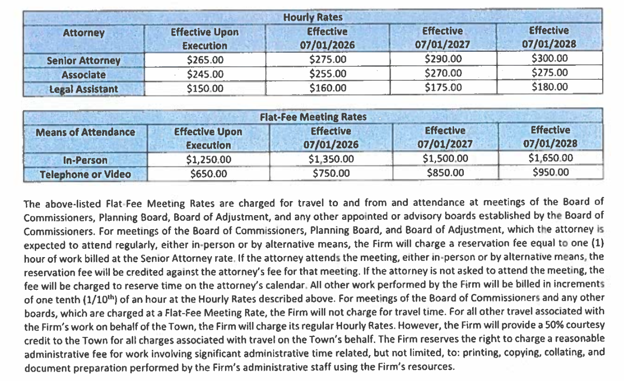
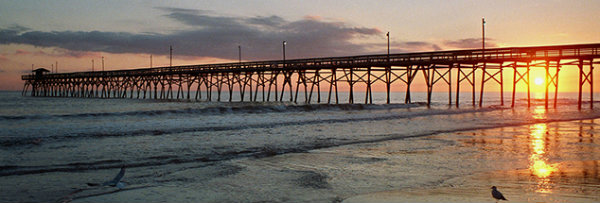 Update –
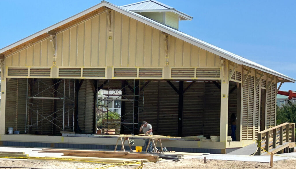


 Turtle Talk






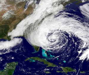
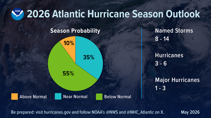





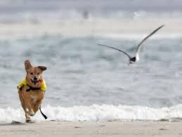
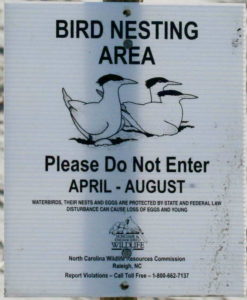

 News from Town of Holden Beach
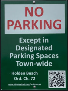



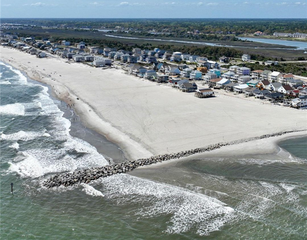

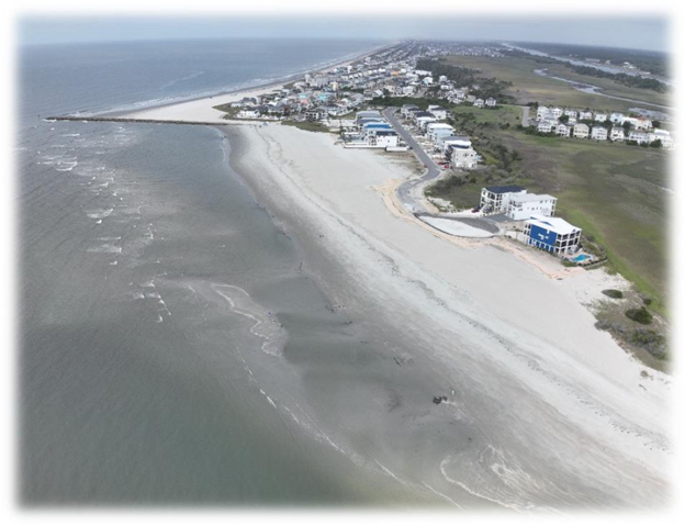



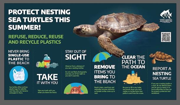

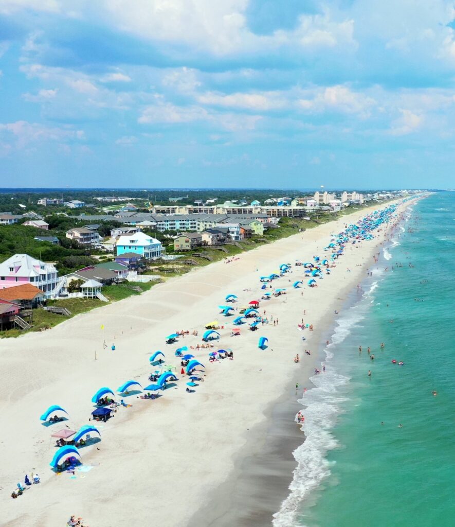

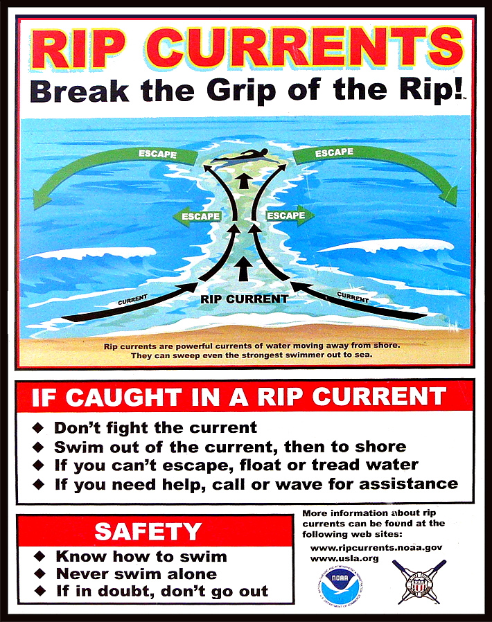



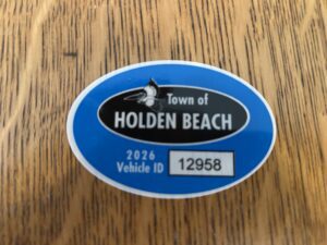




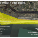
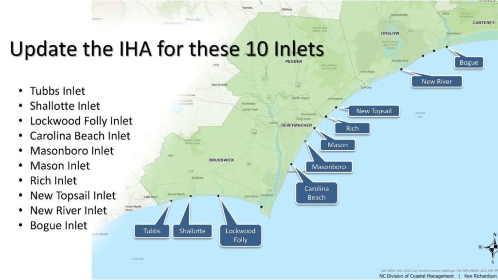














 Brunswick County Agricultural Fair and Expo