The National Flood Insurance Program aims to reduce the impact of flooding on private and public structures. It does so by providing affordable insurance to property owners and by encouraging communities to adopt and enforce floodplain management regulations. These efforts help mitigate the effects of flooding on new and improved structures. Overall, the program reduces the socio-economic impact of disasters by promoting the purchase and retention of general risk insurance, but also of flood insurance, specifically. Read more » click here
Previously reported – May2023 FEMA Releases New Flood Insurance Rates by ZIP Code. Brace for Impact. When the Federal Emergency Management Agency unveiled its new Risk Rating 2.0 methodology for calculating flood insurance, advocates and critics alike warned that it would mean higher premiums for thousands of property owners, especially in low-elevation coastal areas. Now, the full impact of the sticker shock is becoming clear, thanks to new data released by FEMA that shows price increases – and decreases – by county and by ZIP codes. But some spots will see decreases under RR 2.0, which is based less on FEMA’s much-criticized flood maps and more on a multitude of factors, including rainfall levels, elevation, a home’s distance from water, and rebuilding costs. Existing property owners won’t feel the pain all at once. Federal law limits the rate increases to no more than 18% annually on renewals. For people buying new policies, though, the full impact will be painfully obvious. For the past year, FEMA has required new policies to be rated under RR 2.0. He also noted that some prospective home buyers may not be aware of the soaring premiums. If the seller doesn’t explain about the new rating system, which grandfathers in existing owners, buyers could easily assume that their rates will remain the same. The FEMA spreadsheet with all U.S. ZIP codes can be downloaded here. Read more » click here
Previously reported – August2023
FEMA’s New Rate-Setting Methodology Improves Actuarial Soundness but Highlights Need for Broader Program Reform FEMA’s National Flood Insurance Program is charged with keeping flood insurance affordable and staying financially solvent. But a historical focus on affordability has led to insurance premiums being lower than they should be. The program hasn’t collected enough revenue to pay claims and has had to borrow billions from the Treasury. FEMA revamped how it sets premiums in 2021–more closely aligning them with the flood risk of individual properties. But affordability concerns accompany the premium increases some will experience. We recommended that Congress consider creating a means-based assistance program that’s reflected in the federal budget.
What GAO Found In October 2021, the Federal Emergency Management Agency (FEMA) began implementing Risk Rating 2.0, a new methodology for setting premiums for the National Flood Insurance Program (NFIP). The new methodology substantially improves ratemaking by aligning premiums with the flood risk of individual properties, but some other aspects of NFIP still limit actuarial soundness. For example, in addition to the premium, policyholders pay two charges that are not risk based. Unless Congress authorizes FEMA to align these charges with a property’s risk, the total amounts paid by policyholders may not be actuarially justified, and some policyholders could be over- or underpaying. Further, Congress does not have certain information on the actuarial soundness of NFIP, such as the risk that the new premiums are designed to cover and projections of fiscal outlook under a variety of scenarios. By producing an annual actuarial report that includes these items, FEMA could improve understanding of Risk Rating 2.0 and facilitate congressional oversight of NFIP.
Risk Rating 2.0 is aligning premiums with risk, but affordability concerns accompany the premium increases. FEMA had been increasing premiums for a number of years prior to implementing Risk Rating 2.0. By December 2022, the median annual premium was $689, but this will need to increase to $1,288 to reach full risk. Under Risk Rating 2.0, about one-third of policyholders are already paying full-risk premiums. Many of these policyholders had their premiums reduced upon implementation of Risk Rating 2.0. All others will require higher premiums, including 9 percent who will eventually require increases of more than 300 percent. Further, Gulf Coast states are among those experiencing the largest premium increases. Policies in these states have been among the most underpriced, despite having some of the highest flood risks.
Annual premium increases for most policyholders are limited to 18 percent by statute. These caps help address some affordability concerns in the near term but have several limitations.
First, the caps perpetuate an unfunded premium shortfall. GAO estimated it would take until 2037 for 95 percent of current policies to reach full-risk premiums, resulting in a $27 billion premium shortfall (see figure below). The costs of shortfalls are not transparent to Congress or the public because they are not recognized in the federal budget and become evident only when NFIP must borrow from the Department of the Treasury after a catastrophic flood event.
Second, the caps address affordability poorly. For example, they are not cost-effective because some policyholders who do not need assistance likely are still receiving it. Concurrently, some policyholders needing assistance likely are not receiving it, and the discounts will gradually disappear as premiums transition to full risk.
Third, the caps keep NFIP premiums artificially low, which undercuts private-market premiums and hinders private-market growth.
An alternative to caps on annual premium increases is a means-based assistance program that would provide financial assistance to policyholders based on their ability to pay and be reflected in the federal budget. Such a program would make NFIP’s costs transparent and avoid undercutting the private market. If affordability needs are not addressed effectively, more policyholders could drop coverage, leaving them unprotected from flood risk and more reliant on federal disaster assistance. Addressing affordability needs is especially important as actions to better align premiums with a property’s risk could result in additional premium increases.
FEMA has had to borrow from Treasury to pay claims in previous years and would have to use revenue from current and future policyholders to repay the debt. NFIP’s debt largely is a result of discounted premiums that FEMA has been statutorily required to provide. In addition, a statutorily required assessment has the effect of charging current and future policyholders for previously incurred losses, which violates actuarial principles and exacerbates affordability concerns. Even with this assessment, it is unlikely that FEMA will ever be able to repay the debt as currently structured. For example, with the estimated premium shortfalls, repaying the debt in 30 years at 2.5 percent interest would require an annual payment of about $1.9 billion, equivalent to a 60 percent surcharge for each policyholder in the first year. Such a surcharge could cause some policyholders to drop coverage, leaving them unprotected from flood risk and leaving NFIP with fewer policyholders to repay the debt. Unless Congress addresses this debt–for example, by canceling it or modifying repayment terms–and the potential for future debt, NFIP’s debt will continue to grow, actuarial soundness will be delayed, and affordability concerns will increase.
Risk Rating 2.0 does not yet appear to have significantly changed conditions in the private flood insurance market because NFIP premiums generally remain lower than what a private insurer would need to charge to be profitable. Further, certain program rules continue to impede private-market growth. Specifically, NFIP policyholders are discouraged from seeking private coverage because statute requires them to maintain continuous coverage with NFIP to have access to discounted premiums, and they do not receive refunds for early cancellations if they switch to a private policy. By authorizing FEMA to allow private coverage to satisfy NFIP’s continuous coverage requirements and to offer risk-based partial refunds for midterm cancellations replaced by private policies, Congress could promote private-market growth and help to expand consumer options.
Why GAO Did This Study NFIP was created with competing policy goals–keeping flood insurance affordable and the program fiscally solvent. A historical focus on affordability has led to premiums that do not fully reflect flood risk, insufficient revenue to pay claims, and, ultimately, $36.5 billion in borrowing from Treasury since 2005. FEMA’s new Risk Rating 2.0 methodology is intended to better align premiums with underlying flood risk at the individual property level. This report examines several objectives, including (1) the actuarial soundness of Risk Rating 2.0, (2) how premiums are changing, (3) efforts to address affordability for policyholders, (4) options for addressing the debt, and (5) implications for the private market. GAO reviewed FEMA documentation and analyzed NFIP, Census Bureau, and private flood insurance data. GAO also interviewed FEMA officials, actuarial organizations, private flood insurers, and insurance agent associations.
Recommendations GAO recommends six matters for congressional consideration. Specifically, Congress should consider the following:
Authorizing and requiring FEMA to replace two policyholder charges with risk-based premium charges
Replacing discounted premiums with a means-based assistance program that is reflected in the federal budget
Addressing NFIP’s current debt–for example, by canceling it or modifying repayment terms–and potential for future debt
Authorizing and requiring FEMA to revise NFIP rules hindering the private market related to (1) continuous coverage and (2) partial refunds for midterm cancellations
GAO is also making five recommendations to FEMA, including that it publish an annual report on NFIP’s actuarial soundness and fiscal outlook. The Department of Homeland Security agreed with the recommendations. Read more » click here
Previously reported – October2023 Flood-Insurance Program Faces a Backlash–and a Deadline Home-purchase closings could be derailed if it lapses A federal program that provides critical flood insurance is set to lapse unless renewed by the end of the month, potentially stranding new home buyers in need of coverage.The National Flood Insurance Program provides a safety net for the increasing number of communities that are vulnerable to flooding and might not have access to any other coverage. Now lawmakers are deadlocked over extending the program, which is facing a backlash over a new pricing model intended to make premiums better reflect a home’s risk.”The only thing worse than what we have is nothing,” said Sen. John Kennedy (R., La.), whose bill to extend the program by one year was blocked last week. Congress may find a way to renew the program before it lapses on Oct. 1 or shortly after, as in years past, through legislation that is either separate from or part of the budget fight to prevent a government shutdown. The deadline comes at a critical juncture for the 55-year-old program.The Federal Emergency Management Agency is being sued by 10 states that want to block the program’s revamped pricing, which was intended to help address its decadelong funding shortfalls and to prevent homeowners in relatively low-risk areas from continuing to subsidize those in flood-prone ones. The new pricing will take several years to be fully implemented and result in rate hikes for two-thirds of the program’s 4.7 million policyholders, according to the Government Accountability Office. The states suing FEMA say the new rates could drive people out of flood zones, slam property values and even lead to people losing their homes because they can no longer afford insurance that is a condition of their mortgages. Average annual premiums will eventually more than double in 12 coastal and landlocked states under the revamp, according to a report this week by First Street Foundation, a research firm. The county with the steepest increase is in Louisiana, where the average premium in Plaquemines Parish will surge more than sixfold to $5,431 from $842 in coming years once the new premiums are in full effect, according to First Street. “Flood insurance policies have become their own natural disaster,” said Jeff Landry, the attorney general for Louisiana who is leading the states’ lawsuit. Other states where average premiums more than doubled include hurricane-prone Florida and Mississippi, as well as Kentucky, South Dakota and West Virginia. David Maurstad of the National Flood Insurance Program said that FEMA doesn’t have the authority to consider affordability when setting premiums but that the agency “continues to work with Congress to examine flood insurance affordability options.” Previously, premiums were based on an outdated model that FEMA said no longer accurately reflected a home’s risk of flooding. Critics said the cheap insurance encouraged people to buy pricey homes in flood-prone areas, in part by repeatedly bailing them out. More than 3,000 properties had 10 or more claims from 1978 through 2022, according to FEMA. Nearly two-thirds of those were in five states: Louisiana, Texas, New Jersey, Missouri and New York. To help shore up its funding, FEMA last year asked Congress to consider letting it drop coverage on properties that received four or more claim payments of at least $10,000. Congress has yet to take any action. Since the program caps rate increases at 18% a year, it will take until 2037 before the new premiums are being charged for 95% of current policies, the GAO estimated. That delays the full impact of rate increases for several years for policyholders but leaves the program with $27 billion less in premium revenue than it otherwise would have.Already, the program’s failure to charge adequate rates for years has dug it deep into debt. It is paying $1.7 million in interest a day to the Treasury on $20.5 billion in loans, even after Congress forgave it $16 billion of debt in 2017.Meanwhile, the program has lost almost a million policyholders since 2009, despite floods becoming more frequent and costly. In counties affected by Hurricane Idalia last month, fewer than one in five homes on average had federal flood insurance, according to an analysis for The Wall Street Journal by private insurer Neptune Flood.A failure by Congress to renew the program wouldn’t stop claims from being paid. But it could affect home purchases in high-risk flood zones and derail thousands of closings in the peak of hurricane season, according to the Insurance Information Institute, an industry group. In the last six years, lawmakers have allowed the program to lapse briefly three times, according to FEMA.It isn’t yet clear how lawmakers will try to extend the program. A renewal could be included as a provision in any temporary funding legislation to keep the government running.Sen. Kennedy of Louisiana is also expected to again try and pass his legislation for an extension.His attempt last week was blocked by Sen. Mike Lee (R., Utah), who said he wasn’t willing to agree to “yet another hollow promise” of reforms. “It’s a broken subsidy program,” Lee said. Read more » click here
Previously reported – November2023 The Flood Insurance Program is Sinking: The actual words of David Maurstad, the federal official in charge of the Nation Flood Insurance Program, were “the NFIP is not fiscally sustainable in its present form”when he spoke with reporters in late October. That may not be a surprise, but what hasn’t generally been reported is the wholesale reform package that the Biden administration has proposed to Congress.
First, some background. With more than 4.7 million policies, FEMA has borrowed over $20 billion to stay afloat and nearly ran out of money in September. Even with the much-maligned Risk Rating 2.0 NFIP premium increases, the program is struggling to deal with hurricanes and fires at a time when those disasters might be fewer in number but are increasing in cost. Given that background, the Biden administration has sent Congress no less than 17 proposals to overhaul the NFIP.
Here’s a short list of some of the most important points of this package –
Requires communities participating in the NFIP risk reduction plan to establish minimum flood-risk reporting requirements for residential sellers and lessors.
Allows for the use of replacement cost value in determining premium rates to “more accurately signal policyholders’ true risk.”
Creates separate classes for coastal versus inland flood zones in the NFIP’s rate tables.
Provides a means-tested assistance program for offering a graduated discount benefit for low- and moderate-income households.
Prohibits coverage for new construction in high-risk areas and prohibits [presumably new] coverage for all commercial properties “to promote the growth of the private market….”
Prohibits coverage for “excessive loss properties” or properties that flood repetitively and require insurance payouts of at least $10,000 each time.
These are obviously major changes, and there are more we haven’t listed. Congress has shown little interest in tackling NFIP reform, preferring to kicking the can down the road with two dozen extensions of the existing program. That means these proposals may be dead in the water. However, having to forgive over $20 billion in outstanding debt to the Treasury (which will happen next year or very soon after) plus inevitably needing to provide more billions to enable the program to stay afloat may be just the impetus Congress needs to face reality.
To be clear on why the can keeps getting kicked, there is no doubt that members of congress recognize the problem with the program – premiums are too low and do not reflect actual risk exposure carried by the program. Yet these same members are essentially held hostage by their voter bases to ensure NFIP premiums stay low. Because constituents simply do not want to pay more, supporting more expensive premiums (which reflect actual risk) puts members’ re-election on the line. WATERLOG – November Newsletter
Previously reported – January2024
More states deciding home buyers should know about flood risks ‘It’s a recognition that flooding is only going to get worse and that they need to take action now to protect home buyers and renters,’ says one advocate Hours into a marathon meeting earlier this month, and with little fanfare, the North Carolina Real Estate Commission gave its blessing to a proposal that could have profound impacts in a state where thousands of homes face threats from rising seas, unprecedented rainfall and overflowing rivers. Soon, anyone who sells a home in the state will be required to disclose to prospective buyers far more about a property’s flood risks – and flood history. Rather than merely noting whether a home is in a federally designated flood zone, they will have to share whether a property has flood insurance, whether any past flood-related claims have been filed, or if the owner has ever received any federal assistance in the wake of a hurricane, tidal inundation or other flood-related disaster. With the changes, North Carolina became the fourth state this year to embrace more stringent disclosure requirements, joining South Carolina, New York and New Jersey. Advocates say the shifts, which for the most part encountered little outward opposition, represent an acknowledgment that flood risks are surging throughout the country and that more transparency about those risks is a common-sense measure that could mean more homes have flood insurance and fewer buyers face catastrophic surprises. “It’s a recognition that flooding is only going to get worseand that they need to take action now to protect home buyers and renters,” said Joel Scata, a senior attorney at the Natural Resources Defense Council, which tracks flood disclosure laws around the country. “It’s also a recognition of the importance of transparency and fairness.” The changing disclosure policies come at a time when scientists say the nation’s coastlines will experience as much sea level rise in the coming few decades as they have over the past century. They also have documented how the warming atmosphere is creating more powerful storms and more torrential and damaging rainfalls, which already are inundating communities where aging infrastructure was built for a different era and a different climate. The more stringent rules adopted this year also follow a path set by some of the country’s most flood-battered states. Louisiana, facing massive land loss from rising seas and the prospect of stronger storms, has what environmental advocates and even the Federal Emergency Management Administration agree is one of the most robust sets of disclosure laws in the nation. Likewise, in the wake of cataclysmic flooding caused by Hurricane Harvey in 2017, Texas adopted new rules that have also made the state a model for flood disclosure. But even as several additional states finalized new disclosure rules in 2023, many others still do not require sellers to divulge to buyers whether a home has previously flooded. That includes places such as Florida, which faces significant and rising risks from hurricanes, climate-fueled rain bombs and inland flooding along rivers. According to NRDC, more than one-third of states have no statutory or regulatory requirement that a seller must disclose a property’s flood risks or past flood damage to potential buyers. Others have varying degrees of requirements – a patchwork that means where people live can greatly influence how much they actually know about the flood risks of a home they buy or rent. “There are still too many states who keep home buyers in the dark,” Scata said. “That needs to change. Flooding is only going to become more severe due to climate change. And people have a right to know whether their dream home could become a nightmare due to flooding.” Earlier this year, FEMA proposed federal legislation that would require states to mandate certain minimum flood risk reporting requirements as a condition for ongoing participation in the National Flood Insurance Program. The agency said having a nationwide requirement would “increase clarity and provide uniformity” in many real estate transactions, but it has not yet become a reality. That lack of action on Capitol Hill has not stopped individual states from moving forward. In June, the South Carolina Real Estate Commission added new questions to the state’s residential disclosure that go into far more detail than before, including whether a homeowner has filed public or private flood insurance claims or made flood-related repairs that weren’t submitted to an insurer. “It’s definitely a step in the right direction,” said Nick Kremydas, chief executive of South Carolina Realtors, which publicly supported the enhanced disclosure requirements. Still, he said he hopes Congress will eventually allow buyers to access FEMA’s database of flood claims for individual properties. “That’s the best-case scenario.” Over the summer, New Jersey’s legislature overhauled what NRDC had labeled the state’s “dismal” disclosure requirements, instead putting in place new rules that require sellers to document a wide range of flood-related information. In addition, it requires that purchasers in coastal areas be warned about the potential impacts of sea level rise. “The idea is that the more people understand about the hazards, the more they can incorporate that into their decision-making, and the more they can have ownership of those decisions,” said Peter Kasabach, executive director of New Jersey Future, a nonprofit that advocates smarter growth and resilience policies. In September, New York Gov. Kathy Hochul (D) signed similar legislation, calling it a “monumental step“ toward protecting residents from the increasing impacts of climate change. In addition to mandating more detailed flood information, it eliminated a previous option that allowed sellers to provide a $500 credit at closing in exchange for waiving the disclosure requirement. The legislation followed a similar measure from late 2022, requiring flood disclosures for renters. “This is a person’s home, and they should be warned,” said New York State Assembly member Robert Carroll (D), a prime sponsor of the disclosure bills. “This is really about knowledge and proper warning.” In large swaths of the country, there is little doubt that more properties are likely to face flooding risks over time. A report last year by the National Oceanic and Atmospheric Administration, NASA and other federal agencies projected that U.S. coastlines will face an additional foot of rising seas by 2050. NOAA has detailed how specific places are likely to see a sharp rise in high-tide, or nuisance, flooding, and that coastal flood warnings “will become much more commonplace“ in coming decades. Likewise, scientists have documented an abnormal and dramatic surge in sea levels along the U.S. gulf and southeastern coastlines since about 2010, and other researchers have warned that the nation’s real estate market has yet to fully account for the expanding threats posed by rising seas, stronger storms and torrential downpours. In a study last year commissioned by NRDC, the independent actuarial consulting firm Milliman found that in New Jersey, New York and North Carolina, 28,826 homes sold in 2021 – 6.6 percent of total sales – were estimated to have been previously flooded. In addition, the firm found that expected future annual losses for a home with previous flood damage are significantly higher in each state than for the average of all homes, regardless of flood damage, in that state. Because one of the best indicators of whether a house will flood is whether it has flooded before, meaningful disclosure requirements are crucial, said Brooks Rainey Pearson, legislative counsel for the North Carolina branch of the Southern Environmental Law Center, which last year petitioned the state’s real estate commission on behalf of multiple environmental and community groups to make the disclosure changes. “People can take steps to protect themselves when you give them the information they need,” she said. “It matters, because with climate change we are seeing more frequent flooding events, including more intense storms and more flooding of houses. It’s a huge investment for a family to make to buy a house. People deserve to know whether the house they are purchasing has flooded or could flood.” Pearson says she hopes the changes coming to North Carolina and other states will help illuminate otherwise unknown risks and ultimately help reduce the number of homeowners who are displaced and devastated financially after storms such as Hurricane Florence, which battered her state in 2018. “What it comes down to,” she said, “is giving the buyer the information they need to make smart decisions.” Read more » click here
Previously reported – January 2025 Insurance rates to increase in 2025, and 2026, with Cape Fear beach communities among hardest hit Insurance Commissioner Mike Causey announced today that the N.C. Department of Insurance has ended its legal dispute with insurance companies about their proposed homeowners’ insurance rate increase filed in January 2024. The N.C. Rate Bureau originally requested an average 42.2% increase last year, with proposed increases of up to 99.4% in the beach areas in Brunswick, Carteret, New Hanover, Onslow and Pender Counties. Under the agreement signed by Commissioner Causey and the Rate Bureau, the average statewide base rate will increase by 7.5% on June 1, 2025, and 7.5% on June 1, 2026. The beach areas in Brunswick, Carteret, New Hanover, Onslow and Pender Counties will see a 16%increase on June 1, 2025, and a 15.9%increase on June 1, 2026. Eastern Coastal areas of Brunswick, Carteret, New Hanover, Onslow & Pender Counties will see a 10.5% increase on June 1, 2025, and a 10.1% increase on June 1, 2026. “The insurance companies wanted to raise our homeowners’ rates up to 99.4% in some areas and an average 42.2% statewide in a single year,” Commissioner Causey said. “I fought for consumers and knocked them back to 7.5% increases over two years with a maximum of 35% in any territory. We consider this settlement a big win for both homeowners and North Carolina.” The Rate Bureau is not a part of the Department of Insurance and represents homeowners’ insurance companies in North Carolina, and the agreement prohibits the Rate Bureau from undertaking an effort to increase rates again before June 1, 2027. “North Carolina homeowners will save approximately $777 million in insurance premiums over the next two years compared to what the insurance companies requested. This also protects homeowners from future base rate increase requests until June 2027,” said Commissioner Causey. “These rates are sufficient to make sure that insurance companies, who have paid out large sums due to natural disasters and face increasing reinsurance costs due to national catastrophes, have adequate funds on hand to pay claims. Read more » click here
NC, home insurance companies reach deal on new premiums.
Here’s how much you’ll pay. Homeowners’ insurance rates in North Carolina will increase by an average of about 15% over the next two years under a settlement Insurance Commissioner Mike Causey and the N.C. Rate Bureau announced Friday. The N.C. Rate Bureau, which represents more than 100 companies that write insurance policies in North Carolina, had requested an average 42.3% increase that would have started this month. In some coastal areas, the Rate Bureau was asking to nearly double rates. Setting insurance rates is a delicate balancing act, with consumer protections and the cost of premiums on one side and ensuring that companies will continue writing policies in the state on the other. During a public hearing that started in October, witnesses for Causey’s office argued that rates should be increased by a maximum of about 3% or even lowered. The hearing was the first held during Causey’s eight years in the office. “These rates are sufficient to make sure that insurance companies, who have paid out large sums due to natural disasters and face increasing reinsurance costs due to national catastrophes, have adequate funds on hand to pay claims,” Causey said in a written statement. In Durham and Wake counties, rates will increase by an average of 7.5% in each of the next two years. Orange County’s average increases will be significantly lower, with 3.4% in 2025 followed by an additional 3.2% in 2026. For homeowners in Mecklenburg County, rates will increase by 9.3% in 2025, followed by an additional 9.2% in 2026.
Generally, the settlement’s highest increases will come in places that were hit hard by Hurricane Matthew in 2016 and Hurricane Florence in 2018. Those include:
Beach areas from Carteret to Brunswick counties will see average 16% increases in 2025 followed by an additional 15.9% in 2026.
Duplin and Lenoir counties, where rates will increase by an average 13.6% in 2025, followed by an additional 13.5% in 2026.
Edgecombe and Wilson counties, where rates will increase by an average 11.6% in 2025, followed by an additional 11.6% in 2026.
The areas hit hard by Hurricane Helene last September are poised to see some of the lowest average increases in the state. Buncombe, Watauga and Yancey counties, for example, are all set for a 4.4% increase in 2025 followed by 4.5% in 2026. And Mitchell County’s average increase will be 0.7% in 2025 followed by 0.9% in 2026. Jarred Chappell, the Rate Bureau’s chief operating officer, indicated in a written statement that the Rate Bureau is virtually certain to call for another significant increase once the two-year period covered by the settlement ends. “It’s a step in the right direction, but the North Carolina Rate Bureau asked for a larger increase because that’s what recent claims data called for. Storms have gotten stronger and more damaging, more people are living in disaster-prone areas, inflation in the construction industry has been particularly high and reinsurance costs have exploded. All these cost drivers remain an issue,” Chappell said. Under state law, companies writing homeowners’ insurance have the option to use “consent-to-rate” to set premiums. That allows insurers to charge as much as 250% of the regulatory cap. In 2022, about 40% of the state’s homeowners’ policies were set by consent-to-rate policies, with those homeowners’ average premiums costing 47% more than the caps negotiated by Causey and the Rate Bureau. The Rate Bureau, Chappell wrote, is aiming to keep as many carriers as possible writing homeowners insurance policies in the state. Some companies have already started to pull out of disaster-prone parts of North Carolina, most notably Nationwide, which last year did not renew about 10,000 policies from Pitt and Greene counties to the Outer Banks.
Other recent negotiated increases included:
An average 4.8% increase in 2017 after the Rate Bureau had requested 18.7%.
An average 4% increase in 2018 after the Rate Bureau had requested 17.4%.
An average 7.9% increase in 2020 after the Rate Bureau had requested 24.5%.
In most states, insurance companies file their rate requests independently of each other. But North Carolina is one of very few states — and perhaps the only one — where a rate bureau files for requested rates and negotiates on behalf of the entire industry. Nationally, insurance companies are seeing their profits worn away by large natural disasters coming in quick succession, along with increased building costs. In 2024, there were 27 disasters that caused at least $1 billion in damage, according to the National Centers for Environmental Information. That total is the second-highest since 1980 and includes Helene, which caused an estimated $58 billion in Western North Carolina alone. Read more » click here
Homeowner insurance rates set to rise significantly across the Wilmington area The deal between state regulators and the insurance industry calls for an average 15% increase by mid-2026. But many coastal areas will see much steeper increases. N.C. Insurance Commissioner Mike Causey recently announced his department and the state’s insurance companies had reached a legal settlement over how much the companies will be allowed to raise homeowner insurance rates over the next two years.Industry had asked for an average statewide increase of 42%, with some areas around Wilmington seeing their rates double. The settlement calls for an average of 15% over the next two years, 7.5% this year and another 7.5% next year, with areas along the N.C. coast seeing double that.Causey hailed the deal as a victory for consumers and a fair settlement for the industry, which has been hammered by a series of natural disasters on both ends of the state in recent years.“The insurance companies wanted to raise our homeowners’ rates up to 99.4% in some areas and an average 42.2% statewide in a single year,” Causey said in a statement. “I fought for consumers and knocked them back to 7.5% increases over two years with a maximum of 35% in any territory. We consider this settlement a big win for both homeowners and North Carolina.”But property owners, especially in and around Wilmington, will still have to dig deeper into their pocketbooks to pay for insurance − and industry officials have said the deal doesn’t solve the underlying problems that are driving insurance companies to seek steeper and steeper rate increases. So, is it a good deal? Let’s dig into the facts.
How did we get here? In January 2024, the N.C. Rate Bureau, a 14-member board that represents the industry, submitted a proposal to raise homeowner insurance premiums by 42% statewide and an eyewatering 99% in beach and coastal areas around Wilmington.Since North Carolina is a regulated insurance market, industry needs to win state approval to raise rates.The proposal, after a public hearing, was swiftly and vocally rejected by N.C. Insurance Commissioner Mike Causey.The commissioner’s action triggered a judicial hearing, which started in October and wrapped up late last year. Causey then had 45 days to announce his decision.
Why such a big, proposed increase? The N.C. Rate Bureau cited two main factors for the surprisingly large rate increase proposal. First, is the rising cost of pretty much everything, including labor and potential repairs, driven by inflation and the lingering impacts of labor and material shortages tied to the COVID-19 pandemic.The other is climate change, which is causing more frequent and widespread property destruction, particularly tied to bigger and stronger hurricanes, as the warming climate fuels more severe weather events. Damages in North Carolina tied to 2018’s Hurricane Florence, for example, were estimated to top $22 billion, with much of that hitting inland areas.Other factors that are playing a role in the proposed substantial increase include the moratorium that was put into place during the pandemic on any rate increases and the cost of reinsurance − basically insurance for the insurance companies themselves in case a large-scale disaster stretches their financial ability to respond.While a regulated market, theoretically meaning North Carolina just be ring-fenced from some of the issues hammering insurance markets in other states, notably Florida, Louisiana and California, reinsurance operates on a global scale. That means increasing costs of insurance for companies operating, say, in California due to massive wildfire payouts and exposure will be felt by companies operating in North Carolina.
What does the settlement call for? The deal calls for an average statewide increase of 7.5% this year, effective June 1, and 7.5% next year in homeowner insurance rates.But not all parts of the state are being treated equally.
Here’s the breakdown for the Wilmington area and some other N.C. regions.
Beach areas in New Hanover, Brunswick and Pender: +16% this year; +15.9% in 2026; Rate bureau had sought a 99.4% increase.
Eastern coastal parts of New Hanover, Brunswick and Pender: +10.5% this year; +10.1% in 2026. Rate bureau had sought a 71.4% increase.
Western parts of New Hanover, Brunswick and Pender: +5% this year; +4.8% in 2026; Rate bureau had sought a 43% increase.
Beach areas on the Outer Banks: +5.1% this year; +4.8% in 2026. Rate bureau sought a 45.1% increase.
Duplin and Lenoir counties: +13.6% this year; +13.5% in 2026. Rate bureau had sought a 71.4% increase.
Wake and Durham counties: +7.5% increase; +7.5% increase in 2026. Rate bureau had sought a 39.8% increase.
Buncombe County (Asheville): +4.4% increase this year; +4.5% in 2026. Rate bureau had sought a 20.5% increase.
Why does the coast look like it’s getting singled out? Like many things, rate increases lag the big disasters that prompted the industry to re-examine its exposure and business model. In an interview this fall, Causey said this rate increase request was mostly tied to the industry’s costs and payouts associated with the spate of natural disasters, including 2018’s Hurricane Florence, North Carolina saw several years ago. He added that his office is still dealing with claims tied to Florence, having recently paid one out to the University of North Carolina Wilmington (UNCW) tied to that devastating storm. “It takes years from the time a storm hits for the rates to catch up,” Causey said. That means damage from September’s unnamed storm, which dropped historic amounts of rain on parts of the Cape Fear region, and losses associated with Tropical Storm Debby and any from Hurricane Helene aren’t taken into account with this rate filing. Ditto for the devastation Helene caused in Western North Carolina and why this rate increase is heavily weighted toward the coast and Eastern N.C. With some damage estimates for Helene in the mountains pushing $60 billion, that will likely change when the rate bureau asks for its next increase.
Wait, another increase? According to the settlement, the insurance industry can’t ask for another increase until June 2027.Causey said that is a fair compromise for all parties.“These rates are sufficient to make sure that insurance companies, who have paid out large sums due to natural disasters and face increasing reinsurance costs due to national catastrophes, have adequate funds on hand to pay claims,” he said in a statement.But industry officials made it clear that they didn’t get everything they wanted.In a statement, Jarred Chappell, chief operating officer with the rate bureau, said the approved rate increase isn’t “adequate.”“It’s a step in the right direction, but the North Carolina Rate Bureau asked for a larger increase because that’s what recent claims data called for,” he said. “Storms have gotten stronger and more damaging, more people are living in disaster-prone areas, inflation in the construction industry has been particularly high and reinsurance costs have exploded.“All these cost drivers remain an issue.”With little to forecast that any of those factors will change or even slow down in the coming years, especially with greenhouse gas emissions, the primary source of climate change, still on the rise globally, Chappell said the state and the insurance industry could find themselves at loggerheads again in just a few years.“Unfortunately, when the two years covered by this settlement are up, we will almost certainly be in a similar position, calling for a significant increase to keep the North Carolina market strong and to encourage as many carriers as possible to compete here for customers,” he said. Read more » click here
Commissioner Causey negotiates settlement on Rate Bureau’s homeowners’ insurance request Average 7.5% agreement will take effect on June 1 Insurance Commissioner Mike Causey announced today that the N.C. Department of Insurance has ended its legal dispute with insurance companies about their proposed homeowners’ insurance rate increase filed in January 2024. The N.C. Rate Bureau originally requested an average 42.2% increase last year, with proposed increases of up to 99.4% in some areas. Under the agreement signed by Commissioner Causey and the Rate Bureau, the average statewide base rate will increase by 7.5% on June 1, 2025, and 7.5% on June 1, 2026. The Rate Bureau is not a part of the Department of Insurance and represents homeowners’ insurance companies in North Carolina. “The insurance companies wanted to raise our homeowners’ rates up to 99.4% in some areas and an average 42.2% statewide in a single year,” Commissioner Causey said. “I fought for consumers and knocked them back to 7.5% increases over two years with a maximum of 35% in any territory. We consider this settlement a big win for both homeowners and North Carolina.” In addition, the agreement prohibits the Rate Bureau from undertaking an effort to increase rates again before June 1, 2027. “North Carolina homeowners will save approximately $777 million in insurance premiums over the next two years compared to what the insurance companies requested. This also protects homeowners from future base rate increase requests until June 2027,” said Commissioner Causey. “These rates are sufficient to make sure that insurance companies, who have paid out large sums due to natural disasters and face increasing reinsurance costs due to national catastrophes, have adequate funds on hand to pay claims.”
Previously reported – May 2025 Homeowners’ insurance rates going up Sunday, with some Cape Fear areas seeing a 10% spike Homeowners in the Cape Fear should be prepared for an insurance rate spike over the weekend. On January 17, 2025, Insurance Commissioner Mike Causey announced the end of a legal dispute between the N.C. Department of Insurance and insurance companies about their proposed homeowners’ insurance rate increase filed in January 2024. The N.C. Rate Bureau originally requested an average 42.2% increase last year, with proposed increases of up to 99.4% in some areas, like the eastern coastal areas of Brunswick, New Hanover, and Pender Counties. Under the agreement signed by Commissioner Causey and the Rate Bureau, the average statewide base rate will increase by 7.5% on June 1, 2025, and 7.5% on June 1, 2026. You can see your insurance rate bump here, with those eastern coastal areas of Brunswick, New Hanover, and Pender Counties seeing an increase of 10.5%. The Rate Bureau is not a part of the Department of Insurance and represents homeowners’ insurance companies in North Carolina. “The insurance companies wanted to raise our homeowners’ rates up to 99.4% in some areas and an average 42.2% statewide in a single year,” Commissioner Causey said back in January. “I fought for consumers and knocked them back to 7.5% increases over two years with a maximum of 35% in any territory. We consider this settlement a big win for both homeowners and North Carolina.” In addition, the agreement prohibits the Rate Bureau from undertaking an effort to increase rates again before June 1, 2027. “North Carolina homeowners will save approximately $777 million in insurance premiums over the next two years compared to what the insurance companies requested. This also protects homeowners from future base rate increase requests until June 2027,” said Commissioner Causey. “These rates are sufficient to make sure that insurance companies, who have paid out large sums due to natural disasters and face increasing reinsurance costs due to national catastrophes, have adequate funds on hand to pay claims. Read more » click here
Previously reported – August 2025 Brunswick and New Hanover ranked among NC’s most insurance-stressed counties A new report on North Carolina’s home insurance ranks both New Hanover and Brunswick counties among the top five most at-risk counties in the state. A Raleigh-based independent insurance agency, Guardian Service, ranked both counties within the top five most at-risk counties in the state where high climate risk and insurance market stress are colliding. Guardian Service researchers analyzed around 90 North Carolina counties using data from a mix of federal, state and proprietary sources. The research team examined climate risk, insurance costs, historical trends and homeowner strain. The report estimates coastal counties such as Brunswick, New Hanover and Pender are expected to see some of the biggest increases in home insurance premiums in the next year.
Here’s how climate-related risks are expected to impact home insurance rates in the Cape Fear region.
New Hanover ranked first in climate and insurance pressures Guardian Service ranked New Hanover County as the county with the most climate and insurance pressure in the state.In 16 of the studied counties, current average home insurance premium costs exceed $4,000. However, New Hanover County had the highest average cost of $6,631, the report states. Carteret and Dare counties follow suit with average insurance premium cost also above $6,000.According to the report, home insurance premium costs in New Hanover County by 2026 are expected to rise by more than $1,400, pushing the average annual cost of home insurance premiums around $8,000.Reasons for New Hanover County’s high climate and insurance vulnerability, per the report, include a 36% paid loss ratio and insurance claims averaging more than $17,000 each.Paid loss ratio is the percentage of premiums that insurance companies pay back to homeowners in claims, Guardian Service spokesperson Dayna Edens said.
Brunswick County home insurance premiums skyrocket Brunswick County was the fourth most climate and insurance pressure-burdened counties in the report. The county also ranked fourth in having one of the highest insurance claim severity changes between 2018-2022.“Claim severity has grown by 33% statewide,” the report states.The report reveals that Brunswick County jumped from having a $7,800 average in home insurance claim in 2018 to nearly a $20,500 average in 2022. That’s a 162.4% increase in only five years – higher than both New Hanover and Pender counties.Edens said the average cost of a Brunswick County home insurance policy in 2025 is $4,813, based on a $350,000 dwelling coverage.“That figure is projected to rise to $5,865 in 2026, based on already-approved rate filings,” said Edens.From 2018-2022, the rate at which insurers chose not to renew policies decreased by 1.9% and the average rate of claims filed per policy also decreased by 4.9% since 2018, Edens said.Edens explained that the paid loss ratio in Brunswick County is 26%.“That number can reflect how much weather-related damage or other losses are occurring in the area,” Edens said.
Pender County could also see higher insurance rise Pender County ranked 13th for climate and insurance pressure-burdened counties in the report. The county also ranked sixth in high claim severity changes from 2018-2022.The report shows Pender County had a 120.5% jump in insurance claim severity between 2018 and 2022. This hike was a nearly $10,000 swell over five years and was 0.3% higher than New Hanover County’s increase.Out of the three counties, New Hanover is expected to have the smallest bump in home insurance premium policy costs in the next year. Guardian Services anticipates the New Hanover County home insurance premium average to increase $999 by 2026. Read more » click here
Previously reported – January 2025 Hearing set for proposed 68% increase in NC dwelling insurance rates North Carolina Insurance Commissioner Mike Causey has scheduled a public hearing to review a proposed 68.3% increase in dwelling insurance rates across the state. The hearing is set for May 4, 2026, and will begin at 10 a.m. in the second-floor hearing room at the Department of Insurance, located at 3200 Beechleaf Court in Raleigh. Causey said the hearing is the next required step after the North Carolina Rate Bureau filed its proposed increases earlier this fall. “We are not in agreement with the Rate Bureau’s proposed increases,” Causey said. “It is now necessary to schedule a hearing in order to work toward a resolution that will make the most financial sense for our residents and insurance companies.” The hearing will move forward unless the Department of Insurance and the Rate Bureau reach a settlement beforehand. State law gives the insurance commissioner 45 days to issue a ruling after the hearing concludes. The Rate Bureau could then appeal the decision to the North Carolina Court of Appeals, and potentially to the state Supreme Court. The Rate Bureau filed the proposed increase on Oct. 30, requesting an average 68.3% hike in dwelling insurance rates statewide. Dwelling policies cover fire and extended coverage for non-owner-occupied properties of up to four units, including rental and investment properties. They are not the same as standard homeowners insurance policies. Under the proposal, most policyholders would see double-digit increases, though the exact impact would vary by region. The last time the Rate Bureau sought a major dwelling insurance rate increase was in July 2023, when it requested an average 50.6% increase. That filing was ultimately settled at an average 8% increase, which took effect on Nov. 1, 2024. Read more » click here
Insurance rates to increase in 2025, and 2026, with Cape Fear beach communities among hardest hit Insurance Commissioner Mike Causey announced today that the N.C. Department of Insurance has ended its legal dispute with insurance companies about their proposed homeowners’ insurance rate increase filed in January 2024. The N.C. Rate Bureau originally requested an average 42.2% increase last year, with proposed increases of up to 99.4% in the beach areas in Brunswick, Carteret, New Hanover, Onslow and Pender Counties. Under the agreement signed by Commissioner Causey and the Rate Bureau, the average statewide base rate will increase by 7.5% on June 1, 2025, and 7.5% on June 1, 2026. The beach areas in Brunswick, Carteret, New Hanover, Onslow and Pender Counties will see a 16% increase on June 1, 2025, and a 15.9%increase on June 1, 2026. Eastern Coastal areas of Brunswick, Carteret, New Hanover, Onslow & Pender Counties will see a 10.5% increase on June 1, 2025, and a 10.1% increase on June 1, 2026. “The insurance companies wanted to raise our homeowners’ rates up to 99.4% in some areas and an average 42.2% statewide in a single year,” Commissioner Causey said. “I fought for consumers and knocked them back to 7.5% increases over two years with a maximum of 35% in any territory. We consider this settlement a big win for both homeowners and North Carolina.” The Rate Bureau is not a part of the Department of Insurance and represents homeowners’ insurance companies in North Carolina, and the agreement prohibits the Rate Bureau from undertaking an effort to increase rates again before June 1, 2027. “North Carolina homeowners will save approximately $777 million in insurance premiums over the next two years compared to what the insurance companies requested. This also protects homeowners from future base rate increase requests until June 2027,” said Commissioner Causey. “These rates are sufficient to make sure that insurance companies, who have paid out large sums due to natural disasters and face increasing reinsurance costs due to national catastrophes, have adequate funds on hand to pay claims. Read more » click here
Previously reported – March 2026 NC Rate Bureau proposes nearly 70% increase on dwelling insurance policies Living along the coast is already expensive, and now the cost could be going even higher if it’s not your primary residence. The North Carolina Rate Bureau (NCRB) is proposing an average rate increase of 68.3% for dwelling insurance policies, a move that would affect vacation homes, rental properties, and other non-primary residences across the state. North Carolina Insurance Commissioner Mike Causey said he opposed the proposal from the start. “In this case, in my view, this is excessive,” Causey said. The increase would be implemented over two years. In the first year, consumers would see a 28.5% increase, then a 30.9% increase in the second year. A $400,000 dwelling policy averages $2,071 per year. This increase would make it jump to roughly $3,479 per year. If the proposed increase were to take effect, the first hike would take effect on July 1, 2026, with the second on July 1, 2027. Causey says the biggest reason for the jump is inflation, rising claim costs, and insurance fraud cases going up. To clarify, there is a difference between dwelling insurance and homeowners’ insurance. Dwelling insurance usually covers homes that are not your primary residence.
Such policies are often purchased for the following types of properties:
Vacation homes
Vacant homes
Seasonal homes
Secondary homes
Rental properties
Older homes
When Causey was initially presented with the proposal, he says he said no. “So, what happens when you say no, you’re required to go to court,” said Causey. Because the rate bureau and Department of Insurance are separate and the power lies with the state agency, the two often reach settlements that produce significantly less extreme policy increases. A hearing is still scheduled for May 4 to work toward a resolution. However, the Department of Insurance and the NCRB can negotiate a settlement beforehand. “We’re in talks right now,” said Causey. “I can’t talk about the negotiations, but we’re hopefully to come up with something that would be favorable.” The last NCRB dwelling rate increase filing was in July 2023, requesting an average statewide 50.6% increase. A settlement was negotiated, resulting in an average 8% increase. “When you can cut more than two-thirds of what they were trying to raise, that puts money back in your pocket, and consumers can live with something reasonable,” said Causey.
In the wake of the proposed rate increase, the North Carolina Rate Bureau released the statement below:
“By its nature, insurance tries to manage risk in a wide range of situations, so there are many different types of property insurance policies. Dwelling policies generally cover rental properties owned by landlords as well as vacation homes, as opposed to primary homes that the owner lives in.
Primary homes are covered by homeowners’ policies and will not be affected by this filing. The NC Rate Bureau reviewed data on tens of thousands of actual insurance claims from 2019 through 2023 to determine the premiums needed to cover risks and build this request. We’ve asked for a substantial increase in the dwelling rate because claim costs have increased substantially. Climate change is here, and so are the financial costs from it. The 27 separate billion-dollar disasters that hit the United States in 2024 would have been an all-time record, had it not been for the 28 billion-dollar disasters that hit in 2023. Adding to these costs: Inflation in the construction industry has far outpaced overall inflation in recent years, and some of the fastest-growing areas in North Carolina are coastal areas where storm damage is more common. Simply put, severe storm damage is becoming more common, it’s impacting more homes, and it’s more expensive to rebuild afterwards. The Rate Bureau tries to strike a balance between affordable rates, rates that cover the risks to properties, and rates that encourage a large number of insurance carriers to compete for business in North Carolina. Finally, whatever rates the Department of Insurance approves, customers should not necessarily expect their premiums to increase by that amount. Rates vary by geography, by carrier, and based on how each insurance carrier assesses an individual property’s risk. The rate-setting process we’re engaged in with the Department of Insurance caps premiums that property insurance carriers charge, but the actual premiums are set on a case-by-case basis.” Read more » click here
Previously reported – May 2026 North Carolina homeowners insurance rates rising 7.5%; Democrats call hike ‘insurance crisis’ North Carolina homeowners will face an average 7.5% insurance rate increase beginning June 1. Democratic leaders and residents warn that rising premiums, climate-related disasters, and state policy failures are fueling a growing insurance affordability crisis. North Carolina homeowners will soon see an average 7.5% increase in homeowners insurance rates statewide. The increase takes effect June 1 and comes after negotiations between Insurance Commissioner Mike Causey and the insurance industry. Insurers had originally requested an average 42% increase statewide before Causey rejected the proposal in 2024. The final agreement lowered those proposed increases substantially, but homeowners and Democratic leaders say the approved rates still place additional financial strain on families already struggling with rising housing and recovery costs. According to Bankrate, the average cost of homeowners insurance in North Carolina is about $2,951 per year, which breaks down to roughly $246 per month for a home with $300,000 in dwelling coverage. That is higher than the national average of $2,424 annually. A recent report from the U.S. Government Accountability Office also found some North Carolina communities experienced insurance premium increases exceeding 50% after adjusting for inflation between 2019 and 2024, particularly in coastal areas vulnerable to severe storms. State Sen. Natalie Murdock, D-Chatham and Durham, said homeowners across the state are facing policy non-renewals, denied claims and rapidly increasing premiums. WRAL News reached out to the North Carolina Department of Insurance on Wednesday. A spokesperson outlined the responsibilities of the office- finding insurance companies are making enough to pay claims, while ensuring rates are not excessive or discriminatory.
The DOI also provided tips to help homeowners save:
Shop around- not every insurance company is going to have the consent-to-rate
Make sure you’re covered for the right amount- don’t pay for more than you need
Ask insurance company if they have discounts available
The higher the deductible, the less your insurance is going to be
The spokesperson stopped short of describing North Carolina as a state in an “insurance crisis.” Read more » click here
National Oceanic and Atmospheric Administration (NOAA) The National Oceanic and Atmospheric Administration (NOAA) defines a hurricane as “an intense tropical weather system with a well-defined circulation and maximum sustained winds of 74 mph (64 knots) or higher.”
THB – EVACUATION, CURFEW & VEHICLE DECALS For more information » click here
If the Town declares a mandatory evacuation, PLEASE LEAVE General Assembly during the 2012 Session, specifically authorizes both voluntary and mandatory evacuations, and increases the penalty for violating any local emergency restriction or prohibition from a Class 3 to a Class 2 misdemeanor. Given the broad authority granted to the governor and city and county officials under the North Carolina Emergency Management Act (G.S. Chapter 166A) to take measures necessary to protect public health, safety, and welfare during a disaster, it is reasonable to interpret the authority to “direct and compel” evacuations to mean ordering “mandatory” evacuations. Those who choose to not comply with official warnings to get out of harm’s way, or are unable to, should prepare themselves to be fully self-sufficient for the first 72 hours after the storm.
No matter what a storm outlook is for a given year,
Overview Hurricanes are tropical cyclones that rotate counterclockwise with wind speeds in excess of 74 mph. Most hurricanes form over warm seas near the equator. They are created when the sun heats the ocean surface, causing heated water vapor to rise, condense, and form clouds. These clouds begin to spiral as the earth rotates. More air is pulled underneath and a large vortex is formed.On average, six Atlantic hurricanes develop each year. When a hurricane moves toward coastal areas it often causes severe damage. Strong winds create storm surges, floods, rip tides, and can even spawn tornadoes. As the hurricane moves forward, its right front quadrant is typically where the most devastation occurs.Hurricane season begins June 1 and continues through November 30. Be sure to practice hurricane preparedness and learn about hurricane safety and survival.To assist in being prepared before, during, and after a storm, review the following links for helpful information.
Hurricane Preparedness Tips We would like to encourage you to start preparing for emergencies and stay #ReadyBrunswick by reviewing the following tips.
NOAA predicts below-normal 2026 Atlantic hurricane season Early preparation essential to staying safe all season Forecasters with NOAA’s National Weather Service are predicting a below-normal hurricane season for the Atlantic basin this year. NOAA’s outlook for the 2026 Atlantic hurricane season, which runs June 1 to November 30, predicts a 35% chance of a near-normal season, a 10% chance of an above-normal season, and a 55% chance of a below-normal season. The agency is forecasting a total of 8-14 named storms (winds of 39 mph or higher). Of those, 3-6 are forecast to become hurricanes (winds of 74 mph or higher), including 1-3 major hurricanes (category 3, 4 or 5 with winds of 111 mph or higher). NOAA has a 70% confidence in these ranges. An average season has 14 named storms with seven hurricanes, including three major hurricanes. “With the most advanced forecast modeling and hurricane tracking technologies, NOAA and the National Weather Service are prepared to deliver real-time storm forecasts and warnings,” said Commerce Secretary Howard Lutnick. “Our experts are integrating cutting-edge tools to ensure communities in the path of storms receive the earliest, most accurate information possible.” “NOAA’s rapid integration of advanced technology, including AI-based weather models, drones, and next-generation satellite data will deliver actionable science to safeguard the lives and livelihoods of the American people,” said NOAA Administrator Neil Jacobs, Ph.D. “These new capabilities, combined with the unmatched expertise of our National Weather Service forecasters, will produce the most accurate forecasts possible to protect communities in harm’s way.”Key factors driving NOAA’s forecast The Atlantic season is expected to be below-normal due to competing factors. El Niño is expected to develop and intensify during the hurricane season, while ocean temperatures in the Atlantic are expected to be slightly warmer than normal and trade winds are likely weaker than average. El Niño conditions tend to support less tropical storms and hurricanes, while warmer ocean temperatures and low winds support a more active year.“Although El Niño’s impact in the Atlantic Basin can often suppress hurricane development, there is still uncertainty in how each season will unfold,” said NOAA’s National Weather Service Director Ken Graham. “That is why it’s essential to review your hurricane preparedness plan now. It only takes one storm to make for a very bad season.” NOAA’s outlook is for overall seasonal activity based on large-scale weather and climate patterns. It does not indicate where or when any storms may affect land as that is determined by short-term and variable weather patterns is not a landfall forecast. “Preparing now for hurricane season — and not waiting for a storm to threaten — is essential for staying ahead of any storm. Visit weather.gov/safety and Ready.gov for important preparedness information,” added Graham.New and enhanced communication products this season
NOAA’s National Hurricane Center (NHC) will implement an improved version of the tropical cyclone forecast cone graphic that will now include tropical storm and hurricane watches and warnings for inland areas for the continental United States, Hawaii, Puerto Rico and the U.S. Virgin Islands.
NHC will begin testing an experimental version of the tropical cyclone track forecast cone that will capture a greater range of possibilities for the track of the storm by incorporating uncertainties for both direction of movement and timing.
NHC will provide new products and services for the Hawaiian Islands to include storm surge watches and warnings, and a peak storm surge graphic. These will be publicly available for the main Hawaiian Islands on gov.
Advancements to hurricane analysis and forecasts
NOAA, in collaboration with the Unified Forecast System community, is testing an experimental high-resolution Seasonal Forecast System that utilizes the latest modeling technology and new methods to assess the evolution of the global ocean-atmosphere system. The system is helping forecasters better simulate tropical storms and hurricanes, and more effectively predict the number of hurricanes and major hurricanes.
NOAA’s Atlantic Oceanographic and Meteorological Laboratory (AOML) is using machine learning to quality-control data collected from tail Doppler radar — a specialized radar system mounted on the back of NOAA’s “Hurricane Hunter” aircraft. This new method gathers more than 25% more meteorological data than the current method and leads to more high-quality data to support structure and wind analysis by forecasters.
Innovative technologies for this year
NOAA’s Office of Water Prediction high-resolution Flood Inundation Mapping (FIM) services provide emergency managers visualizations of those streets and neighborhoods likely to go underwater. FIM covers 60% of the U.S. population and will expand to nearly 100% by late September 2026.
Don’t get complacent with tropical outlook; ‘it only takes one’ The below-normal activity predicted for the 2026 Atlantic hurricane season doesn’t give North Carolinians a pass on preparation this year. “For the Atlantic hurricane season, NOAA is predicting a below-normal season for 2026, with roughly a 55% chance of being below normal, a 35% chance of near normal, and a 10% chance of above normal,” National Oceanic and Atmospheric Association Administrator Dr. Neil Jacobs said during a media conference Thursday morning from NOAA’s Aircraft Operations Center at Lakeland Linder International Airport in Lakeland, Florida. “This equates to eight to 14 named storms with winds at or above 39 miles an hour. Of these, three to six hurricanes with winds at or above 74 miles an hour, and one to three major hurricanes, that’s your Category 3 to 5 with winds at or above 111 miles an hour,” he added. Jacobs is referring to the Saffir-Simpson hurricane wind scale, which categorizes maximum sustained wind speeds for tropical storms. Categories 1 and 2 are windspeeds between 74 and 110 mph, categories 3 to 5 are major hurricanes with speeds from 111 to 157 or higher, according to NOAA. Hurricane season begins Monday, June 1, and ends Nov. 30. “Even though we’re expecting a below-average season in the Atlantic, it’s very important to understand that it only takes one,” Jacobs said, adding there have been Category 5s that made landfall in the past during below-average seasons. During the news conference Thursday morning, Jacobs said that “what’s driving this forecast is largely an El Niño event. There’s a 98% chance of El Niño conditions occurring later this season, and an 80% chance that this El Niño will be moderate to strong.” NOAA National Weather Service Director Ken Graham, who spoke after Jacobs, reiterated that “it just takes one,” and urged the public during the press conference not to “let words like ‘below average’” change the way you prepare.“Now’s the time to start thinking about your hurricane preparedness,” Graham said. “Early preparedness is absolutely everything. Period. End of story. The actions that you take today really get you ready for the hurricane season.” Especially a season like this, “there’ll never be a Hurricane Just-a. We’ll never make that a name. There’s no such thing as just a Cat 1, just a tropical storm, just a Cat 2. That is absolutely not the case,” Graham said. “It doesn’t matter what it is, you got to look at the size, the forward motion, little wiggles matter on the impacts. Even the smallest storm, if it’s slow enough and big enough, it’s going to create catastrophic flooding and storm surge.” Graham said that the public needs to pay attention to every single one of the storm “systems, and the actual impacts, not the category, not the name, but the actual impacts associated with that storm, and that includes the tornadoes, heavy rain, damaging winds, even the high surf and rip currents, as well, including storm surge.” Erik Heden, warning coordination meteorologist in the National Weather Service’s Newport office, said in an interview with Coastal Review that just because the forecast calls for a below-normal season, residents shouldn’t let their guard down. “Just because the outlook says it’s going to be a low year doesn’t mean we won’t be impacted,” he said, adding “It just takes one storm. The graphic says a 55% chance below-normal year, but if we get one storm, it really doesn’t matter what the prediction was, it could be a big deal for us.” Heden also warned in the interview against making decisions based on the category of the storm. “Categories are only wind,” he said. Wind is to be respected, but the other storm impacts are more likely to be more frequent in terms of issues in our area. “Water is what kills people. About 85% of people that die in hurricanes, it’s water related — nothing to do with the wind. but it’s, it’s things like rip currents, storm surge, and flooding. Those are the three things that would get us if we get a storm.” Two years ago, the Southeast faced a potential tropical cyclone that didn’t have a name. No. 8 resulted in almost 20 inches of rain in the Wilmington area, and last year Tropical Storm Chantal produced six to 10 inches of rain in Raleigh. Steven Pfaff, meteorologist-in-charge for the National Weather Service’s Wilmington office, in an email to media partners Thursday morning, also expressed concern that the forecast for below-normal activity can cause messaging challenges because people may misinterpret what it means for any potential local impacts. “All it takes is one storm to define a hurricane season regardless of the outlook,” his emphasis, “Given southeast NC’s and northeast SC’s hurricane history our communities must prepare the same way every year,” Pfaff continued. “Now is the time to prepare for hurricane season and remain vigilant this summer and fall.” Jacobs said during the press conference that for official forecast guidance, go to hurricanes.gov. “June 1 is almost here. Be ready, have a plan, listen to your state and local emergency managers. Preparation is essential. You can learn more at ready.gov,” Jacobs added. Heden told Coastal Review that the best way to stay informed in eastern North Carolina is to remember “if it’s the weather you love, it’s weather.gov,” where there’s up-to-date information, as well as on the office’s website, Facebook or X. Read more » click here
Previously reported – June 2026 Brunswick County reminds community to prepare for 2026 Atlantic hurricane season June marks the start of the Atlantic hurricane season, which runs from June 1 through Nov. 30, and the National Oceanic and Atmospheric Administration (NOAA) predicts below-normal hurricane activity in the Atlantic basin this year. Brunswick County encourages all community members to start preparing now. For the 2026 Atlantic hurricane season, NOAA is forecasting a range of 8 to 14 total named storms (winds of 39 mph or higher). Of those, three to six are forecast to become hurricanes (winds of 74 mph or higher), including one to three major hurricanes (category 3, 4 or 5; with winds of 111 mph or higher). NOAA has a 70% confidence in these ranges. An average season has 14 named storms with seven hurricanes, including three major hurricanes.The alphabetical list of 2026 Atlantic hurricane names can be found at hurricanes.gov/aboutnames.shtml#atl.Prepare for Hurricane Season with Brunswick CountyTo be ReadyBrunswick is to be responsible for your personal and household preparedness efforts, and to stay alert for any events that could impact you and your loved ones. During the month of June, Brunswick County will be doing a weekly countdown for hurricane preparedness. Each week will focus on different actions you and your household can take to prepare for any tropical activity that may impact the area.
Week 1 (June 7-13): Make a plan. Create and practice a Family Emergency Communication Plan that includes all members of your household and pets. Discuss your household evacuation plan for every member of the household and pets. Review your insurance policies (including flood insurance) to ensure your property is covered for any flooding or natural disasters that could occur.
Week 2 (June 14-20): Build a kit. An emergency kit is vital for your survival in situations where help might not be easily accessible due to power outages and road damage. When preparing an emergency kit, it is recommended to prepare three to seven days’ worth of medicine, water, and non-perishable food for each person and pet in your home. Make sure you store important documents physically and digitally in secure locations.
Week 3 (June 21-27): Stay informed. It’s important to plan for multiple ways you will receive credible and accurate information before, during, and after a tropical event. To get updates from Brunswick County, sign up for the ReadyBrunswick Emergency Notification System and follow Brunswick County on social media. Know the terms and categories used by weather professionals and public safety officials for tropical cyclones.
Week 4 (June 28-July 4): Practice resilience. Take time to learn how to prepare your home/property before, during, and after a storm. Know who maintains roads and how residents play a part. Practice home safety skills to protect your family and property.
For more hurricane preparedness tips from Brunswick County, visit BrunswickCountyNC.gov/hurricanes. Find information on emergency planning and hurricane safety online at ReadyNC.gov or Ready.gov. View updates from the National Hurricane Center, a real-time emergency weather map, and additional online resources at nhc.noaa.gov. Read more » click herePrepare now as hurricane season begins, NC officials urge With this year’s Atlantic hurricane season beginning Monday, which is forecast to have below-normal activity, state officials are urging residents to prepare now for tropical weather impacts because “North Carolinians know that it takes only one storm to affect communities statewide.” Gov. Josh Stein said Monday in a press release marking the start of hurricane season that this time of year brings uncertainty for families across the state. “I encourage all North Carolinians to make a plan now to keep themselves and their families safe in case of a storm,” he explained. “Just as you prepare your family for hurricane season, the state emergency management team is preparing by closely monitoring forecasts, updating response plans, and coordinating with federal and local partners.” TheState Emergency Response Team has been preparing for the hurricane season that ends Nov. 30 by reviewing lessons learned from past storms, updating response procedures, meeting with all levels of government, coordinating with the private sector and nonprofit organizations, and conducting exercises. “Preparation is the key to resilience during hurricane season. We encourage all North Carolinians to take time to develop plans and take proactive steps with their loved ones before a storm impacts our state,” N.C. Emergency Management Director Will Ray said Monday. Ray added that preparation includes “creating evacuation plans in case you must leave your home, securing all important documentation in a waterproof container, and checking your insurance policies to make sure you are properly covered. Home and flood insurance are especially important resources in returning to normalcy after a disaster.”Officials recommend taking the following steps to be prepared before disaster strikes:
Put together an emergency kit with up to a week’s supply of nonperishable food, including one gallon of water per person per day, and prescription and over-the-counter medication.
Be aware of any unique needs for babies, elderly, or disabled members of the household, as well as pets.
Have multiple ways to receive severe weather warnings such as a weather alert app on your phone, a battery-powered or hand-crank radio or other device and extra batteries to listen to NOAA Weather Radio, or app or radio access to local news outlets.
If you live along the coast or are planning to visit the beach this season, Know Your Zone! This is how local governments order evacuations along the coast when storm surge is a threat. Visit KnowYourZone.NC.Gov to search by address.
Establish an emergency evacuation plan and meeting point if your group becomes separated.
Have a printed list of family member’s phone numbers, social media handles, email addresses, and medical information in case mobile devices lose power or otherwise become disabled.
Have copies of important papers such as birth and adoption certificates, driver licenses, or military IDs.
Meet with your insurance agent so you know what is covered should a storm affect your neighborhood.
Prepare a full list of personal items, along with photos and videos of every room in your home, to help with insurance settlements or tax deductions.
Be sure you know how to shut off your utilities safely. Water, electricity, and gas are key services that can also cause special problems during an emergency. Do not try to turn the gas back on yourself. Call a trained expert.
The N.C. Flood Inundation Mapping and Alert Network, or FIMAN, features access over 700 flood gauges across the state. Visit Fiman.NC.Gov to search for the flood gauges closest to your home and to sign up for alerts.
To become involved in preparedness efforts where you live, officials recommend learning about schools, workplace, and neighborhood emergency plans and join in preparedness exercises and drills. Other ways include volunteering with a Community Emergency Response Team, or CERT, to learn about disaster preparedness and receive training in basic disaster response skills or contacting N.C. Volunteer Organizations Active in Disaster at ncvoad.org for more ways to help. For more information on how to prepare for hurricane season, visit ReadyNC.Gov. Read more » click here
Previously reported –January 2019 New proposed rules could significantly impact real estate property values Significantly expands area covered on the island
by .4 miles on the east end
by 1.7 miles on the west end
Coastal Resource Commission report to be presented at their February meeting
Panel Proposes Redrawn Inlet Hazard Areas Read more » click here
Coastal Resources Commission CRC Science Panel / Inlet Hazard Area (IHA) Delineation Update Read more »click here
Previously reported – March 2019 CRC Advances New Inlet Hazard Maps, Rules The North Carolina Coastal Resources Commission has approved preliminary boundaries and building rules at inlets. Though official adoption of the redrawn inlet hazard area, or IHA, maps and guidelines for development within those areas is still months away, the CRC’s decision last week puts the state one step closer to amending the current outdated maps.
North Carolina Division of Coastal Management Director Braxton Davis told members of the commission at the quarterly meeting Thursday that the regulatory agency understands the revised maps are going to be a topic of controversy in the coastal towns at inlets. “These maps were done in 1981,” he said. “We have IHAs that don’t even capture some of these areas.” A little more than 2,900 acres of land is designated as IHA at 10 of the 19 active inlets in the state. The 10 are: Tubbs, Shallotte and Lockwood Folly inlets in Brunswick County; Carolina Beach, Masonboro, Mason and Rich inlets in New Hanover County; New Topsail Inlet in Pender County; New River Inlet in Onslow County; and Bogue Inlet in Carteret County. The CRC approved removing IHA designations at inlets where the adjacent land is undeveloped and owned either by the state or federalgovernment.
IHAs are defined as shorelines especially vulnerable to erosion and flooding where inlets can shift suddenly and dramatically. Inlets typically move over time in one of two ways. An inlet migrates, meaning it moves in one general direction, or it oscillates, wagging back and forth. A majority of the state’s inlets oscillate. Long-term erosion rates are about five times greater at oceanfront shorelines near inlets. The proposed maps expand current IHAs collectively by a little more than 1,359 acres while removing about 470 acres from existing boundaries at the 10 developed inlets. A majority of IHAs are being expanded under the proposed boundaries. The preliminary maps place an additional 152 acres and 243 structures within an ocean hazard area of environmental concern, or AECs. Ocean hazard AECs are defined as those that may be easily destroyed by erosion or flooding or may have environmental, social, economic or aesthetic values that make it valuable to the state.
Rules governing development within IHAs were established to control density and structure size along the shorelines affected by the dynamic waterways. The proposed setbacks have been established through years of work by the science panel that advises the CRC. The science panel studied historical shoreline data at each inlet, then used that information to predict erosion and accretion rates at those inlets. DCM has established building setbacks in the new boundaries based on the annual inlet erosion rates rather than the oceanfront erosion rates now. For some of the inlets, this method of calculation equates to no change in the current building setbacks. For others, the setbacks vary. Current rules do not allow lots about one-third of an acre in size to be subdivided. Residential structures of four units or fewer or nonresidential structures of less than 5,000 square feet are only allowed on lots within an IHA. The updated rules maintain the size limitation to no more than 5,000 square feet of heated space and remove restrictions on the number of units allowed in a structure. Larger structures that would be included in the new boundaries would be grandfathered under the rules.
North Topsail Beach Alderman Mike Benson expressed his concerns about condominiums at the north end of town that would be grandfathered in under the new maps. Benson told the commission during a public hearing on the proposed IHA map changes that the revised boundary at New River Inlet would include 11 buildings that are all larger than 5,000 square feet. If any of those buildings were to be destroyed in a hurricane or fire, Benson wanted to know if they could be rebuilt. DCM shoreline management specialist Ken Richardson clarified that structures between 5,000 and 10,000 square feet could be rebuilt to the same footprint. The owners of a structure greater than 10,000 square feet, such as Shell Island Resort in Wrightsville Beach, could request a variance from the CRC to rebuild. Richardson said he will turn over DCM’s recommended changes to the state Office of State Budget and Management for review. Once that office confirms its findings, a series of public meetings will be held where the public will get an opportunity to comment on the maps and rules. Richardson said he hopes those meetings will kick off some time in the spring and that revised maps are adopted by year’s end. If adopted, the new IHA boundaries would be updated every five years. Read more » click here
Previously reported – April 2019 Development rules near inlets have been basically the same since 1981. This year that could change Over 1,000 inlet-adjacent acres in the Cape Fear region could soon be subject to an additional set of state development regulations. At the same time, 500 acres could be removed from the same regulatory designation designed to limit risky development near dynamic inlet shorelines. Read more » click here
Holden Beach Property Owners Association / Inlet Hazard Areas The Coastal Resources Commission (CRC) has established new boundaries for Inlet Hazard Areas on each end of the island, greatly increasing the number of properties that fall within this designation. The CRC determined the new IHA boundaries based on historic vegetation line data. The CRC sent the rules to the State for review. After review there will be public comment before the rule are put in place.
Inlet Hazard Areas (IHAs) are sections of islands that are more vulnerable to erosion due to the impact of the inlets. The new maps show Holden Beach will be hit hard, especially on the West End.
The West End currently has 15 lots in the IHA, which will go up to 173 lots, and includes all the oceanfront properties from roughly Sailfish to the end of the island. The area will increase from 290.5 acres to 569.3 acres, almost double in size. This will be the largest IHA in the state.
The East End will also see changes. The IHA there is 64 acres and will jump to 189.5 acres – an almost 200% increase in size. Currently, there are 52 lots in the IHA, which will increase to 156.
Visit our website to see the maps and determine if your property is impacted by the new IHA boundaries.
What Does It Mean?
1) Structures (residential or commercial) will be limited to 5000sf of heated space. Existing larger structures would be grandfathered and could be rebuilt if destroyed.
2) Insurance is impacted for homes in an IHA.
3) New development would require lots with a minimum of around one-third acre.
4) The ability to have a concrete slab under a home might be restricted in some cases, as impervious surfaces at ground level may not be allowed
It is not clear what impact the changes will have on property values and the Town’s tax base – if any.
Previously reported – October 2019 Public Can Weigh in on Inlet Hazard Updates The North Carolina Division of Coastal Management will host of public meetings on proposed updated inlet hazard area boundaries and building rules within those areas, after a series of hearings about the updated erosion rates used to determine the proposed IHAs. Everyone from coastal property owners to developers will get a chance to weigh in on the preliminary boundaries, which were approved earlier this year by the state Coastal Resources Commission, or CRC.
The CRC unanimously approved the fiscal analysis and rule amendments to the proposed inlet hazard areas, or IHAs, Wednesday during the commission’s quarterly meeting held in Wilmington. That analysis, approved Aug. 30 by the Office of State Budget and Management and state Department of Environmental Quality, details the number of structures removed from and added to be included within the boundaries. Currently there are 750 structures within IHAs, which are defined as shorelines especially vulnerable to erosion and flooding where inlets can shift suddenly and dramatically. Of those structures, 307 would be removed from ocean hazard areas, or OHAs, under the proposed boundary revisions. Any of those homes built before 1980 would, for the first time in nearly 40 years, not be included inside of these boundaries, according to Ken Richardson, shoreline management specialist with Division of Coastal Management.
OHAs are made up of three areas of environmental concern, or AECs: IHAs, ocean erodible areas, or OEAs, and unvegetated beach. The proposed updated boundaries would include a total of about 930 structures within IHAs. Of those, 219 would be new to the OHA, meaning this would be the first time they would be within an IHA or OEA. Properties newly exempt from the OHA will have less stringent development and redevelopment rules than those within an IHA. AECs are identified as areas that may be easily destroyed by erosion or flooding or may have environmental, social, economic or aesthetic values that make it valuable to the state. More than 2,900 acres of land is within IHA boundaries at 10 of the 19 active inlets in the state. The 10 are: Tubbs, Shallotte and Lockwood Folly inlets in Brunswick County; Carolina Beach, Masonboro, Mason and Rich inlets in New Hanover County; New Topsail Inlet in Pender County; New River Inlet in Onslow County; and Bogue Inlet in Carteret County.
A majority of IHAs are being expanded under the proposed boundaries, which include building setbacks that vary from inlet to inlet. The science panel that advises the CRC has for years worked on the proposed setbacks, studying historical shoreline data at each inlet and using that information to predict erosion and accretion rates at those inlets. Building setbacks in the new boundaries are set based on annual inlet erosion rates rather than oceanfront erosion rates. For some of the inlets, this method of calculation equates to no change in the current building setbacks. For others, the setbacks vary. Setback requirements will not change for a little more than 730 properties in IHAs. Fifty-seven properties will have decreased setback requirements, while setback requirements will increase for 137 properties. Under the proposed changes, boundaries and setbacks will be reviewed every five years.
Richardson told the CRC last week that OEAs and IHAs are not factors in the calculation of flood insurance premiums. The proposed IHA updates “do not have an immediate negative or positive impact” to community National Flood Insurance Policy’s Community Rating System, a voluntary program that incentivizes communities that go above and beyond the minimum floodplain management requirements, according to the fiscalanalysis.
The updated rules maintain the structure size limitation to no more than 5,000 square feet of heated space and no more than one unit per 15,000 square feet of land area. Homes and businesses that exceed the size limit and would be included in the new boundaries would be grandfathered under the rules. IHA rules apply to property owners who want built a new structure or replace one that has been damaged and requires more than 50% repair.
If approved, the amended boundaries and rules may be adopted by early next year.
Public hearings on the updated erosion rates use to determine the proposed IHAs will be held at the following times and locations:
3 p.m. Oct. 17, North Carolina Division of Coastal Management, 400 Commerce Ave., Morehead City. Read more » click here.
Previously reported – November 2019
The Holden Beach Property Owners Association (HBPOA) has been monitoring the proposed changes to the Inlet Hazard Area (IHA) boundaries on the east and west ends of our island. The proposed IHA will impact more than 200 property owners on the west end of our island by placing new restrictions on what they can build (or rebuild) on their property.
This is the highest number of structures in any IHA in the state and adding this many properties to an IHA on our island will have a significant impact not just to the impacted property owners, but to our overall tax base as well. We don’t understand the rationale behind this change, since the west end of Holden Beach has been continuously accreting for decades, as documented in surveys by the Town’s engineer. The Inlet Hazard Area Method (IHAM) does not take any of this into account.
Ken Richardson reported at the NCBIWA conference that public hearings on the IHA changes will begin next month and comments will be closing at the end of January. We are trying to notify our impacted property owners so they can provide input, but there is no notice of the hearing on the Division of Coastal Management website, only scientific documents.
We need your help with informing our property owners. Given the significance of the changes to the IHA and the short timeframe for input occurring over the holidays, the HBPOA would like to conduct a public hearing or information session to inform our members about this significant potential impact to their property. Your assistance with conducting this session would be greatly appreciated.
Soon to be Commissioner Brian Murdock sent e-mail, this was the response from Braxton C. Davis, Director – NC Division of Coastal Management / Department of Environmental Quality
I understand your concerns and agree that the timing of the hearing is probably not good for many who are planning to travel for the holidays. I also appreciated the comments made by Tim Evans on behalf of the Town at our meeting this week. Our December hearing has already been advertised in the newspaper, so we will need to move forward with it, but we are absolutely willing to come back in January to hold a “workshop” so that we can try and clarify the overall process and background on the proposed changes, and to make sure we get additional public comments to take back to the Commission at their meeting in February. We will also begin a 60-day public comment period on Dec. 2 (ending late January) – it will be announced in the NC Register, and written comments can be sent to me at the office address below or via email.
Previously reported – December 2019
The Holden Beach Property Owners Association (HBPOA)has been monitoring the proposed changes to the Inlet Hazard Area (IHA) boundaries on the east and west ends of our island. The proposed IHA will impact more than 200 property owners on the west end of our island by placing new restrictions on what they can build (or rebuild) on their property.
This is the highest number of structures in any IHA in the state and adding this many properties to an IHA on our island will have a significant impact not just to the impacted property owners, but to our overall tax base as well. We don’t understand the rationale behind this change, since the west end of Holden Beach has been continuously accreting for decades, as documented in surveys by the Town’s engineer. The Inlet Hazard Area Method (IHAM) does not take any of this into account.
Ken Richardson reported at the NCBIWA conference that public hearings on the IHA changes will begin next month and comments will be closing at the end of January. We are trying to notify our impacted property owners so they can provide input, but there is no notice of the hearing on the Division of Coastal Management website, only scientific documents.
We need your help with informing our property owners. Given the significance of the changes to the IHA and the short timeframe for input occurring over the holidays, the HBPOA would like to conduct a public hearing or information session to inform our members about this significant potential impact to their property. Your assistance with conducting this session would be greatly appreciated.
Soon to be Commissioner Brian Murdock sent e-mail, this was the response from Braxton C. Davis, Director – NC Division of Coastal Management / Department of Environmental Quality
I understand your concerns and agree that the timing of the hearing is probably not good for many who are planning to travel for the holidays. I also appreciated the comments made by Tim Evans on behalf of the Town at our meeting this week. Our December hearing has already been advertised in the newspaper, so we will need to move forward with it, but we are absolutely willing to come back in January to hold a “workshop” so that we can try and clarify the overall process and background on the proposed changes, and to make sure we get additional public comments to take back to the Commission at their meeting in February. We will also begin a 60-day public comment period on Dec. 2 (ending late January) – it will be announced in the NC Register, and written comments can be sent to me at the office address below or via email.
Inlet Hazard Area Changes If your property is west of Sailfish or East of Blockade Runner, you should be aware of the proposed changes. For more information and the maps, check out the Hot Topics page on the HBPOA website. For more information » click here
From the Mayor’s Desk Inlet Hazard Area Changes The Coastal Resources Commission is in the process of developing new rules that have the potential to greatly impact several hundred lots at Holden Beach. Please review the information below for an executive summary prepared by the Business Alliance for a Sound Economy (NCBASE) complete with details of the rules, dates/times of public hearings, maps of properties affected and contact information for those needing to receive feedback on the proposed changes.
Please take the time to review, attend the hearings if possible and provide your comments/concerns.
Information from NCBASE: The NC Division of Coastal Management is holding public hearings and accepting feedback regarding the proposed changes to the Inlet Hazard Areas (IHA). The proposal put forth will 1) greatly expand inlet hazard areas as well as 2) significantly change in the way that setbacks are measured in these areas. If approved by the Coastal Resources Commission, this proposal will impact thousands of acres of coastal land and thousands of parcels and structures in our region.
The proposed rules can be found in the attached document (click here) on pages 16. On pages 6 – 7, you can see the breakdown (structure, acres) by community.
Here are some additional links to resources related to the IHA update:
Inlet Hazard Area Update Report The CRC Memo which includes the basis for the rules, also includes new maps starting on page 103.
Please review the new maps and new rules. Then make plans to attend the public hearings and make your voice heard.
Public Hearings and Comment Period: Public hearings start on December 17, 2019 in Brunswick County and will be held in a number of coastal locations through mid-January. The full schedule is at the end of this document. Written comments, questions and feedback will also be accepted. Provide written comments, questions and feedback via email to DCM Director Braxton Davis (braxton.davis@ncdenr.gov) and/or Ken Richardson (ken.richardson@ncdenr.gov).
Comments will be accepted through January 31, 2020. Depending on breadth of comments, the issue could go to the Coastal Resources Commission at the February 2020 meeting and have an implementation date of April or May 2020.
Over the same period, the state of North Carolina and individual communities have continued to proactively advance coastal management strategies including the creation of a shallow draft inlet fund, the permitting of terminal groins and investment in continued coastal storm damage reduction projects to enhance our coastal infrastructure.
Concerns:
The impacts of the expanded Inlet Hazard Areas and revised setback calculations will be widespread and significant.
Has DCM notified property owners that will be in the expanded Inlet Hazard Area?
Has DCM notified property owners in the current Inlet Hazard Area that the setback factors are changing?
The Proposed IHA Rule Changes and new setback calculations could result in a taking of private property if they completely prevent development of a parcel. For example, if a lot is 150′ deep and its setback goes from 60′ to 240′-it is unbuildable.
The Proposed IHA Rule Changes may increase the CRC’s exposure to takings claims. Such claims may arise because the Proposed IHA Rule Changes and setbacks would prohibit development within areas in which development is not currently prohibited. They may also arise where property owners who acquired or held their property with the expectation of being able to develop at a certain intensity are not satisfied with the limited development potential that the Proposed IHA Rule Changes would permit in protectedIHAs
The grandfathering provisions need to be expanded. The grandfathering protection the CRC Memo says would apply to all lots under 15,000 sq.ft. is not actually included in the Proposed IHA Rule Changes.
The CRC Memo states that the Proposed IHA Rule Changes include provisions to grandfather all existing structures within the new IHAs as well as all lots under 15,000 square feet, platted after July 23, 1984 or before the effective date of the Proposed IHA Rule Changes, with respect to density restrictions. However, there is no language in the Proposed IHA Rule Changes that expressly grandfathers such lots.
The cumulative effect of the Proposed IHA Rule Changes is to make an additional 1,819.7 acres of coastal land subject to development restrictions-in addition to expanding restrictions on existing parcels in the IHA. This will impact property values in a range of affected communities.
The Proposed IHA Rule Changes imply a causal connection between the size of a structure, the number of units in a structure, and the size of a lot and the risk of erosion, flooding, and other adverse effects of sand, wind and water associated with dynamic ocean inlets. It is unclear, however, how the size of a home, the number of units, or size of a lot has any causal relationship to the risk of realizing hazards associated with dynamic ocean inlets.
The revised rules will negatively impact property values and complicate potential sales and financing as a result of the “new” nonconforming status of the structures and parcels identified in the CRC Memo. To help alleviate the concern about making existing structures nonconforming, CRC could include a provision in the Proposed IHA Rule Changes that would allow for reconstruction of nonconforming structures and structures on nonconforming lots without the need to come into compliance with currentrules.
Table 3 of the CRC Memo shows that, under the Proposed IHA Rule Changes, the number of lots within IHAs that do not meet the 15,000 square feet minimum lot size requirement more than doubles, from 894 lots to 1,805 lots.
Similarly, Table 2 of the CRC Memo shows that, overall, the Proposed IHA Rule Changes would increase the number of structures with heated area greater than 5,000 square feet within or intersecting IHA boundaries from 24 to 41. Under the Proposed IHA Rule Changes, all such structures would be non-conforming with respect to the proposed maximum floor area allowance.
Public Hearing Schedule / Inlet Hazard Area Update
Brunswick County December 17, 2019 10:00 a.m. Brunswick County Government Complex 30 Government Center Drive, NE Bolivia, NC 28422
New Hanover County December 17, 2019 3:00 p.m. New Hanover County Government Center 230 Government Center Drive Wilmington, NC 28403
Onslow County December 18, 2019 10:00 a.m. Sneads Ferry Library 1330 Highway 210 Sneads Ferry, NC 28460
Pender County December 18, 2019 3:00 p.m. Assembly Building 720 Channel Blvd. Topsail Beach, NC 28445
Carteret County January 7, 2020 3:00 p.m. NCDCM 400 Commerce Avenue Morehead City, NC 28557
Hyde County January 8, 2020 10:00 a.m. Community Center – Multipurpose Room 30 Oyster Creek Road Swan Quarter, NC 27885 *broadcast simultaneously to Ocracoke Island:
Ocracoke Community Center 999 Irvin Garrish Highway Ocracoke, NC 27960
Dare County January 14, 2020 11:00 a.m. Town of Nags Head Board of Commissioners Room 5401 S. Croatan Highway Nags Head, NC 27959
State’s Inlet Hazard Plan Criticized at Hearing Holden Beach is taking the state Division of Coastal Management to task for its proposal to expand the western end of the island’s inlet hazard area. During the first in a series of public meetings the division is hosting through January, a small group of Holden Beach residents and the town’s planning director on Tuesday morning questioned a state official as to why the preliminary boundary at Shallotte Inlet stretches eastward for about 2 miles from the end of the island that is accreting. “I really have concerns just about how you came up with these boundaries,” said Vicki Myers, resident and chair of the town’s Inlet and Beach Protection Board. “I think your math is wrong.” The preliminary boundary encompasses a little more than 200 structures, nearly four times the 51 structures in the current inlet hazard area. “This is a huge issue,” said Holden Beach Property Owners Association President Tom Myers. “To look at these numbers it makes it look like it’s the most dangerous place in the state. Just looking at it makes no sense that our west end of the island has the most houses in an inlet hazard area in the state.” The Myerses, who are married, do not live in the current or proposed inlet hazard area, or IHA, but said expanding the area at the western end, which has been accreting since the 1970s, does not make sense.
Developed inlets IHAs are defined as shorelines especially vulnerable to erosion and flooding where inlets can shift suddenly and dramatically. Shallotte Inlet is one of 19 active inlets in the state. Ten of those are called developed inlets. A little more than 2,900 acres at the 10 developed inlets are designated as IHAs. Those inlets include Tubbs, Shallotte and Lockwood Folly in Brunswick County; Carolina Beach, Masonboro, Mason and Rich in New Hanover County; New Topsail and New River in Pender County; and Bogue Inlet in Carteret County. Discussions and attempts to update IHA boundaries, which were first drawn in the late 1970s, go to back to 1998-99, when members of the first-appointed science panel suggested to the commission that the boundaries were outdated. Current IHAs were drawn based on the historic migration of the inlet shoreline. To establish the proposed updated IHAs, the science panel is using the hybrid vegetation line, or landwardmost position of the historic vegetation line, to determine boundaries. The proposed maps expand current IHAs collectively by a little more than 1,359 acres while removing about 470 acres from existing boundaries at the 10 developed inlets. Inlets typically move over time in one of two ways: An inlet migrates, meaning it moves in one general direction, or it oscillates, wagging back and forth. A majority of the state’s inlets, including Shallotte Inlet, oscillate. In its recommendations released to the Coastal Resources Commission earlier this year, the commission’s science panel explained that the historic repositioning of the outer bar channel from the southwest to the southeast reshaped the ebb-tide delta and its effect on the adjacent oceanfront shorelines on Holden and Ocean Isle beaches. The ebb channel has generally aligned in a southeast/east-southeast direction since the late 1960s, which has allowed sand to accrete at the western end of Holden Beach. During this same time, Ocean Isle’s oceanfront shoreline at the inlet has experienced chronic, long-term erosion. If the ebb channel were to re-orient itself again toward Ocean Isle, then Holden Beach would erode, according to the science panel. Holden Beach Planning and Inspections Director Tim Evans said the data indicate the inlet essentially stabilized in the 1970s. “Our vegetation line is constantly growing,” he said. “I think that Holden Beach really needs to be looked at again, especially where the original inlet hazard area was. I just don’t see how we can believe in the science.” The new proposed boundaries come with updated rules, which include the current limit that structures within an IHA can be built no larger than 5,000 square feet of heated space and no more than one unit per 15,000 square feet of land area. Homes and businesses that exceed the size limit within the new boundaries would be grandfathered under the new rules. Existing structures destroyed or damaged, requiring more than 50% repair, can be rebuilt regardless of size or density as long as the structure meets the setback requirements within the IHA. Setbacks vary in each area. If a structure does not meet the setback requirements, a structure that meets current grandfathering rules may apply. Those rules include being built before Aug. 11, 2009, meeting minimum setbacks, staying within the original footprint and rebuilt as far landward on a lot as possible. The current preliminary boundary at the west end of Holden Beach stretches about 2 miles, Evans said. He argued that a major storm, not inlet erosion, could damage and destroy the more than 200 homes within the proposed IHA. If those homes cannot be rebuilt because they do not meet setback conditions, that would have a significant economic impact to the town, Evans said.
More hearings scheduled
Public hearings are being hosted in counties where there are developed IHAs.
Hearings were held in New Hanover, Pender and Onslow counties Tuesday andWednesday.
Jan. 8 – Community Center, Multipurpose Room, 30 Oyster Creek Road, Swan Quarter, and broadcast simultaneously to Ocracoke Island at the Ocracoke Community Center, 999 Irvin Garrish Highway.
Jan. 14 –Nags Head Board of Commissioners room, 5401 S. Croatan Highway, NagsHead.
Public comments may be submitted to the Division of Coastal Management through Jan.31, 2020.
Public comments will likely be presented to the Coastal Resources Commission at its February meeting next year. If the commission adopts the new boundaries, those may go into effect between April and May.
Previously reported –January 2020 Inlet Hazard Update Workshop The state Division of Coastal Management will hold a workshop for the Town of Holden Beach to review proposed Inlet Hazard Area boundary updates and associated Coastal Resources Commission rule amendments. The workshop is scheduled for Thursday, January 16th at 2:00 p.m. in the Town Hall Public Assembly. This is important information for our community. Please make plans to attend this workshop.
Urgent Action Required
The Division of Coastal Management will be conducting a workshop at Town Hall Thursday, January 16th, at 2:00PM to review the proposed changes to the Inlet Hazard Area boundaries and rules.
The HBPOA Board has passed a resolution in opposition to these proposed changes. We have also engaged legal counsel to represent property owner interests relative to these changes.
We are very concerned that the new IHA will have significant negative impacts to all property owners. Property owners in the IHA will be restricted with regards to what they can build or rebuild on their property. The changes could reduce the value of these properties, which would impact all other property owners by shifting the taxburden.
Click here to determine if your property will be in or near the new IHAs. You can also determine the potential impact to your property by viewing the lines that will be used for calculating setbacks. For more information on how to use the mapping tool click here or go to our Hot Topics page.
The comment period closes on January 31st so now is the time to provide your input. You can reference our Resolution with regards to the issues we believe to be significant. You can also check our Hot Topics page for additional information.
Inlet Hazard Update Workshops Set The first Inlet Hazard Areas, or IHA, in the state were developed in 1978 to recognize that shorelines adjacent to inlets are more dynamic than those along the oceanfront and some inlets since have had significant changes, according to the Inlet Hazard Area Boundary, 2019 Update. An IHA, a designated Area of Environmental Concern, is a natural-hazard area vulnerable to erosion, flooding and other adverse effects of sand, wind, and water because of its proximity to dynamic ocean inlets.
Currently there are 750 structures within IHAs, or shorelines especially vulnerable to erosion and flooding where inlets can shift suddenly and dramatically. Of those, 307 would be removed from ocean hazard areas, or OHAs, under the proposed boundary revisions. The proposed updated boundaries would include a total of about 930 structures within IHAs and would include 219 properties new being included in an ocean hazard area, according to the report. Read more » click here
Inlet Hazard Area Workshop 01/16/20
The state Division of Coastal Management held a workshop for the Town of Holden Beach to review proposed Inlet Hazard Area boundary updates and associated Coastal Resources Commission rule amendments.
Ken Richardson –NC Division of Coastal Management
“At a Glance” . 1. Boundary: Updated Inlet Hazard Areas . 2. Rule: All structures treated equally .. • Structure size: 5,000 sq. ft. . . • Density: 1 unit per 15,000 sq. ft. of land . 3. Rule: setback based on inlet erosion rates . 4. Rule: Grandfathering rules still apply
CRC’s Science Panel on Coastal Hazards used a methodology which involve possibilities, not certainties.
They seem convinced that the west end will have serious erosion issues that are influenced by the inlet
The IHA is based on the worst-case scenario
One has to ask: What is happening in the inlet, other than that OIB is building a terminal groin there?
THB is penalized for the west end accretion in model based on standard deviationformula
Realtors and contractors both felt very strongly that this designation would be like a Scarlett letter
The change could have a significant negative impact for the entire island
The word HAZARD paints too negative a picture, they should consider a change to use RISK instead
Ken requested and wants community input and it would carry more weight coming from the Town
He recommended that the THB send them something summarizing the communitiescomments
The comment period closes on January 31st
There were eighty-seven (87) members of the community in attendance
. Breaking News Public Comment period on the proposed rulemaking to update IHA has been extended to March 2nd
Previously reported – February 2020
Public Comment Period Extended The N.C. Coastal Resource Commission is extending the public comment period until March 2nd for proposed rulemaking intended to update Inland Hazard Area boundaries and associated development rules. The original comment period was scheduled to end on January 31st.
The proposed rules and related documents are available on the DEQ website.
Please take the time to familiarize yourself with this very important matter and send comments in.
Written comments may be mailed to: Braxton Davis, Director Division of Coastal Management 400 Commerce Avenue Morehead City, NC 28557
Please list “Inlet Hazard Area updates” in the subject line.
Town Website Inlet Hazard Area Comment: The N.C. Coastal Resource Commission extended the public comment period until March 2nd for proposed rulemaking intended to update Inland Hazard Area boundaries and associated development rules. The proposed rules and related documents are available on the DEQ website. The Town has submitted a letter in opposition of the proposed update. Click here to see the letter. Applied Technology & Management, the Town’s consulting coastal engineer also provided comments. Click here to view the letter. It is important that individuals take the time to familiarize themselves on the topic and submit their own letters. For more information » click here
State Extends Time For Input On New IHAs The state Division of Coastal Management has extended the public comment deadline on proposed redrawn inlet hazard area boundaries and building rules within them. Public comments may be submitted through March 2, an additional month past the original Jan. 31 deadline. Ken Richardson, a shoreline management specialist with the division, told members of the North Carolina Coastal Resources Advisory Council, or CRAC, on Wednesday that the division had received a hefty amount of comments about the proposed boundaries and rules. Given the volume of comments the state had already received, Richardson said a staff summary of that public feedback would be presented to the Coastal Resources Commission, or CRC, which will likely discuss the proposed changes during its April meeting in Manteo. “This is just kind of the start,” he said. The CRC may discuss in April issues raised by the public, including proposed grandfathering dates related to rebuilding after storms, proposed limits on the size of structures built within the boundaries and whether the method established to draw the new boundaries accurately predicts erosion rates at the state’s developed inlets.
Spencer Rogers, a member of the Science Panel and CRAC, told fellow council members Wednesday that there are problems with some of the proposed changes. The most serious, he said, is that erosion rates are severely underestimated at some of the inlets under the proposed rules. Current Inlet Hazard Areas, or IHAs, were drawn based on the historic migration of the inlet shoreline. Under the proposed changes, the hybrid vegetation line, or most landward position of the historic vegetation line, is used to establish setbacks within inlet hazard boundaries. Inlet hazard areas are defined as shorelines especially vulnerable to erosion and flooding where inlets can shift suddenly and dramatically. Erosion rates are more similar and evenly parallel along a straight shoreline. That’s not the case at inlet shores, which curve around. Including the average oceanfront erosion shoreline rates with part or all of an inlet shoreline can distort the historical rate of change to an inlet’s shore, Rogers explained. In a memo to the CRAC, Rogers points to Tubbs Inlet as an example of the disparity. The Sunset Beach shoreline at Tubbs Inlet was “blocked” to have an erosion rate of 2 feet per year. That shoreline eroded about 1,000 feet between 2009 and 2014, a rate of about 200 feet a year, Rogers said. Tubbs Inlet is one of 19 active inlets in the state. A little more than 2,900 acres at the state’s 10 developed inlets are designated as IHAs. Those inlets include Tubbs, Shallotte and Lockwood Folly in Brunswick County; Carolina Beach, Masonboro, Mason and Rich in New Hanover County; New Topsail and New River in Pender County; and Bogue Inlet in Carteret County.
The proposed maps expand current IHAs collectively by a little more than 1,359 acres while removing about 470 acres from existing boundaries at the 10 developed inlets. The greatest pushback on the proposed boundaries comes from Holden Beach in Brunswick County and North Topsail Beach in Onslow County. During a series of public meetings DCM hosted late last year and into this year, beach property owners and town officials from Holden Beach expressed their concerns about the proposed expansion of the IHA at Shallotte Inlet eastward for about 2 miles from the end of the island, which is accreting. The preliminary boundary encompasses a little more than 200 structures, nearly four times the 51 structures in the current IHA.
People have also criticized the proposed structure size limit within IHAs. New construction is limited to structures no larger than 5,000 square feet. Rogers said the CRC needs to clarify whether that limit is strictly meant for buildings or all structures, including parking lots, roads and bridges. He also suggested that the CRC consider changing the proposed grandfathering date of August 2009 to the date the new rules are adopted. Currently, buildings in IHAs that are larger than 5,000 square feet and built before Aug. 11, 2009, may be rebuilt after a storm. Those buildings could not be rebuilt under the proposed rules. Other changes to existing rules, including overturning the prohibition of dune construction near inlets, and changing the general permitting rule to allow bulldozing in IHAs may also be considered.
The Science Panel recommends that the IHA boundaries be updated every five years.
Submit comments Written comments may be sent to Braxton Davis at braxton.davis@ncdenr.gov or Ken Richardson at ken.richardson@ncdenr.gov.
Details The Coastal Resources Commission’s proposed amendments reference the proposed update of Inlet Hazard Area boundaries and associated development setback factors. The proposed amendments are in the public interest as they are intended to minimize the loss of property and human life by establishing development setbacks between structures and the Atlantic shoreline.
Comment Period: April 18, 2022 – June 17, 2022
Written Comments Division of Coastal Management 400 Commerce Avenue Morehead City, NC 28557
Previously reported – December 2022 Process of updating inlet hazard area rules to be continued The long-drawn process of updating maps at coastal inlets and building rules within those areas will stretch well into the New Year. Proposed updates to the state’s inlet hazard areas, or IHAs, will be tweaked again and up for discussion at the state Coastal Resources Commission’s February 2023 meeting. If the commission at that time approves rule amendments proposed by Division of Coastal Management staff, it will kick off another round of the state rulemaking process, giving everyone from property owners to developers more time to express their opinions on the matter. IHAs were established at developed inlets along the state’s coast more than 40 years ago to tighten building rules in these areas where shorelines are especially vulnerable to erosion and flooding. “So, because they’re the most dynamic places we have on the coast, that’s where we typically see our erosion hotspots, that’s where we end up with sandbags and emergency orders and long-term impacts to inland habitats and beach uses and economic impacts. Those are the most hazardous spots,” Division Director Braxton Davis said at the commission’s Nov. 17 meeting. IHAs are designed to control density and structure size at inlets. Commission members during their September meeting unanimously approved updated maps and rules for these areas, wrapping up decades of discussions on how to best predict inlet erosion and accretion rates. But shortly after that mid-September meeting, division staff discovered that the way the new rule was written cut out an exception that would allow homes of up to 2,000 square feet to be built in areas where the new erosion rate-based setbacks in the IHAs would prevent construction of new houses. The division later that month withdrew the updated rules from the Rules Review Commission, which reviews and approves rules adopted by state agencies. The division hosted a series of workshops in late 2019 through early 2020 in communities that will be affected by the rule updates and extended the public comment period for the proposed amended rules. Property owners, developers and town officials continue to raise concerns about some of the proposed amendments and the map updates. Davis told commission members that most of the letters he had read were from property owners whose lots were in an IHA and who worried that they would not be able to rebuild their homes if destroyed or damaged more than 50% by storms, fire or other causes. “And that is just not the way that rule reads,” he said. “In fact, all of the existing homes would be grandfathered under the rules the same way that they’re grandfathered across the entire oceanfront in North Carolina.” However, there are restrictions to rebuilding. “You have to have at least 60 feet of distance between the oceanfront vegetation line and where the structure is,” Davis said. “You can’t expand the footprint and so there’s some conditions.” North Carolina has 19 active inlets. Ten of those are developed, including Tubbs, Shallotte and Lockwood Folly in Brunswick County; Carolina Beach, Masonboro, Mason and Rich in New Hanover County; New Topsail and New River in Pender County; and Bogue Inlet in Carteret County. Hundreds of acres at those inlets are designed IHAs. At least some Ocean Isle Beach property owners are pushing back on the proposed map for Shallotte Inlet, arguing that erosion at the island’s east end is being curtailed by the terminal groin built there last spring. The terminal groin, a wall-like structure made of rocks placed perpendicular to the shore at inlets to reduce erosion, was built well after the proposed updated maps were recommended for the commission’s approval. Steve Johnson lives at Ocean Isle’s east end. He was one of a handful of people who spoke during the commission’s meeting earlier this month in Beaufort about the proposed IHA rule amendments and updated maps. “The current plan was designed in 2019,” he said. “It is 2022, three years later. We’re not talking about the current state of reality on any design, specifically Ocean Isle. Why in the world would we implement rules on something that is not current reality.” Ocean Isle property owner Cherri Cheek agreed. “The map created several years ago affects many homes and properties on Ocean Isle Beach,” she said. “Studies for creating these maps need to be performed in the present and take into consideration our present-day beach renourishment and the completion of the terminal groin before causing the property rights of our citizens to be in danger. The map does not change the dynamics of nature, but it does take away the property rights of our tax paying citizens. The tax repercussions to our town and our county are huge.” Ocean Isle Beach Assistant Town Administrator Justin Whiteside said that adding another 152 acres of property in the existing IHA would exceed the $1 million impact threshold set by the state. The state’s goal is to update the IHAs every five years. Read more » click here
Previously reported – February 2024 CRC science panel to resume Inlet Hazard Areas discussion The science panel that advises the state’s Coastal Resources Commission has scheduled a virtual meeting to pick up its review of Inlet Hazard Areas boundaries that began during its Nov. 27, 2023, meeting and discuss recent studies and data on sea level rise. The meeting is to begin at 2 p.m. Thursday, Feb. 29, and is open for public listening either online or call 415-655-0003 and use access code 242 570 64312. Comments can be submitted to DCMcomments@deq.nc.gov with “Science Panel” in the subject line.The Coastal Resources Commission, known as the CRC, sets rules and policies for the 20 coastal counties, which the Division of Coastal Management, under the North Carolina Department of Environmental Quality, carries out. The science panel provides the CRC with scientific data and recommendations pertaining to coastal topics. Inlet Hazard Areas are areas of environmental concern that are especially vulnerable to erosion, flooding, and other adverse effects of sand, wind, and water because of their proximity to dynamic ocean inlets, according to the “Inlet Hazard Area Boundary, 2019 Update: Science Panel Recommendations to the North Carolina Coastal Resources Commission.”The panel during its November meeting began the discussion on Inlet Hazard Areas because of the three-part charge issued by the CRC to reevaluate every five years its IHA methods and boundaries, incorporating data collected since its 2019 study, reassess its 2019 recommendations and consider alternative methods for calculating oceanfront shoreline change rates. They are to present the draft reports including proposed ag boundaries and erosion rates in summer of 2024. The panel discussed the background of IHAs, the work that has taken place since the ongoing effort began in the late 2000s, complications, and possible alternatives, such as using different approaches for the inlets experiencing the most erosion. They will continue this discussion. Read more » click here
Previously reported – April 2026
Commission to consider updating inlet hazard areas The North Carolina Coastal Resources Commission is to meet next week to consider proposed language amendments for inlet hazard areas. The meeting for the commission, which establishes policies for the N.C. Coastal Management Program and adopts rules for both the Coastal Area Management Act and the N.C. Dredge and Fill Act, will begin with a field trip to Ocean Isle Beach’s terminal groin at 3 p.m. on April 15. The full commission meeting is scheduled for 9 a.m. on April 16 at 111 Causeway Drive, Ocean Isle Beach. An in-person public comment period is scheduled for 9:30 a.m. that day. The public may sign up to speak upon arrival at the meeting. Members of the public may attend in-person or join the meeting Thursday through the North Carolina Department of Environmental Quality’s YouTube channel. The commission establishes areas of environmental concern, which are authorized under CAMA, and are the bases of the permitting program for regulating coastal development. There are three types of ocean hazard AECs: ocean erodible, inlet hazard, and unvegetated beach. The ocean erodible area is “the area where there exists a substantial possibility of excessive erosion and significant shoreline fluctuation,” and the inlet hazard area is defined as “locations that ‘are especially vulnerable to erosion, flooding and other adverse effects of sand, wind, and water because of their proximity to dynamic ocean inlets,” according to the division, which carries out the rules and regulations for the commission. During the meeting, the commission will consider ocean erodible area and inlet hazard area erosion rates and setback factors. The division has since 1979 used the same long-term erosion data to determine construction setbacks in inlet and ocean hazard areas, and to establish the landward boundaries of ocean erodible areas of environmental concern. The commission’s setback rules are used to site oceanfront development based on the size of the structure according to the graduated setback provisions. In areas where there is a high rate of erosion, buildings must be located farther from the shoreline than in areas where there is less erosion. The size of the structure determines how far back a house must be located away from the shoreline. Because of limited data and resources, erosion rate setback factors within inlet hazard areas have traditionally been based on the rates of adjacent ocean erodible areas. “Given the rapid changes that can occur at inlets, this method has often resulted in setback factors that underestimate the true erosion dynamics of these areas,” division documents state. During the commission’s August 2025 meeting, Dr. Laura Moore, the chairperson of the commission’s Science Panel on Coastal Hazards, presented the panel’s recommendations on updated boundaries for inlet hazard areas and ocean erodible areas, and their corresponding erosion rate setback factors. A subcommittee was appointed at the time to evaluate the possible changes and presented its recommendation during the February meeting. Updating ocean hazard area boundaries for inlet hazard areas and ocean erodible areas, along with the associated erosion rate setback factors, requires rule amendments to reference the updated report and maps, documents continue. Because inlet hazard area boundaries have remained static and adjacent ocean erodible area erosion rates were applied within the inlet hazard areas, the primary amendment has been to the rule “to simply reference the updated oceanfront erosion rate report. However, this update includes revised IHA boundaries and inlet-specific erosion rates within IHAs, necessitating additional rule amendments to reference the applicable reports, maps, and use standards,” documents explain. Division staff noted that the 2025 study is consistent with previous update studies, in that inlet hazard area boundaries at undeveloped inlets were not analyzed. The commission at this month’s meeting is to consider approving rule amendments that reflect the subcommittee’s findings and recommendations and supported by the Coastal Resources Advisory Council, updated inlet hazard boundaries, and updated ocean erodible areas and inlet hazard areas erosion rate setbacks, to include ocean erodible areas landward boundaries. Division staff are to recommend removing the inlet hazard area designations from Little River Inlet, New River and Brown’s Inlets at Marine Corps Base Camp Lejeune, Bogue Inlet at Hammocks Beach State Park, Barden Inlet, Ocracoke Inlet and Hatteras Inlet. “It is important to note that while inlet hazards are present at these sites, these areas are not being developed,” staff said. In addition, division staff are to present updates on septic systems within the ocean hazard areas of environmental concern, consider draft rule amendments for human-made ditches requested by a petition for rulemaking, and a permit for temporary weather monitoring structures on the beach in the ocean hazard area of environmental concern. The full meeting agenda and briefing materials are on the commission’s website. Read more » click here
Commission moves forward with inlet hazard area updates North Carolina’s Coastal Resources Commission is moving through the steps to update rules for building along high-hazard coastlines that are particularly vulnerable to erosion and flooding. When the commission met April 16 in Ocean Isle Beach’s town hall, members voted unanimously to advance the rulemaking process to draft language amendments for ocean erodible areas and inlet hazard areas. Proposed changes include using the most recent data for erosion rates and maps for the two zones, which are classified as areas of environmental concern. If approved, this will be the first time new inlet hazard boundaries have been updated since they were initiated in the late 1970s. The commission has been discussing revisions for decades, but the complicated process and public blowback have pushed talks of updates year to year. Both inlet hazard and ocean erodible areas fall under the ocean hazard areas category of areas of environmental concern, which are the foundation for the Coastal Area Management Act permitting program. CAMA was enacted in 1974, along with the commission to adopt rules for legislation that protects the state’s coastal resources. The Division of Coastal Management, under the North Carolina Department of Environmental Quality, acts as staff to the commission. Inlet hazard areas, or IHAs, encompass land along the narrow body of water that allows for tidal exchange between the ocean and inland waters. These swaths of shoreline are susceptible to inlet migration, rapid and severe erosion, and flooding. Land within the boundaries is subject to the commission’s development rules. Ken Richardson, the division’s shoreline management specialist, told Coastal Review that in addition to the proposed updates to inlet hazard area boundaries, one of the primary changes under consideration is that erosion rate setbacks within inlet hazard areas will be based on inlet-specific erosion rates detailed in a 2025 report rather than the adjacent ocean erodible area, or oceanfront, rates, which is currently the case. Because of limited data and resources, erosion rate setback factors within inlet hazard areas have been based on the rates of adjacent ocean erodible areas, essentially treating the inlet shoreline as an extension of the oceanfront. “Given the rapid changes that can occur at inlets, this method has often resulted in setback factors that underestimate the true erosion dynamics of these areas,” according to the division. Erosion rates are used to determine how far back new construction must be from the shoreline. Richardson said that, “Additionally, the rules would effectively ‘hold the line’ of existing development by preventing seaward expansion of new development in inlet areas that have experienced natural accretion.” He referenced the “Inlet Hazard Area Boundaries, 2025 Update: Science Panel Recommendations to the North Carolina Coastal Resources Commission,” presented in August 2025 to the commission that explains “any accretion at most inlets is temporary and likely to reverse over time; maintaining this line helps reduce future exposure to erosion hazards.” The commission’s Science Panel on Coastal Hazards was directed in 2016 to update IHA boundaries. Rules were in the process of being updated in 2019, but the COVID-19 pandemic paused draft rules from moving forward. The “Science Panel recommended updating IHAs on a five-year cycle alongside oceanfront erosion rates, by the time work resumed after the pandemic, the next oceanfront study (2025) was already approaching. As a result, some stakeholders asked the CRC to proceed with a coordinated update,” leading to the directive in 2023 to provide another five-year review, Richardson told Coastal Review. Richardson explained during the meeting last week that the science panel analyzed for the 2025 update the state’s developed inlets, which are Bogue, New River, New Topsail, Rich, Mason, Masonboro, Carolina Beach, Lockwood Folly, Shallotte and Tubbs. Panel Chair Dr. Laura Moore, professor of coastal geomorphology at the University of North Carolina Chapel Hill, presented the findings in the inlet hazard area boundaries report during the August 2025 meeting. Last February, the Coastal Resources Advisory Council and a subcommittee reviewed the report and suggested deviating from the panel’s recommendation to measure setbacks from the hybrid-vegetation line because of concerns that existing structures would be nonconforming, and therefore harder to replace if something happened to the structure. They decided to base the language on existing rules and continue to measure setbacks within inlet hazard areas from the actual vegetation line or pre-project line but not extend farther oceanward than the footprint of an existing structure, or, in the case with vacant lots, the landward-most adjacent neighboring structure, according to the division. Richardson told the commission that another recommendation included amending the language for ocean erodible areas language citing the 2019 report to the “North Carolina 2025 Oceanfront Setback Factors & Long-Term Average Annual Erosion Rate Update Study: Methods Report.” Richardson noted that there are no boundary maps for ocean erodible areas because boundaries are measured from the vegetation line, which are dynamic and could change overnight, so the landward boundary is determined in the field. Staff also proposes eliminating the distinction of residential or nonresidential for the type of structure, because “It doesn’t matter to erosion what the structure is being used for,” Richardson said. Now, the proposed rule changes will go through the fiscal analysis. This step in the rulemaking process determines the financial impact of the proposed amendments. After the analysis is presented and voted on, the commission will decide to move on to the public comment period, then to final approval before sending it to the Rules Review Commission.
Septic tank update Cameron Luck, a policy analyst for the division, briefed the commission on the work to develop rules for septic system siting, repair and replacement within ocean hazard areas. He began by sharing what took place during a meeting March 30 in Buxton coordinated by the North Carolina Coastal Federation, with representatives from the North Carolina Home Builders Association, North Carolina Septic Tank Association, Outer Bank Association of Realtors, National Park Service, and from county health departments. Attendees were brought up to speed on some of the issues surrounding failed septic tanks on the oceanfront, heard from Cape Hatteras National Seashore representatives about their policies and ongoing struggles and efforts to address both the threatened oceanfront structures and the failed septic tank systems and systems out on the beach Department of Health and Human Services provided a quick synopsis of their process, focusing on the role within and alongside local health departments, with a discussion on how the department permits and cites septic tanks and how and failure enforcement. Luck said that he and other division staff presented the most recently proposed rule language for discussion. “We spent a good amount of time talking through the proposed language and some areas that could be improved,” Luck said. Main points in the discussion focused on defining what type of repair would qualify for a permit. “In other words,” Luck explained, would property owners be required to secure a permit if a filter or a section of pipe needs to be replaced, or does the rule need to be more focused on extreme failures. Discussion also focused on whether the proposed rule changes should be applied coastwide or be more targeted to specific situations or locations. “Perhaps, key takeaway from that meeting was a clear consensus among those attendees that some form of action is needed to limit the repair of failed septic systems on the ocean beach and to prevent them from remaining on the beach once they failed,” he said, adding that staff is working on those rule language updates. Read more » click here
CRC approves draft inlet development rule changes
The Coastal Resources Commission (CRC) has approved draft rules that would update how the state regulates development near coastal inlets in Brunswick County. The commission voted unanimously April 15 to move forward with the proposed changes, which include updates inlet hazard area (IHA) maps, new erosion rate data and revised setback requirements. The vote does not finalize the rules but begins the formal rulemaking process that will include fiscal analysis, public hearings, additional review and an adoption vote before any changes would take effect, Department of Coastal Management Shoreline Management Specialist Ken Richardson said. The CRC has been working on these proposed rule amendments since August and has focused most on the IHA boundaries. IHAs define the most dynamic and erosion-prone parts of barrier islands near inlets, where development is subject to stricter regulations — mainly setback factors. The current IHA maps date back to 1979 and were originally intended to be updated more regularly, Richardson said. The new rules are based on data presented by the CRC’s science panel, which published a report last summer proposing new inlet hazard area boundaries for each inlet in Brunswick County. In Ocean Isle Beach (OIB), the number of structures within the IHA would jump from 41 to 230. In Holden Beach, the number would increase from 63 to 186. Sunset Beach, however, would see a decrease from 206 to just 17, Richardson said. The proposed changes would divide some inlet areas into multiple sections with varying setback factors. Setback factors are based on erosion rates, and they determine how far structures must be built or rebuilt from the vegetation line. The vegetation line is the line between the dry sand on the beach and the dune vegetation.
Here’s how the current setback factors would change:
Setback factors in Sunset Beach’s IHA at Tubbs Inlet would not change. They are two.
The OIB IHA at Tubbs Inlet would be split into two sections with setback factors of 10 and two.
The OIB IHA at Shallotte Inlet would be split into eight sections with setback factors ranging from 2 to 17.5.
Setback factors in the Holden Beach IHA at Shallotte Inlet would largely remain at two except for two small sections on the northern bend that would increase to nine and 16.
The Holden Beach IHA at Lockwood Folly Inlet setback factors would decrease. Two sections would have setback factors of two and five.
Alongside the boundary updates, the CRC is also proposing to adopt a study that recalculates long-term erosion rates for Brunswick County shorelines. Those rates are used to define ocean-erodible areas (OEA), where additional development restrictions apply. The updated erosion data would not change setback factors in any OEAs on Brunswick County’s beaches, according to the study. However, the proposed changes would significantly change how many properties fall within IHAs in Brunswick County, and some inlets would see high increases in setback factors. The east end of OIB would see the most drastic change in numbers. The CRC took a field trip to this area on April 14, where OIB’s terminal groin sits. The terminal groin, completed in 2022, is a jetty structure made of large rocks that juts out into the ocean on OIB’s east end. “The inlet where we were at yesterday,” Richardson said, “that’s going to be one of the places where you’re going to see the most significant impact in terms of how erosion rates are applied.” During the 2025 hurricane season, the east end of OIB partially washed away. Erosion threatened homes in The Pointe OIB subdivision and collapsed a portion of its culdesac, Grand View Drive. This area would see sharp required setback increases under the new rules. During the field trip, the group stood at the base of the terminal groin as it heard from representatives of the engineering firm the town of OIB hired to design the terminal groin. Some CRC commissioners questioned what was causing such extreme erosion just east of the terminal groin, and whether it was the terminal groin itself. Coastal Protection Engineering’s Senior Marine Biologist Brad Rosov said he believes that it is impossible to pinpoint one factor as the cause of erosion on any barrier island. Just west of the terminal groin, sand from a 2022 beach renourishment project remains in front of homes that used to have ocean water underneath them at high tide, he noted. Mayor Debbie Smith explained that sandbags still remain beneath the budding dunes in front of those homes behind the terminal groin. Those sandbags used to be the only wall of protection. Now, the terminal groin appears to be protecting those homes, while The Pointe OIB stands behind a wall of sandbags waiting for renourishment. Jimmy Bell, a representative of The Pointe OIB community, spoke during the public comment period at the beginning of the April 15 meeting. He inquired about the financial implications that the updated setback requirements would have on existing homes and undeveloped lots in the proposed IHAs. The proposed rules include provisions allowing existing structures that become nonconforming to be rebuilt under certain conditions. Property owners would be allowed to replace damaged or destroyed structures as long as the new building does not exceed the original footprint or square footage, meets the required setback and is placed as far landward on the lot as feasible, Richardson said. For undeveloped lots within IHAs, new construction would be limited to a line no farther seaward than the landward most adjacent neighboring structure and must be as landward as feasible. Richardson said the intent of the “grandfathering” rules is to prevent incremental encroachment toward the ocean in areas that may temporarily gain sand but be expected to erode again. Questions remain about how the proposed changes could affect specific areas and property owners. The next step in the approval process is the fiscal analysis, which will likely come back before the CRC for approval in August. After that is approved, the CRC would hold a public hearing in Brunswick County, Richardson said. Read more » click here
Previously reported – February 2019 USACE dredge boat Murden replaced the Merritt and will be here until February 25th as long as conditions remain favorable. Murden deposits sand nearshore which is more beneficial than the side-caster Merritt, but not as good as putting it on the beach with a pipeline project. The good news is it is placing the sand off our beach, not Oak Island’s. That sand is then in “the system” and will eventually append to our beach – not just fall back in the inlet.
USACE Merritt
The Merritt is a side-cast dredge that has two drag arms on each side of the vessel that operators lower into the water. The dredge removes sediment from the bottom and pumps it through a discharge pipe outside of the channel and into the direction of the current. It can dredge to a depth of up to 20 feet. The Merritt is especially suited for maintenance of shallow, un-stabilized inlets where larger hopper dredges cannot operate due to strong currents and ocean environment.
USACE Murden
This vessel will work in the shallow-draft ocean bar channels along the Atlantic Coast. In addition to removing dredged material from the channel it can transport the material to the downdrift beach and deposit it in the surf zone to nourish sand-starvedbeaches.
Previously reported – January 2020 Lockwood Folly Inlet Navigation Maintenance Project The Lockwood Folly Inlet Navigation Maintenance Project currently contracted with Goodloe Marine by the US Army Corps of Engineers has been idle since late last week.As of Thursday, the dredge was (and is) on station near Browns Landing with shore pipe stretching from the waterway side of the Holden Beach east end along the dune line heading west past Amazing Grace to near Public Walkway #120 at 317 McCray Street.Some dredging of the crossing has occurred prior to last Thursday with beneficial placement of the material going in the area between Amazing Grace and 317 McCray Street.It is unknown at this time when dredging operations will begin again.We have been informed by the Corps of Engineers that the estimated 200,000 cubic yard excavation will be finished early/mid-January.Please be mindful of the danger that this industrial work zone presents to the general public and stay well clear should you be inclined to visit the east end beach while enjoying this beautiful weather! Holden Beach Newsletter dated December 26th
Previously reported – March 2020 QUARTERLY LONG-TERM MOA USER’S GROUP MEETING From:Mike Pearson, Inlet and Beach Protection Board Vice Chair
Todd Horton Chief of Waterways Management Brennan Dooley Shallow Draft Navigation Project Manager Wilmington District Date: 19 February 2020
Brennan Dooley, Shallow Draft Navigation Project Manager, talked about Lockwood Folly and the dredging and sand placement on Holden Beach by Goodloe Marine. He said there was a large amount of sand taken from the bend widener and placed on Holden Beach. He stated that the project would be completed either today or tomorrow. The Corp did their survey of the project on February 18 and the assessment would be done on February 19. The side-caster Merritt is scheduled to return and begin dredging the Inlet on April 1 – 14, 2020. As of February 18, there was still $311,000 in the fund to finish the Merritt job. There also will not be a mobilization charge when the Merritt returns.
Mr. Dooley also gave an update on AIWW maintenance projects for FY 21.
These included: . “¢ Lockwood River Crossing . “¢ Lockwood Inlet Crossing . “¢ Shallotte River Crossing . “¢ Shallotte Inlet Crossing
The schedule is as follows: . 1) Issue work in June 2020 . 2) Bids in July 2020 . 3) Award of Contracts in August 2020
Another speaker gave updated rates for the dredges as follows: . “¢ Murden – $1,700 per hour . “¢ Currituck – $1,500 per hour . “¢ Merritt – $2,292 per hour . “¢ Snell – $1,500 per hour Rates are based on a minimum10-hour day for scheduling purposes
Sand build up in LWF Inlet causing issues as waterway waits for dredging The narrow passage between Oak Island and Holden Beach is even more narrow than usual as sediment buildup has left Lockwood Folly Inlet at critically shallow depths. According to the Feb. 3 survey by the U.S. Army Corps of Engineers, a majority of the inlet is less than six feet deep at low tide, with localized spots barely having three feet of water. “About any boat that’s going to come in and out of there is going to scrub the bottom at the moment,” said Cane Faircloth, who is president of the Lockwood Inlet Association. Faircloth said before Hurricane Dorian, the inlet was in the best shape it has seen in decades after it was dredged following Hurricane Florence. “We had it, it was about eight feet at low tide, and then Hurricane Dorian hit, and it pumped that thing full of sand,” he said. “And that’s just how mother nature works. You know, you have events you have erosion, so we end up with a lot of sand in it, and then now we’ve been playing catch-up.” Read more » click here
Previously reported – April 2021 Lockwood Inlet Association warns boaters of broken pipe, other dangers inwaterway After a year of lockdown, many anticipate a busier than ever beach season. For the Lockwood Inlet Association, this raises some concerns. Members of the association, Vice President Ryan Williams and President Cane Faircloth, are cautioning boaters who plan to use the inlet for work or for play as spring break approaches and warm weather lingers. “The biggest factors when it comes to navigating the inlet, definitely the tide and the weather,” Williams said. “If the swells up and you’ve got a hard southwest wind, onshore wind, it’s going to be really rough in there and very dangerous in there right now,” Faircloth added. The two noted several ongoing issues like an unmarked Civil War wreck that could be hazardous to boats passing by but identified two important issues that need immediate attention as the waterway begins to see more traffic. Most recently an exposed, broken pipe has surfaced in the middle of the inlet. Who is responsible for the pipe remains a mystery, but the algae growth on the pipe suggests it has been in the water for quite some time. Additionally, why it’s just now surfacing remains unanswered as well. Some speculated recent dredging events broke the pipe, but the U.S. Army Corps of Engineers says the only impact dredging would cause is lifting sand off the pipe, relieving pressure, and allowing it to rise to the surface. Once notified about the pipe, the U.S. Coast Guard marked it with a buoy, but it remains a hazard for boats traveling at a high rate of speed or with low visibility at night or early in the morning. “It’s something that we can fix and we can save a life doing it,” Faircloth said. “Basically, we need the Corps of Engineers, Brunswick County, and the U.S. Coast Guard to grab the bull by the horns, and let’s remove this.” The U.S. Army Corps of Engineers says there’s not much they can do until an owner of the pipe is identified. When that happens, they can partner with the Coast Guard and write a letter to the owner, notifying them that it needs to be removed. The second pressing issue is the absence of navigational buoys directing boaters. This became a problem after Hurricane Isaias scattered them and they were never replaced by the Coast Guard. “If our inlet is not quite 100%, the coast guard doesn’t want to put the navigational aids in there, but in all reality, the truth is that any navigational aids that we can have are going to greatly help you in the situation,” Williams said. “I mean, it’s like saying the road is not 100% so we’re going to take up the stoplights and stop signs.” A spokesperson for the Coast Guard explained that following recent dredging events, the inlet is not wide or deep enough to allow buoys to be safely installed. However, they remain ready to assess surveys of any future dreading events. In the meantime, Faircloth encourages anyone who will be using Lockwood Folly to go to the U.S. Army Corps of Engineers website to download the most recent survey of the inlet outlining GPS points to help navigate the waterway. The Lockwood Inlet Association members call on the community to get involved, share their concerns with elected officials and make their voices heard, not only for the inlet but for all issues they are passionate about within the community. “The inlet needs the public’s support long before it becomes a problem,” Williams said. “It’s one of our state’s greatest resources, our shallow-draft inlets. It kinda makes who we are with our backwater, our estuaries, our river systems, our fish, our clams, our oysters, all that depends on the inlet,” Faircloth said. WWAY has reached out to Brunswick County for comment on the concerns and a spokesperson confirms they are working to get more information. Read more » click here
Previously reported – May 2021Lockwood Folly Inlet reaches danger point Brunswick County, Oak Island and Holden Beach have made significant financial commitments in their draft 2022 budgets for maintenance dredging of the badly shoaled Lockwood Folly Inlet. The hope is that other regulatory agencies will solve the immediate issue and regularly schedule the work to avoid potentially hazardous situations like the one on the water today. “We’re in an emergency” said Cane Faircloth, president of the Lockwood Folly Association. Faircloth, a charter captain, said he could not safely transit the inlet in his boat that draws three feet of water. Last week, the U.S. Coast Guard issued an “urgent bulletin” to mariners, warning the inlet was as shallow as two feet at mean low tide. The Coast Guard also removed remaining navigational buoys, stating that they no longer offered realistic assistance to boaters. Brennan Dooley of the U.S. Army Corps of Engineers told the Brunswick Shoreline Protection group last Wednesday that the situation “does not look very good,” with the throat of the inlet badly shoaled, according to a survey last week. “It’s a tough situation as you all know,” he said. “We don’t have a definitive plan yet.” The use of a hopper dredge in 2019 opened the channel and added sand to Oak Island’s west beach. Hopper dredges have claws that reach downward to scoop the sand. They cannot operate in extremely shallow waters, even if a dredge is available. The Corps relies on the Merritt, a sidecast dredge that works more like a lawn mower, pulling sand through a pipe and blasting the sand/water mix to the side. This clears the channel but does not move sediments out of the dynamic inlet system that can quickly shoal. Faircloth said his fear was that if shoaling continued unabated, the Corps may not be able to employ the sidecast dredge Merritt to clear even a marginal channel. Commercial anglers, crabbers, shrimp boats, charter fishermen and recreational boaters all depend on the Lockwood Folly inlet for ready access to the ocean and Long Bay. Dooley said it would be at least 30 days before he expected the Merritt to be here. Members of the group, an intergovernmental ad hoc committee, asked the Corps for an estimate on the costs for annual dredging, which can happen once or twice a year, depending on conditions, budgets and the availability of dredges. Dooley said it would be 2022 before any hopper dredge would be available for Lockwood Folly, which spans the gap between Holden Beach and Oak Island. Dooley said the next available sand from Lockwood Folly, including an inlet widening project, would go to Holden Beach. Masons Creek, Brown Inlet and Snows Cut will also see dredging. The state’s Shallow Draft Inlet Fund picks up most of the costs. Brunswick County will pay half of the “local share.” Oak Island and Holden Beach will split the remaining 25-percent each of the local match, according to Meagan Kaescak, county spokeswoman. Holden Beach has committed $383,000; Brunswick County will contribute $200,000 and Oak Island’s share is $100,000. If the three local government units agree to their draft budgets, “the county will take the lead … in the funding process,” Kaescak stated. Read more » click here
Previously reported – June 2021 ‘People are going to die’: Lockwood Folly Inlet dangerously shallow As summer approaches, the Lockwood Folly Inlet is reaching the danger zone with alarmingly shallow waters. The U.S. Army Corps of Engineers’ latest survey of the inlet reveals the inlet is severely shoaled, meaning it’s very shallow. According to a bulletin from the Coast Guard, the waters are less than two feet deep at low tide. Lockwood Inlet Association President Captain Cane Faircloth says the inlet is in peril and if something is not done soon visitors who use the inlet may be in danger as well. “People are going to be in the inlet in rougher conditions in their boats who are not from the area, not familiar with this area, and they’re going to get in trouble,” Faircloth said. “Boats are going to capsize, and people are going to die.” The captain draws an analogy to the Cape Fear Memorial Bridge to explain the inlet’s condition. “You can imagine if you tried to go across the bridge and there was half a lane and some cars were just falling off into the water,” Faircloth said. “That’s where we’re at with this infrastructure right now.” It’s not just an environmental concern, but public safety and economic one. Faircloth says not only are boaters at risk of grounding, but people getting caught in rip currents at Oak Island and Holden Beach who depend on water rescue teams who use the inlet and not lifeguards to keep swimmers safe, fishermen, and more all depend on the inlet. “In Tubbs Inlet, the oysters and the clams are starting to die because the inlet does not flow well. It’s really clogged up and lost probably forever,” Faircloth said. “We do not want to see Lockwood go the same route. If we let that inlet close up, the Lockwood Folly River is not going to flow correctly, and all the oysters, clams, and fish are going to start dying.” So what is the solution? Faircloth says the inlet needs another dredging project immediately. Ideally with a hopper dredge vessel. The last time a hopper was used, Faircloth says the channel lasted a year. Although, the only hopper available has prior commitments right now. The Corps of Engineers is working to complete a new survey of the inlet before beginning a new dredge project using the Merritt, a side caster dredge vessel. “It does an okay job, but ideally the hopper dredge is the one that can go in there really remove the sand and create a good long-lasting channel,” Faircloth said. The USACE survey could be completed as early as Thursday. If USACE does not need additional funds from Brunswick County to begin a new project, a spokesman says they will be able to start very soon. If they do need more funding, it could be weeks before they are able tostart.
Meagan Kascsak, a spokeswoman for Brunswick County, shared the following statement concerning funding for the project. “Brunswick County’s recommended budget for Fiscal Year 2022 contains another appropriation to the Shoreline Reserve of $200,000, which is the same amount the County appropriated to the reserve the past few years. The reserve has a positive balance at this time and will have enough funds available to support the County’s portion (50% of local match) of an annual project with USACE for the Lockwood Folly Inlet Navigation Channel. It is our understanding that the Towns of Oak Island and Holden Beach also plan to recommend their respective portions (25% each of local match) of such a project for FY22. If all three budget plans are approved as recommended, the County will take the lead with USACE and the NCDEQ Division of Water Resources in the funding process.” Read more » click here
Follow up: Lockwood Folly Inlet still dangerously shallow Lockwood Folly Inlet is reaching the danger zone with alarmingly shallow waters. The depth is still decreasing, and the danger is increasing. According to Oak Island Water Rescue a boat capsized in the inlet last weekend. No injuries were reported. Oak Island Water Rescue is advising boaters against using the inlet; especially during low tide. Some areas of the inlet are only two feet deep.
It’s gut wrenching,’ Lockwood Folly Inlet reaches critical level as dredging project sees delays Lockwood Folly Inlet has a history of filling up with sand and creating a dangerous situation for people on the water, but leaders say they’ve never seen it this bad before. The inlet between Oak Island and Holden Beach has already seen one boat flip this week. While no one was hurt in the crash, Captain Cane Faircloth, the president of the Lockwood Inlet Association, says it’s only a matter of time before it happens again. “It’s gut wrenching to watch people come in and out of it, especially when there’s a swell to watch boats get hung up, you’re just waiting for that moment for the next one to capsize,” said Faircloth. The $600,000 project is already paid for by the Shallow Draft Inlet Fund, the town of Holden Beach, the town of Oak Island, and Brunswick County. The issue is the US Army Corps of Engineers says it’s going to be July before they can get a dredge out there. During the pandemic, dredging ceased, and crews haven’t been able to keep up with the workload since then, explained Faircloth. “We were hoping there would be a cycle in March, and from March, it got pushed to April. And from April, got pushed to May. In May, we were told in 30 days the dredge should be here,” explained Faircloth. “We’re failing as a state to protect the tourism and the tourists that come to the beach and protecting their lives by giving water rescue a chance to save them.” The inlet is just 1-2 feet deep at low tide, a level so dangerous the Coast Guard removed its navigation buoys and deemed the inlet unsafe.Oak Island Water Rescue Chief Tony Young says they know people are still using the inlet and he’s concerned about safely accessing the area to save someone in trouble. “We would hate to have someone be hurt and waiting for us to get to them and we can’t get there because there’s no safe way for us to approach them,” said Tony Young. “Somebody goes through there at a high speed, and there’s only a foot and a half of water and the motor hits the bottom, that stops the boat. It can go aground or strand them on the sandbar and turn sideways into the waves, and then they roll over – and now there’s a potential for people under a boat or separate from the boat in the breakers. There’s all kinds of bad things that happen in that situation – none of it’s good for the boaters or for the rescuers.” It’s an area that’s historically troublesome, but experts say they’ve never seen it this bad, and they’re pleading with leaders to keep Lockwood Folly Inlet at the top of the priority list to avoid a tragedy. Faircloth is asking people to write to congressional leaders to bring more attention to the issue. “We’re at the point that we’re going to start losing lives. Is it gonna take a family of six dying out there this weekend to maybe get them to pay attention? Let’s save a life, let’s do what’s right,” added Faircloth. Both organizations and the Coast Guard are warning people to avoid the inlet until the work is complete. Read more » click here
Previously reported – August 2021
US Army Corps of Engineers set to complete dredging of dangerously shallow Brunswick County inlet Dredging is finally underway in Lockwood Folly Inlet, an area fishermen, rescuers and recreational boaters alike have been eagerly awaiting the much-needed maintenance. The area between Oak Island and Holden Beach had gotten so shallow that boats were in danger of crashing and flipping over. The inlet was just 1-2 feet deep at low tide, a level so dangerous the Coast Guard removed its navigation buoys and deemed the inlet unsafe. Leaders hoped to get the US Army Corps dredge down this spring, but due to several delays, crews couldn’t make it down until early August. US Army Corps of Engineers says there’s several factors that play into their dredging schedule. Because they only have four vessels that work all across the entire east coast, they have to prioritize projects very carefully. Things grow even more challenging, given the size of the shallow draft inlet. The only ship in the fleet that can clear the channel is the side caster dredge, called the Merritt. Elements like public safety, commerce, and the source of the funding play into the order USACE tackles its projects, but the agency also isn’t immune to equipment breakdowns, COVID-19 delays, storms, or having to respond to emergencies around its coverage area, which stretches from Maine to the Gulf of Mexico. Despite the obstacles, leaders were happy to be back to maintain Lockwood Folly, where they aim to dredge the channel every few months. “We’re here to help. We don’t like it any more than they do. If we could just pick up everything and come right away to all these areas that need us to dredge, we absolutely want to do that, but we’re just – we have constraints that we have to take into consideration, and again we have to prioritize, but if we can get there, we’re going to,” said USACE Chief of Navigation Jeremy Smith. The dredging of the inlet was funded by the town of Holden Beach, Oak Island and Brunswick County. The project cost rang in at $600,000. No federal dollars were used. The dredging kicked off in early August and is expected to wrap up in the next week. Read more » click here
Previously reported – October2021
Boaters call for USCG to add navigational buoys back to Lockwood Folly Inlet The Lockwood Folly Inlet between Oak Island and Holden Beach is no longer dangerously shallow following a recent dredging project. The U.S. Army Corps of Engineers surveyed the inlet on Monday morning to follow up on the dredging project that was completed on September 5. The Corps said the project was successful and President of the Lockwood Folly Inlet Association Cane Faircloth agrees. “We had a lot of beach erosion from the tropical storms that were passing by and the high tides, but the inlet faired really good from that,” Faircloth said. “It actually got better; it didn’t get worse. That’s always a concern when you have sand eroding from the beaches.” The conditions are a stark difference from earlier this summer. In June, the Coast Guard shared a bulletin saying parts of the inlet were less than two feet deep at low tide. Now the Corps said according to a survey performed just after the dredging project was complete, the channel is seven to eight feet deep and 150 feet wide. “The inlet’s in great shape, we have a great channel, but it’s really important for us to get our navigational aids put back so that boaters can know exactly where this channel is because it’s really shallow to the east or the west of the channel,” Faircloth said. Another concern is the shipwreck close by the inlet that’s only visible at low tide. “Over the past month, we’ve had a couple of boaters hit it. We had one boater hit it this weekend and tear the lower unit of his engine off,” Faircloth said. The Coast Guard is the entity in charge of placing the navigational buoys. A spokesperson said they are awaiting the results of Monday’s survey to see if the project held and it’s safe for them to mark the channel. The spokesperson explained the water must be deep enough for their cutter to place and maintain the buoys. The results of Monday’s survey are expected to be available by Tuesday afternoon. The Coast Guard spokesperson added there are no plans to mark the shipwreck and it has never been marked before. While Faircloth waits and advocates for the return of the buoys, he advises people to follow boaters who are familiar with the inlet to get a track line and remain cautious while navigating the area. Read more » click here
Lockwood Folly Inlet survey results are in The latest survey results of Lockwood Folly Inlet have been posted by the U.S. Army Corps of Engineers. On Tuesday afternoon, the Corps posted the results of the survey conducted on Monday morning. The survey was a follow-up from the latest dredging project that concluded on September 5. The Corps said on September 27 that the dredging project was successful, citing a survey performed just after the completion of the project that showed the channel was seven to eight feet deep and 150 feet wide. Lockwood Folly Inlet Association President Cane Faircloth said the inlet is in great shape following the latest dredge. Faircloth said the heavy rainfall helping the inlet rather than hurting it shows the environment is responding well to the project and it’s evident the economy is benefitting judging by the number of fishermen using the inlet. Faircloth said the final piece of the puzzle in making the inlet as safe as possible would be returning to navigational buoys. Returning the navigational aids is up to the U.S. Coast Guard. A USCG spokesperson said they will review the latest survey to determine if they can safely return the buoys because the water must be deep enough for their cutter to place and maintain the buoys. Read more » click here
Editor’s Note – It is my understanding that the inlet buoys were put back on October 19th
Ready for a fight: How this group wants to preserve a Brunswick County inlet Cane Faircloth walks the docks at Holden Beach Marina and looks out toward the Lockwood Folly Inlet. Though the inlet itself is not visible, Faircloth, a Holden Beach native and fifth-generation fisherman, has navigated the waters many times. “See that tree line?” he asks, pointing to a cluster of trees. “The inlet’s right around there.” Faircloth has seen the Lockwood Folly Inlet when it was 10 to 12 feet deep throughout and boats of all sizes could pass through easily, and he’s seen it as it is now – nearly impassable. As president of the Lockwood Inlet Association, a local nonprofit organization, he’s working to see the inlet maintained and preserved for future generations. For years, the association has been fighting to have the inlet dredged three to four times a year, but now, members of the association are proposing a more permanent solution: a jetty system between Oak Island and Holden Beach. Importance of the Inlet Faircloth spends much of his time on and in the water, and he understands how important the area’s rivers and waterways are for the area. “The Atlantic Ocean’s our greatest resource here at the coast,” he said. “That inlet, as an outlet to the ocean, is another one of your greatest resources.” He explained preserving the inlet achieves three goals: promoting public safety, providing economic stimulus through tourism and fishing, and protecting the environment. When it comes to public safety, the inlet provides easy access to both Oak Island and Holden Beach. Faircloth explained this is important, especially in the summer months when the area is crowded and people are in the water. When it comes to the inlet’s economic importance, Faircloth said it’s crucial for it to be “open and safe” because many tourists use it, and they may not be familiar with the area. Currently, there are four known sunken Civil War-era vessels in the Lockwood Folly Inlet, including two blockade runners. At low tide, part of one of the vessels protrudes above the water. Finally, Faircloth noted when the inlet is open, it performs an important function for the environment. “A healthy inlet improves water quality because it’s getting flushed good,” he said. “The tide goes out, and it carries nasty water out, and then it filters itself out in the big ol’ ocean, and it brings clean, fresh water back in.” Faircloth said last summer, the Lockwood Folly River experienced algae bloom events. Members of the community took the samples to labs for testing, and Faircloth said the tests revealed something called “sea sawdust” because the bacterial colonies look like sawdust floating on the water’s surface. “That was the first time something like that has happened here in my lifetime that I know of,” he said. “But that’s where we’re headed, and if we don’t get this under control, it’s just going to get worse.” What about dredging? For years, Lockwood Folly Inlet has been maintained through dredging provided by the U.S. Army Corps of Engineers. But Faircloth said getting the area dredged as often as needed wasn’t easy. It required funding and the availability of a shallow-draft dredge. Faircloth recalled when the inlet association first started, the “battle” was to get the funding for dredging. Then the federal government created the shallow-draft inlet fund in 2021, which allocated money for the maintenance of the state’s shallow-draft inlets. “We got on a really good program, and felt like we won that battle,” Faircloth said. But then he said getting the dredge to the area became an issue. Faircloth said he had a conference call with representatives from the U.S. Army Corps of Engineers who told him the Oregon Inlet dredging project was being given priority. But according to David Connolly, spokesman for the U.S. Army Corps of Engineers Wilmington District, the Lockwood Folly Inlet isn’t being dredged because it has become too shallow. “The issue is that Mother Nature isn’t allowing us to get in there,” Connolly explained. He noted that when it comes to the Lockwood Folly, the Corps uses a side-casting dredge from its shallow draft fleet, usually the Merritt, which Connolly acknowledged is in high-demand right now. He added that funding to dredge the Lockwood Folly Inlet is available, and the Corps will do it once the area is deemed accessible. But Faircloth believes the inlet became inaccessible due to a lack of maintenance, and the association is looking at other ways to address the problem. A permanent solution When it comes to keeping the Lockwood Folly Inlet open and navigable, the Lockwood Inlet Association is exploring its options. One solution proposed involved teaming up with the Carolina Beach Inlet Association to purchase a dredge that could be shared, but another solution – a jetty – garnered more support during a recent association meeting. According to Connolly, constructing a jetty will require a permit from the Corps of Engineers. At this point, he said no applications have been submitted for the project. But Faircloth said the decision to advocate for a jetty system was just made in early March. Now, the association will begin approaching local, state and federal officials to advocate for the project. Faircloth acknowledged it may be an uphill battle. “Anytime you do a hard structure, there are going to be people opposed,” he said. “There are environmental groups and law firms, and that’s their job; it’s what they look for. They sue for a living, so there’ll be lawsuits, there’ll be hurdles we have to overcome. But when it comes to protecting the inlet, he’s ready for the fight. “It’ll be a process, and it’ll be a long process,” he said. “But, hey, if we work for it, and we get one in 10 years, it’s worth it.” Read more » click here
Coast Guard removes buoys from Lockwood Folly Inlet Serious issues with the condition of Lockwood Folly Inlet were discussed during the March 29 Brunswick Shoreline Protection group’s meeting. Lockwood Folly Inlet is so shoaled that the Coast Guard has removed navigational buoys, and passage is so difficult that U.S. Army Corps of Engineers staff said that except at high tide, even a shallow-draft sidecast dredge like the Merritt cannot safely operate. “This is the worst I’ve seen Lockwood Folly in my career,” said the Corps’ Bob Keistler. The Corps has a $1-million budget to deal with the inlet, but that amount of money won’t begin to pay for mobilization, work and de-mobilization of a large, ocean-going dredge.
Corps leaders said they needed to have more internal discussions before deciding how to proceed. “We need an ongoing solution,” said Brunswick County Commissioner Marty Cooke, adding that a dredge dedicated to the region, a jetty or rock groin terminal are possibilities. “We’ve got to find ways to keep that inlet open,” Cooke said. The channel has a federally authorized depth of 12 feet, plus or minus two feet from high tide.
Members shared concerns about offshore wind energy and heard about an effort to ensure that states receive a 37.5-percent portion of all offshore energy proceeds, be it wind or fossil fuels. Oak Island Mayor Liz White said she was told by energy leaders that if North Carolina fights wind power, they’ll take their investments to South Carolina.
Members also discussed the pros and cons of whether the Grand Strand (South Carolina) transportation planning group should continue planning for expansion and extension of the Carolina Bays Parkway (SC 31) into Brunswick County, or whether that task should shift to the Wilmington-based planning group. Ocean Isle Mayor Debbie Smith said she believed that Brunswick County has and will receive a better plan sticking with the South Carolina-based group. The goal is to tie an interstate-quality highway into U.S. 17 somewhere in Brunswick County.
The group will meet again in the county conference room at10 a.m. on Wednesday, May 24. Read more » click here
Previously reported –May 2025 Army Corps to dredge Lockwood Folly Inlet The United States Army Corps of Engineers is set to dredge the Lockwood Folly Inlet navigational channel this summer, and though the bulk of the project cost will be covered by state grant funds a local match is required from Brunswick County and the towns of Holden Beach and Oak Island. The $744,500 dredging project will dredge the navigational channel of the Lockwood Folly Inlet, located between the east end of Holden Beach and the west end of Oak Island, to a depth of eight-feet and be done by the Corps’ sidecast dredge Merritt, as that is the only U.S. Army Corps of Engineers (USACE) dredge currently available. The bulk of the project cost – $558,375 or 75% – will be covered by the NC Department of Environmental Quality (DEQ) Shallow Draft Navigation Channel Dredging and Aquatic Weed Fund, with the remaining 25%, or $186,125, required to be split between the county and the two towns. During the Brunswick County Board of Commissioners May 19 meeting, Assistant County Manager Niel Brooks said with previous similar projects, Brunswick County covers 50% of the local match, totaling in this case $93,062.50, with the remaining 50% of the local match to be split between local jurisdictions, leaving Holden Beach and Oak Island to cover $46,531.25 each. Brooks said the town of Holden Beach said it is on board with the project, but noted the town of Oak Island had not confirmed its willingness to provide a local match. “But in order to keep this project moving forward and meeting the schedule that the Corps has that the dredge is available, staff would recommend that we go ahead and have you authorize the county to pay the entire match, $186,125, and then that we get look to get the reimbursement from the two jurisdictions.”Commissioner Randy Thompson asked staff were the funds are coming from. In response, County Finance Director Aaron Smith said, “We have a reserve that we set aside for these type of projects and we’ve got more than enough available to cover what he’s proposed.” The county commissioners voted unanimously to approve allocating the funding, though some expressed concerns with undertaking the project will a sidecast dredge, which does not place any dredged sand onto beaches but instead scoops material and ejects it off either side back into the inlet. “It’ll shoal back in within two weeks,” Chairman Mike Forte said. “Well, hopefully not but, yeah – it’s better than nothing,” Commissioner Marty Cooke said in response, to which Forte agreed. Following the county’s May 19 approval, Holden Beach Interim Town Manager Christy Ferguson during its May 20 Board of Commissioners meeting confirmed the town of Holden Beach’s intention to provide its share of funds for the project. The town had already budgeted funding for dredging Lockwood Folly this fiscal year, she said.“We do stand ready to pass those funds along to the county,” Ferguson said, “and we’ll be doing that for our part.” As noted above, Brooks during the May 19 meeting said the town of Oak Island has not provided the county with a “firm yes” regarding the project. Oak Island just completed the first round of its own dredging of the Lockwood Folly, separate from the Corps’ dredging, town leaders said during the May 21 Brunswick County Shoreline Protection Consortium meeting. Oak Island Mayor Elizabeth White during the recent consortium meeting expressed concerns about USACE’s plans to dredge the Lockwood Folly Inlet navigational channel with a sidecast dredge. “A sidecaster doesn’t put sand where we need it,” she said. “So, the next dredge that they’re doing at Lockwood Folly casting the sand off to the side, that sand could go to the beach.” Also, during the recently Shoreline Protection Consortium, Commissioner Cooke said the county has been considering purchasing a dredge. He said the county would look for something similar to the Miss Katie dredge, a hopper dredge – which collects dredged material and transport it to another location. Read more » click here
Previously reported – March 2026 Spring dredging scheduled for Shallotte, Lockwood Folly inlets The United States Army Corps of Engineers (USACE) is scheduled to dredge the Lockwood Folly Inlet in March and the Shallotte Inlet in April. The dredged sand from the projects will be placed on both Holden Beach and Ocean Isle Beach, USACE Project Manager Bob Keistler said. Keistler attended the Feb. 18 Brunswick Shoreline Protection Consortium meeting to give an update to local public leaders on the federal projects recently completed or scheduled in Brunswick County. Just days before the meeting, the USACE completed placing sand on Oak Island after it dredged the Wilmington Harbor. Oak Island gained about 1.5 million cubic yards of sand, Keistler said. “In this case, the town of Oak Island … has provided additional funds,” Keistler said. “So while we were there, we were able to put some more sand on the beach there. They got about 600,000 yards that they paid for with their money, and then we paid for the other 900,000 yards.” The USACE is in the process of removing equipment from the beach, Keistler said. Another dredge is currently at Carolina Beach, but it will soon move on to dredge the Lockwood Folly Inlet crossing in March so that it is navigable to the Intracoastal Waterway, Keistler said. “We’re happy to hear that we’re still on schedule for March,” Holden Beach Assistant Town Manager Christy Ferguson said. She noted that the town plans to dredge its canals from November 2026 to January 2027. After Lockwood Folly, the USACE’s dredge will go to the Shallotte Inlet and place sand on Ocean Isle Beach, Keistler said. The contractor is planning to finish by the end of April. However, to give the project a time cushion, USACE is requesting an extension for placement of sand on Ocean Isle Beach past the environmental window, Keistler said. The USACE will dump an estimated total of 60,000 cubic yards of sand on the Ocean Isle Beach strand. It will place 35,000 cubic yards west of the terminal groin, and 25,000 cubic yards will go on the backside of the island, Keistler said. The USACE’s planned dredge will not place sand on the far east end of Ocean Isle Beach where erosion crept up to a luxury housing subdivision last October. The erosion has retreated slightly in the winter months, but homes may be vulnerable this coming hurricane season. “When we dredge the material out of the waterway,” Keistler said, “we want to put it on an adjacent beach with a permit where it doesn’t come right back into our spot. So the material that we’re paying for with our money, we’re putting on the western side of the terminal groin.” Ocean Isle Beach Town Manager Justin Whiteside said the town is in the process of requesting permission to place sand east of the terminal groin. It must address the increased erosion in that spot because of a monitoring clause in the groin’s permit, Whiteside said. “We had to monitor if those thresholds were exceeded,” Whiteside said, “and we have to do some type of mitigation effort.” The town of Ocean Isle Beach, in addition to USACE, is asking permission from the state to dredge outside of the environmental window, which ends April 30. The town hopes to complete the additional dredging at the same time the USACE dredges the Shallotte Inlet, Whiteside said. “That will be a short-term mitigation measure,” Whiteside said. “We’re also engaged with our engineer to look at long-term mitigation measures to hopefully ensure that those erosion thresholds don’t get breached in the future. That could be anything from shortening the terminal groin, lowering it a little bit by removing rocks or it could be placing something else out in the water.” Sunset Beach Councilwoman Christie Batchelor said that Sunset Beach has entered an agreement with Coastal Protection Engineering for phase two of the Jinks Creek realignment project. While the town has no trouble with erosion on the beachfront, the back side of the island’s east end has become slim where it meets the bank of Jinks Creek. This erosion has affected the Palm Cove gated community. The Palm Cove homeowners association entered a memorandum of agreement with the town to solve the issue. The project will be fully funded by state grant funds and Palm Cove HOA funds, The Brunswick Beacon reported. “They have a lot of sand bags out there right now to stop erosion,” Batchelor said, “but long term strategies are being looked at to try to alleviate the [erosion] where the homes are.” The next Brunswick Shoreline Protection Consortium meeting is scheduled for 10 a.m. on May 20. Read more » click here



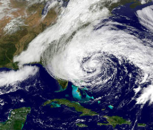
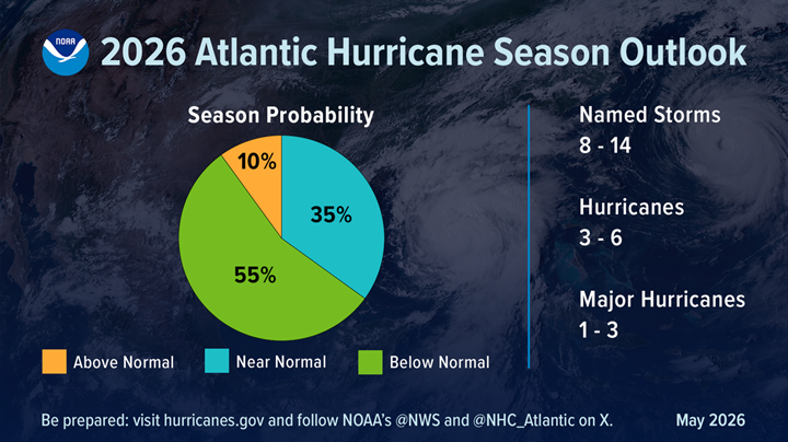

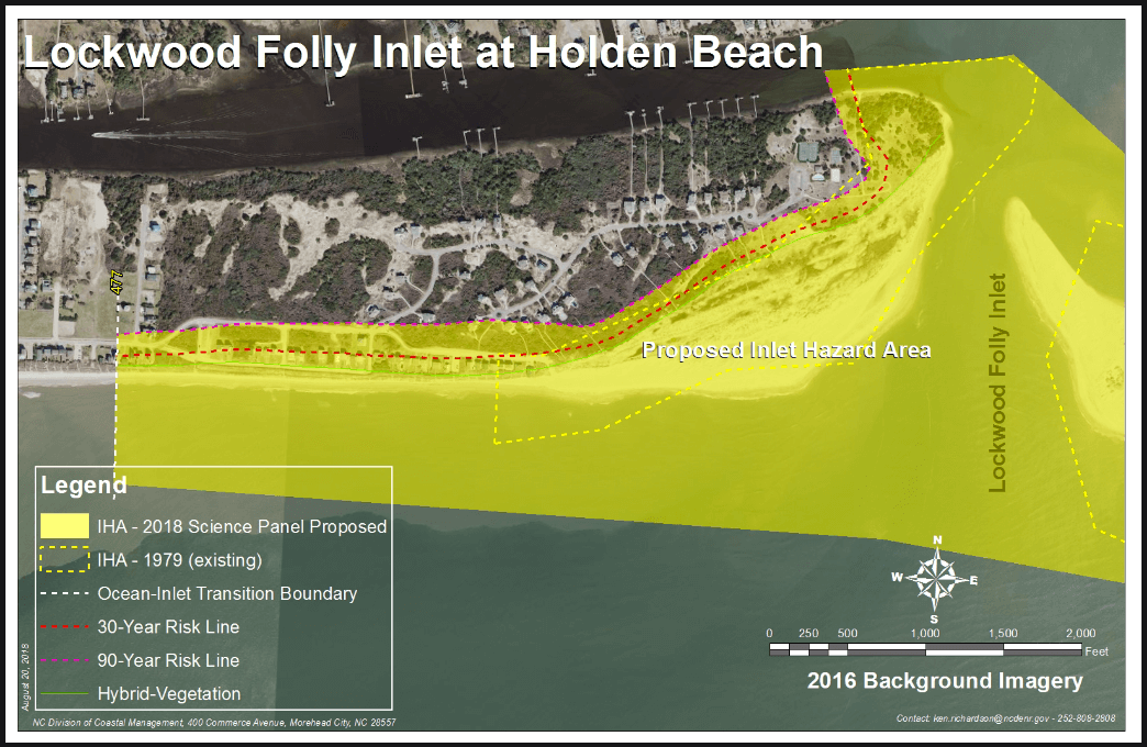
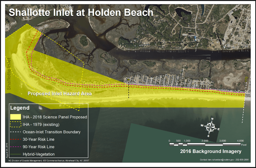
 The
The 
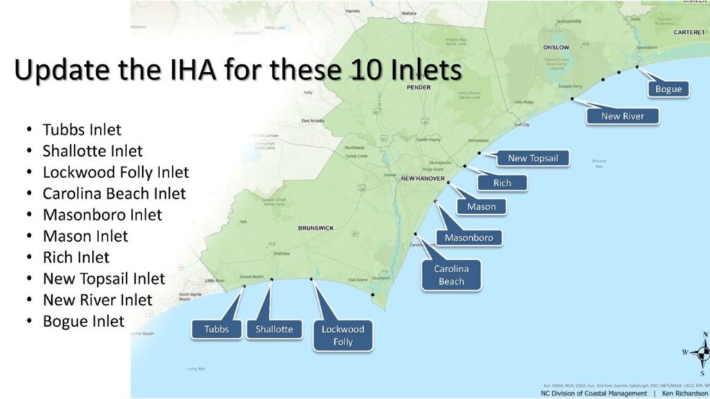

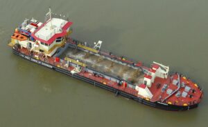
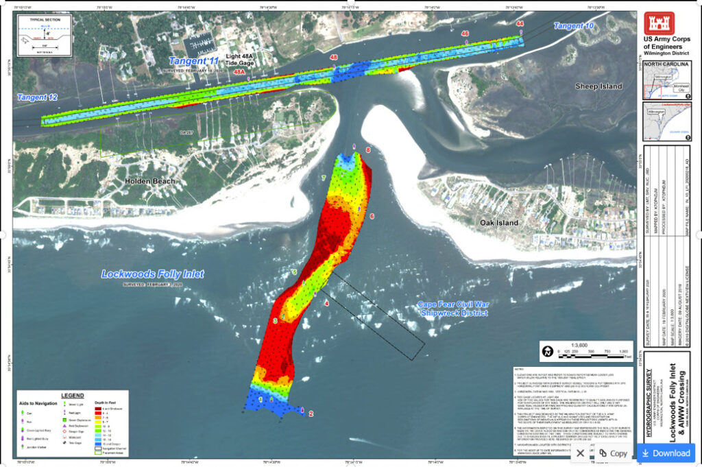
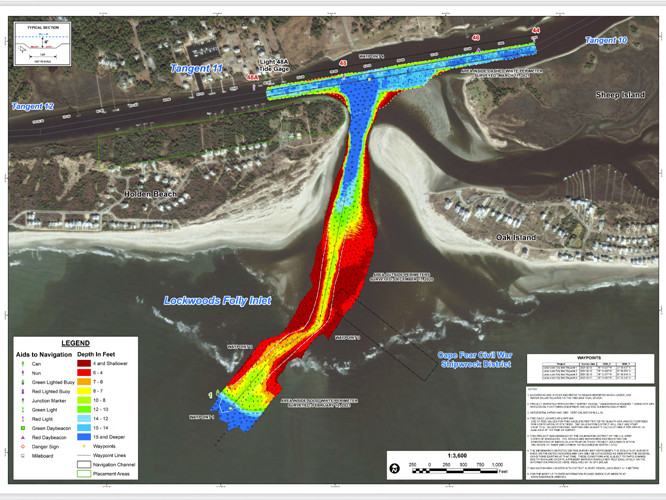 Lockwood Inlet Association warns boaters of broken pipe, other dangers inwaterway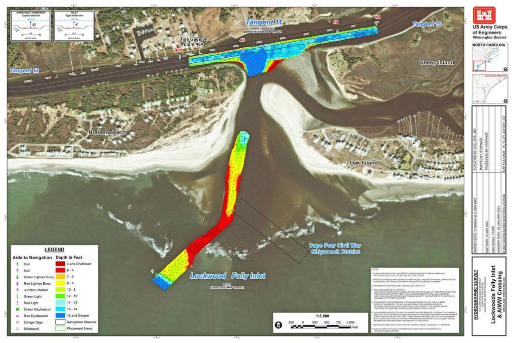
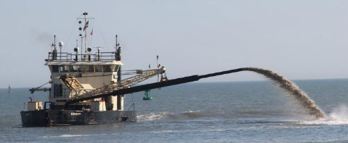 US Army Corps of Engineers set to complete dredging of dangerously shallow Brunswick County inlet