Lou’s Views
“Unofficial” Minutes & Comments
BOC’s Public Hearing / Regular Meeting 10/21/25
Board of Commissioners’ Agenda Packet » click here
Audio Recording » click hereÂ
Public Hearing
PUBLIC HEARING: Proposed Revisions to Town of Holden Beach Code of Ordinances Section 157.087, Building Numbers
Agenda Packet – pages 48 – 53
Section 157.087 » click here
Previously reported – September 2025
ISSUE/ACTION REQUESTED:
Request a date to be set for a public hearing for revisions to Town Ordinance 157.087
BACKGROUND/PURPOSE OF REQUEST:
The Planning & Zoning Board voted to approve revisions to Town Ordinance 157.087
TOWN MANAGER’S RECOMMENDATION:
Follow staff and Planning Board recommendations
Zoning policy
All proposed amendments to the zoning ordinance must go through Planning & Zoning Board for review, comments, and a consistency statement. State statutes require that the governing board hold a public hearing prior to the adoption, amendment, or repeal of any ordinance regulating development.
§157.087 BUILDING NUMBERS.
   (A)   The correct street number shall be clearly visible from the street on all buildings. Numbers shall be block letters, not script, and of a color clearly in contrast with that of the building and shall be a minimum of six inches in height. Numbers shall be provided on each unit in a duplex or multiple unit building and shall consist of the building number with a suffix letter (A, B, C, and the like). Numbers existing on the effective date of this chapter and at least four inches high and clearly visible from the street shall be allowed to remain. Replacement numbers shall comply with this section.
   (B)   Beach front buildings will also have clearly visible house numbers from the strand side meeting the above criteria on size, contrast, etc. Placement shall be on vertical column supporting deck(s) or deck roof on the primary structure. If no such condition exists for the building, or if a clearer line of sight position exists on the building, the numbers shall also be affixed to the primary structure. For buildings with a setback of over 300 feet from the first dune line, a vertical post shall be erected aside the walkway with house numbers affixed. The post shall not exceed eight feet in height above the base of the walkway. The post will be placed on the highest elevation of the walkway within 300 feet of the first dune line. In all cases the numbers must be clearly visible from the strand. Other placements may be acceptable with approval of the Building Inspector.
 (C)   Structures abutting the Atlantic Intercoastal Waterway, canals, and any public trust waters shall have house number affixed to the back of the structure or on the end of the dock/pier visible so as in case an emergency and per the North Carolina Residential Code Section R319.1        Â
Timbo explained that this is a safety issue. Any changes made to the Zoning Code Section 157 requires a Public Hearing. The motion was made to schedule a Public Hearing for Zoning Ordinance change before the next BOC’s Regular Meeting on October 21st.
Holden Beach schedules public hearing for Oct. 21
The Holden Beach Board of Commissioners will hold a public hearing during its Oct. 21 regular meeting for its plan to amend the town ordinance. The amendment, if adopted, will require property owners along canals and the intracoastal waterway to display their addresses on the back of their homes. Town Planning and Inspections Director Tim Evans said during the board’s June 17 meeting that when his crew drove a boat through the waterways to conduct assessments, they found it difficult to discern their location. “I think we’re playing with a time bomb,†Evans said, “because I think if we ever have a water rescue, or we have a high flooding event, and someone has to come in, they’re not going to be able to find any of these houses.†Commissioner Rick Paarfus asked if Evans wanted the house numbers on a dock piling or on the houses themselves. Evans said it will be up to the property owner but that the numbers simply need to be distinguishable. “Everyone that we have been talking to,†Evans said, “and have asked to do this or told them that they needed to do this, have all complied. They all think it’s a great idea.†The motion to schedule the public hearing for Oct. 21 at 5 p.m. during the board’s regular monthly meeting passed unanimously.
Read more » click here
Update –
The Public Hearing was held to hear comments on requiring property owners along canals and the ICW to display building numbers on the back of their homes.Â
Regular Meeting
1. Conflict of Interest Check
2024 Rules of Procedure for the Holden Beach Board of Commissioners
(e) Conflict Check. Immediately after the approval of the agenda, the Presiding Officer shall poll each member to disclose any potential conflicts of interest. In the event that a potential conflict is disclosed, the members will vote on a motion to allow or excuse that member with respect to the agenda item. If excused, the member may not participate in any discussion, debate, or vote with respect to the agenda item.
The Board was polled by Heather our Town Clerk. All of them declared that there was no conflict of interest with any agenda item at this meeting.
2. Annual Parking Report – Jim Varner, Otto Connect (Town Manager Chadwick)
Agenda Packet – pages 11 – 19
Parking Report » click here
ISSUE/ACTION REQUESTED:
Otto Connect, our parking vendor, met with staff to review the annual parking report. The company usually presents to the board yearly and will be at the meeting to discuss the report summary attached.
BACKGROUND/PURPOSE OF REQUEST:
The purpose of the presentation is to provide an overview of this year’s parking data.
TOWN MANAGER’S RECOMMENDATION:
Recommend to accept the report as given.
Total Net Revenue:
2022: Â $455,841
2023: Â $682,933
2024: Â $829,399
2025: Â $802,448 (YTD)Â Â Â Â Â Â Â Â Â Â Â Â Â Â Â Â Â Â Â Â Â Â Â Â Â Â Â Â Â Â Â Â Â Â Â Â Â Â Â Â Â Â Â Â
Planning for 2026 – pending BOC approvals
No Changes recommended
-
- Parking rates and fines consistent with Brunswick County beach towns
- Note: Change to Oak Island Season Permit rate
- Consideration for Resident Parking Permits – TBD
Assessment underway for signage (updates/replacements/etc.)
-
- Continue regular reviews and any updates from the Town
- NOTE: Pier Lot needs to be repainted – for Handicap spaces
- NOTE: Block Q parking lot – consideration for 1 hour limit (free) – monitored
Parking Permits:
-
- Make 2026 Season Permits available in Dec’25
- Make all other permits available 1/1/26
Previously reported – March 2024
The Board changed the rates  and extended the season to charge for parking year-round.
They also discussed but did not approve a proposed resident annual pass at a reduced rate.
Update –
Otto Connect presented the annual paid parking report.
Key Takeaways:
This is the first year that we had year round parking
Revenue is ahead of last year and estimated to exceed $850K
Violation payment rate is 74.2%
.  • Remainder is sent to collections after 30 days
Only 3.6% citation violations
Permits run only for the current calendar year that they were purchased in

With over $800K in revenue I think it is time to fix the pier parking lot. It is really unacceptable that the people that pay for parking have to walk through standing water to get to their vehicle. Believe that we need to address the standing water issue, grade the parking lot and put in lines designating parking spots.
3. Presentation of Plaque for Successful Participation in the National Flood Insurance and Community Rating System – Town Manager Chadwick
Agenda Packet – page 20
ISSUE/ACTION REQUESTED:
Presentation of Plaque for Successful Participation in the National Flood Insurance (NFIP) and Community Rating System (CRS)
BACKGROUND/PURPOSE OF REQUEST:
FEMA has determined the Town will increase to a Class 6 in the NFIP CRS. This determination qualifies our property owners for a 20% discount on flood insurance premiums for most NFIP policies issued or renewed on or after October 1, 2025. This savings is a tangible result of the flood mitigation activities implemented by the Town to protect lives and reduce property damage. A plaque will be presented to the Inspections Department staff for their hard work in securing this rating for the Town. Inspections Director Evans will provide more background information during his monthly report.

Community Rating System (CRS)
The National Flood Insurance Program’s (NFIP) Community Rating System (CRS) is a voluntary incentive program that recognizes and encourages community floodplain management activities that exceed the minimum NFIP requirements.
As a result, flood insurance premium rates are discounted to reflect the reduced flood risk resulting from the community actions meeting the three goals of the CRS:
-
- Reduce flood damage to insurable property;
- Strengthen and support the insurance aspects of the NFIP, and
- Encourage a comprehensive approach to floodplain management.
For CRS participating communities, flood insurance premium rates are discounted in increments of 5% (i.e., a Class 1 community would receive a 45% premium discount, while a Class 9 community would receive a 5% discount (a Class 10 is not participating in the CRS and receives no discount)). The CRS classes for local communities are based on 18 creditable activities, organized under four categories:
-
- Public Information
- Mapping and Regulations
- Flood Damage Reduction
- Flood Preparedness
National Flood Insurance Program Community Rating System
For more information » click here
Update –
Town Manager Chadwick thanked the Planning & Inspections department for their efforts that improved our rating, which translates into lower insurance premiums for all of us. Mayor Holden and Town Manager Chadwick  presented a plaque to the staff and was followed by a photo-op.
4. Police Report – Chief Jeremy Dixon
Agenda Packet – pages 21 – 26
Police Report » click hereÂ

Jeremy reviewed the actions that were taken by them last month
We are in the shoulder season, they experienced a normal seasonal decline of activity
Festival by the Sea is scheduled for October 26th– 27th
Be patient, expect traffic and plan accordingly
Car “break-ins†are happening on multiple islands including ours
Crime Prevention 101 – Don’t make it easy for them
Don’t leave vehicles unlocked
Don’t leave valuables in your vehicles
Public Service AnnouncementÂ
Low Speed Vehicle Safety » click here
Low-speed vehicles (Golf Carts) are required to follow the same traffic laws as every other motor vehicle, including travel lane regulations. They are required to be registered with the DMV and all operators must possess a valid driver’s license.All occupants MUST wear a seat belt, including children who must be secured in an age/weight appropriate child safety restraint.
Download our free app for important updates and notifications.

Staffing –
Having the full complement of eleven (11) police officers seems to be an elusive goal.
What he did not say –
Public Service AnnouncementÂ
Hunting season runs from October till the end of January
Jeremy stated that hunting is prohibited within Town limits
Please notify the Police Department if you hear shots being fired
§130.01 DISCHARGE OF FIREARMS PROHIBITED; EXCEPTIONS.
   It shall be unlawful for a person to shoot or project any stone, rock, shot, or other hard substance by means of a slingshot, bean shooter, air rifle, popgun, bow, or other similar contrivance, or to fire any pistol, gun, or other firearms within the town except on archery ranges, firing ranges, or in legally-established shooting galleries or ranges, or in the discharge of duty by law enforcement officers, provided that the use of firearms in the destruction of rodents, pigeons, squirrels, or similar animals or birds or reptiles that are considered to be a menace to public health or property may be permitted by special permission of the Chief of Police.
§130.02 HUNTING PROHIBITED.
   It shall be unlawful for any person or group of persons to do any hunting of wildlife with dogs or without dogs within the town limits.
A Message from your Brunswick County Sheriff’s Office
What programs does the Brunswick County Sheriff’s Office offer for seniors?
 Brunswick County has one of the highest senior populations in the state, and our older residents are a vital part of our community. We’re proud to offer several programs designed to support their safety and well-being:
Â
Are You OK? – A free daily telephone check-in program for seniors living alone.
Learn more: https://www.brunswicksheriff.com/community-programs/ruok
Â
Project Lifesaver – Provides tracking bracelets for individuals who may wander due to Alzheimer’s, dementia, or other cognitive conditions.
Learn more: https://www.brunswicksheriff.com/community-programs/project-lifesaver
Â
Senior Citizens Academy – An interactive program that gives seniors a behind-the-scenes look at the Sheriff’s Office and local public safety operations.
Learn more: https://www.brunswicksheriff.com/community-programs/senior-citizens-academy
Â
We’re honored to serve and support our senior community every day here in Brunswick County.
Â
For more information on all the programs offered by the Sheriff’s Office, visit our website: https://www.brunswicksheriff.com/
If you know something, hear something, or see something –
call 911 and let the police deal with it.
5. Inspections Department Report – Inspections Director Evans
Agenda Packet – pages 27 – 38
Inspections Report » click hereÂ
ACTIVE NEW HOME PERMITSÂ Â Â Â Â Â Â Â Â Â Â Â Â Â Â Â Â Â Â Â Â Â Â Â Â Â Â Â Â Â Â = 29
OTHER ACTIVE PERMITSÂ Â Â Â Â Â Â Â Â Â Â Â Â Â Â Â Â Â Â Â Â Â Â Â Â Â Â Â Â Â Â Â Â Â Â Â = 506
PERMITS ISSUED OVER $30,000Â Â Â Â Â Â Â Â Â Â Â Â Â Â Â Â Â Â Â Â Â Â Â Â Â Â Â Â Â Â = 62
.  * AMOUNT INCLUDED IN ACTIVE TOTAL
PERMITS ISSUED OVER $100,000Â Â Â Â Â Â Â Â Â Â Â Â Â Â Â Â Â Â Â Â Â Â Â Â Â Â Â Â Â = 4
.  * AMOUNT INCLUDED IN ACTIVE TOTAL
PERMITS ISSUED SUBSTANTIAL IMPROVEMENTSÂ Â Â Â Â Â Â Â Â Â Â Â Â = 2
.  * AMOUNT INCLUDED IN ACTIVE TOTAL
PERMITS ISSUED WAITING PICK UPÂ Â Â Â Â Â Â Â Â Â Â Â Â Â Â Â Â Â Â Â Â Â Â Â Â Â = 38
TOTAL PERMITSÂ Â Â Â Â Â Â Â Â Â Â Â Â Â Â Â Â Â Â Â Â Â Â Â Â Â Â Â Â Â Â Â Â Â Â Â Â Â Â Â Â Â Â Â = 573
PERMITS IN REVIEWÂ Â Â Â Â Â Â Â Â Â Â Â Â Â Â Â Â Â Â Â Â Â Â Â Â Â Â Â Â Â Â Â Â Â Â Â Â Â Â = 10
CAMA ISSUEDÂ Â Â Â Â Â Â Â Â Â Â Â Â Â Â Â Â Â Â Â Â Â Â Â Â Â Â Â Â Â Â Â Â Â Â Â Â Â Â Â Â Â Â Â Â Â = 3
CAMA EXEMPTIONSÂ Â Â Â Â Â Â Â Â Â Â Â Â Â Â Â Â Â Â Â Â Â Â Â Â Â Â Â Â Â Â Â Â Â Â Â Â Â Â Â = 8
ZONING ISSUEDÂ Â Â Â Â Â Â Â Â Â Â Â Â Â Â Â Â Â Â Â Â Â Â Â Â Â Â Â Â Â Â Â Â Â Â Â Â Â Â Â Â Â Â Â = 5
NOTICE OF VIOLATIONSÂ Â Â Â Â Â Â Â Â Â Â Â Â Â Â Â Â Â Â Â Â Â Â Â Â Â Â Â Â Â Â Â Â Â Â Â = 4
DELINEATIONSÂ Â Â Â Â Â Â Â Â Â Â Â Â Â Â Â Â Â Â Â Â Â Â Â Â Â Â Â Â Â Â Â Â Â Â Â Â Â Â Â Â Â Â Â = 1
CAMA SITE INSPECTIONSÂ Â Â Â Â Â Â Â Â Â Â Â Â Â Â Â Â Â Â Â Â Â Â Â Â Â Â Â Â Â Â Â Â Â Â = 15
PERMITS SERVICED FOR INSPECTIONS FROM 09/01 – 09/30Â Â Â Â Â = 107
TOTAL INSPECTIONS MADEÂ Â Â Â Â Â Â Â Â Â Â Â Â Â Â Â Â Â Â Â Â Â Â Â Â Â Â Â Â Â Â Â = 252
National Flood Insurance Program (NFIP) Community Assistance Visit (CAV)
This letter is to inform you that the Community Assistance Visit (CAV) for the Town of Holden Beach performed on April 20, 2023, has been finalized and our office has determined that all requested items have been adequately addressed, and this CAV is considered closed.
The Town of Holden Beach has been enrolled in the regular phase of the National Flood Insurance Program (NFIP) since May 26, 1972, thus making flood insurance and other Federal benefits available throughout the Town. Presently there are 1,937 flood insurance policies in force. for coverage in the amount of $568,083,000.
Participation in the NFIP is voluntary; for a community to maintain compliance in the program it must effectively administer and enforce floodplain management regulations that meet or exceed the minimum standards established by the NFIP as set forth in Title 44, Code of Federal Regulations (CFR), Section 60.3. The overall goal of participation in the NFIP is to reduce the loss of lives and property from flooding. Through this process, we have observed that town staff are effectively implementing the overall goal of the NFIP which is to reduce the loss of lives and property from flooding for the community.
Please continue to enforce all provisions of the town’s floodplain management regulations and maintain all records pertaining to floodplain management indefinitely. Often agencies purge building permits and other types of zoning/development permits on a regular retention schedule; however. records pertaining to floodplain development should be kept in perpetuity.
Update –
Timbo briefly reviewed department activity last month, the department is staying busy. The town staff are effectively implementing the overall goal of the National Flood Insurance Program (NFIP), they got a near perfect score on their annual evaluation.
 Contractors Information Seminar
The Planning & Inspections Department, supported by the town staff, will be hosting the fourteenth  annual Contractors Information Seminar.
6. Finance Department Report – Finance Officer McRainey
Agenda Packet – pages 39 – 44
Finance Report » click hereÂ
Update –
Daniel briefly reviewed the Finance Report
7. Public Works Department Report – Public Works Director Benton
Agenda Packet – pages 45 – 46
Public Works Report » click hereÂ
Department Overview
The Public Works Department continues to focus on maintaining the quality of life for residents and visitors to Holden Beach through consistent operations and upkeep of town infrastructure . Our activities this month included routine maintenance, repairs, and preparedness for weather events .
Key Activities and Accomplishments
.  a) Roadway Maintenance & Repairs
• Pothole Repair: Several areas on the island were identified and repaired, ensuring safer driving
• Signage Repairs: We installed and repaired traffic signs around the townÂ
.  b) Storm ManagementÂ
-
-
- Generator Maintenance: Made sure that all Vac Station generators were fueled and ready to be in use if
- Flooding : Serviced our pumps and made sure we had proper discharge hose in the event we had to pump streets.
- Park : Removed shades from park and winterized the splash
- Valves: Crew located and exercised all water and sewer valves on the
.  c) Water and Sewer
-
-
- Water Meters: Crew installed 6 new water services this
- Water Leaks: We had 4 water service leaks.
- Water Meter Changeouts and Rereads: Crew completed a list with around 230 meters that needed to be reread. Crew identified 30 of those meters to be bad and changed them out.
- Sewer Pits: Crew installed 4 new sewer pits this
- Service Calls : Crew ran close to 100 service calls this This included calls just to speak with a customer or cut the water on and off, sewer pit calls, etc.
Capital Projects & Long-Term Maintenance
.  a) Ongoing Projects
-
-
- Pump Station 2: We had Air Vac on site this past Wednesday and Thursday to start up the new pumps. Everything went as planned and we are now running on the new pumps.
- Meter Maintenance: We are continuing to repair and replace
.  b) Upcoming Projects
-
-
- Fire Hydrants: We are preparing to begin grinding and painting all of our Our plan is to be finished early spring.
- Station 1: We are looking to replace vacuum pumps in Station l and re plumb the station as we
Conclusion
The Public Works Department remains committed to serving the Holden Beach community with quality, timely services. Our team is focused on ensuring safety, cleanliness, and effective infrastructure. We continue to work diligently on ongoing projects and are prepared to tackle any issues that arise in the future.
Update –
Chris/Beef briefly reviewed the Publics Work Report
8. Town Manager Report – Town Manager Chadwick
Agenda Packet – page 47
Town Manager Report » click here
Bryan reviewed the Town Manager Report

Greensboro Street / Sewer Lift Station #2
Staff met onsite with contractor and engineer on 9/23/2025
Contractor did not meet October 1st construction ending deadline
.  • flood door order error means projected delivery date of November 14th
Previously reported – September 2025
91% complete, scheduled completion date of October 1st
Ready for final payment request date of October 30th
Previously reported – August 2025
Sixth application for payment was submitted to funding agencies
82% complete based on the time line
Previously reported – July 2025
Progress meeting between engineer, contractor, and town staff was held on June 26th Fourth application for payment submitted to EPA
State still lags in sending payments and now they are doing a computer system changeover
Previously reported – June 2025
Contractor given an additional seventy-two (72) days to complete the project
Construction schedule completion will now be around October
Previously reported – April 2025
Construction schedule anticipates completion in August
Buy America Build America waivers granted by EPA

Block Q Restrooms & Parking
Contractor is moving toward completion by the end of October
Previously reported – September 2025
Apparently vendor still having issues
Contractor had to have structural engineer back out to reevaluate some work performed
Optimistic that they will still meet the grant deadline
Previously reported – August 2025
They have had numerous construction issues
Contractor had to have structural engineer back out to reevaluate some work performed.
Meeting with contractor, Pinnacle, and structural engineer occurred on August 7th
Contractor was at the meeting to address the BOC’s concerns
Timbo is monitoring the situation very closely and is confident we are back on track
The estimated completion date is now not till the end of September
The BOC’s are concerned about the work being completed as required
If the project is not done by the deadline it could jeopardize the grant funding
Previously reported – July 2025

Breaking News – now the vendor is saying completion will be sometime late in October, which may create some problems for the Town
Contractor struggled early to meet expectations but staff has engaged in several meetings and things appear to be improving
Deliverable for completion remains optimistic for end of August but money will need to be reallocated for contract at July meeting
Pouring concrete, the week of July 1st
Previously reported – June 2025
They have some serious concerns about the work that is being done there
New project superintendent taking over
Previously reported – May 2025
The bathroom on Block Q is scheduled to be completed by August 20th
There will be a Ground Breaking ceremony on June 4th at 10:00am
Previously reported – April 2025
Extension applied for with the state
Ocean Boulevard Stormwater
PPA has been executed on both sides
A meeting is being scheduled with the staff and the Corps for next steps
Previously reported – September 2025
Corps developed PPA
McGill presenting on additional areas of concern as part of September agenda
Previously reported – August 2025
Awaiting Project Partnership Agreement from Wilmington District
Previously reported – July 2025
The Letter Report that Bob Keistler mentioned had the financial certification completed by finance officer
Wilmington District was submitting the Draft Letter Report for review
Previously reported – June 2025
The Town was awarded $2.2M in Environmental Infrastructure Disaster Relief Funding for stormwater projects. To get started USACE requires the execution of the Project Partnership Agreement. The Town portion of the 2.2 million dollar project is 25%, which would cost us $550,000. The motion was made to approve the project partnership agreement with the USACE and have the town staff execute the paperwork.
Pier Site
Future Scope of Work Discussion – TBD
Previously reported – September 2025
On hold awaiting the bond referendum results
Previously reported – August 2025
Draft report ready and on agenda for consideration
Future Scope of Work Discussion
THB Newsletter (04/15/25)
Work has been completed and the pier parking lot and walkways are now open.
Please be mindful not to stand or sit under the pier structure.
NC Resilient Coastal Communities Program
Engineer to contact town staff once contracts are signed with the State
Previously reported – September 2025
The Town participated in an orientation session regarding Phase I of the program on September 9th
Previously reported – August 2025
The Town was selected to receive a technical assistance award through the program
ESP Associates has been assigned as our engineer firm and will receive $70,000
Staff will have an orientation session regarding our phase of the program on 09/09Â
Previously reported – April 2025
N.C. Resilient Coastal Communities Program » click here
North Carolina Division of Coastal Management  is accepting applications from eligible communities for no-cost technical assistance to complete Phases I and 2 of the Resilient Coastal Communities Program. The motion was made to complete an application to Resilient Coastal Communities Program by the deadline of April 25th, if it is at all possible.
LWF/Bend Widener Project
The County voted to provide funds back per our request
Previously reported – September 2025
The motion was made to approve Ordinance 25-14 to provide funds for the Atlantic Intracoastal Waterway (AIWW)Â Crossing/Bend Widener Project which is for the Lockwood Folly Inlet dredging. Christy is working with the county to recoup a percentage of the 25% local share.
Employee Updates
Carey Redwine received her Electrical Inspector Level I certification
Previously reported – September 2025
We filled the vacant Public Works Supervisor position by promoting from within
Mark Thomas Senior Public Service Tech was promoted to Supervisor
County Fire Services
Attended a meeting with the County and other municipalities to discuss fire services
In Case You Missed It –
THB Newsletter (09/09/25)
PUBLIC NOTICE
Every year, Brunswick County Public Utilities and the towns, cities, and other utilities that purchase water from Brunswick County implement an annual flushing program. Public Utilities employees flush the water mains by opening fire hydrants and allowing them to flow freely for a short period of time. The flushing cleans out sediment and allows routine maintenance of the more than 1,440 miles of water lines and over 7,789 fire hydrants in the Brunswick County service area. Flushing may result in discoloration and presence of sediment in your water. These conditions are not harmful and are temporary. During the annual flushing program, a slight change is made in the water treatment process to facilitate an effective flushing program. Throughout the year, Brunswick County Public Utilities adds combined chlorine (in the form of chloramines), to the water as the primary disinfectant. During the annual flushing program, chlorine is added in an uncombined state, commonly referred to as free chlorine. Free chlorine is more effective than combined chlorine at reacting with sediments suspended during flushing. This common practice is also used as preventive maintenance to kill bacteria that, though harmless when consumed by humans, can introduce unwanted taste and odor, and create issues with maintaining a disinfectant residual. Brunswick County will use free chlorine as the primary disinfectant from October 7, 2025, through November 2025. Depending on your location within the distribution system and usage patterns, it could take 7 to 10 days for your drinking water to transition from combined chlorine to free chlorine at the beginning of the flushing program. The annual change from chloramines to free chlorine for this brief period is required by the North Carolina Department of Environmental Quality to promote optimal disinfection throughout the water distribution system. You may experience a change in the taste or smell of your drinking water while free chlorine is being used as the primary disinfection agent. If you are especially sensitive to the taste and odor of chlorine, try keeping an open container of drinking water in your refrigerator. This will enable the chlorine to dissipate and reduce the taste of chlorine in your water. Remember – drinking water has a shelf life. Change out the water in your refrigerated container weekly.
Note: If you have an aquarium or pond, always test the water that you add to your aquatic environment to be sure it is free of any chlorine before adding fish or other animals. Chemical additives with directions for removing either free chlorine or chloramines from water for use in fish tanks or ponds are available at pet/fish supply stores. Kidney dialysis clinics and customers on home kidney dialysis equipment should also be aware of this change.
If you have any questions regarding this process, contact Brunswick County Public Utilities at 910.253.2657, 910.371.3490, 910.454.0512, or via email, or contact your water service provider directly at pworks@hbtownhall.com.
Dog Reminders
Please remember that any time your dog is off your premise, they must be on a leash, cord or chain at all times. Also, dog owners must remove dog waste immediately after it is deposited by the dog when on public property or any private property, including vacant lots, without the permission of the private property owner. Dog waste stations are conveniently located throughout the island.
Emergency Operations Center
The EOC building is being used by Tri-Beach Fire Department while they renovate their fire station on Sabbath Home
National Flood Insurance Program: Reauthorization
Congress must periodically renew the NFIP’s statutory authority to operate. On March 14, 2025, the president signed legislation passed by Congress that extends the National Flood Insurance Program’s (NFIP’s) authorization to September 30, 2025.
As the federal government shutdown drags on, one quiet corner of the housing market has seized up: The sales of homes in flood-prone areas. With the National Flood Insurance Program lapsed since Oct. 1, the government can no longer issue most new policies or renewals, leaving buyers who need coverage for their mortgage uncovered, and throwing deals that had already been negotiated into uncertainty.
News from Town of Holden Beach
The town sends out emails of events, news, agendas, notifications and emergency information. If you would like to be added to their mailing list, please go to their web site to complete your subscription to the Holden Beach E-Newsletter.
For more information » click here
Upcoming Events –
Monster Mash Trunk-or-Treat / October 31st
SBI Three Bridge Tour / November 8th
Veterans Appreciation Luncheon /Â November 10th
Volunteer Appreciation Luncheon /Â November 14th
Turkey Trot / November 27th
Tree Lighting / December 4th
9. Discussion and Possible Approval of Ordinance 25-15, An Ordinance Amending Town of Holden Beach Code of Ordinances Section 157.087, Building Numbers – Inspections Director Evans (Town Manager Chadwick)
Agenda Packet – pages 48 – 53
Ordinance 25-15 » click here
ISSUE/ACTION REQUESTED:
Discussion and Possible Action on Proposed Changes to Holden Beach Code of Ordinances, Section 157.087, Building Numbers
BACKGROUND/PURPOSE OF REQUEST:
Proposed revisions to Section 157.087, Building Numbers were presented to the Board at the September meeting. The Board scheduled a public hearing for October 21st . The amendment has already been reviewed and approved by the  Planning & Zoning Board. If the Board would like to move forward with the proposed changes, the recommended motion would be to approve Ordinances 25-15, along with the corresponding Statement of Consistency.
TOWN MANAGER’S RECOMMENDATION:
 Recommend approval based on staff and Planning & Zoning Board opinion.
Zoning policy
All proposed amendments to the zoning ordinance must go through Planning & Zoning Board for review, comments, and a consistency statement. State statutes require that the governing board hold a public hearing prior to the adoption, amendment, or repeal of any ordinance regulating development.
§157.087 BUILDING NUMBERS.
   (A)   The correct street number shall be clearly visible from the street on all buildings. Numbers shall be block letters, not script, and of a color clearly in contrast with that of the building and shall be a minimum of six inches in height. Numbers shall be provided on each unit in a duplex or multiple unit building and shall consist of the building number with a suffix letter (A, B, C, and the like). Numbers existing on the effective date of this chapter and at least four inches high and clearly visible from the street shall be allowed to remain. Replacement numbers shall comply with this section.
   (B)   Beach front buildings will also have clearly visible house numbers from the strand side meeting the above criteria on size, contrast, etc. Placement shall be on vertical column supporting deck(s) or deck roof on the primary structure. If no such condition exists for the building, or if a clearer line of sight position exists on the building, the numbers shall also be affixed to the primary structure. For buildings with a setback of over 300 feet from the first dune line, a vertical post shall be erected aside the walkway with house numbers affixed. The post shall not exceed eight feet in height above the base of the walkway. The post will be placed on the highest elevation of the walkway within 300 feet of the first dune line. In all cases the numbers must be clearly visible from the strand. Other placements may be acceptable with approval of the Building Inspector.
 (C)   Structures abutting the Atlantic Intercoastal Waterway, canals, and any public trust waters shall have house number affixed to the back of the structure or on the end of the dock/pier visible so as in case an emergency and per the North Carolina Residential Code Section R319.1        Â
Timbo explained that this is a safety issue. Any changes made to the Zoning Code Section 157 requires a Public Hearing. The motion was made to schedule a Public Hearing for Zoning Ordinance change before the next BOC’s Regular Meeting on October 21st.Â
Update –
Public Hearing was held at the beginning of the meeting as required. The proposed ordinance change requires property owners with homes on the waterways to display building numbers on the back of their homes. The motion was made to accept Consistency Statement and Ordinance 25-15 as submitted.
A decision was made – Approved unanimously
10. ADA Assessment Update – Inspections Director Evans (Town Manager Chadwick)
Agenda Packet – pages 54 – 67
ADA Assessment Report » click hereÂ
Executive Summary
This comprehensive report  assesses the Americans with Disabilities Act  (ADA) compliance of key public facilities in the Town of Holden Beach, North Carolina, as of October 1, 2025. The evaluation covers nineteen (19) physical locations, including parking areas, walkways, restrooms, parks, and municipal buildings, alongside a digital accessibility review of the town’s website (https://hbtownhall.com/). Assessments are based on ADA standards for physical elements (e.g., signage, access routes, slopes, landings, handrails, fixtures) and Web Content Accessibility Guidelines (WCAG) 2.1 Level AA for digital accessibility.
Key findings indicate that most physical facilities are fully or partially compliant, requiring minor maintenance (e.g., repainting, signage adjustments, walkway sealing) or limited construction (e.g., concrete pads at Sailfish Park). Digital accessibility needs enhancements to support assistive technologies. Budget allocations, including $500,00 for ADA projects in FY 2024-2025 (required by Mediation Agreement), $180,00 for existing projects. A proposed FY 2025-2026 budget maintaining tax rates, support these efforts. Total estimated costs for physical fixes range from $500,000 to $1M over 2-3 years, with digital upgrades at $5,000-$20,000 initially and $1,000-$5,000 annually. Three future sites are identified for assessment. Prioritizing these recommendations will ensure equitable access, mitigate legal risks {e.g., lawsuits averaging $10,000-$50,000 per case). and align with Holden Beach’s tourism-driven economy.
Overall Recommendations and  Prioritization
-
- Physical: Address Sailfish Park (concrete pad, routes) and construction sites (103.5 QBE, Block Q). Maintain annually to counter coastal
- Digital: Audit com, implement fixes (alt text, contrast, navigation), and train staff.
- Coastal Challenges: Use corrosion-resistant materials, clear sand regularly, and coordinate with NC DEQ for environmental
- Funding: Leverage SPART funds ($334,000), pursue NC DEQ grants ($2.25M statewide in 2025).
- Community: Engage via public hearings (e.g., October 21, 2025) and
- Future: Assess new sites (357.5 OBW Walkway, 1017 OBW Walkway, 1191 OBW – New Walkway at West End Gate). And all improvements to existing non-compliant walkways.
- Update: Perform annual ADA assessment for the Town of Holden Beach, for budget analysis and workload.
Previously reported – February 2025
Small Town ADA Assessment » click here
ISSUE/ACTION REQUESTED:
Discussion and possible action- Small Town ADA Assessment
BACKGROUND/PURPOSE OF REQUEST:
ADA compliance is a federal requirement under the American with Disabilities Act. Often, ADA compliance can be overlooked when considering activities, maintenance, and changing guidelines such as the ABA requirements for certain activities and locations. The town has indicated a desire to make the activities and structures located within the Town as accessible as possible and practical and to ensure compliance with the ADA guidelines.
TOWN MANAGER’S RECOMMENDATION:
Receive outline and timeline and provide feedback as necessary to staff.
The Americans with Disabilities Act gives civil rights protections to individuals with disabilities like those provided to individuals because of race, color, sex, national origin, age, and religion. It guarantees equal opportunity for individuals with disabilities in employment, transportation, State and local government services, telecommunications, and in the goods and services provided by businesses.
-
- Existing Facilities: Program Accessibility
- New Construction, Alterations, and Additions
- Maintenance and Accessible Features
- Effective Communications,
- Process for complying with ADA
Director Evans presented the ADA Assessment plan. He stated that they started the evaluation when we entered into the Key Bridge Mediation Agreement. The town has indicated a desire to make the activities and structures located within the Town as accessible as possible and practical and to ensure compliance with the ADA guidelines. The goal is to identify areas where we don’t meet state or federal requirements, plus any opportunities for improvement. The Town has spent more than $750,000 so far and when projects are completed it will have exceeded what was required.
Update –
Timbo developed a Small Town ADA Assessment which he described as a good start. We still don’t meet all of the ADA guideline requirements yet. Motion was made to accept the assessment, which will be posted to the Town’s website for public review.
A decision was made – Approved unanimously
11. Presentation and Discussion of the Legal Responsibilities and Obligations for the Pier Property under the PARTF Grant Agreement – Attorney Moore (Mayor Pro Tem Myers and Commissioner Paarfus)
Agenda Packet – pages 68 – 84
PARF Grant Report » click here
 ISSUE/ACTION REQUESTED:
Presentation and Discussion of the Legal Responsibilities and Obligations for the Pier Property under the PARTF grant agreement by the Town Attorney.
BACKGROUND/PURPOSE OF REQUEST:
At the October 2024 BOC meeting, there were several questions that remained after the Town Attorney’s presentation of the Town’s legal responsibilities and obligations for the pier property under the PARTF grant agreement. There was also a concern from two commissioners that the information presented may not agree with the PARTF/ Recreation Resource Service’s understanding of the agreement. This presentation and the attached documents are intended to answer these questions and to demonstrate that the two parties are in agreement as to the Town’s responsibilities and obligations under the agreement.
Legal Requirements for the Pier Grants
Remaining Obligation
Only remaining legal obligation regarding the PARTF grant for property located at 441 Ocean Blvd W (246DB001 and 246DB002) is to develop the property for public use under the five (5) year development requirement for property acquired with PARTF funds.
Until development is complete, the Town must keep the property open to the public to the greatest extent possible. Interim facilities must at least include public access or parking on the site and some form of recreation such as a picnic area, trail, or access.
Grant Requirements
The property must be kept for public use and recreation in perpetuity.
-
- In other words, that means forever
Town may not discriminate against any person on the basis of race, sex, color, national origin, age, residency, or ability with regard to use of property or facilities.
Resident parking fees may be no less than 1â„2 the amount charged to non-residents. Ex: Non-resident fees are $200/year; lowest resident fee would be $100/year
The purpose of this memorandum is to explain the Town of Holden Beach’s legal obligations to NC Parks and Recreation Trust Fund (“PARTF”) for the grant obtained for land acquisition of the parcels with Tax Parcel Numbers 246DB001 and 246OB002, collectively known as the “Pier Property”. This memorandum will explore and define the remaining legal obligations, grant requirements, and legal options.
The Town’s only remaining legal obligation to PARTF at this time is to develop the property for public use under the five (5) year development requirement for property acquired with PARTF funds. To fulfill this obligation, the Town is not tied to the conceptual plan submitted with the application for developing the property. Development may be in the form of parking lot enhancement, bathroom or bathhouse enhancement, improvements of camping area, picnic tables, shaded areas, or other recreational facilities. The Town is not limited to the aforementioned ideas so long as whatever is developed on the property allows for public recreational use thereof. In the interim, the Town must keep the property open to the public to the greatest extent possible. Further, PARTF states that interim facilities must at least include public access or parking on the site and some form of recreation such as a picnic area, trail, or access.
Although all other legal obligations have been met, the PARTF Grant Manual for Local Governments lists several requirements that the Town must follow with regards to the Pier Property since the land was acquired with PARTF assistance via land acquisition grant. The property must be kept for public use and recreation in perpetuity. The Town may not discriminate against any person on the basis of race. sex, color, national origin, age, residency or ability with regard to use of property or facilities. Of particular concern regarding parking fees, the Town may have lower parking or admission fees available for residents, but non-resident fees cannot be more than twice the amount charged to residents. Additionally, if the Town applies for additional PARTF grants available for development of the Pier Property, the facilities resulting therefrom must be operated and maintained to provide  public recreation  for twenty-five (25) years from  the project’s  completion,  keep said area open and accessible for public use at all appropriate times, and conduct a site inspection on behalf of N.C. Department  of Natural  and  Cultural  Resources(DNCR) at least once every five (5) years.
The Town has already met other legal obligations, and the deed restriction has been recorded for both parcels. The question of removing said restriction from the Pier Property has been posed, for which there are two (2) options: 1) return the grant or 2) conversion. It is important to note than returning the grant would render the Town ineligible for any and all PARTF grants and the amount to be repaid would be the current market property, not the original grant amount of $500,000.
PARTF defines conversion as the use of property acquired with PARTF assistance for a purpose other than public recreation and occurs in several different instances: 1) exchanging encumbered property with another parcel, 2) selling encumbered property, 3) making use of the property for purposes other than public recreation, 4) leasing the property, or 5) permanently closing all or a portion of the property to the public.
PARTF strongly discourages conversion, and the mitigation process would be time consuming and costly for the Town. Mitigation measures would require the Town replace the Pier Property with a new property of equivalent fair market value and recreational or natural resource usefulness at the time of the conversion and would require prior DNCR approval. The request will be denied if approval would impede access to or result in a net loss of recreational opportunities for the surrounding community. If the request is approved, the replacement property will be encumbered by the same obligations and deed restrictions.
If it is determined the land cannot be replaced, the conversion may be mitigated by the Town repaying PARTF with funds equal to the current value of the land. Thus, selling the property triggers a conversion with the mitigation measure being repayment of current land value to PARTF. A conversion may also be triggered by adding any public or private facilities, other than public recreation facilities (or facilities to support recreation) to the property . This includes  the addition or cellular towers, town halls, fire stations, libraries, etc. for long term use; however, short term uses (less than one year) are not considered a conversion, but do require DNCR approval.
Additionally, leasing or otherwise granting control of all or a portion of the property to another entity will trigger a conversion unless said lease fits one of the two (2) following exceptions. First, a short-term lease, under one year, which has minimal negative impact on the public recreational value of the project is not a conversion but does require DNCR approval. Second, a lease for the purpose of having an entity operate the property on behalf of the Town for public recreational purposes is not a conversion, but DNCR must he notified and aware of such operational leases.
After researching and weighing the pros and cons of each available option previously discussed, it is my legal opinion that it is in the Town’s best interest to develop the Pier Property for recreational use as any funds from sale thereof would not go toward repayment of the loan, but to PARTF as consideration for the removal of the deed restriction on the parcels.
Previously reported – May 2024
Some of the Board members still have questions regarding what the Town is legally required to do by having accepted these grants. Basically, they want to know what can be included and what is required to be included before they approve any plan of action. They simply want to have all our ducks in a row and feel that the prudent thing to do is have our Town attorney review them. The motion was made to have the Town attorney investigate the Town’s legal requirements for the pier grants.
Previously reported – October 2024
BOC’s tasked Town Attorney to report on Town’s legal obligations for grants acquired on pier properties.
Legal Obligations on Pier Properties (Abridged Version)
5 year Development Requirement for property acquired with PARTF funds:
Town is not tied to the conceptual plan, but it does provide ideas for developing the property.
Development can be in the form of parking lot enhancement, bathroom or bathhouse enhancement, improvements of camping are,. picnic tables, shaded areas, recreational facilities, etc. Not limited to any of these ideas.
Pier House deemed to have no value in structure at purchase; may be removed, replaced, repurposed, etc.
Public recreation use should begin ASAP, can be delayed up to 5 years from start date of the PARTF grant contract. Property must be open to public to greatest extent possible.
-
- Interim facilities must at least include public access/parking on the site and some form of recreation (picnic area, trail, access, etc.)

The Town Attorney was tasked with determining our legal requirements by accepting the pier grants. Sydnee briefly reviewed the grant guidelines and presented a summary of the Town’s obligations. She was not able to get some of the answers from the grant itself. This is her official legal position after doing research and after speaking to Brittany the state coordinator, who is the grant liaison person.
Key Takeaways
-
- Need to retain and use property for public access
- Town must keep property/facilities open and accessible for public use
- Need to develop parcels for recreational purposes
- Town must operate and maintain property
- Town is not tied to the conceptual plan
- Pier house has no value and can be removed, replaced, or repurposed
The motion was made to have the Town Attorney prepare a formal opinion to codify the information
Update –
Our Town Attorney Sydnee Moore did an analysis of the pier grant requirements. The intent of the discussion was to clarify obligations and responsibilities that were mutually agreed to. Specifically, to make sure everyone understands the constraints that we have there.
12. Direction and Possible Action on Request for Qualifications for Technical Services to Develop a Comprehensive Design Plan for Jordan Boulevard, Block Q, Bridge Area and Former Pavilion Properties – Assistant Town Manager Ferguson (Town Manager Chadwick)
Agenda Packet – pages 85 – 90
ISSUE/ACTION REQUESTED:
At the September BOC meeting, the board directed staff to bring back an RFQ for a master plan for Block Q, Jordan Boulevard, the bridge area and the site of the former pavilion.
BACKGROUND/PURPOSE OF REQUEST:
The purpose of the RFQ is to solicit professional design firms that can bring their expertise regarding all the property available. The following document is attached for your consideration and further direction.
TOWN MANAGER’S RECOMMENDATION:
Recommend approval to distribute RFQ for a master plan as prepared by staff.
Editor’s note –
A Request for Qualifications (RFQ) is a document that asks potential suppliers or vendors to detail their background and experience providing a specific good or service. In this case, the buyer is only concerned about the vendor’s skills and experience. Professionals responding will be selected solely based on their qualifications and not on price. Once a firm is selected the Town will negotiate a contract for the desired services. Therefore, the response is not a bid.
Previously reported – September 2025
ISSUE/ACTION REQUESTED:
Discussion and possible action to direct staff to develop a Request for Qualifications (RFQ) for technical services to develop a comprehensive plan for the Jordan Blvd, Block Q, bridge area and former pavilion properties.
BACKGROUND/PURPOSE OF REQUEST:
There have been several proposals for the development of Block Q with amenities such as a band stand/pavilion, pickle ball courts, boat parking and vehicle parking. However, a comprehensive plan to develop not only block Q but the surrounding parcels (Jordan Blvd, former pavilion site, bridge area) is needed to make the most efficient use of the available properties to provide these amenities. Subsequent construction of these amenities could then be accomplished in phases according to priorities and budget availability. The intent is to allow a professional design firm to bring their expertise and creativity to bear in developing the master plan, considering all the property available. The BOC should provide some initial guide lines for the RFQ but shall not constrain the firm to those guidelines in developing the master plans.
Possible motion:
Instruct staff to develop an RFQ for a comprehensive design for Block Q, Jordan Blvd, bridge area, and the site of the former pavilion to be reviewed by the BOC.
They want to develop a comprehensive plan not only for block Q but also the surrounding parcels. The Board is trying to approach the development by keeping the end in mind. The plan is to only provide the vendor with guidelines of what they would like to see there. The motion was made to instruct staff to develop an RFQ for a comprehensive design for Block Q, Jordan Blvd, bridge area, and the site of the former pavilion to be reviewed by the BOC.
Update –
Christy presented the Request for Qualifications (RFQ) document a comprehensive design plan for Block Q,  Jordan Boulevard, the bridge area, and the site of the former pavilion for their consideration. Commissioner Paarfus was not ready to support this document as written. The vote to approve the RFQ failed. Mayor Holden attempted to do an end run by proposing that they bring back the previous plans so that they can move forward with a concert venue. After considerable discussion that mostly revolved around protocols the Town Manager intervened. The staff will incorporate comments from the commissioners regarding the RFQ. They will also look at moving forward with the original concert venue plan separately as another option. Staff will have something prepared for them by the next regular BOC’s meeting.
No decision was made – No action taken\
 How many times have we plowed this field?!
Know the difference between wants and needs?
One of the most basic concepts of economics is want vs. need.
A need is something you have to have.
It’s something you can’t do without.
A want is something you would like to have.
It’s not absolutely necessary, but it would be a good thing to have

13. Discussion and Possible Action on Donation Request from the General Federation Women’s Club of Holden Beach – Assistant Town Manager Ferguson (Town Manager Chadwick)
Agenda Packet – pages 91 – 94
ISSUE/ACTION REQUESTED:
During budget workshops, there was a desire by some commissioners that donations come before the BOC for approval. GFWC is one of the organizations that submitted a request and is asking for the donation to be released.
BACKGROUND/PURPOSE OF REQUEST:
This request was included as part of the budget message and the subsequent adoption. The board can review the following application in order to make a determination.
TOWN MANAGER’S RECOMMENDATION:
Recommend approval based on funding approved by commissioners in current FY26 budget.

GFWC of Holden Beach is a volunteer community service organization, and member of the General Federation of Women’s Clubs (GFWC), which is 130 years strong, and “Living the Volunteer Spiritâ€. We are a diverse, fun-loving, group of women, dedicated to serving our community and country, offering opportunity for personal growth and leadership, and  promoting friendship and fellowship among our members.      Â
Update –
There was no discussion, they approved the donation request as submitted.
A decision was made – Approved unanimously
14. Mayor’s Comments
He did not say all of this but this is what he usually says:
Alan was thankful that we got through the storm events this year with minimal damage. Although hurricane season is still on the calendar, traditionally by the middle of October we have been out of the woods. He feels that we have safely made it through another hurricane season and have been very fortunate this year.
15. Executive Session Pursuant to North Carolina General Statute 143-318.11(a)(3), To Consult with the Town Attorney
No decision was made – No action taken
General Obligation Bond Referendum –

Resolution 25-03 » click here
Resolution 25-04 » click here
Resolution 25-06 » click here
Bond Order » click here
Resolution 25-07 » click here
Original Version / Pier Bond – FAQ’s
What is the referendum for?
It is only for the demolition and removal of the existing pier and construction of a new pier. Â It does not cover the debt on the initial purchase, building a pier building, maintenance, or any operating costs.
Can the bond money be used to construct a new pier building?
No, the bond money can only be used to remove the existing pier and construct a new one. Additional new debt may be needed to construct a building. (Source: Bond Counsel)
Can the bond money be used to pay for the pier property?
No, the land was purchased in March 2022 at a cost of $3.2M financed at 3.18% over 15 years with an annual debt service cost of $260k. (Source: Audit Reports)
Why do we need to vote on a referendum?
Since the land was used as collateral for financing the purchase of the pier property, we will need to issue General Obligation (GO) bonds. Issuing General Obligation (GO) bonds (which use taxing authority as collateral) is the best way to fund the construction of a new pier, and General Obligation bonds require a voter referendum. (Source: State Statute § 159-61 (a))
When will we vote on the referendum?
The referendum will be forwarded to the Brunswick County Board of Elections and appear on the November 4th ballot for voter consideration.
What will the referendum ballot say?
It will have a YES or NO vote on approving the bonds. The final wording will be set on September 5th, but it is required to state: 1) total amount of the bonds; 2) the amount of the principal and interest payments to pay off the debt; and 3) the amount property taxes would need to be increased to cover the payments. (Source: State Statute § 159‑61 (d))
Will property owners get to vote?
No, only voters who are registered to vote at Holden Beach, NC can vote on the referendum. (Source: State Statute§ 159-61 (a))
Will all registered voters in Brunswick County get to vote on the referendum?
No, only registered voters who live on the island. (Source: Board of Elections)
How much will it cost to build a new pier?
The engineer’s Not-To-Exceed estimated construction cost is $7.3M. The estimated interest cost of the bond is $4.3M, making the total cost $11.6M. (Sources: HDR report and Town of Holden Beach and bond financial advisor)
Are grants available to pay for the pier?
Not at this time. Our lobbyist has been working with town staff to search for grant opportunities but they have not identified any. A PARTF grant of $500k was obtained for the purchase of the land in 2022. (Source: Budget Meeting Minutes)
How will this affect my property taxes?
The estimated amount of property tax liability increase for each one hundred thousand dollars ($100,000) of property tax value to service the cumulative cost over the life of the bond provided above would be $31.60 per year.
Taxes will increase 22.6%
Our current tax rate is 14 cents per $100
The new tax rate would be 17.16 cents per $100
The estimated amount of property tax liability increase for each one hundred thousand dollars ($100,000) of property tax value to service the cumulative cost over the life of the bond provided above would be $31.60 per year.
Property tax increase of $0.0316 per $100.00 of assessed valuation
A home on the island with a value of $1,000,000 estimated cost will be:
($1,000,000 % $100,000) x $31.60 = $316.00 per year
$316.00 x 20 years = $6,320
Our current tax rate is 14 cents per $100
The new tax rate would be 17.16 cents per $100
This would be a 22.6% tax increase
If the referendum fails, can we still build the pier?
Probably not, since it is unlikely, at least in the short-term, that the Local Government Commission would approve an alternate form of financing for a project that did not pass at a General Obligation Bond referendum. (Source: Bond Counsel)
Could we use our fund balances to pay for it in cash?
Possibly, but depleting our funds would impact other planned investments like the fire station and beach nourishment. (Source: Holden Beach Town Budget)
Could the BOC levy an assessment to pay for it?
Yes, but the BOC would need to go against the will of the voters. (Source: Town Ordinances)
 If the referendum passes, are we required to build the pier?
No. It is unlikely that the Local Government Commission would not approve debt passed at a referendum. The Board of Commissioners would then have to take action to actually issue the bonds in the future and they have discretion as to whether to issue some or all of the bonds or none at all. (Source: Bond Counsel)
If the referendum passes, how long can we wait before issuing the bonds?
Seven (7) years.Â
How long is the term of the bonds?
The expected term of the bonds is twenty (20) years.Â
Can we insure the pier against storms?
No, a new pier will be uninsurable for wind or water, and we will still need to pay off the bonds even if the pier is damaged in a storm and is no longer usable. (Sources: LGC, Town of Holden Beach)
What is the design of the new pier?
It is a wooden, pedestrian-grade, 996-foot-long pier with a covered “T†at the end – very similar to the design of the original pier, but taller and stronger for better protection from waves. (Source: HDR report)
How deep will the water be at the end of the pier?
Between 10 to 20 feet, depending upon the tide, according to beach profile elevation survey conducted by the engineer. (Source: HDR report)
How much will it cost to maintain the pier?
The engineer’s estimated funding needs for maintenance, preservation, rehabilitation, and major capital replacement projects to extend its life to 50 years is $3.6M, which equates to $72,560 per year on an annualized basis. (Source: HDR report).
How much will it cost to operate the pier?
The engineer did not estimate operating costs, but they are anticipated to include water, electricity, insurance (liability, vandalism & fire) and personnel costs for staffing it.  (Source: HDR presentation to the BOC)
How will the pier generate revenue for the town?
Operating revenues have not been estimated, but are anticipated to include admission and fishing fees, increased parking revenues, and increased occupancy tax revenues. Any increase in sales tax revenue would be insignificant due to the way it is allocated within the county. (Source: Town Budget)
Will the pier generate a profit?
Most likely no, since it is very doubtful if pier revenues will exceed operating and maintenance costs, let alone cover debt service costs. Â (Source: HDR report on lifecycle costs)
Can parking revenue pay for the pier?
Partially, but all parking revenues are currently being used to pay other expenses, including the debt service cost of the pier property purchase. These expenses would need to be reduced, and/or parking fees increased, before parking revenues could be used to cover a meaningful portion of the debt service cost of the bonds. (Source: Town Budget)
Can we save the existing pier?
Possibly, but according to our engineering studies, it would cost more than to replace it, and the old pier does not comply with current building codes and would not be as strong as a new one. (Source: HDR report)
How much will it cost to remove the existing pier?
The $7.3M Not-To-Exceed estimate includes removal of the existing pier. There is no cost estimate for removing the existing pier without replacing it. (Source: HDR report)
Will there be a new pier building?
Most likely, but there are no viable plans or cost estimates at this time, and the building design is dependent on the fate of the pier. Â There are significant PARTF grant restrictions on what functions the building can support (i.e., it must be dedicated as a recreation site for the use and benefit of the public for a minimum of 25 years). (Source: PARTF Grant Contract)
Is a Public-Private Partnership a viable approach to pay for the pier or the building?
Possibly, but it would be a very complex arrangement that must meet the requirements of the PARTF grant and would require Local Government Commission approval. (Source: NC Session Law 2013-401; House Bill 857)
Updated Version / Pier Bond – FAQ’s
What is the referendum for?
It is only for the demolition and removal of the existing pier and construction of a new pier. It does not cover the debt on the initial purchase, building a pier building, maintenance, or any operating costs. Â
Can the bond money be used to construct a new pier building?
No, the bond money can only be used to remove the existing pier and construct a new one. Additional new debt may be needed to construct a building. (Source: Bond Counsel)
Can the bond money be used to pay for the pier property?
No, the land was purchased in March 2022 at a cost of $3.2M financed at 3.18% over 15 years with an annual debt service cost of $260k. (Source: Audit Reports)
Why do we need to vote on a referendum?
Issuing General Obligation (GO) bonds (which use taxing authority as collateral) is the best way to fund the construction of a new pier, and General Obligation bonds require a voter referendum. (Source: State Statute § 159‑61 (a))
When will we vote on the referendum?
The referendum will be forwarded to the Brunswick County Board of Elections and appear on the November 4th ballot for voter consideration.
What will the referendum ballot say?
It will have a YES or NO vote on approving the bonds.Â
Additional property taxes may be levied on property located in the Town of Holden Beach, North Carolina in an amount sufficient to pay the principal of and interest on bonds if approved by the following ballot question.
Shall the order authorizing $7,300,000 of bonds plus interest to finance the capital costs of the demolition and removal of the existing pier and construction of a new pier, including any improvements related thereto, and providing that additional taxes may be levied in an amount sufficient to pay the principal of and interest on the bonds be approved, in light of the following:
(1) The estimated cumulative cost over the life of the bond, using the highest interest rate charged for similar debt over the last 20 years, would be $11,586,345 (consisting of $7,300,000 principal amount of bonds plus $4,286,345 of interest).
(2) The estimated amount of property tax liability increase for each one hundred thousand dollars ($100,000) of property tax value to service the cumulative cost over the life of the bond provided above would be $31.60 per year.
Will all property owners get to vote?
No, only voters who are registered to vote at Holden Beach, NC can vote on the referendum. (Source: State Statute § 159‑61 (a))
Will all registered voters in Brunswick County get to vote on the referendum?
No, only voters who are registered to vote at Holden Beach, NC can vote on the referendum. (Source: Board of Elections)
How much will it cost to build a new pier?
The estimated cumulative cost over the life of the bond, using the highest interest rate charged for similar debt over the last 20 years, would be $11,586,345 (consisting of $7,300,000 principal amount of bonds plus $4,286,345 of interest.Â
Are grants available to pay for the pier?
There may be grant opportunities available in the future. Our lobbyist has been working with town staff to search for grant opportunities but none have been available this early on in the process. (Source: Budget Meeting Minutes)
How will this referendum affect my property taxes?
Your taxes may increase to a maximum as follows:
The estimated amount of property tax liability increase for each one hundred thousand dollars ($100,000) of property tax value to service the cumulative cost over the life of the bond provided above would be $31.60 per year.
For a property on the island with a value of $1,000,000 estimated cost will be:
($1,000,000 /$100,000) x $31.60 = $316.00 per year
$316.00 x 20 years = $6,320
If the referendum fails, can we still build the pier?
Funding the pier will be more challenging, since it is unlikely, at least in the short-term, that the Local Government Commission would approve an alternate form of financing for a project that did not pass at a General Obligation Bond referendum. (Source: Bond Counsel) Other forms of paying for the pier have not been explored at this time and may be challenging based on costs outlined in our Capital Improvement Plan.Â
If the referendum passes, are we required to build the pier?
No. It is unlikely that the LGC would not approve debt passed at a referendum. The Board of Commissioners would then have to take action to actually issue the bonds in the future and they have discretion as to whether to issue some or all of the bonds or none at all. (Source: Bond Counsel) The Town has seven years to issue the bonds.
How long is the term of the bonds?
The expected term of the bonds is twenty (20) years.
Can we insure the pier against storms?
No, a new pier will be uninsurable for wind or water. (Source: Town of Holden Beach)
What is the design of the new pier?
It is a wooden, pedestrian-grade, 996-foot-long pier with a covered “T†at the end – very similar to the design of the original pier, but taller and stronger for better protection from waves. (Source: HDR report)
How deep will the water be at the end of the pier?
Between 10 to 20 feet, depending upon the tide, according to beach profile elevation survey conducted by the engineer. (Source: HDR report)
How much will it cost to maintain the pier?
The engineer’s estimated funding needs for maintenance, preservation, rehabilitation, and major capital replacement projects to extend its life to 50 years is $3.6M, which equates to $72,560 per year on an annualized basis. (Source: HDR report).
How much will it cost to operate the pier?
The engineer did not estimate operating costs.
How will the pier generate revenue for the town?
Operating revenues have not been established.
Will the pier generate a profit?
We do not know.Â
Can parking revenue pay for the pier?
All parking revenues are currently being used to pay other expenses, including the debt service cost of the pier property purchase. (Source: Holden Beach Town Budget)
Can we save the existing pier?
According to our engineering studies, it would cost more to repair the pier than to replace it, and the old pier does not comply with current building codes and would not be as strong as a new one. (Source: HDR report)
How much will it cost to remove the existing pier?
The $7.3M Not-To-Exceed estimate includes removal of the existing pier. There is no cost estimate for removing the existing pier without replacing it. (Source: HDR report)
Will there be a new pier building?
Most likely, but there are no viable plans or cost estimates at this time. Â
Is a Public-Private Partnership a viable approach to pay for the pier or the building?
It would be a very complex arrangement that must meet the requirements of the PARTF grant.Â
This Board has outlined the necessary steps and costs for constructing a new pier and is presenting the decision to the community through a public referendum. The referendum allows for the public to decide whether to spend the money for a pier not just the five (5) Board members. Personally, I believe that most of the public would like to have a pier but the high cost may lead to limited public support. I just don’t think that the island property owners are willing to pay for it.

Editor’s note –
Received the following anonymous email from HBVoter
Do not know who sent it or who else they sent it to
That said, we are including it, as submitted, so that you get another point of view
 Let’s talk about the Pier Bond Referendum
 Dear Holden Beach Voters,
The Holden Beach Commissioners have voted to put the Pier Bond referendum on the 2025 November ballot. They are asking the voters if they want to pay to rebuild the Pier instead of unilaterally deciding like the previous board (that included Page Dyer and Rick Smith) did with the Pier property purchase; here’s your chance to make your voice heard.
Here are some critical facts about the new Pier:
★    The Pier Cannot be insured! If it gets destroyed the taxpayers will continue to pay the debt with nothing to show for it
â—‹Â Â Â Â Â Would you build a $7.3M home and not insure it? So why would/should the taxpayers build a $7.3M structure that is in the direct path of hurricanes?
★    Taxes will go up 22.6% based on the total cost of $11.6M ($7.3M + interest)
â—‹Â Â Â Â Â $31.6 per $100k property value per year
â– Â Â Â Â Â That means a $1M home would pay $316/year or $6,320 over 20 years
○     Is this the best use of our money? Wouldn’t this money be better spent on critical infrastructure such as:
â– Â Â Â Â Â Sand Renourishment – FEMA and the CORE will likely not help us when we have our next hurricane
â– Â Â Â Â Â New Fire Station – Holden Beach needs a year-round fire station on the island, not just 7am-7pm during tourist season
â– Â Â Â Â Â Stormwater mitigation – We need to be able to drive down Ocean Blvd after a storm
â– Â Â Â Â Â Sewer Sub-Stations – Replacement pumps are expensive!
★    A BOC could still build a Pier if the referendum does not pass
â—‹Â Â Â Â Â If the referendum does not pass in November, a BOC could still build a new pier similar to how the previous board (that included Page Dyer and Rick Smith) did when they BOUGHT the Pier property against the wishes of the homeowners BUT:
â– Â Â Â Â Â The LGC would not let the town borrow the money if the voters voted against a tax increase via the referendum
-
-
-
-
-
- A new BOC could still use savings to build the pier without a loan – but this savings should be going toward critical infrastructure (Sand Renourishment, Fire Station, Stormwater Mitigations, Sewer Sub-Stations, etc.) not an amenity like the Pier (which cannot be insured!)
- A new BOC could impose a tax assessment to pay for the Pier regardless of the Voters’ wishes (A tax assessment is a fixed dollar amount added to every property tax)
- This is why it’s important to elect new commissioners that will respect the referendum vote (Chad Hock and Maria Surprise)
â—‹Â Â Â Â Â The Commissioners would be proceeding against the voters’ express wishes if they proceeded to build a new Pier. Going against the voters who voted them into office to represent them is not a smart idea. Wait, that’s exactly what the previous board (which included Page Dyer and Rick Smith) did when they bought the Pier for $3.3M. But remember the ‘3’ replaced that board, and it is VERY unlikely they would vote to go against the voters choice – isn’t that why they voted to have the referendum? To let the voters decide if they wanted a new Pier – so let’s vote to keep like-minded people in the majority like Chad Hock and Maria Surprise (BTW, Page Dyer and Rick Smith voted against the referendum initially)
 ★    The Pier will NEVER be self-sustaining or financially viable.
○     This cost does NOT include the loan repayment cost for the $7.3M loan to BUILD the Pier
○     Do the math. The projected Maintenance cost alone is projected to be an average of $72k/year for 20 years.
○     $72,000/365 days/$10 (1 rod cost on Oak Island) = 20 people fishing on the pier every single day of the year to pay for the maintenance cost only
○     This cost does NOT include the loan repayment cost for the $3.3M loan to BUY the Pier property
â—‹Â Â Â Â Â This cost does NOT include operating cost – liability insurance, electricity, water, cleaning, trash, employee costs, etc.
â—‹Â Â Â Â Â So, if you’re expecting a new Pier to pay for itself with fishing fees it will never happen. It’s a recreational amenity like the parks or the basketball/pickleball court – it is not a business, which is why a Public-Private Partnership) PPP was never a viable option for building the pier (even though Page Dyer brings a PPP up at every BOC meeting)
★    The Pier will not bring in significant additional economic benefits to Holden beach
○     There has not been a decrease in Occupancy tax during the last three years that the Pier has been closed, proving that tourists are coming to Holden Beach for the BEACH not the Pier.
â—‹Â Â Â Â Â Paying $11.6M for an uninsurable Pier is an extremely high risk venture for the taxpayers who would be funding it
So please get out and VOTE NO for the Pier Referendum in the November 4th election!! You need to make your voice heard to the commissioners. It will be much harder for the BOC to build a Pier if the referendum does not pass
And while you’re there voting I highly encourage you to vote for Maria Surprise and Chad  Hock – let’s keep the momentum going on making fact based fiscally sound decisions and letting the voters weigh in on important decisions like the Pier.

Personally, I am strongly against constructing the pier.
First and foremost, how are we going to pay for this?
If the bond referendum passes then great, if that’s what the people paying for it want.
If not, it’s preposterous to think that donations, fundraisers, paid parking, or grants will be adequate to cover the $11.6M total cost.
So far donations are not even a half of one percent, they are nowhere near that amount which would be $58,000, which is grossly inadequate.
The paid parking revenue, for the entire island, does not even cover the pier property purchase debt obligation.
The current federal administration is clawing back funds that have already been approved so it is not likely that we would be getting any grants anytime soon.
Therefore, it is not a realistic expectation that we will be able to raise adequate funds elsewhere.
 Other talking points to consider –
 Taxes will increase by 22.6%
The pier will never be financially viable
Pier revenues will not even cover operating and maintenance costs, let alone cover debt service costs
The pier cannot be insured, we will still need to pay off the bonds even if the pier is damaged in a storm and is no longer usable
 Plans for the pier property are all over the place, it is not a panacea
Frankly, this is not a viable location for a year-round business and does not have adequate parking even for a seasonal business
The parking lot there has been full throughout the year regardless of the weather
That is without either the pier being available for use or any business running out of a building there
There just is not adequate parking there to support beachgoers, fisherman, and whatever else we plan to do with a building there.Â
The pier has a huge economic impact via tourism and rental occupancy is a cockamamie narrative
No one is renting a house at the beach just because we have a pier
The Pier is a nice amenity but it will not bring in any significant additional economic benefits to the town
The Holden Beach Fishing Pier has been closed to the public since 2022 due to significant disrepairÂ
Occupancy tax revenue has not been negatively impactedÂ
during the period that the pier has been closed
¯\_(ツ)_/¯
2018-19Â Â Â Â Â Â Â Â Â Â $2,931,730
2019-20Â Â Â Â Â Â Â Â Â Â $3,008,435
2020-21Â Â Â Â Â Â Â Â Â Â $3,946,327
2021-22Â Â Â Â Â Â Â Â Â Â $4,730,112
2022-23Â Â Â Â Â Â Â Â Â Â $5,117,217
2023-24Â Â Â Â Â Â Â Â Â Â $5,306,333
2024-25Â Â Â Â Â Â Â Â Â Â $4,181,413
2025-26Â Â Â Â Â Â Â Â Â Â $4,050,000 / budget estimate

Holden Beach Property Owners Association
UNOFFICIAL HOLDEN BEACH TAXPAYER STRAW POLL
HBPOA’s Role: Ensuring Every Taxpayer Has a Voice
Under its charter, HBPOA is committed to giving all Holden Beach property owners a chance to be heard—whether or not they are eligible to vote in November.
To that end, HBPOA is conducting this Unofficial Straw Poll, asking each Holden Beach Household to vote Yes or No on the exact same Referendum that will be on the November 6 Ballot.
 How the Straw Poll Works
-
- HBPOA is sending this Unofficial Straw Poll to each of the 2000+ Holden Beach Households by email and/or US Mail.
- Each Household may cast ONE YES or NO vote on the Referendum question – regardless of the number of residents in the household or whether they are registered Holden Beach voters.
- Each Household has a Voter ID and a Password to ensure that only one vote can be cast per Household and to assure election integrity and voter anonymity.
This Unofficial Straw Poll is being conducted using Election Runner – an independent third-party service used by many nonprofit organizations.
Go to https://electionrunner.com for more information.
Unofficial Straw Poll Results
The results will be posted on HBPOA’s website: https://holdenbeachpoa.com.
Municipal Elections –
2025 Municipal Elections
The following candidates have officially filed for Holden Beach municipal electionsÂ
Holden Beach Mayor
Mike Felmly      137 Carolina Avenue   Holden Beach
Alan Holden     128 OBW             Holden Beach (incumbent)
Holden Beach Commissioner
Robert Brown    109 Crab Street        Holden Beach
Sylvia Pate       11 Charlotte Street    Holden Beach
Keith Smith      105 Durham          Holden Beach
Maria Surprise   159 OBE              Holden Beach
Chad Hock       1222 OBW            Holden Beach
Board of Commissioners Duties and Responsibilities include:
-
-
- adopting the annual budget
- establishing the annual tax rate
- enacting local ordinances and Town policies
- formulating policies for the conduct of Town operations
- making appointments to advisory boards and committees
- oversee long range plans for the community
2025 Municipal Election Guide Brochure (PDF)
Editor’s note –
In the past , I have not endorsed any candidates nor am I planning to start now. The litmus test for me, to determine whether the nominee will receive my vote, is simply whether they would move forward with constructing the pier even if the referendum failed. Regardless of whom I ultimately vote for, I will support and be at their service of whoever is elected.
Women voters league to host Brunswick County municipal candidate forums
With Election Day two months away on Nov. 4, area candidate forums are heating up. In October, the League of Women Voters of Lower Cape Fear is asking for Brunswick County residents who live and vote in Leland, Oak Island, Southport and Holden Beach to join them for four forums. All will be non-partisan, representing candidates in the municipal elections. Voters are welcome to submit questions to LWVLCF.org. Deadlines for Leland and Oak Island are Sept. 20 and Sept. 27 for Southport and Holden Beach.
The schedule is below and all forums are held 6 p.m. – 8 p.m.
Oct. 17 —  Holden Beach Candidate Forum:
Holden Beach Town Hall, 110 Rothschild St.
Additional information about voting and registering to vote can be found here.

Meet the Candidates Night
The objective of a Candidates Night event is to help the electorate make an informed choice when they vote for Town leaders.
Meet the Candidates >>> Answers

Be a Voter – Your Vote Matters!
Star News Online / Meet the Candidates
Holden Beach Mayor
There are two candidates running for Mayor of Holden Beach. Mike Felmly is challenging longtime mayor Alan Holden.
This Brunswick County beach town is south of Oak Island and north of Ocean Isle, and according to data from the U.S. Census Bureau, it has a population of about 1,000 full-time residents.
The town has a mayor and a board of five commissioners with one acting as the mayor pro tempore. Commissioners serve four-year terms, and the mayor serves a two-year term. This race is nonpartisan. According to information provided by the Holden Beach town clerk, the mayor receives a stipend of $150 a month and commissioners receive $100 a month.
The municipal election will be held on Tuesday, Nov. 4, and polls will be open from 6:30 a.m. to 7:30 p.m. Voters may also cast their ballots absentee by mail and during the early voting period, which begins Thursday, Oct. 16 and goes through Saturday, Nov. 1. Absentee ballots are due at the Brunswick County Board of Elections office by 7:30 p.m. on Election Day.
Here are the candidates’ responses and their thoughts on current issues.
 Candidate responses have been edited for style, grammar and length.
NOTE: Mike Felmly did not respond to multiple requests to participate in this StarNews candidate questionnaire. If a response is received, this story will be updated.
Alan Holden
-
- Age:76
- Occupation:Businessman (self-employed)
- Family:Single; three grandchildren
- Education: 16 years — Methodist University (1971 class)
- Political experience: Holden Beach Commissioner, 10 years: mayor pro-tempore, two years; mayor, 18 years
- Political affiliation: Unaffiliated
What are the top issues facing Holden Beach?
Holden:
The town needs to become more unified and celebrate the wonderful place that enticed the residents and visitors to come here. Protect property values by protecting assets such as the beach strand, water, sewer, canals, etc.
What goals do you have for Holden Beach?
Holden:
As in the past, support the Holden family’s vision of a family beach.
 Why are you the best candidate for this position?
Holden:
My 28 years as mayor and/or commissioner, the many years as emergency director and other years on the planning board and board of adjustments have provided much education and on-the-job training. Also, my 76 years as my one and only ever home on the island have allowed me to witness and be a part of this town even before it became a town, an involved community and state leader in business and everyday life.
 What is your vision for the pier complex?
Holden:
To support the will of the people as I have no vote. The five commissioners will make the decisions.
 What does responsible growth look like in Holden Beach?
Holden:
The island has approximately two-thirds of its lots developed of the potential 3,500 lots. Maintaining the infrastructure to provide adequate services for controlled growth as a family beach without a directional change is my goal. Safety, security, sound management, services, and protection of financial investments are critical.
Holden Beach Board of Commissioners
There are four candidates vying for two seats on the Holden Beach Board of Commissioners.
Voters may cast ballots for two of the following candidates for the board of commissioners: Chad Hock, Sylvia Pate, Keith Smith, and Maria Surprise. Robert E. Brown had also filed to run but withdrew from the race after the filing period ended.
This Brunswick County beach town is south of Oak Island and north of Ocean Isle, and according to data from the U.S. Census Bureau, it has a population of about 1,000 full-time residents.
The town has a mayor and a board of five commissioners with one acting as the mayor pro tempore. Commissioners serve four-year terms, and the mayor serves a two-year term. This race is nonpartisan. According to information provided by the Holden Beach town clerk, the mayor receives a stipend of $150 a month and commissioners receive $100 a month.
The municipal election will be held on Tuesday, Nov. 4, and polls will be open from 6:30 a.m. to 7:30 p.m. Voters may also cast their ballots absentee by mail and during the early voting period, which begins Thursday, Oct. 16 and goes through Saturday, Nov. 1. Absentee ballots are due at the Brunswick County Board of Elections office by 7:30 p.m. on Election Day.
Here are the candidates’ responses and their thoughts on current issues.
Candidate responses have been edited for style, grammar and length.
 Chad Hock
-
- Age:53
- Occupation:Â Retired
- Family:Â Married with two adult children
- Education:High school graduate; U.S. Army
- Political experience: Holden Beach planning and zoning
- Political affiliation: Unaffiliated
Sylvia Pate
-
- Age:Â 72
- Occupation:Â Broker/REALTOR with PROACTIVE Real Estate
- Family: Married; one daughter with three grandchildren
- Education:S. in organizational leadership and management, University of North Carolina Pembroke; B.S. in special studies, Western Carolina University
- Political experience: Did not answer
- Political affiliation: Unaffiliated
Keith Smith
-
- Age: 55
- Occupation:Insurance Adjuster
- Family:Â My wife and I have 10 children with ages ranging from 11 to 30. We have one grandchild with two more on the way.
- Education:I graduated high school from John T. Hoggard High School in Wilmington North Carolina. I have several years of higher education but no completed degrees.
- Political experience: I have assisted other local candidates to run for elected office, but I have never held an elected office myself. This is the first time I have run for an elected political seat. I have served on the Holden Beach Parks and Recreation Board for the last several years.
- Political affiliation: Republican
Maria Surprise
-
- Age:58
- Occupation:Â Retired
- Family:John Woods, husband
- Education:S. electrical engineering, University of Vermont
- Political experience: Town of Holden Beach Planning and Zoning board member; president of the Holden Beach Property Owners Association
- Political affiliation: Democrat
What are the top issues facing Holden Beach?
 Hock:
1) Cost of living: We must focus how we spend our money, or we will push out those that have lived here for years and force visitors to consider other beaches; 2) Infrastructure: Police fully staffed and incentivize them to live in the community. Fire: we require a new firehouse, equipment, water, and more personnel. Stormwater: extend what we are doing today. Beach nourishment: We cannot depend on anyone else but ourselves. 3) Community: Move on from analysis paralysis and finish Block Q strong. Parking: Homeowners free/discounted parking; 4) Pier: See question 4.
 Pate:
Our Board of Commissioners is divided, leading to decisions not always serving the best interests of Holden Beach. Too often, transparency is lacking, and personal agendas appear to take priority. We need a comprehensive strategic plan to guide the many major projects on the horizon and ensure alignment with our community’s long-term goals. In addition, recent stormwater and water studies highlight infrastructure needs that must be addressed in addition to the need for a new fire department building and fully staffed police department. It’s time for accountable leadership, open communication, and a clear vision to move Holden Beach forward together.
 Smith:
Economic impact via tourism and rental occupancy; revising term limits for commissioners; transparency of our elected officials; stormwater, water, and sewer functional reliability; recreating and promoting the sense of community in Holden Beach.
Surprise:
Infrastructure, public safety and community. It’s imperative to have robust utilities and a healthy beach strand. The future of FEMA is in question, and we need to plan and prepare to ensure adequate funding. We need a new fire station on the island, and we need to solve the stormwater drainage issue on Ocean Boulevard. Our community is more divided than I’ve seen in the last 25 years, mostly due to issues surrounding the pier. We need leadership to bring residents, guests and property owners together to collaborate on practical solutions.
What goals do you have for Holden Beach?
Hock:
1) Holden Beach Attitude, Holden Beach Latitude: Bring back our sense of community as we are all in this together, and boy, are we lucky to know what a gem Holden Beach is; 2) Execute a plan for our 70th anniversary on February 14, 2029, that secures our community and infrastructure. No more analysis paralysis; 3) Work with the state and federal government to find what we will do together to ensure our current bridge, and our only access, has a service date/replacement date on which we can depend.
Pate:
1) Transform the “Block Q†area to create a versatile and vibrant recreational and community hub, including a pavilion for concerts and events, boat trailer parking, pickleball courts, and open green space. 2) Build a stronger, safer island by securing funding and resources to establish a new fire department on the island and ensure adequate funding for staffing the police department. 3) Bring the pier project complex to life with a fully planned recreational venue by identifying necessary resources such as grants, donations, government earmarks, or public/private partnerships for project completion to minimize or negate any tax burden for property owners.
Smith:
Revise/return the term limits for all commissioners to a two-year term for greater accountability; increase occupancy/reduce vacancy for Holden Beach property owners that rent their properties (1400 properties); move all correspondence for elected officials to city-maintained email servers for quick and easy access for the public to review; make access to public records and public records request transparent and less complicated for town staff; continue to increase capabilities of our infrastructure systems (water, sewer, stormwater drainage); increase parks and recreation offerings for vacationers to provide a better experience; balanced budget
Surprise:
It’s time for collaboration and camaraderie on Holden Beach. One of my main goals is to make the Board of Commissioners a more cohesive body and to encourage a more cooperative environment. It is possible to work together constructively even when there are differences of opinion. Along with my goal of having a strong financial plan to ensure utility robustness and beach strand maintenance, I would love to bring a comprehensive plan for the Block Q and Jordan Boulevard area to fruition. It’s a great outdoor space that could be a beautiful welcome to Holden Beach.
Why are you the best candidate for this position?
Hock:
I lead with “Holden Beach Attitude, Holden Beach Latitude.†We have allowed ourselves to become divided when what we all just want and deserve is the best for our beach community. Bringing a level sense of community for all while a practical focus on what the town can and should do.
Pate:
With deep family roots in Holden Beach, my commitment is to serving the best interests of our community. Change is certain but requires a thoughtful, strategic approach. I bring 35+ years’ experience in economic, community and workforce development, paired with a strong educational background, local government insight and active community involvement. With strong skills in collaboration, problem-solving, and preparation, I would utilize these skills in researching issues, engaging with commissioners and listening to property owners. By working together, we can guide growth wisely while preserving and enhancing the family-friendly character and unique charm that makes Holden Beach such a special place.
Smith:
I don’t get offended very easily, and I forgive quickly. I can usually reach common ground with others. I want to honor those who have come before us by carrying on the traditions of the past while embracing the excitement of the future.
Surprise:
Since the 2023 election, I’ve gained experience as a regular member of the planning and zoning board, attending all meetings since my appointment. I was elected to serve as president of the Holden Beach Property Owners Association, and that responsibility has given me insight into how our residents, guests and property owners feel about the most pressing issues we face. I’m a retired energy executive with a degree in electrical engineering and 30+ years of experience. I’m passionate about the town of Holden Beach, and I would be honored to serve its people.
 What is your vision for the Pier complex?
Hock:
1) This has destroyed our community, which is the worst thing. It is time to look at letting a private group take this project on with our legal team. The LGC/PARTF grant has handcuffed our ability to be flexible with these properties’ choices, so tough decisions are ahead; 2) We have too many needs right now from police, fire, stormwater, and beach nourishment. The cost for the pier is more than our infrastructure needs today. This is not including what it will be to maintain the pier and potentially re-build per the LGC/PARTF.
Pate:
More than a fishing pier — I envision a recreational venue that unites our community and visitors while celebrating the beauty and spirit of Holden Beach. Designed to reflect our island’s character, it will be welcoming, safe, and accessible to all. Picture convenient parking, a beachside cafeÌ, an upstairs restaurant, and a shop with fishing supplies, snacks, and keepsakes. Families can enjoy a game room, residents a community gathering space, and everyone the fishing pier that connects us to the ocean. More than amenities, this vision enhances our economy, builds memories and ensures the heart of Holden Beach continues to shine.
Smith:
A fully functional fishing pier with related amenities and activities to serve the eastern United States throughout the entire year.
Surprise:
If elected to serve as commissioner, I will listen to what the people want and work to ensure a fiscally sound solution for the pier property. I would like to see a beautiful, eco-friendly and ADA-compliant welcoming amenity for residents and guests, along with paid parking and emergency access for our first responders.
What does responsible growth look like in Holden Beach?
Hock:
Growth at any cost is a broken strategy as we can see in Brunswick County. We are faced with an average 17% increase in insurance costs a year, valuations of homes continue to skyrocket meaning higher taxes, and inflation is only increasing, which leads to infrastructure under severe pressure. Holden Beach government must focus on need vs. want scenarios so we can effectively balance the needs of its homeowners and visitors. Growth must be focused on infrastructure first then amenities to ensure we achieve a proper balance and responsible use of taxpayer funds.
Pate:
Responsible growth requires balance—welcoming new development while safeguarding the natural environment, culture and heritage of the Town. This means addressing coastal storm risk management, protecting dunes, marshes, and wetlands, and managing beach erosion. Growth should be guided by a comprehensive strategic plan that prioritizes initiatives with environmental stewardship in mind. At the same time, it must preserve the island’s family-oriented character and heritage, offering amenities and activities that attract vacationers while also maintaining the qualities that make it an appealing place to retire.
Smith:
As there are just over 500 vacant lots, responsible growth must take into account the infrastructure’s capabilities. In addition, any deficiencies in the current infrastructure would need to be addressed in order to accommodate 500 more homes. I am not in favor of placing a moratorium on the growth in Holden Beach.
Surprise:
Responsible growth means investing in our infrastructure to keep it running in top condition as more users drain resources. It means having a stormwater drainage plan to keep our roads navigable. It means common-sense decisions on when to use impervious surfaces and when to use more natural materials. It means investing in public safety and building a new fire station on the island and recruiting more top-notch police officers to our town.Â
Read more » click here
Beacon / Meet the Candidates
Town of Holden Beach Board of Commissioners questionnaires
Chad Hock
Office sought:
Town of Holden Beach Commissioner.
Age:
53.
Education:
High school, Army, School of Life.
Profession:
Retired.
Political and public service experience:
Town of Holden Beach Planning and Zoning Board.
How long you have lived in Holden Beach:
Homeowner for 13-plus years.
Email address:
votehock25@gmail.com.
Telephone number:
(910) 448-4714.
Website:
votehock25.com.
Best way for voters to reach you:
Email, call or I will be glad to come to you.
Identify the top issues in the town of Holden Beach you plan to address if elected/reelected:
As there is a limitation of words for most questions, please refer to https://votehock25.com/issues.
Explain how you will address these issues if elected/reelected:
As there is a limitation of words for most questions, please refer to https://votehock25.com/goals.
What are your thoughts on the fire service funding issues in Brunswick County, and if elected/reelected how would you work to ensure the Tri-Beach Volunteer Fire Department receives the funding and resources needed to provide adequate service and balance ensuring citizens will not being paying significantly more for fire service under a new funding mechanism, especially considering there are plans for an additional fire station in town? Holden Beach is unique as we are our own fire district, which means we must fund our fire needs. We need a new firehouse, equipment, water, emergency access and full-time staff. We will not be able to avoid these added costs, this is a core need for the town. To look for balance our focus must be on our needs not our wants.
What is your stance on the pier and Block Q projects, and how would you work with the board to address these projects?
As there is a limitation of words for most questions, please refer to https://votehock25.com/issues.
How do you think the town has accommodated growth while keeping a stable property tax rate? If elected/reelected, what would you do to ensure the town can meet the demands of growth while maintaining low property tax rates?
We are faced with an average 17% increase in insurance costs a year, valuations of homes continue to sky rocket meaning higher taxes and inflation only increasing. This leads to an infrastructure under severe pressure. We must focus how we spend our money or we will push out those that have lived here for years and force visitors to consider other beaches. Simply put: we must focus on our needs versus wants.
The town implemented paid parking a few years ago for the beach season before making paid parking year-round. How do you think the program has gone and what changes, if any, would you work to implement going forward? We have decided to tax home owners twice by requiring full cost parking permits per car like our visitors to the island. We have to consider a better program for homeowners with discounts or even free parking for homeowners.
The sitting board of commissioners has had issues working together. If elected/reelected, how would you work with fellow commissioners to ensure the board is taking the best possible action for Holden Beach citizens? Holden Beach Attitude, Holden Beach Latitude. We must lead everyday with this in mind. We can disagree on policy but at our core we are neighbors doing what we think is best for our community.
If elected/reelected, how much preparation do you plan to do ahead of meetings to ensure you’re informed on the topics at hand?
As much as it takes. We are an extension of our citizens and they depend on us to be prepared, disciplined and, most importantly, with the right attitude.
Sylvia Pate
Office sought:
Town of Holden Beach Commissioner.
Age:
71.
Education:
MS in Organizational Leadership & Management (University of North Carolina Pembroke); BS in Human Resources (Western Carolina University).
Profession:
Realtor/Broker at PROACTIVE Real Estate.
Political and public service experience:
Never served in public office; currently serve on the Brunswick County Association of Realtors Grievance Committee; served on Holden Beach Planning and Zoning Board, Holden Beach Community Alliance, UNCP Alumni Board, Robeson Partnership for Children and Robeson Community Foundation.
How long you have lived in Holden Beach:
in some capacity since 1992 (family since 1968).
Email address:
 sylviahpate@gmail.com.
Telephone number:
(910) 736-2038.
Website:
www.sylviapate.com.
What is the best way for voters to reach you:
Text or email.
Identify the top issues in the town of Holden Beach you plan to address if elected/reelected:
1. Transform the “Block Q†area to create a versatile, vibrant recreational and community hub, including a pavilion, boat trailer parking, pickleball courts and open green space.
2. Bring the pier project complex to life with a fully planned recreational venue by identifying necessary resources such as grants, donations, government earmarks, or public/private partnerships for project completion to minimize/negate any tax burden for property owners.
3. Build a stronger, safer island by securing funding and resources to establish a new fire department on the island and ensure adequate funding for staffing the police department.
Explain how you will address these issues if elected/reelected: Block Q transformation:
Work with the board and community stakeholders to finalize a comprehensive plan for Block Q and move forward with phased implementation. This includes securing funding, setting priorities and ensuring the space becomes a true recreational and community hub with amenities such as a pavilion, boat trailer parking, pickleball courts and green space. Pier project complex: Pursue every possible funding avenue to bring the pier project complex to life. My goal is to deliver a fully planned recreational venue while minimizing or eliminating additional tax burdens on property owners. Public safety investments: Advocate for and help secure funding to build a new fire department on the island, ensuring 24/7 coverage. At the same time, I will work to guarantee adequate funding and resources for staffing our police department so Holden Beach remains a safe and well-protected community.
What are your thoughts on the fire service funding issues in Brunswick County, and if elected/reelected how would you work to ensure the Tri-Beach Volunteer Fire Department receives the funding and resources needed to provide adequate service and balance ensuring citizens will not being paying significantly more for fire service under a new funding mechanism, especially considering there are plans for an additional fire station in town?
This issue must be monitored closely to ensure the Brunswick County Board of Commissioners does not make decisions affecting municipalities without their input. If a fire tax is implemented, it may be tied to property values — potentially resulting in Holden Beach residents paying a disproportionate share. While the town does want to build a new fire station on the island to provide 24/7 coverage, no final decision should be made until we fully understand how county-level fire service funding will impact the town and its residents.
What is your stance on the pier and Block Q projects, and how would you work with the board to address these projects?
I will work with the board to finalize and implement a comprehensive plan for Block Q, transforming it into a vibrant recreational and community hub. The vision includes a pavilion for concerts and events, boat trailer parking, pickleball courts and open green space for all to enjoy. I will also collaborate with the board to reach consensus on the pier project, which I view as more than just a pier — it should include an anchor building that enhances its value to our community. Regardless of the bond referendum outcome, I believe we must exhaust every avenue to secure funding. This includes pursuing grants, earmark requests, fundraising efforts, diversion of some occupancy tax revenue, and public-private partnerships — rather than relying solely on a tax increase.
How do you think the town has accommodated growth while keeping a stable property tax rate? If elected/reelected, what would you do to ensure the town can meet the demands of growth while maintaining low property tax rates?
We are fortunate that Holden Beach has been able to accommodate growth while keeping the tax rate relatively low, thanks in large part to rental occupancy taxes, which generate more revenue than property taxes. Maintaining this income stream is critical — without it, higher taxes would likely be necessary. At the same time, visitors increasingly expect expanded amenities, making it essential to strike the right balance. Responsible growth means welcoming new development while also protecting the town’s natural environment, culture, and heritage. This includes addressing coastal storm risk, safeguarding dunes, marshes, and wetlands, and managing beach erosion. Growth should be guided by a comprehensive strategic plan that places environmental stewardship at the forefront. Equally important, it must preserve Holden Beach’s family-oriented character and heritage — providing amenities and activities that appeal to vacationers while ensuring the island remains an attractive place to retire.
The town implemented paid parking a few years ago for the beach season before making paid parking year-round. How do you think the program has gone and what changes, if any, would you work to implement going forward? From observation, it’s clear that the change was not well received by many. I believe it should be carefully evaluated — both in terms of the actual additional revenue generated by year-round parking and the extra expenses it has created. Based on those results, we can make an informed decision on whether to continue the policy. I am open to making adjustments as the facts dictate.
The sitting board of commissioners has had issues working together. If elected/reelected, how would you work with fellow commissioners to ensure the board is taking the best possible action for Holden Beach citizens?
I believe that working with a divided board requires a strategic, respectful and proactive approach to build trust and strengthen collaboration. My focus would be on fostering one-on-one relationships, encouraging professionalism and promoting a shared vision for the town. In meetings, I would actively listen to colleagues, address disagreements promptly, engage in constructive debate and uphold proper decorum to ensure discussions remain productive and respectful.
If elected/reelected, how much preparation do you plan to do ahead of meetings to ensure you’re informed on the topics at hand?
Simply put — whatever it takes. Specifically, I would do my homework and come prepared by thoroughly reviewing the agenda and related materials in advance, allowing me to make notes, develop questions and consider each item carefully. For complex or high-impact issues, I would dig deeper by researching the financial implications, evaluate potential community impact, and, when helpful, look to examples from other communities. I would listen by seeking input from property owners to ensure their voices are part of the decision-making process. I would decide responsibly as this preparation would ensure that every vote I cast will be well-informed and in the best interest of Holden Beach.
Keith Smith
Office sought:
Town of Holden Beach Commissioner.
Age:
55.
Education:
Diploma.
Profession:
Insurance adjuster.
Political and public service experience:
Served other candidates on their local government campaigns. I have served Holden Beach for the past few years as a member on the Parks and Recreation Board.
How long you have lived in Holden Beach:
Moved here in 2020.
Email address:
infor@votingforkeith.com.
Telephone number:
(270) 401-3278.
Website:
votingforkeith.com.
Best way for voters to reach you:
Email.
Identify the top issues in the town of Holden Beach you plan to address if elected/reelected:
Preserving vacation-based economy, supporting local tourism to make sure the monies are there to pay the bills, maintaining financial stability, ensuring infrastructure and services keep pace with growth and fostering community collaboration.
Explain how you will address these issues if elected/reelected:
I will work with the board to protect our family friendly atmosphere and traditions; support capital improvements including the pier and Block Q projects; maintain low property taxes while planning responsibly for growth; and encourage collaboration among commissioners, town staff and residents to make informed decisions.
What are your thoughts on the fire service funding issues in Brunswick County, and if elected/reelected how would you work to ensure the Tri-Beach Volunteer Fire Department receives the funding and resources needed to provide adequate service and balance ensuring citizens will not be paying significantly more for fire service under a new funding mechanism, especially considering there are plans for an additional fire station in town?
Fire service in Brunswick County faces rising costs and increasing call volumes, and Tri-Beach Volunteer Fire Department must have the resources to provide timely, effective service. If elected, I would work to ensure funding is fair, sustainable and transparent. I support exploring a balanced approach — such as a district-based fire tax phased in gradually (if approved), while seeking grants, shared resources and partnerships to offset costs. I would prioritize Tri-Beach’s operational and capital needs, including the planned additional station, ensuring careful planning to maximize efficiency and response times. Citizen input, transparency and accountability would guide all decisions, so residents understand what they’re paying for and are protected from sudden or disproportionate increases. My goal is to find a funding solution that allows Tri-Beach to serve the community effectively without overburdening taxpayers.
What is your stance on the pier and Block Q projects, and how would you work with the board to address these projects?
I strongly support both the pier and Block Q projects because they represent opportunities to enhance our community, boost tourism and preserve the family-oriented, small-town character of Holden Beach. The pier was a gathering place, a symbol of our heritage, and can be a way to create experiences that bring families together. Similarly, Block Q has the potential to be a hub for community activity and recreation. If elected, I would work closely with the board to ensure these projects are approached thoughtfully and responsibly. That means fostering open communication among all commissioners and reviewing all practical and financial aspects before moving forward. I believe in creating a collaborative process where each project is evaluated not just on its immediate impact but on its long-term benefit to the community. By doing so, we can protect our town’s character while pursuing improvements that enhance quality of life and community pride.
How do you think the town has accommodated growth while keeping a stable property tax rate? If elected/reelected, what would you do to ensure the town can meet the demands of growth while maintaining low property tax rates?
Holden Beach staff has done a good job managing growth while keeping property taxes stable by maintaining a conservative approach to controlling spending. However, we can’t overlook that we currently have a least 500 undeveloped lots remaining, and as those are built on, our demands for core services — like police, fire, sanitation and infrastructure — will naturally increase. If elected, I will focus on proactive planning and long-term financial stability. That means prioritizing projects that improve efficiency, exploring partnerships and grants to offset costs, and ensuring that any new development contributes fairly to the town’s needs. We can continue to protect our small-town charm and quality of life while being financially responsible. Growth doesn’t have to mean higher taxes — it just requires smart planning and teamwork.
The town implemented paid parking a few years ago for the beach season before making paid parking year-round. How do you think the program has gone and what changes, if any, would you work to implement going forward? Year-round paid parking has shown both benefits and growing pains. On one hand, it’s generated much-needed revenue that helps offset the costs of maintaining beach access, facilities and infrastructure that both residents and visitors use. On the other hand, I’ve heard from property owners and locals that the program could be refined to better reflect our town’s character and seasonal rhythms. Going forward, I’d like to see a more balanced approach, one that keeps the convenience and fairness of paid parking for visitors during peak times but explores ways to offer flexibility or consideration for residents and off-season guests. We should also take a close look at where the funds are going and ensure that the revenue is directly reinvested into things that make Holden Beach better for everyone: beach maintenance, public safety, and community amenities.
The sitting board of commissioners has had issues working together. If elected/reelected, how would you work with fellow commissioners to ensure the board is taking the best possible action for Holden Beach citizens?
I would advocate for adding an open work session before key decisions, giving commissioners and the public time to review options, ask questions and work through the details together. This approach ensures decisions are thoughtful, transparent and in the best interest of Holden Beach. It would also foster a better working environment and encourage open communication in the decision-making process. Currently, the way things are handled often leads to behind-the-scenes discussions, which can leave some voices unheard and create unnecessary tension. Additionally, the work session provides a cooling-off period, helping commissioners resolve disagreements constructively rather than rushing into a 3-2 vote after a heated discussion.
If elected/reelected, how much preparation do you plan to do ahead of meetings to ensure you’re informed on the topics at hand?
It is essential to review agendas, supporting materials and relevant data ahead of meetings so that I can ask informed questions, understand the information and represent the interests of our community. Being well-prepared isn’t just about showing up, it’s about making responsible choices that keep Holden Beach moving forward while protecting values and resources. I believe preparation is essential, but time alone doesn’t guarantee being fully informed. You can water a seed all you want, but it won’t grow into a strong tree without sunlight and the right soil. Similarly, commissioners can’t be expected to make the best decisions without the proper process and opportunities to engage with the material. That’s why I support open work sessions before key decisions, giving everyone, commissioners and the public alike, an opportunity to review options, ask questions and work through the details. This ensures decisions are in the best interest of Holden Beach.Â
Maria Surprise
Office sought:
Town of Holden Beach Commissioner.
Age:
58.
Education:
Bachelor of Science, Electrical Engineering, University of Vermont.
Profession:
Retired energy executive.
Political and public service experience:
Town of Holden Beach Planning & Zoning Board, regular member; President, Holden Beach Property Owners Association.
How long you have lived in Holden Beach:
Full-time since 2018, and part-time since 1998.
Email address:
msurprise@icloud.com.
Telephone number:
(404) 353-7441.
Website:
mariasurprise.com.
Best way for voters to reach you:
Email me through my website and feel free to call or text my cell phone.
Identify the top issues in the town of Holden Beach you plan to address if elected/reelected:
Infrastructure, public safety and community. It’s imperative to have robust utilities and a healthy beach strand. Our community is more divided than I’ve seen in the last 25 years, and we need leadership to bring residents, guests and property owners together to collaborate on practical solutions.
Explain how you will address these issues if elected/reelected:
It’s time for cooperation and camaraderie on Holden Beach. Along with my goal of having a strong financial plan to maintain our utilities and beach strand, I want to bring a comprehensive plan for the Block Q/Jordan Boulevard area to fruition for the benefit of our community.
What are your thoughts on the fire service funding issues in Brunswick County, and if elected/reelected how would you work to ensure the Tri-Beach Volunteer Fire Department receives the funding and resources needed to provide adequate service and balance ensuring citizens will not being paying significantly more for fire service under a new funding mechanism, especially considering there are plans for an additional fire station in town? With the tremendous growth Brunswick County is experiencing, funding and resources for fire services absolutely need to be maintained. There’s opportunity for the municipalities in Brunswick County to work in conjunction with the Brunswick County Commissioners to bring funding solutions that work for everyone and do not place an extensive burden on only a few. Having a fire station on Holden Beach would help our town attract additional top-notch first responders to protect our community.
What is your stance on the pier and Block Q projects, and how would you work with the board to address these projects?
If elected to serve as commissioner, I will listen to what the people want, and work with the board to ensure fiscally sound solutions. In both areas, I would love to see beautiful, eco-friendly and ADA-compliant amenities for residents and guests, along with paid parking and emergency access for our first responders. Block Q seems ideal for a bandstand and green space for our residents and guests. The pier property is more complex, given the constraints of the PARTF Grant and the fact that a new pier cannot be insured. I am against using taxpayer money to build a new pier. If other funding sources can be found and used in accordance with the PARTF Grant agreement, I would be open to finding a workable solution.
How do you think the town has accommodated growth while keeping a stable property tax rate? If elected/reelected, what would you do to ensure the town can meet the demands of growth while maintaining low property tax rates?
There are obvious constraints to growth on Holden Beach, and using more concrete translates to more stormwater drainage issues. Ecologically, it makes sense to keep as much natural and green space as possible, to help our island withstand ever-increasing storms and keep sand on our beaches. Responsible growth means investing in our infrastructure to keep it running in top condition as more users drain resources. It means having a stormwater drainage plan to keep our roads navigable. It means common-sense decisions on when to use impervious surfaces and when to use natural materials. It means investing in public safety and building a new fire station on the island and recruiting more top-notch police officers to our Town.
The town implemented paid parking a few years ago for the beach season before making paid parking year-round. How do you think the program went in its first year and what changes, if any, would you work to implement going forward?
Paid parking is working well, and most of the issues we had during the first year implementation have been fixed. Going forward, I’d like to find a way to offer residents a reduced rate, and when the pier property and Block Q projects are complete, I would support an increased parking rate that would include the cost of using the amenities.
The sitting board of commissioners has had issues working together. If elected/reelected, how would you work with fellow commissioners to ensure the board is taking the best possible action for Holden Beach citizens?
We have to remember that we have much more in common than we think. Everyone I’ve spoken to during my campaign loves Holden Beach and wants to see our town maintained as a welcoming family beach, as it has been since its incorporation. Working together means compromise and finding ways to move forward while still respecting one another as human beings. I have a wealth of experience working with people on opposite sides and finding ways of bringing them together. I plan to use those skills to help foster a spirit of cooperation and camaraderie. It’s important to remind the board that we serve the people of Holden Beach and we need to make critical decisions keeping them in mind.
If elected/reelected, how much preparation do you plan to do ahead of meetings to ensure you’re informed on the topics at hand?
As much as is needed to understand the topics at hand and ask informed questions about the agenda items. The town releases the BOC agenda and packet the Thursday before the meeting. That gives the board plenty of time to review the information and address any questions or issues prior to the meeting. If elected, I will encourage all board members to do the same, because if we’re starting from the same page, we can have more productive dialog on critical agenda items.
Mike Felmly
Office sought:
Town of Holden Beach Mayor.
Age:
74.
Education:
BA, Biology; MA Educational Administration; MA, Instructional Design; Advanced Certificate, U.S. Army War College.
Profession:
Naval Officer.
Political and public service experience:
Over 35 years of government leadership experience. Responsibilities range from leading individuals throughout the globe in groups of 20 to 30 to managing hundreds of individuals both operationally and strategically. Experience in Washington, DC included managing a budget of more than 1.9 billion dollars.
How long you have lived in Holden Beach:
13 years.
Email address:
Felmly@gmail.com.
Telephone number:
(401) 862-0595.
Website:
N/A.
Best way for voters to reach you:
Text.
Identify the top issues in the town of Holden Beach you plan to address if elected/reelected:
Strategic leaders have an obligation to develop a strategy to guide their constituents into the future. Developing a strategy ensures the community develops a long-range end state, identifies the ways, and means to achieve the community values. Advocating for developing and instituting a responsible and transparent strategy to determine the vision and the direction of the town. Ensuring sound and responsible management of the town’s tax structure and finances from a responsible Capital Improvement Program (CIP). This would include recommending a forensic audit of the town’s major components. Responsible and mature management of town’s leadership and decision-making process is required.
Explain how you will address these issues if elected/reelected:
The activities of “mayor†are regulated by general statute and those that are conferred upon the mayor by the commissioners pursuant to law. Bottom line is that a mayor’s duties are meant to be very, very limited — responsible management, civic and administrative duties. But, carried out with respect and dignity. As such, I would advocate a restructure of all town “plans†into a responsible ends, ways, means strategy which has the buy-in of the taxpayers and board of commissioners. The current leadership process being employed by the “town†leader is more helter-skelter than organized and not sized to the “town’s†(taxpayers) or commissioner’s desired end-state. One of the mayor’s most responsible jobs is to keep the commissioners informed and to ensure the commissioners desires are carried out. The town’s current six-some-odd plans or programs are a potpourri of separate and somewhat ineffective “wants†and “desires†of various homeowners, residents, vacationers, “special interests†and visitors. They’re not properly documented in the CIP, consisting of a one-page worksheet and does not resource or accurately support the plans. The CIP does not ensure infrastructure and public facilities meet current and future needs. It should address immediate and future requirements and anticipate growth, tech advancements and sustainability. A responsible CIP prioritizes projects based on need, funding and community benefit, ensuring that resources are allocated effectively.
What are your thoughts on the fire service funding issues in Brunswick County and if elected/reelected how would you work to ensure the Tri-Beach Volunteer Fire Department receives the funding and resources needed to provide adequate service and balance ensuring citizens will not being paying significantly more for fire service under a new funding mechanism, especially considering there are plans for an additional fire station in town?
No response provided.
What is your stance on the pier and Block Q projects, and, if elected/reelected, how would you work with the board to address these projects?
No response provided.
The town implemented paid parking a few years ago for the beach season before making paid parking year-round. How do you think the program went in its first year and what changes, if any, would you work to implement going forward?
No response provided.
How do you think the town has accommodated growth while keeping a stable property tax rate? If elected/reelected, what would you do to ensure the town can meet the demands of growth while maintaining low property tax rates?
No response provided.
How would you work with the board of commissioners to ensure the board is taking the best possible action for Holden Beach citizens?
No response provided.
If elected/reelected, how much preparation do you plan to do ahead of meetings to ensure you’re informed on the topics at hand?
No response provided.
Alan Holden
Office sought:
Town of Holden Beach Mayor.
Age:
76.
Education:
High school, Methodist University graduate, professional designations and licenses.
Profession:
Businessman.
Political and public service experience:
Mayor of Holden Beach for 18 years; Commissioner, 10 years; served on board of adjustment and planning board; Emergency Management Director; president, HB Property Owners Association; chairman, Brunswick Hospital Board of Trustees and Brunswick Community College Board of Trustees; Fireman, Tri-Beach Volunteer Fire Department; Brunswick Community College Foundation Board; Holden Beach Chapel Trustee. Additional political & public service: president, NC Association of Resort Towns and Convention Cities, West Brunswick Booster Club, Toastmaster Club, Brunswick County Chamber of Commerce; Methodist University Board of Visitors; Brunswick County Planning Board; Health Dept Advisory Board; Tourism Development Authority; NC Travel Council; NC Travel Industry Association; NC Coastal Resources Commission Advisory Board; Holden Beach Merchants Association; Tri-Beach Volunteer Fire Department Advisory Board.
How long you lived in Holden Beach:
76 years (entire life).
Email address:
alan@alanholdenrealty.com.
Telephone number:
910-842-8686 (w).
Website:
No campaign website.
What is the best way for voters to reach you:
Call or email.
Identify the top issues in the town of Holden Beach you plan to address if re-elected:
Managing the town’s properties, funds, infrastructure and other assets are of prime importance. Public safety and protection of properties are critical, including the beach strand and canals. Taxes, insurance and cost of ownership are major concerns.
Explain how you will address these issues if re-elected:
Listen to the people, gather facts, consider options, and apply my knowledge and skills to address the issue.
What are your thoughts on the fire service funding issues in Brunswick County and if re-elected how would you work to ensure the Tri-Beach Volunteer Fire Department receives the funding and resources needed to provide adequate service and balance ensuring citizens will not be paying significantly more for fire service under a new funding mechanism, especially considering there are plans for an additional fire station in town?
Holden Beach cannot, and should not, make any decisions regarding the fire service funding until Brunswick County makes the decision of how it will address the issue. As a former firefighter with Tri-Beach Fire Department, and a current member of the advisory board there, I know the importance of this service. I am not aware of plans for an additional fire station, but I am aware of plans to upgrade or replace the one on the island.
What is your stance on the pier and Block Q projects, and, if re-elected, how would you work with the board to address these projects?
There is so much misinformation about the pier that has caused a lot of confusion. It appears the majority of the commissioners will push for a “bond vote†before the end of the year, which many consider a yes or no vote for a pier on Holden Beach. Much money has been wasted on studies, proposals, etc. during this delay of action period. The same goes for Block Q. I am left out of these votes and discussions under the new rules of procedure imposed after the last election.
The town implemented paid parking a few years ago for the beach season before making paid parking year-round. How do you think the program went in its first year and what changes, if any, would you work to implement going forward?
The Holden Beach commissioners took a bold step in implementing paid parking and took much criticism because of it. Neighboring towns observed and have now done the same thing. Again, the commissioners make the decision.
How do you think the town has accommodated growth while keeping a stable property tax rate? If re-elected, what would you do to ensure the town can meet the demands of growth while maintaining low property tax rates? If I had a vote, I would cut some of the budget line items and stop doing some of the things that keep being done repeatedly.
How would you work with the board of commissioners to ensure the board is taking the best possible action for Holden Beach citizens?
I would ask the board to go back to the procedure the town operated under prior to the last election that allowed my ability to participate more freely in discussion and suggestions.
If re-elected, how much preparation do you plan to do ahead of meetings to ensure you’re informed on the topics at hand?
I currently look at the Holden Beach Mayor’s job as a 24/7 obligation. The many boards, events, activities, etc. that I am involved with help me stay on top of the issues. The many contacts and resources I have worked with over the decades of service allow me to find information if I do not already know the answer.Â
General Comments –
Commissioner Tracey Thomas – was not in attendance, she did participate remotely
BOC’s Meeting
The Board of Commissioners’ next Regular Meeting is scheduled on the third Tuesday of the month, November 18thÂ

It’s not like they don’t have anything to work on …
The following seven (7) items are what’s In the Works/Loose Ends queue:
-
-
-
- Accommodation/Occupancy Tax Compliance – 2018
- Block Q Project/Carolina Avenue – 2021
- Dog Park – 2019
- Fire Station Project – 2023
- Pavilion Replacement – 2024
- Pier Properties Project – 2021
- Rights-of-Way – 2021
The definition of loose ends is a fragment of unfinished business or a detail that is not yet settled or explained, which is the current status of these items. All of these items were started and then put on hold, and they were never put back in the queue. This Board needs to continue working on them and move these items to closure.


.
Lost in the Sauce –
.
From 2024
Open Flame Devices
Discussion on Possible Actions for Non-Legislative Actions to Inform the Public of Holden Beach Code of Ordinances §91.17, Concerning the Placement of Open Flame Devices – Commissioners Dyer and Paarfus
ISSUE/ACTION REQUESTED:
Discussion on possible actions for non-legislative actions to inform the public of the Holden Beach General regulation 91.17 restriction concerning the placement of open flame devices
BACKGROUND/PURPOSE OF REQUEST:
Several residents have observed the practice of using open flame devices under houses in violation of 91.17 (attached). This usually is the result of the individual having no knowledge of the regulation’s required standoff distance. It is desirable to find an effective means of informing the public about this important safety issue., particularly because houses typically burn in 2;3 or 3’s due to proximity and environmental concerns.
§91.17 OPEN FLAME DEVICES.
Charcoal burners and other open flame devices shall not be operated on or within ten feet of combustible construction. Exception: propane fueled grills.
Discussion was about ways of informing the public concerning the placement of open flame devices. They tossed around a couple of ideas and they felt that they could communicate most effectively through the property management companies. It was decided to have the staff contact the property management companies to get their input on ways to improve communications regarding Town ordinances.
Editor’s Note –
It is my understanding that Hobbs Realty addresses this issue by recommending, if they opt for charcoal, that each rental property have park grills fixed in place away from the structure. That seems like a pretty simple solution, albeit with a minor cost for each rental property. They also notify guests in arrival emails of pertinent ordinances like this one. I’m thinking those are ideas could be a benchmark for the other rental companies.
From 2023
Removing Sand from the Beach
Discussion and Possible Action on Regulations for Removing Sand from the Beach – Mayor Holden
No person, firm or corporation shall remove or cause to be removed any beach sand from its natural state, except necessary excavation in preparation for building, remodeling, or repairing the premises; provided that any beach sand so removed shall be placed nearer the road adjoining the premises or, at the option of the owner of the premises, hauled to another suitable location within the town limits, provided also that the sand dunes lying adjacent to the ocean front shall not be lowered below six feet in height above the abutting street elevation, and that in making such excavation no vegetation shall be destroyed which is growing on the front slope of the ocean front sand dune. Provided further that under no circumstances shall any quantity of beach sand be transported to a location outside the town limits.
Agenda packet included Ordinances from Caswell Beach, Ocean Isle Beach, and Sunset Beach. Alan requested that the town staff examine existing rules regarding the removal of sand from the island. He specifically requested that ordinance includes language stating that under no circumstances shall any quantity of beach sand be transported to a location outside the town limits. The Board instructed the town staff to craft an ordinance that will not allow hauling sand off the island.
Parking Regulated on Public Rights-of-Way
 § 72.02 PARKING REGULATED ON PUBLIC RIGHTS-OF-WAY.
(A) Parking shall be prohibited at all times within the corporate limits of the town on all public streets, rights-of-way, and on town-owned property unless specifically authorized in this chapter.
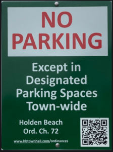
Per Town ordinance, town-wide there is no parking on the streets or rights-of-way except in designated parking spaces identified by Pay-to-Park signs. Paid parking will be enforced April 1st – October 31st in all Holden Beach designated parking areas.

The public cannot legally park their vehicles in the rights-of-way except in designated parking spaces. Three days a week I ride my bike and I see this RV, pictured above, that is parked illegally on High Point Street in the rights-of-way. It’s parked there for weeks, several times a year. The Police Department acknowledged it is not supposed to be there. That said, nothing has been done. Selective enforcement is when a Town enforces rules against some homeowners and not others and is unacceptable. Ordinance enforcement needs to be fair and consistent, not giving any one preferential treatment. If we overlook parking violations for some, then we have to overlook others too. If so, where does the line form so that they can get in the queue too?


Hurricane Season
For more information » click here.
Be prepared – have a plan!
No matter what a storm outlook is for a given year,
vigilance and preparedness is urged.
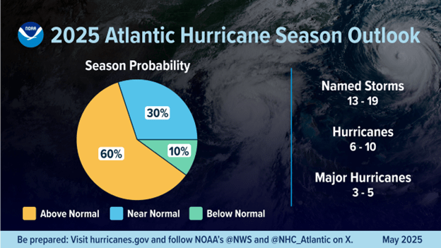
Why This Year’s Hurricanes Keep Turning Away From the East Coast
There are six weeks left in the Atlantic hurricane season.
Dexter, Erin, Gabrielle, Humberto, Imelda, then Jerry. Again and again, this year’s Atlantic hurricane season has featured storms that seemed to be heading straight to the United States, only to suddenly take a sharp turn toward the east, veering away from land and out to the open ocean. Typically, by this time in an Atlantic season, at least three hurricanes or tropical storms would have made landfall in the United States. But with 12 named storms so far this year — four of them hurricanes — the only one to make U.S. landfall was Tropical Storm Chantal, which came ashore in South Carolina in early July. (Another, Tropical Storm Barry, made landfall in Mexico in late June.) Each storm’s eastward turn has its own unique causes, but John Cangialosi, a senior hurricane specialist at the National Hurricane Center, said two main factors determine a storm’s path: where it formed and what is steering it.
Steering
The main steering mechanism for Atlantic storms comes from a large high pressure system known as the Bermuda high. The Bermuda high (also called the subtropical high) normally sits in the Atlantic Ocean. Its light winds circulate in a clockwise direction, which usually push hurricanes westward in the tropical Atlantic, before guiding them northward along its western edge. “They are the primary steering for storms,†Mr. Cangialosi said. However, he added that nearby low pressure systems — along the East Coast, for example — and their associated cold fronts can influence the Bermuda high’s strength. “They can cause the high to weaken and shift, and cause these storms to turn,†he said. “So, it’s a combination of both of those features.†According to the National Hurricane Center, a strong Bermuda high generally pushes hurricanes farther west, toward Florida and the Gulf of Mexico, before turning them northward. A weaker Bermuda high, however, doesn’t drive storms as far west. Instead, it turns them northward sooner, either toward the East Coast of the United States or eastward and out to sea. This year, the eastward paths of Hurricanes Erin, Gabrielle and Humberto and Tropical Storm Jerry were influenced by a weak Bermuda high. Tropical Storm Dexter differed a bit, said Dr. Phil Klotzbach, a senior research scientist at the Department of Atmospheric Science at Colorado State University — another atmospheric steering mechanism was at play: the jet stream. The jet stream is a fast-moving ribbon of air high in the atmosphere that flows from west to east across the North Atlantic. It not only steers storms but can also accelerate or even intensify them. Dr. Klotzbach said Dexter was “already in the jet stream flow†when it formed to the northeast of the North Carolina coast, causing the storm to move away from the U.S. Sometimes a nearby Atlantic storm can lend a helping hand. Last month’s Imelda, Dr. Klotzbach said, “was a really lucky case for the United States.†With Hurricane Humberto positioned to Imelda’s east, which helped weaken the western edge of the Bermuda high just in time, causing Imelda to slow down. The two storms also orbited around a shared center point, in what meteorologists call the Fujiwhara effect. “Then Humberto’s circulation helped pull Imelda to the east,†he said.
Location
Where a storm forms also plays a key role in determining its track. The farther east a storm develops, Mr. Cangialosi said, the more likely it is to encounter a low pressure system along its westward path, which may turn it northward and then eastward, much like the paths of Erin and Humberto. “But hypothetically,†he said, “if a storm forms far to the west, like over the western Caribbean or over the Gulf, in those cases they would probably not avoid the United States with similar patterns.â€Â From October through November, storms tend to form farther west.
What to expect
Months ago, forecasters at the National Oceanic and Atmospheric Administration said they expected an above-average season this year, with up to 18 total named storms by the time it ends in November. A typical season has 14 named storms. Looking ahead, Mr. Cangialosi said, as the season moves into the rest of October and November, storms are expected to form closer to home. “They would be much less likely to miss the U.S.,†he said. “Doesn’t mean they can’t. It just means they are closer to home and therefore would have less of an opportunity to recurve.†Hurricane landfalls after mid-October are “fairly rare,†Dr. Klotzbach said, largely because vertical wind shear near the United States is typically quite strong this time of year. Strong vertical wind shear, or the change in wind direction and wind speed with height, can disrupt a storm’s structure, making it harder for hurricanes to maintain their intensity. On Thursday, the National Hurricane Center began tracking what might become the next named storm sometime in the next week. “It’s still a long way away, so there is a lot of uncertainty,†Dr. Klotzbach said, “but there is a pretty robust signal in the various models.â€
Read more » click here
Do you enjoy this newsletter?
Then please forward it to a friend!
Lou’s Views . HBPOIN
• Gather and disseminate information
• Identify the issues and determine how they affect you
• Act as a watchdog
• Grass roots monthly newsletter since 2008
https://lousviews.com/

 Applied Technology Management

 Public Works have put up snowflake decorations on the boulevard light poles
 Apparently we had some website issues last month
 November 27, 2025


 News from Town of Holden Beach
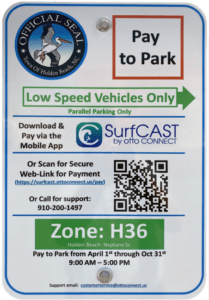


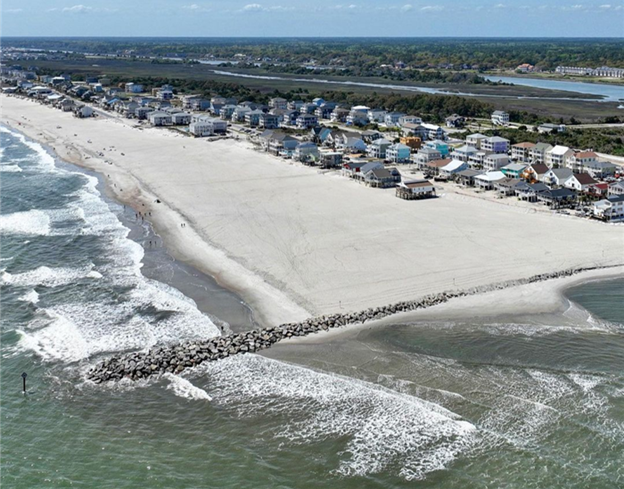

 Sand is vanishing on east side of Ocean Isle $11M erosion fix

 Previously reported –


 Hurricane Vehicle Decals


 WILD DARK SHORE


 SBI Three Bridge Tour

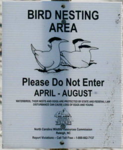


 WITH A VENGEANCE
 Block Q Restrooms & Parking