
Lou’s Views
News & Views / August Edition
Calendar of Events

U.S. Open King Mackerel Fishing Tournament
October 1st thru 3rd
Southport
The U.S. Open King Mackerel Tournament has taken place since 1979 and is held annually the first week in October. The U.S. Open is one of the largest king mackerel tournaments on the East Coast and part of the SKA (Southern Kingfish Association) Tournament Trail. The tournament now attracts almost 400 boats annually.
For more information » click here

Riverfest
October 3rd & 4th
Wilmington
.
.
Wilmington’s Riverfest is celebrated in October since 1979 and runs from the foot of Market Street to Cape Fear Community College over a half mile of free familyentertainment.
For more information » click here

Sunset at Sunset
October 3rd
Sunset Beach
Held the first Saturday in October each year, Sunset at Sunset is the Town of Sunset Beach’s Community Block Party. The annual autumn event has been celebrated since 2007, and is scheduled to happen again this year, in front of Ingram Planetarium on Sunset Boulevard in Sunset Beach.
For more information » click here
 Brunswick County Agricultural Fair and Expo
October 21st thru 25th
Ash
The first annual agricultural fair and expo. Experience thrilling amusement rides and enjoy our vibrant agricultural and livestock exhibits.
For more information » click here

.
N.C. Oyster Festival
October 17th & 18th
Ocean Isle Beach
.
.The annual North Carolina Oyster Festival has been taking place since 1978. Come celebrate everything Oyster witha variety of foods, crafts, contests, children’s activities,and musical performances at Mulberry Park in Shallotte. Signature Festival events include theOyster Shucking Contest, Oyster Eating Contest, and Oyster Stew Cook-off.
For more information » click here

N.C. Festival by the Sea
October 24th & 25th
Holden Beach
Hosted by the Holden Beach Merchants Association this annual two-day festival which started in the 1980’s occurs on the last full weekend in October. The festival is kicked off with a parade down the Holden Beach causeway. There is a fishing tournament, horseshoe tournament, and a sandcastle building contest. Vendors provide food, arts and crafts, amusement rides and other activities. There is live musical entertainment both days at the Holden Beach’s Pavilion.
For more information » click here
 Discover a wide range of things to do in the Brunswick Islands for an experience that goes beyond the beach.
For more information » click here.
Calendar of Events Island
HBPOA Labor Day Meeting
HBPOA meeting at 10:00 a.m. on Saturday, September 5th at Town Hall
 Concerts on the Coast Series
The Town’s summer concert series calendar has been released! Live performances featuring local musical groups will be held at the Block Q concert venue. It will be on Sunday evenings at 6:30pm from May 24th to September 6th. The concerts are FREE of charge.
Beginning May 24th and continuing through September 6th
Meet the Holden Beach Police Dept. and the Tri-Beach Fire Dept. before the concert.

Parks & Recreation / Programs & Events
For more information » click here
Reminders
Pets on the Beach Strand
§90.20 RESPONSIBILITIES OF OWNERS
Effective May 20th through September 10th
-
-
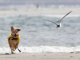
- Pets are not allowed on the beach strand during the hours of 9am through 5pm
- Dog’s need to be on a leash
- Owner’s need to clean up after their animals
-

A Second Helping
.
Program to collect food Saturday mornings (8:00am to 10:30am) during the summer at the Beach Mart on the Causeway.
. 1) Twenty-second year of the program
. 2) Food collections have now exceeded 317,000 pounds
. 3) Collections will begin on Memorial Day weekend
. 4) Food is distributed to the needy in Brunswick County
For more information » click here
.
Hunger exists everywhere in this country; join them in the fight to help end hunger in Brunswick County. Cash donations are gratefully accepted. One hundred percent (100%) of these cash donations are used to buy more food. You can be assured that the money will be very well spent.
Mail Donations to:
A Second Helping
% Sharon United Methodist Church
2030 Holden Beach Road
Supply, NC 28462
 News from Town of Holden Beach
The town sends out emails of events, news, agendas, notifications, and emergency information. If you would like to be added to their mailing list, please go to their web site to complete your subscription to the Holden Beach E-Newsletter.
For more information » click here
 Paid Parking
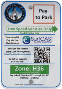
Paid parking in Holden Beach
Paid parking will be enforced from 9:00 a.m. to 5:00 p.m. daily with free parking before and after that time. All parking will use license plates for verification.
Rates
Parking rates for a single vehicle in all designated areas will be:
$5 per hour for up to four hours
$20 per day for any duration greater than four hours
$80 per week for seven consecutive days
Handicap Parking
A vehicle displaying a handicap license plate and/or hang tag parked in a designated handicap space is free. Any other parking space will require a parking permit via the app.
Annual Passes
Annual permits for the calendar year allow vehicles (this includes low-speed vehicles and trailers) access to designated parking.
$175 for a single vehicle
Passes can be purchased via the app, website or by telephone.
Where to Park
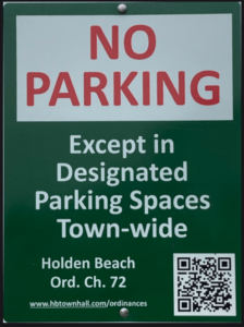
Per ordinance, there is no parking on the streets or rights-of-way except in designated parking spaces identified by Pay-to-Park signs. Click here to view an interactive map. The table with authorized parking can be viewed below.
Citations will be issued for:
-
-
- Parking without an active paid permit in a designated parking area
- Parking within 40 feet of a street intersection
- Parking in a crosswalk, sidewalk, or pedestrian access ways
- Parking blocking a driveway or mailbox
- Parking facing opposing traffic
- Parking in a no parking zone, or within right-of-way
- Parking on any portion of the roadway or travel lane
- Parking a non-LSV vehicle in an authorized LSV location
-
How Do I Pay to Park
The Town uses the SurfCAST by Otto Connect Mobile Solution. This is a mobile app downloadable for Apple and Android devices. Download the app today. Users will setup their account, enter their license plate details and pay for parking directly on the app. Alternatively, users can scan the QR Code located on the parking signs to access a secure website.
The Otto Connect customer service team will be available to help via phone and email.
THB Newsletter (06/18/26)
OttoView by Otto Connect
Just in time for peak beach season, Otto Connect, Inc. has launched a new feature designed to make parking along the coast easier and less stressful for visitors and residents alike. “OttoView by Otto Connect,” is part of the SurfCAST parking system and allows users to check parking availability in real time before heading to the beach. The feature is now available in Holden Beach. For many drivers, finding parking during busy summer weekends can be one of the most frustrating parts of a beach trip. OttoView aims to reduce congestion and save time by showing which lots have open spaces—and which do not—before users arrive. “Instead of circling for a spot, people can now see their options ahead of time and go directly to available parking,” Jim Varner (CEO) said in a statement.
Know before you go:
OttoView can be accessed through the SurfCAST website
(https://park.surfcast.ottoconnect.us/), the QRcode link, and will be available soon via mobile app update (“SurfCAST by Otto”) making it easy for visitors to plan from home or on the go.
What OttoView Shows:
-
- A map of the area and locations of all parking lots
- Real-time parking availability by location
- Estimated availability based on permit turnover
- Directions to nearby parking areas
- Filters for amenities such as restrooms, handicap spaces, and LSV parking
OttoView is fully integrated into the SurfCAST system and is available at no additional cost.
For more information, visit https://www.ottoconnect.us.

Solid Waste Pickup Schedule
GFL Environmental change in service, the Saturday before Memorial Day till the end of September, trash pickup will be twice a week.
Please note:
Trash carts must be at the street by 6:00 a.m. on the pickup day
BAG the trash before putting it in the cart
Carts will be rolled back to the front of the house
GFL Refuse Collection Policy
GFL has recently notified all Brunswick County residents that they will no longer accept extra bags of refuse outside of the collection cart. This is not a new policy but is stricter enforcement of an existing policy. While in the past GFL drivers would at times make exceptions and take additional bags of refuse, the tremendous growth in housing within Brunswick County makes this practice cost prohibitive and causes drivers to fall behind schedule.
Solid Waste Pickup Schedule
starting the Saturday before Memorial Day (May 23rd) twice a week
Recycling
starting after Memorial Day (June 2nd) weekly pick-up
Curbside Recycling – 2026
GFL Environmental is now offering curbside recycling for Town properties that desire to participate in the service. The service cost per cart is $122.93 annually paid in advance to the Town of Holden Beach. The service consists of a ninety-six (96) gallon cart that is emptied every other week during the months of October – May and weekly during the months of June – September.
Curbside Recycling Application » click here
Curbside Recycling Calendar » click here

Trash Can Requirements – Rental Properties
GFL Environmental – trash can requirements
Ordinance 07-13, Section 50.08
Rental properties have specific number of trashcans based on number of bedrooms.
* One extra trash can per every 2 bedrooms
..
§ 50.08 RENTAL HOMES.
(A) Rental homes, as defined in Chapter 157, that are rented as part of the summer rental season, are subject to high numbers of guests, resulting in abnormally large volumes of trash. This type of occupancy use presents a significantly higher impact than homes not used for summer rentals. In interest of public health and sanitation and environmental concerns, all rental home shall have a minimum of one trash can per two bedrooms. Homes with an odd number of bedrooms shall round up (for examples one to two bedrooms – one trash can; three to four bedrooms – two trash cans; five – six bedrooms – three trash cans, and the like).
Upon Further Review
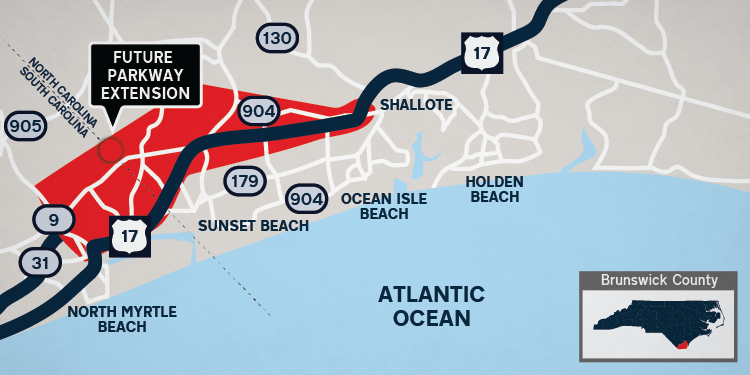 South Carolina advances parkway project as North Carolina lags
A new highway extension planned to add another route connecting North Carolina and South Carolina continues to move ahead, but only for one state department. While the North Carolina Department of Transportation (NCDOT) is facing hurdles on the project, the South Carolina Department of Transportation (SCDOT) is making way to begin construction of the Carolina Bays Parkway Extension project. The NCDOT, SCDOT and Federal Highway Administration are working to extend S.C. 31, known as Carolina Bays Parkway, from S.C. 9 in Horry County, South Carolina, to U.S. 17 in Brunswick County. If constructed, the proposed project will result in a new multi-lane full access freeway connecting the states. The SCDOT is responsible for extending the parkway from its current boundary at S.C. 9 in Horry County to the North Carolina state line, roughly five miles. Nearly 15 miles is in Brunswick County, to be funded and built by the NCDOT. Seven different design alternatives have been mulled over for several years. Alternative map 4, which crosses through Hickman’s Crossroads and the Longwood area, was the chosen preferred route in Brunswick County that would eventually dump onto U.S. 17. All seven of NCDOT’s alternative maps for the highway route can be viewed on NCDOT’s website. A NCDOT news release in April 2026 announced Brunswick County residents’ negative feedback and funding challenges pushed the NCDOT to reroute. Project Manager Brian Harding said the NCDOT is crafting new options for the Carolina Bays Parkway Extension project. He previously told the StarNews that existing alternative maps — not including alternative 4 — remain on the table for consideration. “We’re trying to make something that works a little better for the project as a whole, and for the public,” Harding said. SCDOT Director of Media Relations Jennifer Timmons said the SCDOT is also working on a new alternative route to bring the road to a destination near the state line. The route will likely be presented during a public meeting this fall, said Timmons, noting the SCDOT and Horry County remain strongly committed to completing their portion of the project. “At this point, we do not anticipate any significant delays resulting from NCDOT’s decision,” Timmons said. The SCDOT is now working with the Federal Highway Administration to get advanced right of way acquisition approved to expedite and streamline the project. While finalizing required environmental permits, the department will use a $22 million federal earmark dedicated to the right-of-way acquisition. South Carolina’s timeline remains set to complete environmental documents in 2027, begin right of way acquisition in 2027 and start construction in 2029, said Timmons. Though the project schedule is not substantially changed, Timmons said early acquisition ensures funds are obligated before expiring and allows the department to purchase some necessary right of way in advance. “The remainder of the right of way acquisition is expected to begin in 2027, as was always the plan,” Timmons said. “Again, we want to reiterate that this is not unusual and that the project is not experiencing delays.” Unlike South Carolina, Harding said the NCDOT does not have right-of-way or construction funding. This also means no construction or right-of-way acquisition timeline exists for the North Carolina side of the project. “Our funding only carries us through the environmental document planning portion of the project in North Carolina, which doesn’t include the final design,” Harding said. Harding could not say how long it would take to catch up to the SCDOT if the NCDOT were to receive funding for the project, noting the timeline will be dependent on the selected final design. Asked how much longer the alternative route will take, Harding replied they are still working through the process. The public will have a chance to review and provide input on the new design once completed, Harding added.
Read more » click here
Corrections & Amplifications
Ocean Isle Beach Terminal Groin
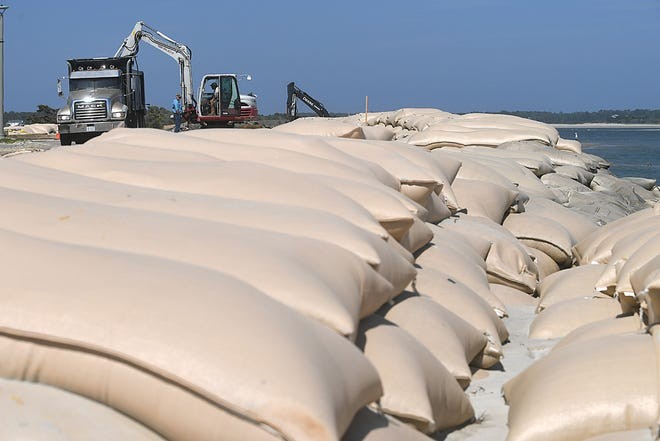
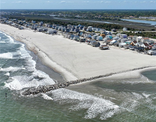 Ocean Isle Beach completed construction of a terminal groin on its east end in April 2022 to help protect the beach immediately behind it. However, this structure has contributed to significant erosion at the east end near Shallotte Inlet by interrupting natural longshore drift, prompting ongoing efforts such as sandbag use to prevent ocean encroachment on properties in that area.
2024 OIB SHORELINE AND INLET ANNUAL MONITORING REPORT
On Holden Beach, the recent volume change rates (May 2024 to November 2024) along the oceanfront shoreline indicated erosion at 12 of the 21 monitoring stations. Similarly, the MHW shoreline change rates indicated a shoreline retreat at 15 of the 21 monitoring stations. The long-term post-construction linear shoreline changes along the Holden Beach oceanfront shoreline indicated landward retreat. However, volumetric changes indicated slight accretion (0.2 cy/ft./yr.) within this area over the long-term period. The shoreline threshold analysis results along the Holden Beach oceanfront shoreline show that the post-construction shoreline change threshold was exceeded at only one monitoring station. This is the first time a threshold has been exceeded at Holden Beach since this annual analysis started in 2022. In addition, the analysis of May 2024 aerial imagery-derived wet/dry line revealed an 885 ft. section of Holden Beach’s inlet shoreline that exceeded the inlet shoreline threshold by a maximum distance of 100 feet. The inlet shoreline threshold on Holden Beach was also exceeded in Year-2. This marks two straight years where this threshold was exceeded. The inlet shoreline recession is believed to likely be attributed to a combination of morphological changes within Shallotte Inlet including the position and orientation of the main channel through Shallotte Inlet and the formation of a flood channel on the inlet shoulder of Holden Beach. Regardless, as stated in the Plan, because the shoreline changes in this area exceeded the threshold over the entire 2-year confirmation period, an assessment of the proper responsive measures will be made through coordination with State and Federal regulatory officials.
 East End/Terminal Groin Short Term Mitigation
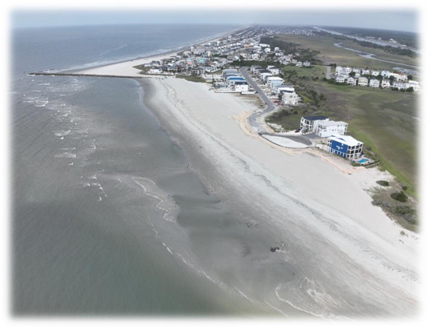
As required by State and Federal permits associated with the Town’s Shoreline and Inlet Management Plan, annual shoreline monitoring identified erosion east of the terminal groin that exceeded established management thresholds. To maintain permit compliance and address localized erosion concerns, the Town implemented a short-term mitigation project consisting of targeted beach nourishment east of the terminal groin.
Project Update
-
- Project completed: May 24, 2026
- Sand placed: Approximately 45,000 c/y
- Engineer: Coastal Protection Engineering
- Contractor: Southwind Construction
- Total project cost: $667,696.61
This project, along with the US Army Corps of Engineers – Shallotte Inlet Crossing & Widener Project, placed 70,000 cy of sand east of the terminal groin with another 35,000 cy west of the terminal groin. With this short-term mitigation measure in place, the Town has engaged with Coastal Protection Engineering (CPE) to investigate long-term mitigation plans to prevent any further erosion adjacent to the terminal groin.
Saving homes or beaches? NC faces tough call on seawall ban
A new report says placing hardened structures along the N.C. oceanfront could help with chronic erosion woes. But they come with plenty of risk.
North Carolina’s love-hate relationship with hardened structures along the oceanfront is heating up. From the Outer Banks in the north to Ocean Isle Beach in the south, many portions of North Carolina’s 320 miles of oceanfront are dealing with erosion woes that are threatening homes, infrastructure and coastal economies. Coastal officials have long complained that the state’s ban, although softened in recent years, on hardened structures along the oceanfront like seawalls and jetties leaves them with few options beyond expensive beach nourishment to deal with the shifting sands. Environmentalists and others say the ban protects the natural beauty and feel of North Carolina’s beaches while reinforcing that there are simply some places that we shouldn’t be developing. They also note that hardened structures often do little but move the erosion woes to other parts of the beachfront. In June 2026, the N.C. Coastal Resources Commission’s Science Panel released its draft report on the effects of hardened structures on the coast. The report, while not taking sides on the state’s four-decade-long ban on permanent structures along the beachfront, is meant to provide guidance for regulators and policymakers as they debate the emotionally charged issue.
How did we get here?
North Carolina’s existing rules on oceanfront construction are largely based on using a 30-year setback rule. The thinking was that a 30-year window of sand and dunes in front of a structure would give homeowners and local communities a chance to come up with a long-term solution if the ocean started encroaching on oceanfront properties. But structures these days often last longer than 30 years, and the environmental conditions of the 1970s aren’t the same as those the coast is facing today. Storms are bigger and more powerful than those of last century thanks to climate change, and sea-level rise is increasing. Sea level is expected to rise by a foot or more by 2050 from today’s levels, amplifying the impacts of tidal flooding and storms that aren’t even tropical in nature. As environmental conditions grow more challenging, oceanfront homes are tumbling into the water. In Rodanthe and Buxton on the Outer Banks, more than 30 homes have collapsed since 2020. Closer to Wilmington, sandbags now line stretches of beachfront in North Topsail Beach, Figure Eight Island and Ocean Isle Beach, offering the last line of protection for million-dollar homes.
‘Maintain a cautious approach’
With pressure mounting on officials to come up with some solutions to disappearing beaches, the science panel was asked to look into shoreline management, both in N.C. and other states, and examine the pros and cons of different measures − particularly the use of oceanfront hardened structures. “Recent erosion impacts in several North Carolina oceanfront communities have brought shoreline management issues back to the forefront, prompting questions about whether alternatives to beach nourishment should be considered to address chronic erosion,” states the report. But the science panel makes it crystal clear that hardening the shoreline to prevent the natural movement of beaches and dunes landward will likely lead to, first, a narrower and then likely a disappearing beach in front of the structure. Groins and jetties, while helping the beach adjacent to them, also end up “starving” beach areas downdrift of the structures. The volunteer panel, however, also noted that securing the shoreline could offer coastal communities an economic lifeline. “The panel therefore recommends that North Carolina maintain a cautious approach to any expansion of the use of hardened structures and that any major reconsideration of the state’s oceanfront management policies include a broad and comprehensive assessment of the physical, ecological, recreational, and economic consequences of expanded use, including consideration of who will likely benefit and who will likely suffer adverse effects, prior to policy modification,” the report states.
Legislators getting involved
As erosion threatens more oceanfront properties, infrastructure, and the coast’s vital tourism industry, legislators are taking notice and proposing solutions. A bill working its way through the N.C. General Assembly could permanently change the face of the state’s coast. Senate Bill 1009, would lift the state ban on hardened structures, including seawalls, jetties and terminal groins, low-slung structures built perpendicular to the shoreline that helps trap sand in areas of high erosion, such as near inlets. Proponents of the legislation say times along the coast have changed, and state policy needs to match the new realities that residents, visitors and local officials are dealing with along the oceanfront. While current rules push beach communities to favor nourishment, enhanced dune systems, and other “natural” approaches to shoreline management, some say more permanent and immediate solutions are sometimes required. Beach nourishment isn’t cheap, with even small projects costing millions, and can be a regulatory challenge if you have to find compatible beach sand that is often in short supply. In places like the Outer Banks, officials have said trying to maintain more than 80 miles of beachfront simply isn’t feasible under current rules and regulations. And to be truly effective, nourishments have to be repeated every few years due to natural erosion and storm-related events − heaping more pressure on state and local budgets that already face a lot of funding priorities. Environmentalists and coastal advocates say installing hardened structures to control erosion means picking winners and losers along the oceanfront, since they will end up taking sand from other parts of the beachfront. There also can be environmental impacts, such as the loss of habitat and beaches for nesting sea turtles and shorebirds. Greg “Rudi” Rudolph, a member of the science panel, said there’s no “magic bullet” for North Carolina’s oceanfront erosion issues, with each possible solution carrying pros and cons. He also said many of the shoreline management tools need to be done in conjunction with each other to offer a truly effective long-term solution, such as a groin and periodic nourishment. “There are trade-offs, there are benefits, and there are costs,” Rudolph said. “That’s what makes this so challenging.”
Read more » click here
‘150 years of negative impacts’ to New Jersey coast: Corbett
In the last six years the Atlantic Ocean has demolished nearly three dozen privately owned oceanfront homes in Buxton and Rodanthe. These collapsed houses represent a broader coastal management challenge, even pushing the commission that makes coastal development rules to reconsider a decades long ban on hardened structures built for erosion control, Dr. Reide Corbett said during a recent talk at Core Sound Waterfowl Museum and Heritage Center on Harker’s Island. A coastal oceanographer and geochemist, Corbett, as of July 16, is the new interim dean of the Thomas Harriot College of Arts and Sciences on East Carolina University’s main campus. He spent the last 14 years as head of the Coastal Studies Institute, or CSI, in Wanchese, led by ECU. His talk was one of five in the “Water/Ways” speaker series last month organized to complement the Smithsonian traveling exhibit with the same name that was on display at the time. “There’s no doubt that we are seeing changes along our shoreline,” and because there’s not just one thing driving coastal change, there’s not one simple solution, Corbett said early in the presentation. “I’ll go ahead and put quotes around ‘solution’ now because I might not do it throughout the entire talk, because a solution to many of these challenges we face is likely only temporary. It’s not going to solve the problem. The process that is driving many of these changes won’t be solved by one thing.”
The process
North Carolina’s coast is protected by low-lying sand deposits called barrier islands. These mobile landforms that separate the mainland from the ocean are in constant but slow motion toward the mainland. This natural process is how these islands maintain elevation and width. This is nothing new, “barrier islands have always changed,” Corbett said, but now these mobile landforms are developed. “For better or worse, it is where we are. These coastlines have been changing since there were coastlines. The difference is we have a lot of infrastructure today in the same areas where these coastlines are changing.” The natural process of erosion on the oceanside and growth on the sound side of the island is being exacerbated by increasing sea levels, development associated with population growth, and storm impacts. The National Oceanographic Atmospheric Administration reported a few years ago that sea level is expected to rise 1 to 1.5 feet by 2050. “To put that in perspective, it took the last almost 100 years for sea levels to change 1 foot in coastal North Carolina,” Corbett said. “And from roughly 2000 to 2050, we’ll expect at least an additional 1-to 1.5-foot rise.” That is a significant amount, and “When you look at what sea level is doing based on tide gauges up and down our coast, we are right on track to meet that if not surpass that” projection that he said has a 95% chance of happening. To illustrate, when a house on the Outer Banks gets taken by the ocean, Corbett said the “narrative is ‘often why did people build here? Why would they put their house right there? It’s so vulnerable,’” but when the houses were built in Buxton, for example, in the 1970s and 1980s, there was 100 to 300 feet of beach, or a few dunes, in front at the time. Now, the ocean is on their doorstep. It’s because these shorelines have been eroding for decades, some at 5, 10 or 15 feet per year every year. Then put a storm on top of that, or this past fall, three storms “one after another after another without any time for recovery, and what you end up doing is deflating the beach, dropping the elevation of that beach, removing significant amount of sand because of the energy in the system.” There has been roughly a 1-foot rise in sea level since 1975 at this location, and erosion has continued anywhere from 4 to 8 feet per year there. “You put those two things together and this is what you have,” he said. As Corbett said early in the program, “there’s not going to be a single simple solution for any community” and what may work for one won’t necessarily work for another.
Community questions
Communities need to ask themselves what they are trying to protect. “Is it an individual home? Is it a way of life? Is it an economy? Where are we acting? Where is it most vulnerable? What are we trying to protect? And where is that? You can ask ‘why are we trying to protect that?’ as well if you like. How far are we looking out into the future? Because I think that’s important to consider when acting on a potential solution.” What can a community do once it decides on a path forward? There are a handful of options, starting with nothing, which Corbett said isn’t really a response. Some areas can be protected. For example, a living shoreline in an estuary could protect infrastructure. Accommodate the change and that might look like houses being raised or a bridge around a very vulnerable location or leave. “Nobody likes to hear the word ‘retreat’ because it seems like you’re giving up. And I don’t disagree with that,” he said, but the idea is to move out of those most vulnerable locations. Corbett said that hardened structures are “being pointed to a lot today as a way of protection, a solution to the problem. And I think it’s important to recognize the tradeoffs.” In North Carolina, hardened structures have not been used to control erosion in decades, because of a policy in the 1980s and then a law in the early 2000s. Corbett noted on the presentation slide that the state law “prohibits the construction of a permanent erosion control structure in an ocean shoreline, including breakwater, bulkhead, groin, jetty, revetment, seawall or any similar structure. This ban was based on extensive studies and technical data documenting the detrimental impacts of erosion control structures, including 150 years of documented negative impacts of shoreline stabilization on the barrier islands of New Jersey.” The different kinds of hardened structures come with their own sets of problems. A vertical structure like a seawall might protect what’s behind it but will lead to higher erosion rates on either side of the structure and a total loss of recreation beach in front of it, Corbett said. The houses actively crumbling have pressed the Coastal Resources Commission to consider potential changes to its laws on hardened structures and charged its science panel, on which he serves, in February to draft a report on the various types of hardened structures for oceanfront and the advantages and disadvantages of each type. The report was first presented during the commission’s June meeting. The North Carolina Department of Environmental Quality’s Division of Coastal Management, which carries out the development rules established by the commission, announced that the commission is to hear an update on the report during the Aug. 26-27 meeting in Manteo. But with all those responses, “I think it’s important to recognize that the processes aren’t changing,” Corbett said. Buxton has three terminal groins that were built in the 1960s that have deteriorated, and the narrative suggests that the deterioration and large holes in the structure farthest south has led to significant erosion. “My argument is, it’s not just that. It’s an erosional system. There’s a lot of data to show that even with these groins, there’s a reason we moved the lighthouse,” said Corbett, referring to the Cape Hatteras Light, which was moved in 1999 a distance of 2,900 feet from where it was built in 1870 because of its proximity to the waves. “It wasn’t a stable system. And those groins have been there since the late ’60s. And so, this is an eroding system. And it’s been eroding regardless of whether those groins were there or not. And it will continue to erode whether we rebuild those groins or not.” Nourishment does protect but is a temporary solution. It’s not changing the process causing the erosion. Beach nourishment is when sand is taken from a borrow area and pumped onto the beach. The amount of time the new sand lasts on the shoreline is no longer projected to be seven years. Now the project planners are calculating for five years. But that’s not long enough either. The sand from a 2022 beach nourishment in Buxton only lasted two years until more was needed. Corbett’s hypothesis is that nourishment projects are causing the shoreface to steepen 15 to 20 feet from the shoreline. He said he was considering looking further into this untested theory to see if the nourishment areas are becoming more vulnerable. Data available on coastsat.space, which uses satellite imagery to map ocean shorelines, shows how the beach is changing and responding to a beach nourishment project. For south Nags Head, the first nourishment project was in late 2011 or 2012, and data shows that after nourishment, the erosion rate became significantly faster. “You place a lot of sand on the beach, it’s unnatural. Yes, it provides a wider beach, but you also increase that erosion rate,” Corbett said. “I’m not saying this isn’t protecting infrastructure” but it doesn’t stop the process. “Nourishment is a Band-Aid for that real physical process of erosion. It hasn’t slowed the process. It is a temporary solution that has to continue. You don’t do a single nourishment, you develop a nourishment program,” he said. “It’s $20 million today. It’s $20 million in five years.” Ultimately, Corbett said communities need to decide what they want to protect and if they’re willing to accept the tradeoff.
Read more » click here
Odds & Ends
Contiguous US breaks its record for hottest month ever, NOAA says
The contiguous United States sizzled to its hottest month ever last month, according to the National Oceanic and Atmospheric Administration. July averaged 76.89 degrees Fahrenheit (24.94 degrees Celsius) across the Lower 48 states, eclipsing the Dust Bowl’s July 1936 by an eighth of a degree. Records go back to 1895. “It’s not good when you’re breaking records from the Dust Bowl, which we are in this case,” said meteorologist Jeff Masters of Yale Climate Connections. “And that was a crazy sort of situation where you put tens of millions of people in motion. You had this great migration because of the drought and the heat that hit the center of the U.S. — just a cataclysmic event in U. S. history. If we’re exceeding records from The Dust Bowl, that says that we’re in deep trouble.” Although it was unusually cool in Alaska, hotter-than-normal conditions blanketed the Lower 48, with the most excessive heat in the Mountain West, Southwest, Northern Plains and Southeast. The heat was so widespread that every one of the Lower 48 states was at least 1 degree Fahrenheit (nearly 0.6 degrees Celsius) warmer than the 20th century average, said Russ Vose, chief of monitoring at NOAA’s National Center for Environmental Information. The heat in the Dust Bowl years was more concentrated in parts of the Midwest and was aggravated by agricultural practices at the time, Vose said. What’s happening now is due to the burning of coal, oil and gas, scientists said. “Extremely high temperatures across the continental U.S. this summer, along with intense drought and fire conditions, are absolutely consistent with the climate change signal,’ said Katharine Jacobs, a climate scientist at the University of Arizona. The biggest driver of the record heat was nighttime lows that smashed the old mark for hottest minimums by 0.7 degrees, NOAA said. Hotter nights are a classic sign of human-caused climate change, according to scientists and several studies in peer-reviewed literature. NOAA’s calculation is based on averaging 24 hours of temperature, not just highs or lows. “If you’re talking heat waves, that nighttime low is incredibly important for determining total heat stress,” Masters said. “So if it doesn’t cool off at night, your body doesn’t have time to readjust to all the heat.” As nighttime temperatures increase, more people die and lose sleep, studies show. The years 2021 and 1936 tie for America’s hottest summer, which is June through August. Through July, 2026 is a shade cooler than 2021, which was powered by record heat in June. Because of climate change, Masters said, “this may be one of the coolest years we’re gonna experience for the rest of our lives.” What’s needed, Masters said, is “to stop burning so many fossil fuels. We also need to be spending money to adapt to the new climate that we’ve put in place.”
Read more » click here
July was the hottest month in the US since records began in 1895
July was the hottest month ever recorded in the United States, according to data released Monday by the National Oceanic and Atmospheric Administration. The month featured long, intense heat domes that led to record hot temperatures from the East Coast to the Plains and Southwestern states. NOAA’s temperature records date back to 1895. By the end of the month, large wildfires were burning in the Pacific Northwest and Canada, mirroring what has been taking place in Europe, which is having its hottest summer on record. July’s average temperature in the Lower 48 states was 3.3 degrees Fahrenheit above the 20th-century average, NOAA reported. This was about 0.1 to 0.2 degrees warmer than July 1936 and July 2012 — the previous record holders — NOAA stated. July tends to be the hottest month of the year in most of the US. More than 600 monthly records for highest maximum and minimum temperatures have been set this year in July across the US. There were fewer than 50 monthly records set on the cool side for temperatures. In any given month those should average out to be even. Climate change due to the burning of fossil fuels has altered this pattern. One feature of the July weather pattern in the US was a seemingly endless series of heat domes that popped up in different parts of the country depending on the contortions of the jet stream. Heat domes act like a lid on a pot, trapping and enhancing hot air beneath them. The jet stream is a narrow corridor of fast-moving air at about 30,000 feet above the Earth’s surface, and it plays a key role in steering and providing energy for weather systems. Long-term, human-caused climate change is making heat waves more intense, longer-lasting and more likely to occur. Last month saw an intense heat wave that enveloped the eastern half of the country through the July 4th holiday weekend, with subsequent rounds of extreme heat that hit after that as well. Above average temperatures stretched across the entirety of the Lower 48 states, with 13 states having monthly average temperatures that ranked in their top-5 warmest Julys. Wyoming had its hottest July and hottest month of any month on record. No state had a ranking near or below average for the month, NOAA found. July has been warming especially rapidly during the past few decades. According to Climate Central, a research and communications nonprofit, in 229 US cities, July temperatures have climbed an average of 2.6 degrees since 1970, with the highest rates of warming occurring in cities in the Pacific Northwest and the Southwest. Cities that had their warmest Julys include Denver and Salt Lake City, as the Intermountain West had the most significant heat compared to average last month. But many cities across the country had a month that ranked in the top-5 warmest, including Miami, L.A. and Minneapolis. In addition to long-term climate change, a rapidly intensifying El Niño event in the tropical Pacific Ocean is also beginning to be a factor in elevating global average sea and air temperatures and may have played a supporting role in increasing July’s air temperatures across the US. However, studies showed that individual heat waves that struck the country were more connected to climate change plus the natural variability of weather systems than El Niño. July’s extreme heat was not limited to the US, as much of Europe saw multiple heat waves that led to wildfire outbreaks at the end of the month and into early August in Spain, France, the UK, Greece and other countries. According to the Copernicus Climate Change Service, Western Europe has had its hottest first two months of summer on record so far.
Read more » click here
This and That
Water Alert
THB Newsletter (07/17/26)
Stage 3 Water Shortage Warning MANDATORY Restrictions
As of July 17, 2026, Brunswick County remains in an Exceptional Drought according to the most recent update from the North Carolina Drought Management Advisory Council.
Due to the Exceptional Drought conditions, Brunswick County will remain under the Stage 3 Water Shortage Warning but will make slight changes to the MANDATORY restrictions list to allow for the use of automated irrigation systems once a week only (see below). This limited schedule would apply to automatic sprinkler systems for residential and commercial lawn and landscape irrigation.
Brunswick County will continue to monitor the drought conditions and water use to determine whether any changes to the Stage 3 Mandatory Restrictions (including the new limited irrigation schedule) may become necessary.
Stage 3 MANDATORY Water Restrictions Now In Effect — Use Water Wisely
Current Water Conservation Alert Level:
Stage 3 Water Shortage Warning MANDATORY Restrictions
As of July 10, 2026, Brunswick County has moved to a Stage 3 Water Shortage Warning MANDATORY Restrictions until further notice due to worsening drought conditions. Under Stage 3, all automated outdoor irrigation is prohibited. There are certain exemptions for commercial power washing and commercial car washing. Full details about all restrictions and fees are outlined on this webpage.
Nearly a third of Brunswick County is now under an Exceptional Drought (D4), which is the highest tier of drought possible. Under the Stage 3 alert level, Brunswick County Public Utilities water customers are required to adjust their water usage habits by following the MANDATORY water usage adjustments.
Brunswick County is monitoring water usage for all water customers using the County’s public water system and is issuing penalties for violations. This applies to all water customers, including wholesale customers, residents, businesses, new developments, etc. Learn more about the Stage 3 non-compliance penalties and fees below.
Brunswick County is actively monitoring the drought conditions and customers’ water usage to determine whether a Stage 4 Water Shortage Warning with Mandatory Restrictions may become necessary. In Stage 4, most outdoor irrigation methods are prohibited and penalties for non-compliance will increase.
For more information » click here
Stage 3 Water Shortage Alert: Addressing Water Usage Questions
PUBLIC NOTICE
Brunswick County appreciates the cooperation and commitment of our water customers who have taken diligent steps to follow the Stage 3 Water Shortage Warning MANDATORY Restrictions and the local burn ban while Exceptional Drought (D4) conditions are affecting our county. Exceptional Drought (D4) is the highest tier of drought possible on the U.S. Drought Monitor scale.
Your efforts to limit irrigation and other non-essential uses of water in and around your property are making a significant impact on protecting our water resources and public safety during this Exceptional Drought period. Thank you for helping spread out the demands on our public water system.
Addressing Questions About Water Usage Under Stage 3 Restrictions
Brunswick County has received some questions about allowed water usage under Stage 3 Water Shortage restrictions that we wish to clarify for customers. Thank you for your questions and patience as we work together to help conserve water during this Exceptional Drought period.
Can I fill my pool under Stage 3 Water Shortage restrictions?
The filling of family, public, or private swimming pools, including wading pools, hot tubs, spas, and whirlpool tubs, is prohibited, except for:
-
- Health and rehabilitative purposes as prescribed by a medical doctor or administered by a medical facility (documentation of fill dates to be provided upon request);
- The minimal amount of make-up water necessary to maintain a pool’s structural integrity and filtration system (documentation to be provided upon request); and
- The minimal amount of water required to initially fill a pool to meet the manufacturer’s or designer’s requirements for structural integrity. The filling of the pool must be scheduled with Brunswick County Utilities during a minimal demand time. Contact Brunswick County Public Utilities to schedule via email at utilityadmin@brunswickcountync.gov.
Can irrigation companies and licensed inspectors test irrigation systems under Stage 3 Water Shortage restrictions?
Yes, irrigation companies and licensed inspectors performing home irrigation inspections can run irrigation systems for up to five (5) minutes for testing. Please provide an invoice or other documentation (inclusive of the inspection date) to the property owner in the event their account is flagged for non-compliant irrigating.
Can I irrigate recently installed sod under Stage 3 Water Shortage restrictions?
Automated outdoor irrigation can be used for maintaining newly installed landscapes, lawns, and erosion control projects that are under a written warranty and that were initiated prior to the issuance of the Extreme Drought Advisory on June 26, 2026, not to exceed the minimum rate necessary on the day of installation and for 28 days following installation, by means designed and operated to maximize water use efficiency and to prevent run-off and excessive watering. Documentation verifying the installation date (inclusive of digitally date-stamped photos, the warranty, receipts with installation address, name, and phone number, etc.) must be provided via email to Brunswick County at utilityadmin@brunswickcountync.gov, and an approval email from Brunswick County must be received and kept in possession prior to irrigating.
Who is affected by these Stage 3 MANDATORY Water Restrictions?
This Stage 3 MANDATORY Alert affects all customers of the following public water systems:
-
-
- Brunswick County Public Utilities Customers (see paragraph below for more details)
- Bald Head Island Utilities Customers
- Holden Beach Utilities Customers
- Oak Island Utilities Customers
- Ocean Isle Beach Utilities Customers
-
Brunswick County Public Utilities provides water service in unincorporated portions of Brunswick County as well as the following communities: Boiling Spring Lakes, Bolivia, Calabash, Carolina Shores, Caswell Beach, Navassa, Northwest, Sandy Creek, Shallotte, Southport, St. James, Sunset Beach, and Varnamtown.
Utilities customers of Bald Head Island, Holden Beach, Oak Island, and Ocean Isle Beach are under the same restrictions since these utilities receive their water from Brunswick County Public Utilities.
Who is NOT affected by these Stage 3 MANDATORY Water Restrictions?
This Stage 3 MANDATORY Alert does NOT apply to properties that use water sources outside of the County’s public water system.
-
- Brunswick County Public Utilities does NOT have the authority to restrict, meter, or penalize water usage from private water sources such as:
- Private groundwater wells
- Retention ponds
- Brunswick Regional – H2GO’s water system. Customers of Brunswick Regional – H2GO should check their website for information about any water conservation or best practices they may have issued for their customers: h2gonc.gov
- Note: Many new developments, businesses, and golf courses irrigate using highly treated reclaimed water and other water sources outside of the County’s public water system. (St. James, Winding River, Sea Trail, and Sandpiper Bay golf courses use reclaimed water. Other golf courses use wells and ponds for irrigation.)
- Brunswick County Public Utilities does NOT have the authority to restrict, meter, or penalize water usage from private water sources such as:
Why is Brunswick County Public Utilities under more strict restrictions than other utility systems?
Every utility system has their own Water Shortage Response Plan that they follow to determine when to issue voluntary or mandatory water alerts. According to the U.S. Drought Monitor map released on July 9, 2026, Brunswick County is currently under Exceptional Drought (D4) conditions, which is the highest tier possible on the U.S. Drought Monitor scale.
When Brunswick County issued a Stage 2 Mandatory Water Conservation Alert on June 26, 2026, a majority of Brunswick County was under Extreme Drought (D3) conditions. Nearly a third of Brunswick County is now under Exceptional Drought (D4) conditions, which is contributing significantly to the increase in irrigation demands and may impact the availability of source water from the Cape Fear River.
You can view North Carolina Drought Management Advisory Council’s (NCMDAC) Current Drought Explainer at ncdrought.org.
Where can I find more information about Stage 3 Water Shortage restrictions?
A full list of MANDATORY water usage adjustments and any exceptions can be found online at BrunswickCountyNC.gov/WaterWise.
Community members and property owners who have questions should contact their water service provider directly or Brunswick County Public Utilities at utilityadmin@brunswickcountync.gov or through our temporary call center. Call center information can be found at BrunswickCountyNC.gov/WaterWise.
For more information » click here
THB Newsletter (08/11/26)
Updated Water Shortage Mandatory Restrictions
Brunswick County remains in an Exceptional Drought (D4) according to the most recent update from the North Carolina Drought Management Advisory Council.
Due to this drought classification, Brunswick County remains under the Stage 3 Water Shortage Warning but has updated the MANDATORY restrictions list to allow for the use of automated irrigation systems twice a week only.
-
- Properties with odd-numbered addresses (ending in 1, 3, 5, 7, 9) and non-addressed facilities may irrigate anytime during the following 8-hour periods:
-
-
-
- From 8 PM on Tuesday through 4 AM Wednesday
- From 8 PM on Saturday through 4 AM Sunday
-
-
-
- Properties with even-numbered addresses (ending in 2, 4, 6, 8, 0) may irrigate anytime during the following 8-hour periods:
-
-
-
- From 8 PM on Wednesday through 4 AM Thursday
- From 8 PM on Friday through 4 AM Saturday
-
-
This limited schedule would apply to automatic sprinkler systems for residential and commercial lawn and landscape irrigation.
Brunswick County is monitoring several factors to determine when changes to the current water restriction stage might be applied. These factors include the overall daily water usage, weather forecasts, rainfall amounts, drought conditions, and the future drought designation from the U.S. Drought Monitor.
A full list of MANDATORY water usage adjustments and any exceptions can be found online at BrunswickCountyNC.gov/WaterWise.
With Brunswick in extreme drought, what it’ll take to ease water woes
Despite multiple rainfalls over the last month, data shows Brunswick County’s critical drought conditions remains with the sizzling summer heat. Brunswick County is staying in the highest level of drought according to the most recent update from the North Carolina Drought Management Advisory Council (NCMDAC), according to a recent news release from the county. Brunswick has been classified as an Exceptional Drought (D4) county since July 9, the highest tier on the U.S. Drought Monitor scale. The county first announced a stage one water conservation alert on June 9. County officials moved to a mandatory stage two water conservation alert on June 26, restricting irrigation from specific days and times for residents using public water. By July 10, the county jumped to stage three water shortage warning with mandatory restrictions due to nearly a third of Brunswick being classified under an Exceptional Drought. That day, county officials began prohibiting automated outdoor irrigation and pool filling for Brunswick County Public Utilities water customers.
Where Brunswick compares to other counties in North Carolina
Most of the state is still in moderate to severe drought, with Brunswick experiencing the worst drought conditions, according to a Aug. 6 North Carolina Department of Environmental Quality (NCDEQ) news release. Rain was hit or miss in the Wilmington area during the first week of August, with just above three inches of rainfall in Wilmington but only 0.71-inches around Longwood, as stated in a Aug. 4 drought update on the NCMDAC website. As of Aug. 6, most of Brunswick remains under severe and exceptional drought conditions. “A rainy July brought steady improvements in drought conditions across most of North Carolina. Groundwater and reservoir levels have been slower to recover. It’s only the beginning of August so we expect higher temperatures and increased water demand for at least another month,” said Klaus Albertin, chair of the NCMDAC and NCDEQ Water Resources engineer.
Nearly 20 inches of rain is needed to catch up
This is the driest the county has been in 15 years, according to the Drought scale. The NOAA Drought Termination and Amelioration map shows the Wilmington area, including Brunswick, needing roughly 17 more inches of rainfall to end the drought by Sept. 9. National Weather Service Meteorologist Jordan Baker said the Wilmington area has a daily rainfall average of .24 inches during this time of year — typically because of tropical systems. Though the Wilmington area has had roughly 11.35 inches of rain in the last month, Baker said southern Brunswick has only had 4.17 in the last month and is already running in a water deficit. A deficit can increase quickly when there is no rain for one or more days at this time of year, Baker said. “We definitely need the rain, but when it comes in thunderstorms and scattered thunderstorms in the afternoon, it misses a lot of different places,” Baker said.
Water restrictions still stand for Brunswick
Under the county’s Stage 3 limited irrigation schedule, water customers may only water lawns and landscaping with automatic irrigation systems less than one inch of water per week, between the hours of 8 p.m.-4 a.m. on designated days. There are certain exemptions for commercial power washing and commercial car washing. Full details about the restrictions and fees can be found on the county website. Residents who have questions should contact their water service provider directly or Brunswick County Public Utilities at 910-253-2657 or utilityadmin@brunswickcountync.gov.
Funding available for impacted small businesses
The U.S. Small Business Administration (SBA) announced the availability of low-interest federal disaster loans to small businesses and private nonprofit organizations in North Carolina to offset economic losses caused by a drought beginning on April 28. The disaster declaration covers numerous counties, including Brunswick, Columbus, New Hanover and Pender counties. Dillon and Horry counties in South Carolina were also listed. Under the declaration, the SBA’s Economic Injury Disaster Loan (EIDL) program is available to eligible small businesses, small agricultural cooperatives, nurseries and private nonprofit organizations — including faith-based organizations — with financial losses directly related to the drought. The SBA is unable to provide disaster loans to agricultural producers, farmers, or ranchers, except for aquaculture enterprises. The loan amount and terms are on each applicant’s financial condition. Loans can be up to $2 million with interest rates as low as 4% for small businesses and 3.625% for private nonprofit organizations, with terms of up to 30 years. The loans may be used to pay fixed debts, payroll, accounts payable and other bills which could not be paid due to the drought. The deadline to return economic injury applications is Jan. 19, 2027. To apply online visit sba.gov/disaster. Applicants may also call SBA’s Customer Service Center at 800-659-2955 or email disastercustomerservice@sba.gov for more information on SBA disaster assistance. For people who are deaf, hard of hearing, or have a speech disability, dial 711 to access telecommunications relay services.
Read more » click here
THB Newsletter (08/17/26)
Brunswick County Moves from Stage 3 to Stage 2 Water Restrictions
Due to encouraging trends in drought conditions, water usage and system demands, Brunswick County has moved from a Stage 3 Water Shortage Warning to a Stage 2 Mandatory Water Conservation Alert. Under Stage 2, some water restrictions are reduced or removed and the automatic irrigation schedule is expanded.
Stage 2 – Key Reminders & Main Restrictions
This is a select list of some of the main differences under a Stage 2 Mandatory Water Conservation Alert. See the full list on the website at BrunswickCountyNC.gov/WaterWise.
-
- Automated outdoor irrigation days are increased. Under this Stage 2 Irrigation Schedule, water customers may only water lawns and landscaping with automatic irrigation systems (spray irrigation, drip irrigation, etc.) less than one inch of water per week, between the hours of 8:00 p.m. to 4:00 a.m. on their designated days.
- Properties with odd-numbered addresses (ending in 1, 3, 5, 7, 9) and non-addressed facilities may irrigate anytime during the following 8-hour periods:
- From 8:00 p.m. on Tuesday through 4:00 a.m. Wednesday
- From 8:00 p.m. on Thursday through 4:00 a.m. Friday
- From 8:00 p.m. on Saturday through 4 a.m. Sunday
- Properties with even-numbered addresses (ending in 2, 4, 6, 8, 0) may irrigate anytime during the following 8-hour periods:
- From 8:00 p.m. on Wednesday through 4:00 a.m. Thursday
- From 8:00 p.m. on Friday through 4:00 a.m. Saturday
- From 8:00 p.m. on Sunday through 4:00 a.m. Monday
- Properties with odd-numbered addresses (ending in 1, 3, 5, 7, 9) and non-addressed facilities may irrigate anytime during the following 8-hour periods:
- Automated outdoor irrigation days are increased. Under this Stage 2 Irrigation Schedule, water customers may only water lawns and landscaping with automatic irrigation systems (spray irrigation, drip irrigation, etc.) less than one inch of water per week, between the hours of 8:00 p.m. to 4:00 a.m. on their designated days.
-
- The installation of sod is not recommended while under the Stage 2 mandatory irrigation schedule and water restrictions.
-
- Power Washing: The use of water for power washing buildings and other structures is prohibited except by licensed commercial businesses and when necessary to meet federal, state, and local public health and safety requirements.
-
- Washing Impervious and Paved Surfaces: The use of water for washing impervious and paved surfaces is prohibited, except for using the minimum rate necessary for sanitation and public health purposes; and prewashing in preparation for painting, recoating, or sealing.
-
- Washing or cleaning mobile equipment including automobiles, trucks, boats and fleet vehicles with a hand-held hose with an automatic shutoff device using less than five gallons per vehicle is allowed. See the full list of requirements for Buildings, Vehicles, and Pavement on the county’s website at BrunswickCountyNC.gov/WaterWise.
-
- The filling of family, public, or private swimming pools, including wading pools, hot tubs, spas, and whirlpool tubs, is prohibited, except for:
-
-
- Health and rehabilitative purposes as prescribed by a medical doctor or administered by a medical facility (documentation of fill dates to be provided upon request);
- The minimal amount of make-up water necessary to maintain a pool’s structural integrity and filtration system (documentation to be provided upon request); and
- The minimal amount of water required to initially fill a pool to meet the manufacturer’s or designer’s requirements for structural integrity.
-
A full list of MANDATORY water usage adjustments and any exceptions, as well as penalties (fees) for violations, can be found online at BrunswickCountyNC.gov/WaterWise.
Turtle Watch Program –
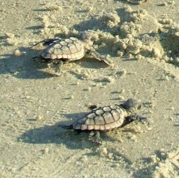
Turtle Watch Program – 2026
.
.
The first nest of the 2025 season was on May 21st
Average annual number of nests is 45
Current nest count – (75) as of 08/22/26
Members of the patrol started riding the beach every morning on May 1 and will do so through October looking for signs of turtle nests.
For more information » click here.
Record turtle nesting season underway at Holden Beach — if the heat doesn’t derail it
Volunteers say rising temperatures could affect sea turtle sex ratios over time
Volunteers with the Holden Beach Turtle Watch Patrol are seeing record-setting nest counts this summer even as relentless July heat raises concerns about hatchling survival and the people spending nights on the sand to protect them. Much of the work happens while most beachgoers sleep. On a recent overnight shift, a small patrol crew raked the beach smooth and posted nest signage, routine prep that helps volunteers spot fresh tracks at first light and identify new nests that need to be marked and monitored.
Nest numbers up sharply from last year
Steve McNeil, the patrol’s project coordinator, said the season has already eclipsed last year’s total. “Last year we had 35-26 nests, this year, we’re already up to 69,” McNeil said. The heat is taking a toll across the beach, McNeil said — including on volunteers and visitors. “The heat impacts a lot of people, even the vacationers, a lot of people saying it’s just too hot to be out here,” he said.
Heat can shift turtle sex ratios
Patrol members say the temperature of the sand does more than make the work uncomfortable: It can influence the sex of the hatchlings. Sand above 85 degrees increases the likelihood of female hatchlings, a concept volunteers sum up with a beachside saying: “Hot chicks, cool dudes.” Deva Tucker, the patrol’s president, said prolonged heat without rain could skew those ratios over time. “It’s gonna be hotter, deeper without the rain to bring some cool air and bring some cooler temperatures in, it can definitely sway the ratio of male to female and over the years that definitely could be a problem if you have more females,” Tucker said.
Cooked eggs a documented concern
Donna McGowan, who has volunteered with the patrol for 17 years, said extreme heat could produce troubling findings during nest excavations. “It’s very troublesome when you go in to excavate and inventory, and you see some unhatched eggs, and you open it, and it looks like it’s been cooked,” McGowan said. She said the patrol has not seen that so far this season. Volunteers sometimes relocate nests if they are laid in vulnerable areas — such as below the tide line — or if a turtle cannot clear a steep escarpment, patrol members said. Otherwise, they leave nests in place and monitor them through the incubation period.
Volunteers say turtles are resilient
Volunteer Beth Baker says the turtles’ instincts help them manage conditions that are harder on the humans monitoring them. “Their intuition, their instinct tells them what to do. So they manage somehow. I would say we suffer more than the turtles do, that’s my guess,” Baker said. To learn more about the mission of the Holden Beach Turtle Watch Patrol and how to get involved, click here.
Read more » click here
How you can protect sea turtles at NC beaches during nesting season
People aren’t the only folks flocking to North Carolina’s beaches as the weather warms up. In the coming weeks, beachgoers could find themselves sharing the sand with mamma sea turtles and shorebirds looking for a spot to start a new family. Already, skimmers, oystercatchers and other birds are vying for space on the sandy spits at the tips of barrier islands like Wrightsville Beach, and North Carolina has already seen one false crawl by a sea turtle even though sea turtle nesting season doesn’t generally start until May 1, according to the N.C. Wildlife Resources Commission. But sharing the beach can be a challenge, with the deck largely stacked against coastal wildlife as the lure of sand and the ocean keeps attracting more and more people to the N.C. coast − never mind the other challenges the animals face in the wild off the beach. Still, officials say following a few simple rules can give the critters a flipper and wing up during their beach visit. “Seeing a sea turtle on the beach is a wonderful, rare experience,” said Terry Meyer, deputy and conservation director at the Karen Beasley Rescue and Rehabilitation Center in Surf City. “But just keep a respectful distance while enjoying it.”
One in 1,000
Sea turtle nesting season in North Carolina occurs from May through September. Female sea turtles emerge from the ocean at night, and using their flippers, dig an 18-inch-deep hole that will serve as the nest where she will deposit 80 to 120 eggs. After laying the eggs, she covers the nest and returns to sea. After about a 60-day incubation period, the hatchlings emerge and make their way to the ocean. Only about one in 1,000 hatchlings will live to reproduce. In 2025 North Carolina recorded 1,088 nests, with the first one recorded on Topsail Island on May 8, 2025. The first nest to emerge was a Kemp’s Ridley nest on Ocean Isle Beach on July 10, 2025. The vast majority of North Carolina nests were laid by loggerheads. Green sea turtle nest numbers are slowly increasing in the state, with Tar Heel beaches seeing 58 last year. There also were 10 Kemp’s Ridley nests.
Range of threats
Both in the water and on land, sea turtles face a range of threats. In the ocean, dangers range from entanglement in fishing gear to boat strikes to ingesting plastics and other trash. But that’s if the hatchlings even make it off the beach to have a life at sea. “Our No. 1 greatest threat by far is artificial lighting,” Meyer said. She said it’s the biggest concern because the lights can not only disorientate the nesting female as she comes ashore, but also hatchlings as they move toward the brightest light they see when they come out of their nest. In a perfect world, that’s the moon or the stars as they make their way toward the ocean. And it isn’t just exterior lighting that is a problem. Meyer said a recent study found 57% of the light pollution along the Topsail Island beachfront was from interior lights − a major concern since many oceanfront homes don’t have shades or curtains on their ocean-facing windows. Factor in a rotating mix of residents as vacationers cycle on and off the island almost weekly and it’s a constant battle for the turtle volunteers and others to get the message about lighting out there. “We just can’t stay ahead of the light situation,” Meyer said, noting volunteers hand out door hangers warning about the danger of keeping lights on at night and promote the use of turtle-friendly ambient light bulbs for exterior uses instead of traditional bulbs. “It’s definitely a challenge.” Predators like foxes and raccoons along with overanxious tourists eager to see and get selfies with a giant marine reptile that predates the dinosaurs are other challenges nesting sea turtles and their hatchlings can face. Climate change also is a growing concern. On the beach, the warming weather is increasing sand temperatures, which helps determine the sex of hatchlings as the buried eggs incubate. If the beach is warmer than 89 degrees, most of the hatchlings will be female; if it’s cooler more will be male. For a long time, researchers have believed that the cooler beaches in the Carolinas produced males to mate with the female-heavy hatchlings produced by the warmer beaches in Florida and along the Gulf Coast. But what will happen if all the country’s beaches get so warm that the vast majority of hatchlings are female? A warming climate, which scientists are predicting for North Carolina in the coming years, also could impact when sea turtles nest, prompting turtles to lumber ashore earlier than the traditional May start date.
‘Fill in those holes’
The Topsail Turtle Project, run by the sea turtle hospital, monitors the beaches in Topsail Beach, Surf City and North Topsail Beach. With volunteer groups in other beach towns along with federal and state agencies, officials monitor all 330 miles of ocean-facing sandy beaches in N.C. for sea turtle nests, stranded animals and even signs of false crawls. “We want them all counted, all documented,” Meyer said. “We want to know how many turtles we have.” If an injured or stressed sea turtle is found, it often ends up at the sea turtle hospital. As of April 21, the turtle hospital was treating 45 patients − most cold-stun victims from this winter that were slowly being nursed back to health. Kathy Zagzebski, the hospital’s executive director, said during the busy fall and winter season the facility sometimes deals with more than 100 turtles at a time, many cold-stunned animals brought down from New England for treatment. Recovery times can often take several months per turtle. As the weather warms up, the hospital sees fewer turtles being brought in suffering from hypothermia or other temperature-related issues. But the animals that are brought in are often those that have been accidently hooked by a fishermen or hit by a boat. “We usually see fewer turtles, but those that we do see probably require more treatment,” Kathy said. Like Meyer, Zagzebski said just taking a few steps and being considerate can help people and sea turtles better share the state’s coastal environment. “And fill in those holes,” she said, noting that holes dug on the beach can deter mother sea turtles from nesting and prevent hatchlings from reaching the ocean after they emerge from the nest.
Read more » click here
The N.C. Sea Turtle Project works with 20 different volunteer groups. Contact information for each is available at nc-wild.org/seaturtles/contacts, or call the statewide sea turtle hotline at 252-241-7367.
How North Carolina sea turtles are faring this summer
As the weather warms and the summer season heats up, people and turtles are crowding N.C. beaches. Here are some tips on how everyone can share the coast
The height of summer along the N.C. coast means several things: People hitting the beach for a vacation; steaming and sticky temperatures; the occasional pop-up afternoon shower; and female sea turtles lumbering ashore looking for a place to nest. But sharing the beach can be a challenge, with the deck largely stacked against coastal wildlife as the lure of sand and the ocean keeps attracting more and more people to the N.C. coast − never mind the other obstacles sea turtles face in the wild off the beach. While adapted to dealing with soaring temperatures, climate change is another growing challenge the marine reptiles face that could have significant impacts on the species’ future. Here’s a mid-season look at sea turtle nesting in North Carolina, which represents just about the northern range of the animal’s nesting habitat.
Nesting so far in 2026
Sea turtle nesting season in North Carolina occurs from May through September. Female sea turtles emerge from the ocean at night, and using their flippers, dig an 18-inch-deep hole that will serve as the nest where she will deposit 80 to 120 eggs. After laying the eggs, she covers the nest and returns to sea. After about a 60-day incubation period, the hatchlings emerge and make their way to the ocean. Only about one in 1,000 hatchlings will live to reproduce. Through July 2, 2026, North Carolina beaches had been busy, with sea turtles laying 1,054 nests, representing an estimated 36,107 eggs, according to statistics compiled by the N.C. Wildlife Resources Commission. As usual, the vast majority of nests are from loggerheads, with a handful of green and leatherback nests thrown in there. Areas with the most nests were Cape Hatteras National Seashore, Cape Lookout National Seashore, Oak Island, Topsail Island and Fort Fisher State Recreation Area. The first nest, surprisingly a leatherback, was recorded April 28 in Atlantic Beach, Carteret County. In 2025 North Carolina recorded 1,088 nests, with the first one recorded on Topsail Island on May 8, 2025. The first nest to emerge was a Kemp’s Ridley nest on Ocean Isle Beach on July 10, 2025. The state saw 1,385 nests in 2024, and 1,723 nests in 2023. That means 2026 is off to a generally strong start for the turtles, which have federal and state protections − although nest numbers can be highly variable from year to year.
Challenges mother and baby sea turtles face
Natural predators and excited, curious humans are some of the challenges turtles face while trying to nest. Officials recommend viewing a sea turtle on the beach from a respectful distance. Nests also are marked to keep humans a safe distance away and often covered in anti-predator cages to prevent foxes, coyotes and raccoons from digging them up. Occasionally, nests also are relocated if they are buried in areas suffering from severe erosion or if threatened from over wash by storms. Even if a mother successfully nests and the hatchling emerge from the sand, the challenges aren’t over. One of the biggest threats baby sea turtles on the beach face is beach lighting. Lights can not only disorientate the nesting female as she comes ashore, but also hatchlings as they move toward the brightest light they see when they come out of their nest. In a perfect world, which should be the moon or the stars as they make their way toward the ocean. And it isn’t just exterior lighting that is a problem. A recent study on Topsail Island found 57% of the light pollution came from interior lights − a major concern since many oceanfront homes don’t have shades or curtains on their ocean-facing windows. Factor in a rotating mix of residents as vacationers cycle on and off the island almost weekly and it’s a constant battle for the turtle volunteers and others to get the message about lighting out there.
How rising temperatures could impact sea turtles
Climate change also is a growing concern among turtle researchers. On the beach, the warming weather is increasing sand temperatures, which helps determine the sex of hatchlings as the buried eggs incubate. If the beach is warmer than 89 degrees, most of the hatchlings will be female; if it’s cooler more will be male. For a long time, researchers have believed that the cooler beaches in the Carolinas produced males to mate with the female-heavy hatchlings produced by the warmer beaches in Florida and along the Gulf Coast. But what will happen if all the country’s beaches get so warm that the vast majority of hatchlings are female? A warming climate, which scientists are predicting for North Carolina in the coming years, also could impact when sea turtles nest, prompting turtles to lumber ashore earlier than the traditional May start date.
Tips if you see a nesting sea turtle
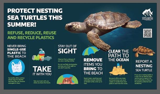
Here are some recommendations by the state wildlife commission on how beach visitors can help protect sea turtles during nesting season.
-
- Minimize beachfront lighting by turning off, shielding or redirecting lights away from the beach.
- Close blinds and curtains in oceanfront rooms at night to keep indoor lighting from reaching the beach.
- Remove chairs, umbrellas, beach toys and boats from the beach at night so they don’t interfere with nesting sea turtles or hatchlings.
- Use your natural vision and moonlight when walking the beach at night.
- If you encounter a sea turtle on the beach, remain quiet and still and observe from a respectful distance.
- If you encounter tracks on the beach, leave them alone. Researchers use them to determine the species of nesting turtle and to locate nest sites.
- If you come across a sea turtle or a nest, contact the beach’s local sea turtle monitoring organization.
Contact information for the groups is available at nc-wild.org/seaturtles/contacts, or call the statewide sea turtle hotline at 252-241-7367.
Read more » click here
Fauna & Flora –

NC State Native Plant Resources » click here
NC Native Plants for Pollinators » click here
NC Sea Grant Coastal Landscapes » click here
New Hanover County Arboretum Native Plant Garden » click here
Audubon Native Plant Database » click here
North Carolina Extension Gardener Plant Toolbox » click here
Fauna & Flora » click here
Holden Beach recommended plant list – deer resistant & salt tolerant
Factoid That May Interest Only Me
ENSO Alert System Status: El Niño Advisory
El Niño is strengthening, with a greater than 90% chance of a very strong event during the Northern Hemisphere fall and winter 2026-27.
El Niño strengthened over the past month, with sea surface temperature anomalies exceeding +2.0°C in the eastern equatorial Pacific. The July Niño index values were +1.4°C in Niño-3.4, +1.7°C in Niño-3, and +2.9°C in Niño-1+2. The equatorial subsurface temperature index (average from 180°-100°W) increased during July, reflecting a deeper-than-average thermocline. Subsurface temperature anomalies were significant, reaching +10.0°C at depth. Low-level westerly wind anomalies and upper-level easterly wind anomalies extended from the western to east-central equatorial Pacific. Convection and rainfall were enhanced from the central to eastern Pacific and were suppressed over Indonesia. The traditional and equatorial Southern Oscillation indices were significantly negative, with values near 2 standard deviations during July. Collectively, the coupled ocean-atmosphere system reflected a strengthening El Niño. The CPC Official ENSO outlook, which synthesizes multiple models from North America and abroad, indicates El Niño will continue to strengthen through the end of the year. During the October-December 2026 season, there is a 69% chance of a historic event that would exceed the strength of previous El Niño events dating back to 1950 (+2.5°C or more for a 3-month RONI value). With an event of this magnitude, the chances of experiencing impacts consistent with El Niño are larger, but they are not guaranteed (see CPC outlooks for probabilities of seasonal anomalies). In summary, El Niño is strengthening, with a greater than 90% chance of a very strong event during the Northern Hemisphere fall and winter 2026-27. This discussion is a consolidated effort of the National Oceanic and Atmospheric Administration (NOAA), NOAA’s National Weather Service, and their funded institutions. Oceanic and atmospheric conditions are updated weekly on the Climate Prediction Center web site (El Niño/La Niña Current Conditions and Expert Discussions). A probabilistic strength forecast is available here. The next ENSO Diagnostics Discussion is scheduled for 10 September 2026. To receive an e-mail notification when the monthly ENSO Diagnostic Discussions are released, please send an e-mail message to: ncep.list.enso-update@noaa.gov.
Read more » click here
El Niño could become strongest on record. What it means for North Carolina
A potentially record-breaking El Niño is changing the forecast for the months ahead in North Carolina — including hurricane season and winter.
A rapidly strengthening El Niño could become the strongest on record, potentially suppressing Atlantic hurricanes this fall while increasing North Carolina’s chances of a wetter winter after months of drought strained water supplies across the state. NOAA’s Climate Prediction Center said Thursday there is a greater than 90% chance of a “very strong” El Niño developing during the fall and winter. Forecasters say there is nearly a 70% chance it reaches an intensity not seen in NOAA records dating to 1950. “We never know exactly what’s going to occur, but in North Carolina during an El Niño, we tend to see wetter weather,” said Lindsey Long, a meteorologist with NOAA’s Climate Prediction Center. “So we can expect more rainfall over North Carolina this winter.”
What is El Niño?
El Niño is a naturally occurring climate pattern that begins in the tropical Pacific Ocean but can alter weather thousands of miles away. Normally, trade winds near the equator push warm surface water westward across the Pacific. During El Niño, those winds weaken, allowing warm water to shift eastward and changing atmospheric circulation. Long said weakening trade winds and pulses of warm water moving across the Pacific are helping this year’s El Niño intensify. NOAA measures El Niño using the Relative Oceanic Niño Index, or RONI, which compares temperatures in a key region of the equatorial Pacific with temperatures across the broader tropical oceans. The measure is designed to better account for the background warming of the world’s oceans. The strongest El Niño in NOAA’s record reached a RONI value of 2.5 degrees Celsius above normal during the 1982-83 event. Long said forecasts indicate this event could reach 2.5 to 2.6 degrees Celsius this winter, potentially setting a new record. July already had the second-highest sea surface temperatures NOAA has recorded in the Niño 3.4 region, Long said.
What could El Niño mean for hurricane season?
For the East Coast, a strong El Niño can come with an unusual benefit during hurricane season. El Niño typically increases vertical wind shear over the Atlantic. Those changing winds at different levels of the atmosphere can disrupt developing tropical systems, making it harder for hurricanes to organize and strengthen. “For hurricanes, that’s kind of a killer,” Long said. “The winds in upper levels just destroy the structure of the hurricane, and so they can’t really get going.” Long said that effect is already contributing to relatively quiet Atlantic activity this August, despite very warm Atlantic waters that would otherwise be favorable for storms. El Niño does not eliminate the threat of hurricanes or guarantee North Carolina will avoid a landfall. It shifts the odds toward less overall Atlantic activity.
Could El Niño help North Carolina’s drought?
The effects could continue long after hurricane season ends. El Niño tends to favor wetter-than-normal conditions across the southern United States during winter, including North Carolina. That could be particularly significant this year. North Carolina experienced its second-driest January through June on record, with rainfall nearly 9 inches below normal. Earlier this summer, low reservoirs and other water supply concerns prompted mandatory conservation measures in several communities. Long said a wetter winter could help ease some of that pressure, although there is no guarantee. “I know that you guys have had a very severe drought that’s been long-lasting, so hopefully this will help decrease that burden on the water supply,” Long said. “But again, no guarantee, but it does greatly increase the odds that we’ll see some wetter weather.” More precipitation could also mean more opportunities for snow or ice if storms coincide with sufficiently cold temperatures. “I would say the odds are higher for winter weather, just because of increased chances for precipitation,” Long said.
Record strength doesn’t guarantee record impacts
Even if this El Niño becomes the strongest measured by NOAA, that does not mean North Carolina will experience record impacts. Each El Niño develops differently, and the phenomenon changes the probability of certain weather patterns rather than determining exactly what will happen in a particular place. Long said NOAA’s forecast should be viewed as an opportunity to prepare for a potentially wetter season while continuing to follow shorter-term forecasts as winter approaches. The event is also developing amid unusually warm oceans globally, but scientists are still studying exactly how human-caused climate change may alter El Niño and La Niña. NOAA expects El Niño to continue strengthening through the fall and peak during the coming winter.
Read more » click here
Storm Events
 Hurricane Vehicle Decals
Property owners were provided with four (4) decals that were included in there water bill. It is important that you place your decals in your vehicle or in a safe place. A $10 fee will be assessed to anyone who needs to obtain either additional or replacement decals. Decals will not be issued in the 24-hour period before an anticipated order of evacuation.
The decals are your passes to get back onto the island to check your property in the event that an emergency would necessitate restricting access to the island. Decals must be displayed in the driver side lower left-hand corner of the windshield, where they are not obstructed by any other items. Officials must be able to clearly read the decal from outside the vehicle.
Property owners without a valid decal will not be allowed on the island during restricted access. No other method of identification is accepted in an emergency situation. Click here to visit the Town website to find out more information regarding decals and emergency situations.
NC General Statute 166A-19.22
Power of municipalities and counties to enact ordinances to deal with states of emergency.
Synopsis – The governing body may impose by declaration or enacted ordinance, prohibitions, and restrictions during a state of emergency. This includes the prohibition and restriction of movements of people in public places, including imposing a curfew; directing or compelling the voluntary or mandatory evacuation of all or part of the population, controlling ingress and egress of an emergency area, and providing for the closure of streets, roads, highways, bridges, public vehicular areas. All prohibitions and restrictions imposed by declaration or ordinance shall take effect immediately upon publication of the declaration unless the declaration sets a later time. The prohibitions and restrictions shall expire when they are terminated by the official or entity that imposed them, or when the state of emergency terminates.
Violation – Any person who violates any provisions of an ordinance or a declaration enacted or declared pursuant to this section shall be guilty of a Class 2 misdemeanor.
Hot Button Issues
Subjects that are important to people and about which they have strong opinions

Climate
For more information » click here.
There’s something happening here
What it is ain’t exactly clear

Flood Insurance Program
For more information » click here
National Flood Insurance Program: Reauthorization
Congress must periodically renew the NFIP’s statutory authority to operate. On February 3, 2026, the president signed legislation passed by Congress that extends the National Flood Insurance Program’s (NFIP’s) authorization to September 30, 2026.
Congress must now reauthorize the NFIP
by no later than 11:59 pm on September 30, 2026.

GenX
For more information » click here

Homeowners Insurance
For more information » click here
Homeowners are paying much more for insurance —
and keeping coverage is getting harder
Homeowners insurance costs are swelling rapidly for consumers — and even for those able to pay, policies are getting harder to keep as insurers drop customers at a higher rate, according to a new industry report. Average premiums for homeowners insurance rose faster than inflation across all major regions of the country from 2018 to 2024, according to a report released Wednesday by the National Association of Insurance Commissioners, a group that represents state insurance regulators. Consumers saw their average premiums rise by 18% in the Northeast, 25% in the Midwest, 27% in the Southeast and 43% in the West over that seven-year period, even after accounting for inflation, according to the report, which broke out data across four regional zones. Average premiums were highest in the Southeast, at $1,818 per year in 2024, while those in the Northeast were lowest at $1,396, NAIC said. Premiums have risen another 7% since the beginning of 2025, according to the Bureau of Labor Statistics’ producer price index. The index doesn’t necessarily reflect consumers’ out-of-pocket costs, but provides a proxy for the movement of premiums over time, according to the National Association of Realtors. The report, compiled with data from state insurance agencies, was the group’s first comprehensive data analysis of the homeowners insurance market in several years, NAIC officials said. Climate change, rising home rebuilding costs and other factors have driven up financial risk for insurers, who are passing that financial burden on to consumers, at least in part, insurance experts said. Meanwhile, the dynamic is straining homeowners amid a broader affordability crunch and a U.S. inflation rate that has been above policymakers’ target for more than five years. People’s ability to afford a home is about 10% lower than it would otherwise be if insurance costs had remained stable since the late 1990s, according to NAR. The expense disproportionately burdens low-income households, who are more likely to drop their coverage altogether — and put their house, often their largest financial asset, at risk if disaster strikes, said Peter Kochenburger, an insurance expert and a visiting professor of law at Southern University Law Center. “It’s a big problem,” Kochenburger said of rising costs for consumers. The NAIC analysis also showed that insurers are dropping customers at elevated rates, opting not to renew their policies when their terms expire. This generally happens when an insurer thinks the risk outweighs their profit potential, Kochenburger said. Nonrenewal rates per 1,000 in-force policies have increased across the country since 2018, by anywhere from 96% in the Southeast to 216% in the West, NAIC found. These nonrenewals are those initiated by insurance companies. There were 103 million homeowners insurance policies in force in the U.S. as of 2024, according to NAIC. “The data tells the story of a homeowners insurance market that is overall operationally robust but nonetheless under pressure and exhibiting signs of stress,” the report’s co-authors, Jeffrey Czajkowski and Paula Harms, wrote. “These trends support consumer sentiment that coverage is becoming more expensive and harder to find or keep in some places,” they wrote.
Why homeowners insurance costs are rising
The report’s findings broadly echo those of other analyses in recent years. The U.S. Treasury Department, for example, said in a report last year that average premiums per policy increased 8.7% faster than the rate of inflation from 2018 to 2022. A poll conducted this year by the Pew Research Center, a nonpartisan research group, found that 42% of homeowners said their costs had gone up “a lot” in recent years. Consumers generally buy homeowners insurance as a form of financial protection against unexpected physical damage to their house. Mortgage lenders also often require prospective homebuyers to buy such an insurance policy to secure a loan. If homeowners insurance becomes too pricey for consumers, there could be a “cascading or domino effect” in the U.S. economy — for example, if fewer people choose to buy homes, Kochenburger said. He said he thinks climate risk is the main driver of rising premiums. Climate change has fueled an increase in the number — and intensity — of severe weather events like wildfires, hurricanes, droughts and floods. The dynamic increases the likelihood that policyholders will need to file insurance claims and the odds that those claims will be for higher amounts, experts said. The number of weather and climate disasters that caused more than $1 billion in damage increased more than fivefold from 2018 through 2022, compared with the 1980s, after adjusting for inflation, according to the Treasury Department. “Catastrophic risk — these hurricanes, wildfire, severe convective storms, winter storms — these are events that are happening more and more frequently,” Czajkowski, director of the NAIC Center for Insurance Policy and Research, told CNBC in an interview. “And they’re impacting consumers.” The elevated risk comes as the Trump administration has moved to dismantle the federal government’s efforts to fight climate change and reduce planet-warming greenhouse gas emissions. While those natural disasters are more obvious in certain parts of the country — wildfires in the West and hurricanes in the Southeast, for example — weather-related risks are growing throughout the country, Kochenburger said. “Hail is a significant source of property damage, and that occurs in a number of states that don’t have much coastal exposure,” he said, as an example. However, factors beyond climate risk also contribute to higher insurance costs. For example, inflation has increased the cost of repairing and rebuilding homes, thereby raising the amount insurers pay out when policyholders file an insurance claim, experts said. Replacement costs for property and casualty-related losses increased by 45%, on average, between 2020 and 2023, according to the Treasury Department. Homeowners insurance is a type of property and casualty insurance. The NAIC data may even undersell the scope of the issue. For one, since the report only breaks out costs by regional zones, it’s “likely” that there are smaller, local areas where premiums have risen much faster than a particular region, according to the NAIC report. It’s also “quite possible” policyholders reduced coverage to blunt the impact of rising premiums, “which would likely show up in the data as a decrease or no change in premium,” it said. Insurers have also generally made their policies less comprehensive over the years, perhaps by removing certain risks from a general homeowners policy or reducing the dollar limits for certain coverage, Kochenburger said.
Read more » click here
Hurricane Season
For more information » click here
Hurricane season runs from June 1 through November 30
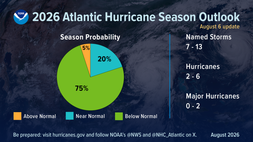
NOAA maintains prediction for below-normal Atlantic hurricane season
Need for U.S. residents to prepare remains
With the climatological peak of hurricane season approaching in early September, NOAA’s prediction for below-normal activity in the Atlantic basin remains. Forecasters from NOAA’s National Weather Service updated today the number of expected named storms to 7-13 (with winds of 39 mph or greater), of which 2-6 could become hurricanes (winds of 74 mph or greater), including 0-2 major hurricanes (winds of 111 mph or greater). These ranges cover the entire season from June 1 through November 30 and are inclusive of the two tropical storms that have already formed. NOAA forecasters predict a 75% chance for below-normal activity, with a 20% chance of a near-normal season, and just a 5% chance of above-normal activity. This updated prediction is similar to the initial outlook issued in May. In the Atlantic basin, a typical hurricane season will yield 14 named storms, of which seven become hurricanes, including three major hurricanes.
Only Gulf storms in the Atlantic Basin so far
To date, the 2026 season has produced two named tropical storms, Arthur and Bertha, and no hurricanes. Tropical Storm Arthur was the first named storm of the Atlantic season. Forming in mid-June in the warm Gulf of America waters off the Texas coast, Arthur brought record rainfall to portions of Louisiana and spawned tornadoes along the Gulf coast. Bertha also formed in the Gulf, originating south of the Florida panhandle before making landfall in St. Bernard Parish, Louisiana. “Inland rainfall is a major cause of damage from tropical storms and hurricanes, as Arthur demonstrated,” said NOAA’s National Weather Service Director Ken Graham. “That’s why it’s important to prepare for every storm that’s projected to impact your area, even if it never reaches hurricane strength.”
Factors influencing the Atlantic hurricane season outlook
For the remainder of the season, tropical storm activity in the Atlantic basin is expected to be tempered by El Nino conditions, which first emerged in the equatorial Pacific in June. El Nino increases wind shear, which tends to prevent tropical storms from forming or from getting stronger once formed. Other less influential factors include temperatures near average in the Atlantic Ocean and a neutral west African monsoon. “When El Nino emerges, it usually becomes the dominant factor in total hurricane season activity, and this El Nino continues to get stronger every month,” said Matt Rosencrans, lead hurricane season forecaster with NOAA’s National Weather Service.“Compared to a mature El Nino, other mechanisms play a smaller role in determining the number and intensity of tropical storms in the Atlantic basin.”
Hurricane outlooks in other ocean basins
Although El Nino tends to limit tropical activity in the Atlantic, it can enhance storm development in the Pacific. NOAA’s outlook for the Eastern Pacific hurricane season remains unchanged with 15-22 named storms, which is above average. So far there have been seven named storms, of which two became hurricanes, including one major hurricane. An above-normal season is also expected in the Central Pacific basin, with 5-13 named storms and tropical depressions.
About NOAA’s Hurricane Season Outlook
NOAA’s Hurricane Season Outlook is for overall seasonal activity and is not a landfall forecast. Landfalls are largely determined by short-term weather patterns, which are only predictable within about a week of a storm potentially reaching land. NOAA’s National Hurricane Center (NHC) provides tropical weather outlooks out to seven days in advance, provides track and intensity forecasts for individual storms and issues watches and warnings for specific tropical storms, hurricanes and the associated storm surge.
Stay informed
Consult the NHC website, hurricanes.gov, for the latest about tropical storm and hurricane activity in the Atlantic and Pacific Ocean basins. You can also follow regular updates from NHC on X at @NHC_Atlantic offsite link and on Facebook. You can also access additional tips and resources to stay safe this season.
Read more » click here
Why the 2026 hurricane season is so quiet; what it means for NC coast
So far the 2026 hurricane season, which started June 1, has been very slow. How slow? It’s the quietest start to a hurricane season this century. Why?
For most of this hurricane season, the National Hurricane Center’s online map of the Atlantic basin has been showing a surprising image and message. Nothing with this text superimposed on the map: “Tropical cyclone activity is not expected during the next 7 days.” So far the 2026 season, which started June 1, has been the quietest start to a hurricane season this century. There have only been three named storms so far, and they’ve lasted a combined four days. Tropical Storm Arthur brought significant rain to parts of the Gulf coast and Southeastern United States in mid-June, but only after it dissipated. Tropical Storm Bertha in mid-July also brought rain to parts of the Gulf but didn’t cause much of a ruckus. And Tropical Storm Cristobal in August hung around for about a day in the middle of the Atlantic before petering out. Even a pair of tropical disturbances that held the possibility of forming into something or even combining into a bigger system before hitting the Caribbean in mid-August fizzled out. So what’s going on, and how soon could we see Dolly and Edouard?
The 2026 season is both normal and unusual
According to the hurricane center, things aren’t actually that unusual this year. “The first named storm typically forms in mid- to late June, the first hurricane tends to form in early to mid-August, and the first major hurricane forms in late August or early September,” the agency states on its website. The busiest part of hurricane season also runs roughly from mid-August into early October, with the peak day for activity being Sept. 10. But according to another factor, this season is a strange one. The Weather Channel reports that the accumulated cyclone energy, which measures how long storms last and how strong they get, for this hurricane season is unusually low. According to the weather site, the 2026 season is the slowest-starting hurricane season in terms of accumulated cyclone energy since 1998.
Enter El Niño
Across the board, meteorologists say the strengthening El Niño in the equatorial Pacific is playing a large role in squashing tropical activity in the Atlantic basin. El Niño is a natural climate pattern in which surface seawater temperatures in the central and eastern tropical Pacific are warmer than normal. Meaning Little Boy in Spanish, El Niño was originally recognized by fishermen off the coast of South America with the appearance of unusually warm water in the Pacific around Christmas. According to the National Oceanic and Atmospheric Administration (NOAA), there’s a nearly 70% chance it could develop into a “super” El Niño, meaning its impacts could be greater than normal. If a super El Niño does develop, it could supercharge weather events across the world. For the U.S. South, which could mean wetter conditions with more heavy rainfall events this fall and winter − bringing much-needed relief to the ongoing drought situation in much of the Tar Heel State. In a world already cooking hotter than normal thanks to climate change, the weather pattern also could amplify extreme heat already baking much of the world. According to the World Meteorological Organization, 2025 was the third warmest year on record, only trailing 2024 and 2023, with sea-surface temperatures also setting records despite cooling La Niña weather patterns. El Niño can have a significant impact on the severity of the hurricane season in both the Atlantic and the Pacific. In the Atlantic, the weather pattern tends to reduce activity in the tropical Atlantic by bringing on stronger upper-level wind shear and sinking air, hindering the formation of tropical weather systems, while having the opposite effect and boosting activity in the Pacific. The Northwest Pacific has already seen three Category 5 storms this season, and in the Central Pacific Hurricane Lala just finished lashing Hawaii with 90 mph winds.
What happens now?
The latest forecast from Colorado State University is only calling for nine named storms this season, which would be an exceptionally low total, especially given how warm most of the tropical Atlantic is right now. In effect, the Caribbean has largely become a no-go zone for hurricane formation. “That’s a great indication of the power of El Niño, that it can develop in the Pacific, but still have a controlling role in weather patterns half a world away,” said N.C. Assistant State Climatologist Corey Davis. While North Carolina missing out on tropical weather might sound good on paper, it also comes with some other impacts. One of those is a loss of the rainfall such a system would bring to Eastern North Carolina, an area that largely remains in drought or a very dry state as of late August. The region relies on passing tropical weather for much of its summer precipitation that helps farmers and recharges underground aquifers. According to the National Weather Service in Wilmington, the Port City had seen 25.3 inches of rain in 2026 as of Aug. 18. That compares to a normal average of nearly 36 inches. “Wilmington averages more than 8 inches of rain in both August and September, and it’s hard to get that much from the sort of spotty showers and storms we’ve seen in recent weeks,” Davis said. “While we certainly don’t wish for anything tropical, some areas could definitely use the rain to make a dent in this drought.” But on the flip side, El Niño normally brings above-average rainfall to the U.S. Southeast in the fall and winter. During the last strong El Niño in 2015, Wilmington has its wettest October on record and fourth-wettest winter, Davis said. “This all feels like a be-careful-what-you-wish-for sort of situation,” he said. “We need the rain now, but we’ll probably be sick of it in a few months.” Tim Armstrong, a meteorologist with the weather service’s Wilmington office, said even with El Niño hindering storm development across much of the tropics, which doesn’t mean Southeastern N.C. is out of the woods for storm development. “There’s still the subtropical Atlantic we have to watch closely,” he said. “El Niño doesn’t affect shear as much outside of the tropics, so a locally grown storm could more easily develop this fall and bring impacts to the Carolinas.” Past examples of these types of storms include Ophelia in 2005 and Diana in 1984. And the unnamed storm that swamped southern New Hanover County and parts of Brunswick County with 20 inches of rain in 2024 was another one of these storms, he added. Officials also continue to stress to coastal residents that even if it appears to be a relatively quiet season, it only takes one storm arriving on your doorstep to make it a terrible hurricane season. “And our own work suggests that it is very difficult to predict that quantity on a year-to-year basis since you are dealing with the statistics are very small numbers,” said Dr. Michael Mann, a meteorologist and scientist at the University of Pennsylvania. “But we do know that there is an increase over time in the maximum intensity of these storms driven by human-caused warming.”
Read more » click here
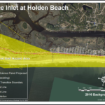
Inlet Hazard Areas
For more information » click here
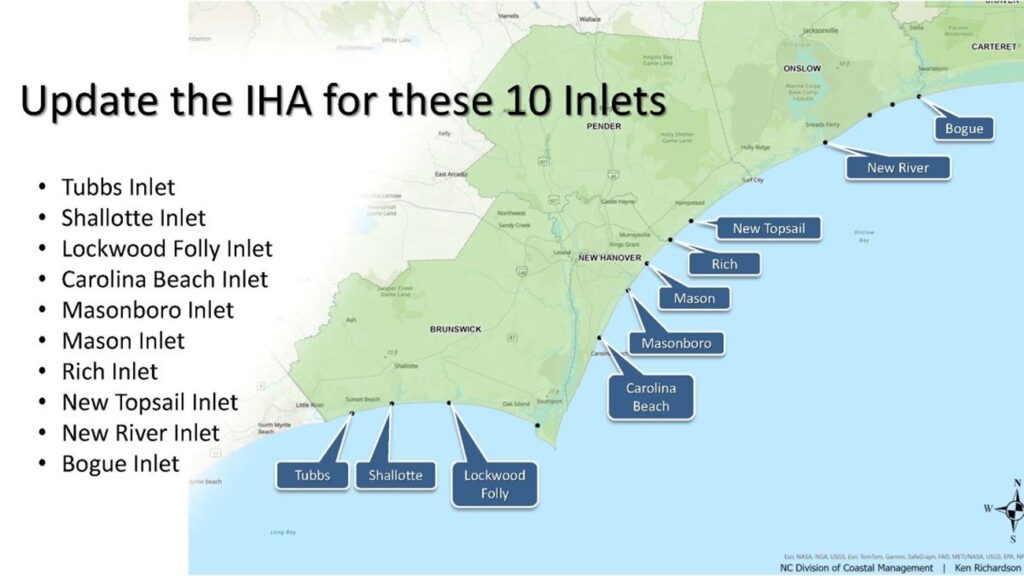
.
Lockwood Folly Inlet
For more information » click here.

Seismic Testing / Offshore Drilling
For more information » click here.

Offshore Wind Farms
For more information » click here
Things I Think I Think
 Eating out is one of the great little joys of life.
Restaurant Review:
The Dinner Club visits a new restaurant once a month. Ratings reflect the reviewer’s reaction to food, ambience and service, with price taken into consideration.
///// July 2026
Name: Savorez
Cuisine: Latin American
Location: 402 Chestnut St, Wilmington, NC 28401
Contact: 910.833.8894 / https://savorez.com/
Food: Average / Very Good / Excellent / Exceptional
Service: Efficient / Proficient / Professional / Expert
Ambience: Drab / Plain / Distinct / Elegant
Cost: $21 Inexpensive <=20 / Moderate <=26 / Expensive <=35 / Exorbitant <=60
Rating: Two Stars
Chef Sam Cahoon opened Savorez in 2018, blending Latin flavors with Southern cooking through fresh, local, and sustainable ingredients. The name says it all: “Savorez” means “flavors” in Spanish. Located just off the beaten path, Savorez is a very small, unpretentious spot with limited seating for only thirty guests. The atmosphere is comfortable, friendly, casual, nothing fancy in this cozy restaurant. The same menu is served at lunch and dinner, and it is fairly limited, offering only seven entrée options. The venue feels too small for its popularity, and because reservations are not accepted, dining there can be a challenge. Despite being ranked #2 out of 699 Wilmington restaurants, our experience did not match the praise. Frankly, we were not impressed, and it did not live up to that kind of rating.
Chianti South set to re-open in Little River under new ownership
A popular Little River Italian restaurant is returning with a new look and feel. Chianti South, located just before the North Carolina state line on Highway 17, is planning to re-open soon under new ownership. The restaurant originally opened back in 1997 and was known for its Italian cuisine and award-winning wine list. It closed down in 2024 after a property sale, but new ownership — led by popular North Carolina restaurateur James Lane — will re-open the restaurant under the same name. “There will be remodeling, for sure,” a spokesperson with Lane’s organization told MyHorryNews. “You’ll see some updates in the building, but it will be a similar menu and dining experience. I think we will open back up with the same nostalgic feeling that people have always had at Chianti South.” Lane owns several restaurants over the state line in Brunswick County, including Lucca Italian Chophouse in Shallotte, Maria’s Pizzeria in Ocean Isle Beach and Oak & Palm in Sunset Beach. The next step for Lane and the business will be crossing over into South Carolina; the re-opened Chianti South will be similar to what locals remembered the restaurant to be. “The menu will reflect a remembrance of Chanti South,” the spokesperson said. “All of our pastas will be house-made, including ravioli and we will have great high-quality steaks and chops, as well.” No date was given on when the restaurant expects to open, although progress and renovations are already being made at the location. Management says they are looking forward to giving back to the Horry County community and putting on events that benefit the area and local charities.
Read more » click here
Editor’s note –
Lane’s organization owns Sorella restaurant in Holden Beach too
/////
Name: Sorella
Cuisine: Italian Restaurant
Location: 3219 Holden Beach Road, Supply NC
Contact: 910.842.2177 / https://www.sorellapizzapasta.com/
Food: Average / Very Good / Excellent / Exceptional
Service: Efficient / Proficient / Professional / Expert
Ambience: Drab / Plain / Distinct / Elegant
Cost: $22 Inexpensive <=$20 / Moderate <=$26 / Expensive <=$35 / Exorbitant <=$60
Rating: Two Stars
Sorella means sister in Italian, they are the sister restaurant of Maria’s Pizzeria in Ocean Isle Beach and Lucca in Shallotte. Located on the causeway to Holden Beach, they are open daily at 11:00 am. A local authentic Italian restaurant, a casual atmosphere, with a limited menu, serving a wide variety of pizzas, pastas, and some traditional Italian dishes. This is one of the better restaurant offerings in the area.
/////
Name: Lucca Italian Chop House
Cuisine: Italian
Location: 4924 MainStreet, Shallotte NC
Contact: 910.754.2334 / https://www.luccachophouse.com/
Food: Average / Very Good / Excellent/ Exceptional
Service: Efficient / Proficient /Professional / Expert
Ambience: Drab/ Plain / Distinct / Elegant
Cost: $26 Inexpensive<=20 / Moderate <=26 /Expensive <=35 / Exorbitant <=60
Rating: Two Stars
Lucca is a local Italian restaurant, dining in a casual relaxed atmosphere with a menu that offers something for everyone. An exceptional value, the food is very good, the portions are generous, and the prices are reasonable. All in all, we had a nice meal there, but it really wasn’t anything special.
Dining Guide – Local * Lou’s Views
Dining Guide – North * Lou’s Views
Dining Guide – South * Lou’s Views
Restaurant Reviews – North * Lou’s Views
Restaurant Reviews – South * Lou’s Views
Book Review:
Read several books from The New York Times best sellers fiction list monthly
Selection represents this month’s pick of the litter
 THE HUNTER by Tana French
A divorced American retired detective tries to blend into rural Ireland in this sequel to the 2015’s The Searcher. At the heart of the story is Cal who moved to rural Ireland looking for peace. He’s built a relationship with a local woman, Lena, and he’s gradually turning Trey from a half-feral teenager into a good kid going good places. But then Trey’s absentee father, Johnny, comes back to town intent on perpetrating a swindle on the townsfolk. His cockamamie scheme sets in motion a series of crimes, including a murder, and suddenly everything the three of them have been building is under threat.

THE KEEPER by Tana French
In the final installment of the Cal Hooper trilogy, retired Chicago detective Cal Hooper tries to preserve the quiet life he has built in a remote Irish village. But when a young woman is found dead in the river, Cal and his fiancée are drawn into a dangerous investigation that exposes local tensions, long-buried secrets, and a corrupt land-development scheme threatening both the town and the fragile new life he has worked so carefully to create.
That’s it for this newsletter
See you next month
Lou’s Views . HBPOIN
-
-
-
-
-
-
-
-
-
- Gather and disseminate information
- Identify the issues and determine how they affect you
- Act as a watchdog
- Grass roots monthly newsletter since 2008
-
-
-
-
-
-
-
-