
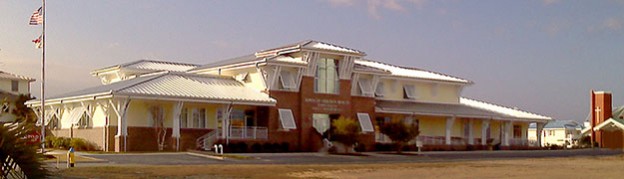
Lou’s Views
“Unofficial” Minutes & Comments
BOC’s Special Meeting 09/04/26
Board of Commissioners’ Agenda Packet » click here
Audio Recording » click here
1. McGill Presentation – Discussion and Possible Action
Welcome & Context Setting (10 mins)
-
- Welcome remarks
- Goal alignment: Define what success looks like by the end of the 2 hours.
- Ground rules: Establish guidelines (e.g., “all ideas are welcome,” “put on your resident hat,”)
Discovery & Site Analysis (30 mins)
-
- Project Area – Project Boundary, and parcels
- Existing Conditions w/ Photos (Traffic Circulation, Parking, Brunswick Avenue, Corridor, Former Pavilion Site, etc.)
- Community Input Summary: Quick review of previous public input.
Q&A session: Clarifying questions from participants regarding site.
A Unified Vision: Design Concepts & Connections (30 Minutes)
Present Concepts for review
-
-
- Transportation – Vehicular
- Brunswick Avenue Corridor
- Under the Bridge – Boat Trailer Parking
- Vehicular Parking
- Block Q Enhancements
- Jordan Blvd Concepts
- Opportunity Zones – Recreational Amenities
-
Commissioner Comments – Building Consensus (1 Hour)
-
-
- Transportation – Vehicular
- Brunswick Avenue Corridor
- Under the Bridge – Boat Trailer Parking
- Vehicular Parking
- Block Q Enhancements
- Jordan Blvd Concepts
- Opportunity Zones – Recreational Amenities
-
Final Comments and Next Steps
Slide Presentation » click here
Update –
The session was conducted as an interactive workshop with the Board of Commissioners. The group briefly reviewed the input gathered from work completed to date. Four key focus areas were identified: Under-Bridge Area, Block Q Green Space, Brunswick Avenue Corridor, and Jordan Boulevard. The next step is to develop a final concept plan and master planning document that establish a unified vision and a connected framework for these areas.
 Once again, the speaker could not be heard clearly because the microphone was not used consistently.
BOC’s Special Meeting 09/15/26
Board of Commissioners’ Agenda Packet » click here
Audio Recording » click here
1. Interviews for Vacancies on Audit Committee
BOC’s Regular Meeting 09/15/26
Board of Commissioners’ Agenda Packet » click here
Audio Recording » click here
1. Consent Agenda Items
a) Police Report – Chief Barger
Agenda Packet – pages 6 – 12
Police Report » click here
b) Inspections Department Report – Inspections Director Evans
Agenda Packet – pages 13 – 16
Inspections Report » click here
c) Finance Department Report – Finance Officer McRainey
Agenda Packet – pages 17 – 22
Finance Report » click here
d) Public Works Department Report – Public Works Director Benton
Agenda Packet – pages 23 – 24
Public Works Report » click here
The Board approved the consent agenda items
2. Update Regarding Federal Priorities – Mike McIntyre, Ward and Smith and the Ferguson Group (Assistant Town Manager Ferguson)
Agenda Packet – page 25
ISSUE/ACTION REQUESTED:
Update from Mike Mcintrye (Ward and Smith) and the Ferguson Group regarding federal priorities.
BACKGROUND/PURPOSE OF REQUEST:
Each year Ward and Smith provides the board with an update regarding federal advocacy and the Town’s current federal priorities. Mike McIntyre and representatives from the Ferguson Group will give the board an overview of what is occurring at the federal level regarding policy and funding.
Previously reported – May 2026
Our lobbyist Mike McIntyre with Ward & Smith in conjunction with the Ferguson Group represents the town in advocacy matters at the federal level. The monthly retainer minimal fee will remain at $9,725 per month, plus out-of-pocket expenses that typically total approximately $2,000 per month for The Ferguson Group. The agreement with Ward and Smith is for an annual total estimated advocacy cost of $140,700.
Update –
Our lobbyist Mike McIntyre provided a federal advocacy update, focusing on policy and funding. The most significant talking point is the proposed FEMA disaster response and recovery reforms that may affect the Town.
3. Update and Possible Action on Path Forward for Planned Canal Dredging Project for 2026 – Assistant Town Manager Ferguson
. a. Resolution 26-10, Water Resources Development Grant
Agenda Packet – pages 26 – 41
Resolution 26-10 » click here
ISSUE/ACTION REQUESTED:
Update regarding the planned canal dredging project for 2026 and consideration and possible action on paths forward.
BACKGROUND/PURPOSE OF REQUEST:
The Town Manager has been expressing for several months that we are working with the Corps regarding a cost to utilize DA292 for dredge spoil disposal. This presentation will highlight paths forward and discuss options.
Update –
Staff has been working behind the scenes on several issues and has identified three potential paths to move the canal dredging project forward. Christy stated that the Town needs to address the grant now and enter the queue to meet the November environmental window. Dredging and spoil-area costs have increased significantly, and several steps must still be completed for dredging to occur this year. Resolution 26-10 requests $1,878,750 in financial assistance from the state, representing 75% of the project construction cost. A motion was made to submit the grant and approve a revised version of Resolution 26-10.
A decision was made – Approved unanimously
4. Discussion and Possible Selection of Audit Committee Members – Town Clerk Finnell
Agenda Packet – pages 42 – 45
ISSUE/ACTION REQUESTED:
Discussion and Possible Selection of Members to Serve on the Audit Committee.
BACKGROUND/PURPOSE OF REQUEST:
We received two applications for the Audit Committee. Interviews are scheduled to be conducted prior to the meeting. Rich Masi will be in attendance. Mark Francis is unable to attend the meeting but provided supplemental information to his application for the Board’s review. Per Town ordinance. the committee should be comprised of three to four regular members, plus one alternate. There are currently two members on the committee. Ballots will be provided or the Board can elect to vote via another method.
Vacant Regular Member
Vacant Regular Member
Vacant Alternate Member
Previously reported – August 2026
BACKGROUND/PURPOSE OF REQUEST:
Section 30.27 of the Code of Ordinance requires the Audit Committee to be comprised of a minimum of three full members. The applicant selected at the July meeting did not accept the appointment so currently there are only two members serving on the committee . There are no remaining applicants from the last round of interviews the Board conducted . If the Board agrees, staff can solicit interest from the community and schedule a special meeting for September 15th at 4:45 p.m. to interview applicants.
§ 30.27 AUDIT COMMITTEE.
(A) Creation, name and number of members. There is hereby established an Audit Committee which shall be comprised of not less than three or more than four residents or property owners of the town as full members , plus one alternate.
There are two vacancies on the Audit Committee: one regular member seat and one alternate member seat. The consensus of the Board was to proceed with filling the vacancies. Interviews will be scheduled at a Special Meeting on September 15th prior to the BOC’s Regular Meeting.
THB Newsletter (08/21/26)
Volunteers Needed
The Town’s Audit Committee has vacancies and is looking for volunteers. Click here to view information on the committee. Interviews for the committee will be held on Tuesday, September 15th at 4:45 p.m. Click here to access an application if you are interested in applying to serve. Completed applications can be emailed to heather@hbtownhall.com or dropped off at Town Hall prior to September 4th.
Update –
A motion was made to approve both Rich Masi and Mark Francis as Regular Members to the Audit Committee.
A decision was made – Approved unanimously
5. Discussion and Possible Action on Parking Revenue – Town Manager Chadwick
Agenda Packet – page 46
ISSUE/ACTION REQUESTED:
Discussion and Possible Action on Parking Revenue
BACKGROUND/PURPOSE OF REQUEST:
The Board discussed altering the parking schedules for November through January 2nd during the budget process. If after discussion the Board would like to move forward with any changes, an amended contract with Otto Connect and a resolution to update the fee schedule will be presented at the October meeting.
Previously reported – January 2026
ISSUE/ACTION REQUESTED:
Discussion and Possible Action to Change Paid Parking Enforcement Dates
BACKGROUND/PURPOSE OF REQUEST:
Several commissioners have requested to discuss the dates paid parking is enforced within Town limits.
Alan included this item on the agenda so that the Board could review the parking program and assess whether any relief for the public might be possible. He emphasized that they need to gather information before making any decisions. The topic will be revisited at next month’s meeting.
This is what they consider important and urgent? Yet, filling the Board vacancy and revising the Rules & Procedures apparently are not priorities. At the very least, property owners deserve access to the monthly revenue figures. Why was this information not made available at the meeting? Both costs and revenues play a critical role in determining the Town’s financial position. Recently, expenses have surged with the purchase of new playground equipment (around $200,000) and planned construction of a concert stage (over $400,000), placing additional strain on the Town’s finances. Despite these rising costs, there now seems to be a proposal to reduce a key revenue stream as well. This strategy is difficult to justify, as it remains unclear how such actions would benefit island property owners. Their decisions appear to serve the interests of mainland residents rather than those who own property locally.
Editor’s note –
Holden Beach
Gross revenue: $1,188,392
Total parked vehicles: 66,659
As of Oct. 8, 2025, the town of Holden Beach has generated a total net revenue of $803,148 from its paid parking program, Varner said on Oct. 21. Varner said he expects the town to make $880,000 by the end of the year. This will be a small bump from the nearly $830,000 made in 2024, per Varner’s presentation.
The town of Holden Beach first implemented paid parking in 2022. Originally, the town enacted seasonal paid parking from April 1 to Oct. 31 with rates of $3 per hour, $15 per day, $60 per week, or $125 per year. In 2023 and 2024, the town increased parking rates to $5 per hour, $20 per day, $80 per week and $175 for a single vehicle annual pass and transitioned to year-round paid parking.
OTTO Connect counted a total of 66,659 vehicles parked on the island so far this year, a decrease of nearly 81,000 vehicles counted in 2024. Over 26,000 vehicles were counted in parking spaces in June and July alone.
Brunswick County paid parking programs in 2025
Holden Beach Year-round
Oak Island April 1st to September 30th
Ocean Isle Beach April 1st to October 31st
Sunset Beach April 1st to October 31st
2025 – Paid Parking Revenue
January $54,561
February $49,404
March $81,713
April $100,051
May $105,148
June $137,738
July $127,309
August $96,236
September $50,288
October $27,378
November $23,010
December $27,300
Previously reported – February 2026
ISSUE/ACTION REQUESTED:
Discussion and Possible Action to Change Paid Parking Enforcement Dates
BACKGROUND/PURPOSE OF REQUEST:
At the January meeting, it was asked that staff bring back information concerning paid parking. Several commissioners requested to discuss the dates paid parking is enforced within Town limits.
They discussed potential changes for the parking program. If we planned on suspending paid parking from November through March we are talking about reducing paid parking revenue by $235,988, a 26.81% reduction in revenue from this program, which is pretty significant. I was surprised when Keith suggested a reasonable comprise to just eliminate paid parking in November and December; which would still reduce the revenue by $50,310. He claims that this is to benefit residences and property owners of Holden Beach. After some discussion they decided they would review this item during the budget process.
No decision was made – No action taken
Their main talking point was that this change is intended to benefit the residents and property owners of Holden Beach. “Don’t pee on my leg and tell me it’s raining”! I seriously question whether eliminating paid parking truly benefits property owners. The Town still faces significant costs to provide necessary services. By having Otto handle parking enforcement, our police officers are freed up to focus on more pressing matters. Part of the narrative suggests that owners and their guests want to use paid parking areas without paying, but every property on the island is within walking distance of a beach access. If someone wishes to visit another part of the island, parking is a reasonable $5 per hour. Let’s be clear: are we really willing to forgo $50K in revenue just so a handful of households can avoid parking fees? This strategy is difficult to justify, as it remains unclear how such actions would benefit the majority of island property owners. In reality, it appears to primarily serve the interests of mainland residents rather than those who actually own property on the island.
Update –
The Town Manager noted that the approved budget already includes a $50,000 reduction for waiving parking fees in November and December, along with an additional $40,000 reduction based on projected trends. Revenues are currently down $41,000. A motion was made for staff to bring back the required documents at the next Regular Meeting.
A decision was made – Approved (3-1)
Commissioner Myers opposed the motion
The Board claims that eliminating paid parking benefits Holden Beach residents and property owners. I disagree; that argument does not hold up. Once again, their narrative suggests that property owners want free use of paid parking areas and that there is no other way to accommodate them. However, every island property is within walking distance of a beach access, and parking elsewhere on the island costs only $5 per hour. Giving up $50,000 in Town revenue so a few households can avoid minimum parking fees is difficult to justify, especially if the primary benefit goes to mainland residents.
6. Town Manager Report – Town Manager Chadwick
Town Manager Report » click here
Bryan reviewed the Town Manager Report
Ocean Boulevard Stormwater
Surveying, preliminary design, and hydraulic modeling have been completed
Previously reported – August 2026
The stormwater project is underway in coordination with NCDOT
Project drawings are not yet available
Previously reported – June 2025
The Town was awarded $2.2M in Environmental Infrastructure Disaster Relief Funding for stormwater projects. To get started USACE requires the execution of the Project Partnership Agreement. The Town portion of the 2.2 million dollar project is 25%, which would cost us $550,000. The motion was made to approve the project partnership agreement with the USACE and have the town staff execute the paperwork.
Block Q Master Plan
Refining options based on meetings that were held recently
Previously reported – August 2026
Block Q stakeholder meetings have been completed. The BOC’s work session and Parks and Recreation Board input meetings have been scheduled.

Block Q Stage Area
Dedication and ribbon cutting was held on September 4th
Resilient Coastal Communities Program (RCCP)
The workshop is scheduled to be held on September 24th
Previously reported – August 2026
Meetings have been held with the engineer, grant administrator, and CAT team
They are still identifying possible projects that qualify
Previously reported – July 2026
Survey is on Town website to help identify potential projects
Previously reported – June 2026
We are in Phase 2 which includes the following: Planning, Project Identification, and Prioritization
Previously reported – May 2026
The Town is currently participating in the 2025 – 2026 cycle of the North Carolina Resilient Coastal Communities Program (RCCP). The RCCP is a community-based initiative that greatly benefits from involvement, engagement and feedback among local stakeholders. Click here to view details on the program.
Previously reported – April 2025
N.C. Resilient Coastal Communities Program » click here
The RCCP is a four-phase program designed to:
-
- Address local barriers to coastal resilience, including limited capacity, economic constraints, and social inequities .
- Assist communities in conducting risk and vulnerability assessments to create a prioritized portfolio of resilience
- Advance coastal resilience projects through engineering and design to achieve shovel ready
- Link communities with funding sources for project
The four phases are :
-
- Phase 1: Community Engagement and Risk & Vulnerability Assessment
- Phase 2: Planning, Project Identification, and Prioritization
- Phase 3: Engineering and Design
- Phase 4: Project Implementation
North Carolina Division of Coastal Management is accepting applications from eligible communities for no-cost technical assistance to complete Phases I and 2 of the Resilient Coastal Communities Program. The motion was made to complete an application to Resilient Coastal Communities Program by the deadline of April 25th, if it is at all possible.
Canal Dredging
This was an agenda item earlier at this meeting
Previously reported – August 2026
Plans are being made to dredge canals this coming winter
Staff is working on alternative disposal site
Staff is actively working with the Corps on the cost of dredge spoils disposal
Pier Property Site
Mid-Atlantic has completed inspection, report will be presented at next BOC’s meeting
Previously reported – August 2026
Mid-Atlantic is supposed to start the pier underwater survey next week
Inlet Hazard Area
Previously reported – August 2026
Staff will be attending the Coastal Resources Commission (CRC) meeting on August 26th and proposed changes to the Inlet Hazard Areas is on the agenda
Hot Button Items / Inlet Hazard Areas
For more information » click here
Dredging Area Maintenance
USACE is still conducting maintenance work at dredge spoil area DA293 which is located off of Sailfish
Fire Station
RFQ is being finalized by staff
Previously reported – August 2026
The Town is preparing an Request for Qualifications (RFQ) for engineering and design services for the new fire station
Editor’s note –
A Request for Qualifications (RFQ) is a document that asks potential suppliers or vendors to detail their background and experience providing a specific good or service. In this case, the buyer is only concerned about the vendor’s skills and experience. Professionals responding will be selected solely based on their qualifications and not on price. Once a firm is selected the Town will negotiate a contract for the desired services. Therefore, the response is not a bid.
Previously reported – July 2025
The Planning Department is working on plans for a new fire station. Director Tim Evans talked to the State Fire Marshal and confirmed that the proposed fire station is the appropriate size, is in the appropriate location, and has the right staffing for a community of our size.
Previously reported – August 2025
Timbo gave a slide presentation that reviewed the justifications and requirements for a new fire station on the island at an estimated total cost of $3,375,000. He recommended that we should put the fire station project into the Capital Improvement Plan which will improve our Community Rating System. The improved Community Rating System ratings could get us additional savings on our insurance premium rates. The motion was made to put the fire station project into the Capital Improvement Plan as an unfunded requirement.
Fire Station Presentation » click here
Crosswalks
Previously reported – August 2026
The Town is working on crosswalk enhancements and the addition of new crosswalks at other locations. Funding is now available at no cost to the Town.
Editor’s note –
-
- Town has been working with the NCDOT evaluating the situation
- Several years ago five crosswalks were approved at four locations with two at Jordan Boulevard
- The locations were determined by working with NCDOT on meeting their nine criteria
- The Town, based on community feedback, would like substantially more
- We currently have twenty-four public beach access points that should have crosswalks
- NCDOT indicated that any painting of crosswalks by the Town is considered unauthorized and illegal
Beach Access Points
Staff are working on identifying emergency access points on the west end of the island
Currently the farthest west emergency access is at the 800 block
Strategic Planning
The Strategic Planning session is scheduled to be held on December 4th
National Beach Sweep
The Town will be participating in the National Beach Sweep on September 18th and 19th
National Day of Service
In remembrance of the 25th anniversary of 9/11, Town of Holden Beach departments participated in a stair-climbing competition with the Town of Shallotte. The challenge was a success, and the departments have since started a running program to prepare for next year’s competition.
In Case You Missed It
THB Newsletter (09/17/26)
Press Release from Chief Barger
HB Police Department Requests Public Assistance Following Vehicle Break-Ins
The Holden Beach Police Department is investigating multiple vehicle break-ins that occurred during the overnight hours of September 16-17, 2026. Officers responded to several reports of vehicles being unlawfully entered in various areas of Holden Beach. Investigators are actively working to identify those responsible and determine whether additional incidents may have occurred that have not yet been reported. The Holden Beach Police Department is requesting the public’s assistance. Residents and visitors are asked to review any home security, doorbell, or surveillance camera footage that may have captured suspicious persons or vehicles during the overnight hours. Any footage showing suspicious activity may be valuable to the investigation. Additionally, anyone who discovers that their vehicle, residence, storage area, or other property was unlawfully entered, or that items are missing, is urged to report the incident by calling 911. As a reminder, residents and visitors are encouraged to take simple precautions to reduce the risk of becoming a victim of crime. Please ensure that vehicle doors, residential doors, and storage areas are locked, and avoid leaving valuables in plain view inside vehicles. The Holden Beach Police Department would also like to thank the Shallotte Police Department for its assistance in this active investigation.
THB Newsletter (08/31/26)
Brunswick County Public Utilities Stage 1 Voluntary Conservation Alert
Due to current and projected weather forecasts, as well as reduced system demands, Brunswick County has moved from a Stage 2 Mandatory Water Conservation Alert to a Stage 1 Voluntary Water Conservation Alert. Under Stage 1, all water usage adjustments become voluntary.
Under a Stage 1 Water Conservation Alert, water system customers are requested to make voluntary adjustments to their water usage habits and to follow the recommended irrigation schedule (see below). The voluntary automatic irrigation schedule applies to automatic sprinkler systems for residential and commercial lawn and landscape irrigation.
Recommended Irrigation Schedule (Voluntary)
Water customers are asked to only water lawns and landscaping with automatic irrigation systems (spray irrigation, drip irrigation, etc.) up to one inch of water per week, between the hours of 8:00 p.m. to 4:00 a.m. on their designated days.
A full list of recommended water usage adjustments can be found online at BrunswickCountyNC.gov/WaterWise.
THB Newsletter (08/31/26)
Brunswick County Public Utilities Annual Change from Chloramines to Chlorine
PUBLIC NOTICE
Every year, Brunswick County Public Utilities and the towns, cities, and other utilities that purchase water from Brunswick County, implement an annual flushing program. Public Utilities employees flush the water mains by opening fire hydrants and allowing them to flow freely for a short period of time. The flushing cleans out sediment and allows routine maintenance of the more than 1,440 miles of water lines and over 8,161 fire hydrants in the Brunswick County service area. Flushing may result in discoloration and presence of sediment in your water. These conditions are not harmful and are temporary.
During the annual flushing program, a slight change is made in the water treatment process to facilitate an effective flushing program. Throughout the year, Brunswick County Public Utilities adds combined chlorine (in the form of chloramines), to the water as the primary disinfectant. During the annual flushing program, chlorine is added in an uncombined state, commonly referred to as free chlorine. Free chlorine is more effective than combined chlorine at reacting with sediments suspended during flushing. This common practice is also used as preventive maintenance to kill bacteria that, though harmless when consumed by humans, can introduce unwanted taste and odor, and create issues with maintaining a disinfectant residual.
Brunswick County will use free chlorine as the primary disinfectant from October 1, 2026 through November 2026.
Depending on your location within the distribution system and usage patterns, it could take 7 to 10 days for your drinking water to transition from combined chlorine to free chlorine at the beginning of the flushing program. The annual change from chloramines to free chlorine for this brief period is required by the North Carolina Department of Environmental Quality to promote optimal disinfection throughout the water distribution system.
You may experience a change in the taste or smell of your drinking water while free chlorine is being used as the primary disinfection agent. If you are especially sensitive to the taste and odor of chlorine, try keeping an open container of drinking water in your refrigerator. This will enable the chlorine to dissipate and reduce the taste of chlorine in your water. Remember – drinking water has a shelf life. Change out the water in your refrigerated container weekly.
Note:
If you have an aquarium or pond, always test the water that you add to your aquatic environment to be sure it is free of any chlorine before adding fish or other animals. Chemical additives with directions for removing either free chlorine or chloramines from water for use in fish tanks or ponds are available at pet/fish supply stores. Kidney dialysis clinics and customers on home kidney dialysis equipment should also be aware of this change.
National Flood Insurance Program: Reauthorization
Congress must periodically renew the NFIP’s statutory authority to operate. On February 3, 2026, the president signed legislation passed by Congress that extends the National Flood Insurance Program’s (NFIP’s) authorization to September 30, 2026.
News from Town of Holden Beach
The town sends out emails of events, news, agendas, notifications and emergency information. If you would like to be added to their mailing list, please go to their web site to complete your subscription to the Holden Beach E-Newsletter.
For more information » click here
What He Did Not Say
Remind everyone it’s Hurricane Season – be prepared, have a plan!
If you know something, hear something, or see something –
call 911 and let the police deal with it.
Low Speed Vehicle Safety » click here
Public Service Announcement regarding low speed vehicle safety.
Police Chief encourages everyone to download the app
NC Police Connect on the AppStore

Upcoming Events
Volunteer Appreciation Luncheon / Friday, September 25th
Monster Mash Trunk-or-Treat / Friday, October 30th
SBI Three Bridge Tour / Saturday, November 7th
Turkey Trot / Thursday, November 26th
Tentative Schedule — events are not yet on the Town calendar.
Shag Lessons
Barktoberfest
Veterans Appreciation Luncheon
Contractors Information Seminar
Tree Lighting
I emailed the Town to confirm tentative dates for five upcoming island events before listing them in Lou’sViews newsletter. Because the events typically occur at about the same time each year, I based the proposed dates on last year’s schedule and asked the Town to identify any changes. The Town replied that only the dates published in the THB Newsletter on August 3rd are being released at this time. I do not understand why the remaining dates cannot be shared sooner.
¯\_(ツ)_/¯ What Evah!
7. Public Comments on General Items
Block Q Restrooms
.
In March 2024, the town accepted a $560,000 state grant and committed $140,000 toward Block Q restrooms, parking, site preparation, and landscaping. Work began in April 2025. Following a project timeline extension, the facility opened in May 2026. Four months later, the new public restroom facility still lacks clear signage identifying the building or directing visitors to the restrooms. Although the parking sign notes that short-term free parking is available for restroom users, there appears to be no other indication of the building’s purpose. Without visible signage, it is unclear how the public would know if the restrooms are available. Anecdotally, this appears to be reflected in current use patterns, as most activity still seems centered around the old bathrooms. At a minimum, I recommend placing a sign on each side of the building. It may also be prudent to add directional signs along Jordan Boulevard to guide visitors to the facility. Given the significant investment in these restrooms, they should not remain underutilized simply because the public is unaware they are there.
General Comments
Commissioner Smith – was not in attendance
• Keith participated remotely but is not permitted to vote
BOC’s Meeting
The Board rescheduled the BOC’s Regular meeting from October 20th to October 27th
-

It’s not like they don’t have anything to work on …
The following five (5) items are what’s In the Works/Loose Ends queue:
-
-
-
- 2019 – Dog Park
- 2021 – Pier Properties Project
- 2021 – Rights-of-Way
- 2021 – Block Q Project/Carolina Avenue
- 2023 – Fire Station Project
-
-
The definition of loose ends is a fragment of unfinished business or a detail that is not yet settled or explained, which is the current status of these items. All of these items were started and then put on hold, and they were never put back in the queue. This Board needs to continue working on them and move these items to closure.
Know the difference between wants and needs?
One of the most basic concepts of economics is want vs. need.A need is something you have to have.
. • It’s something you can’t do without.
A want is something you would like to have.
. • It’s not absolutely necessary, but it would be a good thing to have. -
- Beach Nourishment Need
Fire Station Need
Water Tank Need/Want
Pier Want
Captain Pete’s PropertyWant
- .
We do not have sufficient resources to fund all of these projects. If we use the available funds for wants rather than needs, we will be unable to address our essential priorities. If additional funding is needed, a property tax increase will be required—plain and simple.

.
Lost in the Sauce
.
From 2025 / NA
-

Hurricane Season
For more information » click here.
Be prepared – have a plan!
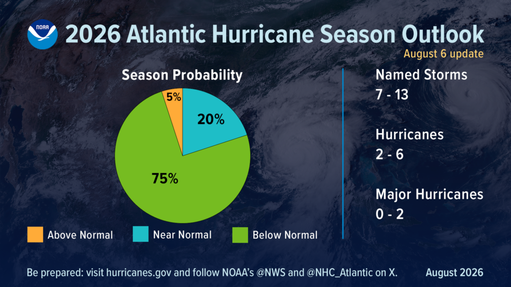
No matter what a storm outlook is for a given year,
vigilance and preparedness is urged.

Why the 2026 hurricane season is so quiet; what it means for NC coast
So far the 2026 hurricane season, which started June 1, has been very slow. How slow? It’s the quietest start to a hurricane season this century. Why?
For most of this hurricane season, the National Hurricane Center’s online map of the Atlantic basin has been showing a surprising image and message. Nothing with this text superimposed on the map: “Tropical cyclone activity is not expected during the next 7 days.” So far the 2026 season, which started June 1, has been the quietest start to a hurricane season this century. There have only been three named storms so far, and they’ve lasted a combined four days. Tropical Storm Arthur brought significant rain to parts of the Gulf coast and Southeastern United States in mid-June, but only after it dissipated. Tropical Storm Bertha in mid-July also brought rain to parts of the Gulf but didn’t cause much of a ruckus. And Tropical Storm Cristobal in August hung around for about a day in the middle of the Atlantic before petering out. Even a pair of tropical disturbances that held the possibility of forming into something or even combining into a bigger system before hitting the Caribbean in mid-August fizzled out. So what’s going on, and how soon could we see Dolly and Edouard?The 2026 season is both normal and unusual
According to the hurricane center, things aren’t actually that unusual this year. “The first named storm typically forms in mid- to late June, the first hurricane tends to form in early to mid-August, and the first major hurricane forms in late August or early September,” the agency states on its website. The busiest part of hurricane season also runs roughly from mid-August into early October, with the peak day for activity being Sept. 10. But according to another factor, this season is a strange one. The Weather Channel reports that the accumulated cyclone energy, which measures how long storms last and how strong they get, for this hurricane season is unusually low. According to the weather site, the 2026 season is the slowest-starting hurricane season in terms of accumulated cyclone energy since 1998.Enter El Niño
Across the board, meteorologists say the strengthening El Niño in the equatorial Pacific is playing a large role in squashing tropical activity in the Atlantic basin. El Niño is a natural climate pattern in which surface seawater temperatures in the central and eastern tropical Pacific are warmer than normal. Meaning Little Boy in Spanish, El Niño was originally recognized by fishermen off the coast of South America with the appearance of unusually warm water in the Pacific around Christmas. According to the National Oceanic and Atmospheric Administration (NOAA), there’s a nearly 70% chance it could develop into a “super” El Niño, meaning its impacts could be greater than normal. If a super El Niño does develop, it could supercharge weather events across the world. For the U.S. South, which could mean wetter conditions with more heavy rainfall events this fall and winter − bringing much-needed relief to the ongoing drought situation in much of the Tar Heel State. In a world already cooking hotter than normal thanks to climate change, the weather pattern also could amplify extreme heat already baking much of the world. According to the World Meteorological Organization, 2025 was the third warmest year on record, only trailing 2024 and 2023, with sea-surface temperatures also setting records despite cooling La Niña weather patterns. El Niño can have a significant impact on the severity of the hurricane season in both the Atlantic and the Pacific. In the Atlantic, the weather pattern tends to reduce activity in the tropical Atlantic by bringing on stronger upper-level wind shear and sinking air, hindering the formation of tropical weather systems, while having the opposite effect and boosting activity in the Pacific. The Northwest Pacific has already seen three Category 5 storms this season, and in the Central Pacific Hurricane Lala just finished lashing Hawaii with 90 mph winds.What happens now?
The latest forecast from Colorado State University is only calling for nine named storms this season, which would be an exceptionally low total, especially given how warm most of the tropical Atlantic is right now. In effect, the Caribbean has largely become a no-go zone for hurricane formation. “That’s a great indication of the power of El Niño, that it can develop in the Pacific, but still have a controlling role in weather patterns half a world away,” said N.C. Assistant State Climatologist Corey Davis. While North Carolina missing out on tropical weather might sound good on paper, it also comes with some other impacts. One of those is a loss of the rainfall such a system would bring to Eastern North Carolina, an area that largely remains in drought or a very dry state as of late August. The region relies on passing tropical weather for much of its summer precipitation that helps farmers and recharges underground aquifers. According to the National Weather Service in Wilmington, the Port City had seen 25.3 inches of rain in 2026 as of Aug. 18. That compares to a normal average of nearly 36 inches. “Wilmington averages more than 8 inches of rain in both August and September, and it’s hard to get that much from the sort of spotty showers and storms we’ve seen in recent weeks,” Davis said. “While we certainly don’t wish for anything tropical, some areas could definitely use the rain to make a dent in this drought.” But on the flip side, El Niño normally brings above-average rainfall to the U.S. Southeast in the fall and winter. During the last strong El Niño in 2015, Wilmington has its wettest October on record and fourth-wettest winter, Davis said. “This all feels like a be-careful-what-you-wish-for sort of situation,” he said. “We need the rain now, but we’ll probably be sick of it in a few months.” Tim Armstrong, a meteorologist with the weather service’s Wilmington office, said even with El Niño hindering storm development across much of the tropics, which doesn’t mean Southeastern N.C. is out of the woods for storm development. “There’s still the subtropical Atlantic we have to watch closely,” he said. “El Niño doesn’t affect shear as much outside of the tropics, so a locally grown storm could more easily develop this fall and bring impacts to the Carolinas.” Past examples of these types of storms include Ophelia in 2005 and Diana in 1984. And the unnamed storm that swamped southern New Hanover County and parts of Brunswick County with 20 inches of rain in 2024 was another one of these storms, he added. Officials also continue to stress to coastal residents that even if it appears to be a relatively quiet season, it only takes one storm arriving on your doorstep to make it a terrible hurricane season. “And our own work suggests that it is very difficult to predict that quantity on a year-to-year basis since you are dealing with the statistics are very small numbers,” said Dr. Michael Mann, a meteorologist and scientist at the University of Pennsylvania. “But we do know that there is an increase over time in the maximum intensity of these storms driven by human-caused warming.”
Read more » click here



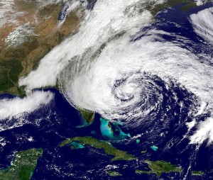
El Niño has broken Atlantic hurricanes. Now the season is breaking records
No hurricanes have formed in the Atlantic Ocean 103 days into the season, a new record-long wait driven by a beast of an El Niño strangling fledgling storms. Until today, September 11 was the date of the latest first hurricanes — Gustav (2002) and Humberto (2013). Or at least, the latest we know with confidence since 1966, when satellites started tracking hurricanes more accurately. The first hurricane is now more than a month overdue, and there are no prospects for one in the foreseeable future. Thursday marked the statistical peak of the season, and with just five short-lived tropical storms to date, it is now also the least active one since 1950, according to Phil Klotzbach, a hurricane expert with Colorado State University. The only system that made a run at becoming a hurricane was tiny Tropical Storm Edouard on September 1. Edouard was 14 mph shy of hurricane strength and intensifying when it made landfall near the Texas-Louisiana border, cutting it off from the Gulf’s warm water fuel. Looking forward, just over 50% of the entire season’s activity typically occurs after September 10, but El Niño will likely have a say in stifling the Atlantic’s final stretch this year. Last year’s first hurricane showed up in mid-August, and three more spun up in the second half of September. The United States managed to avoid a hurricane landfall last year — if the current quiet season repeats that, it’ll be the first back-to-back years without a hurricane landfall since 2009 and 2010. But it’s worth noting that hurricanes can find windows of opportunity to develop even in the most inactive years – and not a single season since 1966 has gone by without one. Most notably, Category 5 Hurricane Andrew’s catastrophic South Florida landfall in August 1992 happened in a season with just seven storms.
El Niño’s hurricane shredder
September is hurricane season’s peak because storm-fueling warm water is at its most expansive and hottest alongside ripe atmospheric factors. About two to three hurricanes develop this month on average. The results can be dangerous, as 2024’s Helene and 2022’s Ian proved, slamming the US Gulf Coast as Category 4s. Water temperatures are warm enough for hurricanes right now, but El Niño-fueled wind shear, aka tropical-system kryptonite, has soured the situation. Wind shear involves changes in wind speed and direction at different levels of the atmosphere, and it can shred apart anything from budding tropical systems to fully developed hurricanes. The shear has been record-strong this summer across the Atlantic’s so-called main development region, which extends from Africa through the Caribbean, according to Klotzbach. Many storms get their start in this region at the height of the season — mid-August to early October — but this year it’s been nearly shutdown. Tropical Storm Dolly is the only system that has formed in this part of the ocean so far in 2026, and a wall of wind shear ripped it apart just 24 hours later. A few other systems have tried to develop but were also defeated by shear. El Niño’s storm-killing winds will remain an obstacle for development in hurricane season’s back stretch, though that’s no reason to get complacent. Plus, late-season storms tend to develop closer to the US, including in the Gulf and off the Southeast coast. Those areas tend to be affected less by El Niño’s wind shear, so they’ll be watched closely. And as we’ve already learned this year, it doesn’t take a hurricane-strength system to cause significant impacts, particularly in a warming world making tropical systems wetter. Tropical Storm Arthur’s remnants fueled widespread flooding along the central Gulf Coast in June. Cottonport, Louisiana, was drenched by 29.06 inches of rain in 24 hours, which obliterated the previous state record of 22 inches set back in 1962. The record is still being reviewed and certified. Heavy rain from Tropical Storm Edouard less than two weeks ago resulted in dangerous flash flooding and water rescues in eastern Texas. A month’s worth of rain fell in an hour and rainfall totals topped 20 inches in some areas north of Beaumont.
Read more » click here
The surprising reason there have been no Atlantic hurricanes this year
El Niño isn’t the only factor. Another force could be contributing to fewer storms and a later peak in the season.
In the last 175 years of record-keeping, there have only been two years that featured zero hurricanes in the Atlantic Ocean: 1907 and 1914. And in those years before satellites, it’s possible that some hurricanes may have been missed in the historical record. Could 2026 become a year without a hurricane? It’s not out of the question, but using history as a guide, the chances are low. The hurricane-free conditions thus far may be giving some coastal residents in the Gulf and eastern United States a reprieve, but they are also fueling drought across the Caribbean. A record-breaking El Niño in the Pacific Ocean has created harsh winds that have swept into the Atlantic, preventing storms from growing. Dry air, occasionally coinciding with dust from Africa’s Sahara Desert, has choked off storms from the moisture they require to become more powerful. But a third limiting factor, linked to the planet’s warming trend, may come as a surprise — and be responsible for shifting the peak of hurricane season later into the year. In the Atlantic, the atmosphere has been more stable than normal. “At its most basic level, atmospheric stability is the tendency for air to want to rise or sink,” said hurricane specialist Michael Lowry, who described it as one of the six key ingredients of hurricane formation identified by hurricane researcher William Gray in the late 1960s. “If any one factor is off-kilter, it can torpedo the usual spate of activity around its sharp peak in August, September and October,” said Lowry. Increasing atmospheric stability in the tropical Atlantic may be connected to a changing climate. Temperatures have been rising at different rates in the troposphere, which is the lowest layer of the atmosphere — and the one in which people live. As the tropical Atlantic has warmed during recent decades, more water has evaporated into the atmosphere. Thunderstorms act like elevators, carrying that extra warmth and moisture high into the troposphere. When the moisture condenses into clouds, it releases heat, helping the upper troposphere warm faster than air closer to the ground. And that matters for hurricanes. If the upper troposphere warms faster than the air below, the atmosphere becomes more stable because the temperature difference between the lower and upper atmosphere shrinks. That makes it harder for air to keep rising and thunderstorms to organize into tropical storms and hurricanes. Since the start of this year’s hurricane season, that atmospheric temperature difference in the tropical Atlantic Ocean has been second smallest on record, with records dating back to 1940. And, relatedly, there haven’t been any hurricanes yet. But this uneven atmospheric warming may also contribute to “a kind of whiplash hurricane season,” said Lowry. Historically, the peak of hurricane season is Sept. 10. But if it’s taking the upper troposphere longer to cool off each fall, Lowry said that it could be contributing to a delayed hurricane season peak. “The relative hurricane season peak has been happening later on average over the past decade,” Lowry said, sharing data that showed how it was pushing more into October and November. “The big question is whether this is a short-term blip or a longer-term trend that could be tied to increasing stability,” said Lowry, adding that it was still an active area of research. The idea that increasing atmospheric stability could contribute to fewer hurricanes overall is not new. The theory was investigated in academic research articles nearly two decades ago and Lowry and other researchers explored it following a lull in hurricane activity during 2024. Meteorologist Andy Hazelton described the stability trend as “an issue that’s become more apparent since around 2010 or so,” sharing a view similar to Lowry that it’s linked to hurricane seasons that feature more activity late in the season rather than early. “If this is a robust change over time, it could have implications for tropical cyclone tracks and risk,“ Hazelton said. If the hurricane season peak shifts later, it could become more challenging for hurricanes to hit the U.S. East Coast. That’s because by October, the jet stream grows stronger and can blow storms out to sea. “Not sure that the sample is big enough yet to say it’s definitively a ‘new normal’ but it’s pretty compelling,” said Hazelton.
Read more » click here
-
Do you enjoy this newsletter?
Then please forward it to a friend!
Lou’s Views . HBPOIN
. • Gather and disseminate information
. • Identify the issues and determine how they affect you
. • Act as a watchdog
. • Grass roots monthly newsletter since 2008