
Lou’s Views
News & Views / November Edition
Calendar of Events
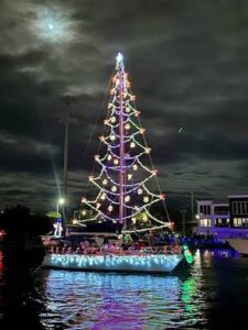
Holden Beach Holiday Boat Flotilla
The Holden Beach Flotilla is scheduled for Saturday, November 28th at 5:30 p.m. Participation is limited to 25 boats. Boaters may register at www.hbflotilla.com.
Editor’s note –
Holden Beach last held this event in December 2013.
Holden Beach Flotilla to bring Christmas lights, boats and community spirit to ICW Nov. 28
A new holiday tradition is coming to Holden Beach this November as the Holden Beach Flotilla takes to the Intracoastal Waterway on Saturday, Nov. 28. The inaugural event will feature up to 25 boats decorated in Christmas lights and holiday displays, creating a festive procession along the Holden Beach waterway. While this will be the first Holden Beach Flotilla, the event will serve as a continuation a holiday tradition that has been part of the local community for many years. The Ocean Isle Flotilla had been held for the past 21 years, and participating boaters and members of the community were saddened to learn that the event would not be returning this year. The flotilla had also served as a significant fundraiser for Brunswick Family Assistance (BFA), leaving the organization facing the loss of an important annual fundraising event. The idea to bring the flotilla to Holden Beach came from Jason Murphy, who had participated in the Ocean Isle Flotilla for the past several years. After learning that the event would not return, Murphy reached out to the Holden Beach Marina, which quickly came on board and began working to build support for the event within the community. Ashley Dyer played an important role in helping move the idea forward and build the foundation needed to make the event possible. Without Dyer’s work and the early support of the Holden Beach Marina, organizers said this announcement may not have been possible. From there, Murphy reached out to Keith Smith, who is also a Holden Beach town commissioner, and the two began working together to bring the idea to life in Holden Beach, with the support of the Marina and other community partners. Their goal was to bring the Christmas lights, boats and community spirit to Holden Beach while continuing the fundraising effort for BFA and the Brunswick County families it assists. The participating boats will begin staging just west of Sailfish Park on the Intracoastal Waterway at approximately 4:30 p.m., with a final radio check scheduled for 5:15 p.m. Then, at approximately 5:30 p.m., the festive lights will begin to glow at Sailfish Park as the flotilla gets underway. From Sailfish Park, the boats will travel along the waterway toward Provisions, continuing toward the Holden Beach Bridge and on to The Wharf Restaurant, where the flotilla will turn around and begin making its way back toward the Holden Beach Marina. With boats spaced approximately one to two minutes apart, the procession is expected to remain visible along the route for an extended period, giving spectators multiple opportunities to see the decorated boats as they make their way along the waterway. The Holden Beach Marina will serve as the final destination for the flotilla, as well as the location for judging and the awards presentation. Judges will be positioned at the marina as the boats arrive. Following the completion of the flotilla, post-flotilla activities and the awards presentation are expected to begin between approximately 7:30 and 7:45 p.m. Following the awards, the celebration will continue with after-parties at local area restaurants, giving residents and visitors an opportunity to continue the holiday festivities while supporting local businesses. While the Holden Beach Flotilla is designed first and foremost as a night of fun, Christmas excitement and community celebration, it also has a charitable purpose. Proceeds from the event will benefit Brunswick Family Assistance, a local nonprofit organization that helps Brunswick County families experiencing times of need. “We want this to be something families look forward to every year,” organizers said. “It’s about seeing the boats, enjoying the Christmas lights, bringing people together and having a great time — but it’s also about giving back to our community and helping our neighbors.”
Registration and sponsorship
Boat registration is now open. Boaters can register through the event website at www.hbflotilla.com. Registration forms can also be requested by email or text using the contact information below. The flotilla is limited to 25 participating boats, with entries being accepted on a first-come, first-served basis. Once all 25 spots are filled, registration will close. Sponsorship opportunities are also filling quickly. Sponsorships are anticipated to remain open through Oct. 28, or until available sponsorship spots are filled. Sponsorship opportunities are also first come, first served. Businesses and organizations interested in supporting the event are encouraged to contact the organizers as soon as possible. The event is being supported by local sponsors and community partners, with additional details about participating boats, sponsors, viewing opportunities and restaurant after-parties to be announced as the event approaches. For safety on the water, the Holden Beach Police Department will lead the flotilla, with Sea Tow following the procession to assist with any issues involving participating vessels. Spectators are encouraged to find locations along the route where they can safely watch the boats pass. More information about viewing locations and event details will be released as plans are finalized.
Read more » click here
 Discover a wide range of things to do in the Brunswick Islands for an experience that goes beyond the beach.
For more information » click here.
Calendar of Events Island
 Turkey Trot
The Town of Holden Beach will hold its twelfth annual Turkey Trot on Thanksgiving morning Thursday, November 26th at 8:00 a.m. Please bring a canned food item to donate to the local food pantry.
Route Map » click here
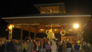 Tree Lighting
Come one, Come all!
The Town of Holden Beach will hold its sixteenth annual tree lighting ceremony on Thursday, December 3rd at 6:00 p.m. with entertainment beginning at 5:30 p.m.

Reindeer Dash and Santa SaunterJoin us on Saturday, December 5th for this family-friendly 2 mile run/walk for the holiday season where you can run like a reindeer or handle things more like Santa in a slow walk. Participants are encouraged to either dress like a reindeer or Santa. The event will begin at 8:00 a.m. The below link outlines the map. Registration is required, please email christy.ferguson@hbtownhall.com by December 1st by noon.
Route Map » click here
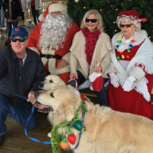
Sandy Paws Dog Parade
Join us on Saturday, December 5th at 9:30 a.m. in front of the Town Hall Public Assembly for our twelfth annual Sandy Paws Dog Parade. The event will be held at Block Q. We will take a walk around the block and then have an opportunity to get your dog’s picture with Santa. Dress to impress! We will take donations for the local animal shelter at the event. Registration is required, please email christy.ferguson@hbtownhall.com by December 1st by noon.
Note: we cannot accept monetary donations.
Parks & Recreation / Programs & Events
For more information » click here
Reminders
Smoke Detectors
Time change means time to check smoke detectors, too. The fire department is encouraging people to test their smoke alarms and change the battery. Smoke alarms should be replaced every 10 years, whether they are battery-operated or hard-wired.
Pets on the Beach Strand
§90.20 RESPONSIBILITIES OF OWNERS
Effective September 10th
-
-
- Pets are allowed on the beach strand
- Dog’s need to be on a leash
- Owner’s need to clean up after their animals
-
 News from Town of Holden Beach
The town sends out emails of events, news, agendas, notifications, and emergency information. If you would like to be added to their mailing list, please go to their web site to complete your subscription to the Holden Beach E-Newsletter.
For more information » click here
 Paid Parking
Paid parking in Holden Beach
Paid parking will be enforced from 9:00 a.m. to 5:00 p.m. daily with free parking before and after that time. All parking will use license plates for verification.

Holden Beach now offers free parking
November 1st – January 2nd
.
Rates
Parking rates for a single vehicle in all designated areas will be:
$5 per hour for up to four hours
$20 per day for any duration greater than four hours
$80 per week for seven consecutive days
Handicap Parking
A vehicle displaying a handicap license plate and/or hang tag parked in a designated handicap space is free. Any other parking space will require a parking permit via the app.
Annual Passes
Annual permits for the calendar year allow vehicles (this includes low-speed vehicles and trailers) access to designated parking.
$175 for a single vehicle
Passes can be purchased via the app, website or by telephone.
Where to Park
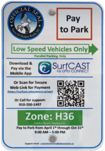
Per ordinance, there is no parking on the streets or rights-of-way except in designated parking spaces identified by Pay-to-Park signs. Click here to view an interactive map. The table with authorized parking can be viewed below.
Citations will be issued for:
-
-
- Parking without an active paid permit in a designated parking area
- Parking within 40 feet of a street intersection
- Parking in a crosswalk, sidewalk, or pedestrian access ways
- Parking blocking a driveway or mailbox
- Parking facing opposing traffic
- Parking in a no parking zone, or within right-of-way
- Parking on any portion of the roadway or travel lane
- Parking a non-LSV vehicle in an authorized LSV location
-
How Do I Pay to Park
The Town uses the SurfCAST by Otto Connect Mobile Solution. This is a mobile app downloadable for Apple and Android devices. Download the app today. Users will setup their account, enter their license plate details and pay for parking directly on the app. Alternatively, users can scan the QR Code located on the parking signs to access a secure website.
The Otto Connect customer service team will be available to help via phone and email.
THB Newsletter (06/18/26)
OttoView by Otto Connect
Just in time for peak beach season, Otto Connect, Inc. has launched a new feature designed to make parking along the coast easier and less stressful for visitors and residents alike. “OttoView by Otto Connect,” is part of the SurfCAST parking system and allows users to check parking availability in real time before heading to the beach. The feature is now available in Holden Beach. For many drivers, finding parking during busy summer weekends can be one of the most frustrating parts of a beach trip. OttoView aims to reduce congestion and save time by showing which lots have open spaces—and which do not—before users arrive. “Instead of circling for a spot, people can now see their options ahead of time and go directly to available parking,” Jim Varner (CEO) said in a statement.
Know before you go:
OttoView can be accessed through the SurfCAST website
(https://park.surfcast.ottoconnect.us/), the QRcode link, and will be available soon via mobile app update (“SurfCAST by Otto”) making it easy for visitors to plan from home or on the go.
What OttoView Shows:
-
- A map of the area and locations of all parking lots
- Real-time parking availability by location
- Estimated availability based on permit turnover
- Directions to nearby parking areas
- Filters for amenities such as restrooms, handicap spaces, and LSV parking
OttoView is fully integrated into the SurfCAST system and is available at no additional cost.
For more information, visit https://www.ottoconnect.us.
Solid Waste Pickup Schedule
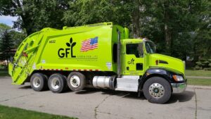
GFL Environmental change in service, the Saturday before Memorial Day till the end of September, trash pickup will be twice a week.
Please note:
Trash carts must be at the street by 6:00 a.m. on the pickup day
BAG the trash before putting it in the cart
Carts will be rolled back to the front of the house
GFL Refuse Collection Policy
GFL has recently notified all Brunswick County residents that they will no longer accept extra bags of refuse outside of the collection cart. This is not a new policy but is stricter enforcement of an existing policy. While in the past GFL drivers would at times make exceptions and take additional bags of refuse, the tremendous growth in housing within Brunswick County makes this practice cost prohibitive and causes drivers to fall behind schedule.
Solid Waste Pickup Schedule
starting October once a week
Recycling
starting October every other week pick-up
Yard Waste Service
Yard debris is collected on the second (2nd) and fourth (4th) Fridays during the months of October, November, and December.Yard debris needs to be secured in a biodegradable bag (not plastic) or bundled in a maximum length not to exceed five (5) feet and fifty (50) pounds in weight. Each residence is allowed a total of ten (10) items, which can include a combination of bundles of brush and limbs meeting the required length and weight and/ or biodegradable bags. Picks-ups are not provided for vacant lots or construction sites.
Curbside Recycling – 2026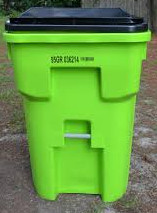
GFL Environmental is now offering curbside recycling for Town properties that desire to participate in the service. The service cost per cart is $122.93 annually paid in advance to the Town of Holden Beach. The service consists of a ninety-six (96) gallon cart that is emptied every other week during the months of October – May and weekly during the months of June – September.
Curbside Recycling Application » click here
Curbside Recycling Calendar » click here
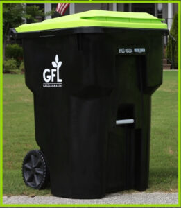
Trash Can Requirements – Rental Properties
GFL Environmental – trash can requirements
Ordinance 07-13, Section 50.08
Rental properties have specific number of trashcans based on number of bedrooms.
* One extra trash can per every 2 bedrooms
..
§ 50.08 RENTAL HOMES.
(A) Rental homes, as defined in Chapter 157, that are rented as part of the summer rental season, are subject to high numbers of guests, resulting in abnormally large volumes of trash. This type of occupancy use presents a significantly higher impact than homes not used for summer rentals. In interest of public health and sanitation and environmental concerns, all rental home shall have a minimum of one trash can per two bedrooms. Homes with an odd number of bedrooms shall round up (for examples one to two bedrooms – one trash can; three to four bedrooms – two trash cans; five – six bedrooms – three trash cans, and the like).
Upon Further Review
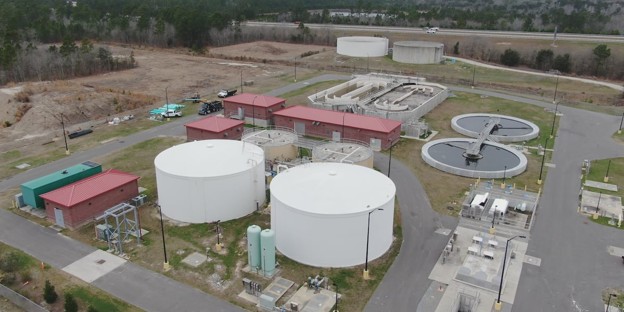
Brunswick County facing hundreds of millions in wastewater expansion costs
As North Carolina’s fastest-growing county continues to expand, Brunswick County leaders are discussing how to increase wastewater treatment capacity, an investment that will likely cost more than half a billion dollars. Earlier this month, Brunswick County Public Utilities Director John Nichols presented county commissioners with several expansion options. Between expected construction on the county’s Navassa treatment plant, slated to start mid-next year, and expansion plans for the Supply and Shallotte plants, Nichols said costs could exceed $700 million. “It’s challenging because we are growing fast,” Nichols said, explaining the importance of addressing the issue. “It determines how development in Brunswick County occurs. So the policy will provide a plan for the strategy behind that development.” The project in Navassa should cost roughly $173 million (split between the county and H2GO) and increase the plant’s capacity by 3.75 MGD from its current capacity of 4.975 MGD. The Supply and Shallotte projects, meanwhile, would likely cost between $440 and $550 million in total, Nichols said Tuesday. Those two projects are still at least three years away from construction, he said. The total cost of the latter two projects would depend on how much capacity is added to the plants. According to the presentation given to commissioners, Supply and Shallotte expansion options range from adding 5-14 MGD. Earlier this year, sewer capacity issues temporarily halted new construction projects in Brunswick County that required sewer line extensions. Senate Bill 673 requires the state to count anticipated wastewater from future homes as already present in the system. Under that calculation, Brunswick County’s wastewater treatment plants were considered over-allotted in the state’s accounting — even though the pipes are not full. The state freeze on issuing new sewer permits started in October 2025, but ended in May 2026, a county spokesperson confirmed Tuesday. The freeze ended after NCDEQ allowed new projects to move forward “with an added variance process,” the spokesperson said. Commissioners will continue discussing how to address the issue at upcoming meetings. Nichols said staff plan to update commissioners with a draft plan at a meeting before the end of the year. Commissioners will also discuss sunset provisions on projects that haven’t made significant progress from approval, which could give the county more space when looking at capacity limits. On Tuesday, Commissioner Pat Sykes said it’s important for the county to keep up infrastructure-wise with development as projects continue popping up. “The issue needs to be tackled immediately,” Sykes said. “It’s always important, whether it’s sewer, water, roads, it’s always important to stay ahead of the growth. But we are behind.”
Read more » click here
Corrections & Amplifications

Revaluation
PUBLIC NOTICE
Over the coming months, Brunswick County will be sharing information and reminders about the county’s latest revaluation, which goes into effect at the start of calendar year 2027. Property owners are expected to receive a notice showing their updated 2027 property value by the end of March 2027. A revaluation (also known as a reappraisal) is a routine update to property tax values to bring them back in line with the current sale price of properties. Our state certified in-house appraisers have diligently and carefully researched and analyzed sales in our local market to determine an estimate of market value for all properties as required by North Carolina law. Below are some of the key reminders to keep in mind as we work toward finalizing assessed values, as well as some upcoming dates when the Board of Commissioners will discuss and/or take possible action on items related to the 2027 Revaluation process. The Brunswick County Tax Office also has a robust website featuring full details and answers to questions about the 2027 Revaluation at https://brunswickcountync.gov/448/2027-Revaluation.
Upcoming Dates
Note: Some dates or time periods for certain processes like the appeal period and 2027 property tax bill mailings are still to be determined and may not be listed here yet. Brunswick County will provide information on any updates or changes to dates or time periods as they become available.
-
- Monday, Oct. 5, 2026, at 3 p.m.: Schedule of Values introduced at Board of Commissioners meeting (The schedule will be available in the agenda packet and can be viewed after this date in person at the Clerk to the Board’s Office, or online at https://brunswickcountync.gov/448/2027-Revaluation.
- Monday, Oct. 19, 2026, at 6 p.m.: Public Hearing for Schedule of Values During Board of Commissioners Meeting
- Monday, Nov. 2, 2026, at 3 p.m.: Board of Commissioners Consider Adoption of Schedule of Values (A possible second public hearing (if desired/necessary) could take place during this meeting)
- Friday, Jan.1, 2027: 2027 Revaluation Effective Date (All real property will be valued based on its market value and condition as of Jan. 1, 2027)
- February/March 2027: Property Owners Receive Notice Showing Updated 2027 Property Value
Important Reminders
Often when we hear about revaluation, we immediately think about property taxes. However, the purpose of a revaluation is to determine a property’s current market value to ensure everyone pays their fair share of the costs for the local government services they use and rely on. Your property taxes help your County, municipality, school district, and/or other public entities provide essential services like education, public safety, ambulance service, fire protection, health clinics and inspections, parks, libraries, planning and community enforcement, municipal roads, and more. Ultimately, your property’s appraised value is only one factor that determines how much property tax you pay.
Here are some things to keep in mind as you prepare to receive your new assessed value in 2027:
-
- An increase in your property value does not necessarily mean your next tax bill will increase.
- It is currently impossible to determine how your new assessed value affects your property taxes until the County, your municipal government, and/or other public entities that serve your property adopt their FY 2028 operating budgets and set tax rates. This is most likely to occur in late spring or early summer 2027.
- The 2027 Revaluation is still not complete, so be cautious of any claims about how much property values or taxes are increasing, whether by dollars or percentage. Wait for your official mailing from Brunswick County to see what your property’s new assessed value is (estimated to arrive February or March 2027).
- Market value is set by the choices of buyers and sellers in the marketplace. The Brunswick County Tax Office does not create market value. Your local tax office analyzes market sales to determine market patterns and trends in different locations across the county.
- Property values will not change uniformly throughout the county or even within your city or town—a lot depends on market conditions and recent sales in your neighborhood. Your assessed value could increase, decrease, or remain the same.
Contacting the Tax Office
The Brunswick County Tax Office is open to discussing the revaluation process with property owners. You are encouraged to check our website first to see if the answers to your questions are available online. Our Tax team is available Monday through Friday from 8:30 a.m. to 5 p.m.
When contacting our office, please have your parcel number or property address available.
-
- Website: https://brunswickcountync.gov/447/Tax-Office
- Phone: 910.253.2829
- Email: taxreval@brunswickcountync.gov
- Main Office: Brunswick County Sandifer Administration Building, 30 Government Center Drive, Bolivia, NC 28422
Ocean Isle Beach Terminal Groin
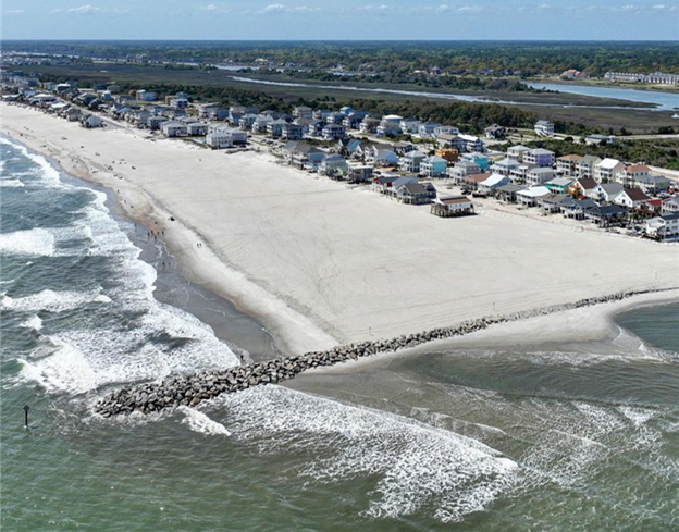 Ocean Isle Beach completed construction of a terminal groin on its east end in April 2022 to help protect the beach immediately behind it. However, this structure has contributed to significant erosion at the east end near Shallotte Inlet by interrupting natural longshore drift, prompting ongoing efforts such as sandbag use to prevent ocean encroachment on properties in that area.
2024 OIB SHORELINE AND INLET ANNUAL MONITORING REPORT
On Holden Beach, the recent volume change rates (May 2024 to November 2024) along the oceanfront shoreline indicated erosion at 12 of the 21 monitoring stations. Similarly, the MHW shoreline change rates indicated a shoreline retreat at 15 of the 21 monitoring stations. The long-term post-construction linear shoreline changes along the Holden Beach oceanfront shoreline indicated landward retreat. However, volumetric changes indicated slight accretion (0.2 cy/ft./yr.) within this area over the long-term period. The shoreline threshold analysis results along the Holden Beach oceanfront shoreline show that the post-construction shoreline change threshold was exceeded at only one monitoring station. This is the first time a threshold has been exceeded at Holden Beach since this annual analysis started in 2022. In addition, the analysis of May 2024 aerial imagery-derived wet/dry line revealed an 885 ft. section of Holden Beach’s inlet shoreline that exceeded the inlet shoreline threshold by a maximum distance of 100 feet. The inlet shoreline threshold on Holden Beach was also exceeded in Year-2. This marks two straight years where this threshold was exceeded. The inlet shoreline recession is believed to likely be attributed to a combination of morphological changes within Shallotte Inlet including the position and orientation of the main channel through Shallotte Inlet and the formation of a flood channel on the inlet shoulder of Holden Beach. Regardless, as stated in the Plan, because the shoreline changes in this area exceeded the threshold over the entire 2-year confirmation period, an assessment of the proper responsive measures will be made through coordination with State and Federal regulatory officials.
 East End/Terminal Groin Short Term Mitigation
As required by State and Federal permits associated with the Town’s Shoreline and Inlet Management Plan, annual shoreline monitoring identified erosion east of the terminal groin that exceeded established management thresholds. To maintain permit compliance and address localized erosion concerns, the Town implemented a short-term mitigation project consisting of targeted beach nourishment east of the terminal groin.
Project Update
-
- Project completed: May 24, 2026
- Sand placed: Approximately 45,000 c/y
- Engineer: Coastal Protection Engineering
- Contractor: Southwind Construction
- Total project cost: $667,696.61
This project, along with the US Army Corps of Engineers – Shallotte Inlet Crossing & Widener Project, placed 70,000 cy of sand east of the terminal groin with another 35,000 cy west of the terminal groin. With this short-term mitigation measure in place, the Town has engaged with Coastal Protection Engineering (CPE) to investigate long-term mitigation plans to prevent any further erosion adjacent to the terminal groin.
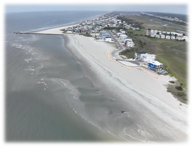
CRC meets amid debate over NC’s hardened shoreline structures ban
The debate over whether to repeal or amend the state’s ban on hardened structures for shoreline protection resumes this week when the North Carolina Coastal Resources Commission (CRC) meets on Aug. 26 and 27 at the Dare County Government Complex in Manteo. A major catalyst behind the effort to re-examine the ban is the crisis in Buxton, where 32 privately owned oceanfront houses have fallen into the ocean since 2020—with 20 of them collapsing since September 2025, generating national headlines. According to the meeting agenda, the CRC will hear a report from its Science Panel on hardened oceanfront structures. On June 18, the panel presented a 47-page report recommending that the state “maintain a cautious approach to any expansion of the use of hardened structures along its sandy, open-ocean coastline.” It also advised that before changing its oceanfront management policies, the state should “include a broad assessment of the benefits, costs, limitations and distribution of effects” arising from an expanded use of hardened structures. The Outer Banks Voice – CRC panel report recommends ‘cautious approach’ to use of hardened structures. In 1985, the CRC banned hardened structures through regulatory action, followed 15 years later by a ban approved by the state legislature, unless a groin was less than 50 percent damaged. Along with its Buxton beach nourishment project this summer, Dare County is also conducting an $8.6 million project to repair the Buxton terminal groin, work allowed under the state exemption. More Beach to Love | Dare County, NC. In the past year, there has also been a flurry of advocacy to revise or repeal the hardened structure ban coming from Outer Banks communities and officials. In October 2025, the Buxton Civic Association asked residents to contact state officials to lobby for an “immediate exclusion of CAMAs hardened structures law” for Buxton. A month later, Dare County Commissioner Chair Bob Woodard sent a letter to North Carolina legislators asking them to take action to combat coastal erosion, a request that included reconsidering the ban on hardened structures. In May 2026, the Currituck County Commissioners approved a resolution supporting state legislative efforts—NC Senate Bill 1009—to repeal the hardened structures ban. The resolution noted that “North Carolina is one of the only U.S. coastal states with a long-standing ban on hardened structure.” That ban, it added, leaves beach nourishment, which the resolution characterizes as “a costly and temporary solution to erosion…as one of the only tools available to counties to combat coastal erosion.” A committee of the North Carolina Senate approved that legislation to repeal the ban in June. Senate Bill 1009 (2025-2026 Session) – North Carolina General Assembly. Asked about the repeal of the hardened structures ban during a visit to the Outer Banks in late June, Governor Josh Stein said solutions to beach erosion need “to be based in science. There [are] clear emotions that are flying here…We want people’s homes to be preserved. But we have to do it in a way that will make long-term success possible.”
Read more » click here
Odds & Ends
NA
This and That

Why deer-car collisions are rising in the Wilmington area, and November is the worst month
As development pushes out from Wilmington, deer-vehicle collisions are on the rise. But the number of deer also appears to be increasing as they adapt and hunting becomes more difficult in many areas
Billy Sampson said he didn’t see much before the collision. The sun had just set as he drove on Sidbury Road in northern New Hanover County headed home from work in November 2024. Just a streak crossing the road before the crash, and then a young doe sitting on his cracked windshield, her neck broken. “You just don’t have time to react,” Sampson said. “It happens before you know it.” Luckily, the damage to Sampson’s car was minimal, and he escaped the incident with only frayed nerves. But deer-vehicle collisions are an increasingly common occurrence in the Wilmington area as the region continues to boom. With subdivisions popping up in formerly off-the-beaten-track areas, deer and human interaction are rising. And with white-tailed deer among the most adaptable of all large animals in North America, in many areas their number are increasing just as the number of residents around the Cape Fear coast and other fast-growing parts of the Tar Heel State continue to rise. The result is an increase in deer-vehicle collisions on area roads after a slight downturn during the COVID-19 pandemic shutdown due to the reduction in traveling. With November the most common month for collisions, here’s a look at why drivers might want to pay a bit more attention out driving over the next few weeks and why this could be a troublesome situation that’s here to stay.
By the numbers
According to the N.C. Department of Transportation’s latest animal-related crash report, which tracked animal-vehicle collisions stretching back to 2017, last year showed a rising trend of incidents. Brunswick County saw the highest number of collisions in the Wilmington area, with 1,422 between 2022-24, ranking ninth in the state. Pender County saw 1,103 crashes over the same three-year period. The damage caused by the 2022-24 collisions was valued at $4.6 million in Brunswick and $3.4 million in Pender, with 39 total injures in Brunswick and 49 − including one fatal − in Pender. Fast-growing Wake County, home to Raleigh and Cary, saw the most animal crashes out of North Carolina’s 100 counties in the 2022-24 period, recording 2,676. Although state collision report forms don’t distinguish between animal types, data analyses shows that approximately 90% of all reported animal related crashes involve deer. In all three counties, 2024 saw the highest number of crashes − a trend that’s been increasing since 2020. While that’s partly due to the COVID-19 pandemic-related restrictions earlier this decade, which severely curtailed people’s traveling, the figures also likely reflect the tremendous population growth the three counties have seen in recent years. Brunswick County, for example, has seen it’s population jump from roughly 136,000 in 2020 to an estimated 175,000 in 2025. Due to its relatively small size and largely urban nature, deer-vehicle collisions in New Hanover County aren’t as high as larger counties, but are still a worry − especially as development pushes into the undeveloped northern parts of the county. According to the DOT report, New Hanover saw 86 collisions in 2024, and 250 in the 2022-24 window. That ranked 73rd in the state.
When are collisions most common?
According to the DOT report, the most collisions, 23% of the 63,487 recorded statewide 2022-24, occurred in November. Officials say a “perfect storm” of factors is to blame for this. They include November representing the height of the deer-mating season, which sees the animals on the move more than normal. Bucks especially can act erratically and with less caution as they chase does. Throw in Daylight Saving Time, which sees the clocks moved back in early November and means shorter days and more darkness during peak travel times, and it’s harder for drivers to see deer just when they are most active. According to the DOT, tips to help lower the chance of an animal collision include slowing down in areas known to be frequented by deer; driving with high beams on as much as possible; slow down and blow your horn if you see deer on the side of the road; and keep a safe distance between vehicles to help prevent you from becoming collateral damage if the car in front of you strikes a deer. After November, the three months that saw the most deer-car collisions were October (14.6%), December (12.9%) and January (8.2%). The DOT report also listed times that most crashes occur, and not surprisingly there were centered around dawn and dusk, with 6 a.m. the worst hour with 9.1% of all crashes. Next was 8 p.m., with 8.4% of crashes.
Why are collisions on the rise?
In many areas of Southeastern North Carolina, deer have always been a common part of the landscape. But as areas that used to be forest are turned into subdivisions and shopping centers, people and deer are coming into contact more often. That, however, doesn’t mean deer numbers are dropping per se. Deer, like coyotes, are very adaptable, and can easily live among human development, sharing parks and wooded areas just around the corner or even within neighborhoods. Limits on hunting in many areas due to public sentiment and safety concerns along with a lack of natural predators, aside from cars, also has allowed deer numbers to explode in many areas. That many yards and gardens include deer-friendly shrubs and flowers also has helped keep the mammals close to suburbia, since finding food is no longer a problem. According to the N.C. Wildlife Resources Commission, there are an estimated 1 million white-tailed deer in the state, a figure that’s remained relatively stable for a few decades. But while some rural areas have seen deer numbers fall slightly, the opposite has been happening in some of the state’s fast-growing metro areas. “Those areas where populations are rapidly increasing are typically urban/suburban areas where the utilization of hunting as a management tool has been greatly hindered,” the wildlife commission stated on its website. The combination of a lack of predators, a hunting ban and a deer smorgasbord of tasty garden treats saw Bald Head Island’s deer population surge in the late 1990s and early 2000s, prompting the ritzy Brunswick County island to turn to contraception to try and control its herd. But that isn’t an option, due to cost and questions of its effectiveness, for most communities. In areas where hunting remains popular, harvest numbers appear to be rising even as deer-vehicle collisions also are ticking up. In Brunswick County, for example, 2,128 deer were harvested in the 2024-25 season. That compares to 1,737 a decade before in the 2014-15 season, according to the wildlife commission. Pender County showed a similar trend, with hunters taking 3,070 deer in 2024-25 compared to 2,622 in 2014-15. Overall, N.C. hunters harvested nearly 189,000 deer during the 2024-25 season.
Read more » click here
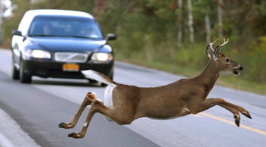 Fear the deer: Crash data illuminates America’s deadliest animal
Behold the deer, the deadliest beast in North America. Deer are responsible for the deaths of about 440 of the estimated 458 Americans killed in physical confrontations with wildlife in an average year, according to Utah State University biologist Mike Conover, employing some educated guesswork in the latest edition of “Human-Wildlife Interactions.” Those deer-inflicted fatalities are not, so far as we know, caused by deer-on-human predation. They’re the unfortunate result of more than 2 million people a year plowing into deer with their sedans and SUV’s, usually on a two-lane road, often at high speed. You might wonder: Where and when am I most likely to hit a deer? And how can I avoid it? To shed light on this herbivorous hazard, we turned, of course, to data. Specifically, we analyzed more than 1 million animal-vehicle collisions compiled by Calumn Cunningham, Laura Prugh and their colleagues at the University of Washington for a recent paper published in Current Biology. They estimate deer were involved in more than 90 percent of the collisions, which occurred in 23 states between 1994 and 2021. With a few exceptions, the data show deer are at their most dangerous in November. Indeed, the deer threat peaks just before Thanksgiving typically Nov. 7 through 14 when you’re about three times more likely to hit a deer than at any other time of year. Experienced deer hunters can probably guess why driving in November can turn into Russian roulette on certain highways and byways: In much of the country, that’s rutting season. And during the rut, deer focus on procreation, not self-preservation. Marianne Gauldin of the Alabama Wildlife and Freshwater Fisheries Division compares rutting bucks to teenage boys. “They are hyper-focused on the opportunity to breed, and they therefore lose some of their wits,” Gauldin said. “They are full tilt looking for does, chasing does and running after does for the opportunity to breed. And they are doing this with tunnel vision … literally running across the road.” Does share similar distractions. They’re either in estrus hormonally receptive to sex and looking to breed or fleeing hot-and-bothered bucks until their cycles catch up. Collisions occur more often in states with the most white-tailed deer which experts say tend to have a shorter, sharper rut than the western mule deer and in states with long stretches of busy rural roads. Separate insurance claim data from State Farm, which is widely cited in academic research, shows a driver out minding her own business on the wending, bending roads of West Virginia had a 1 in 35 chance of hitting an animal between June 2021 and June 2022, making the Mountain State easily the most dangerous in terms of deer-car collisions. Montana and Michigan were next. D.C. drivers, by contrast, had only a 1 in 907 chance of stopping a buck while driving down Pennsylvania Avenue, or anywhere else. Fun fact: Deer are responsible for at least 69 percent of animal-related accident claims, according to State Farm. Another 12 percent of claims involve unidentified animals, many of which could be deer that bounded off before the driver got a good look at them or were mangled beyond recognition in the crash. The third-most-dangerous animals on the road are undifferentiated rodents, which are cited in 5 percent of all animal-related accident claims. However, State Farm spokesperson Dave Phillips noted that many of the drivers never make contact with said rodent: The vast majority of those accidents occur when motorists swerve to avoid a suicidal squirrel or moseying marmot. Our more calendar-conscious readers will note that peak deer-crash season coincides with another big moment in November: the first week of daylight saving time, which begins the first Sunday of the month. And the University of Washington team has found that the two events are not unrelated. To understand why, we need to spelunk deeper into their data, which breaks new ground by including the exact location, date and hour of all these deer disasters. When we glance at a chart of accidents that includes time of day and time of year, one fact strikes us right between the headlights: Evening, the twilight of each day especially in November is the hour of the Gotterdeermmerung. Conveniently for us, the University of Washington scholars used accident coordinates and some basic weather math to calculate exactly when the sun would have risen or set at each location. It turns out that deer danger skyrockets about 30 minutes after sunset and remains extraordinarily elevated for almost half an hour. Those with deer-behavior expertise say drivers should be on high alert as darkness falls in autumn especially when careening through the deer’s favorite transitional habitats, the forest-edge ecosystem created by roads and other developments. But they urge us to take a lesson from the thousands of people who land in hospitals and body shops each year after attempting to avoid a turtle or chipmunk: If you do see a deer, don’t swerve. “Slow down as much as you can, obviously, coming up to it,” said Karlin Gill of the National Deer Association, a hunting and conservation organization. “But if it’s unavoidable and you’re going to hit the deer, don’t try and swerve out of the way. That can cause an even worse car wreck, and you still might hit the deer regardless.” Deer crashes also rise in the morning, about 30 minutes before sunrise, but the number is significantly lower than after sunset. To understand why, we need to dig deeper into both deer and human activity patterns. Biologist after biologist told us deer are crepuscular, meaning they’re most active at dawn and dusk. When Texas A&M University wildlife scientist Stephen Webb and his colleagues fitted GPS trackers onto white-tailed deer in Oklahoma, they found deer movement peaks at both sunrise and sunset. “Deer, unlike humans, don’t lay down for eight hours at night and then get up and move throughout the day,” said Gill , who, as a hunter, closely examines deer behavior. “They actually go through a cycle where they’ll lay down, bed, get up, eat, lay down, bed, get up, eat, and they’ll do this throughout a 24-hour period.” But if deer are equally active at dawn and dusk, why are they so much more likely to be hit in the evening? To untangle that one, we need to examine another somewhat crepuscular species: the American commuter. Our commutes also peak in the morning and evening, but we’re much more likely to be driving at dusk than we are at dawn, and we stay on the roads even as darkness falls, and the deer start moving often squarely into our headlights. It’s a matter of visibility. Deer are just as active two hours before dusk as they are two hours after, yet we’re about 14 times more likely to hit a deer after sundown than we are before. And, as Cunningham notes, right at the peak of the whitetail rut, we throw another variable into the stew: We end daylight saving time. Suddenly, as far as the deer are concerned, our 6 p.m. commute happens an hour later. Millions of drivers find themselves contending with lower visibility just as sex hormones flood the local deer population. “It’s like one of the grandest-scale natural experiments that we can come up with, where humans impose these very arbitrary and abrupt changes on the wildlife,” Cunningham told us from his native Tasmania (he’s at the University of Washington as a Fulbright fellow). People living on the far eastern side of a time zone are about 1.35 times as likely to hit a deer as folks on the far western edge, since folks in the east are more likely to be driving home in the dark. Similarly, folks in Northern states, where days are short and darkness rules the winter, are 1.86 times more likely to hit a deer than their friends in America’s sunny South. Taking these effects into account, the University of Washington team estimates that “falling back” causes a 16 percent jump in deer carnage in the weeks after the shift. It’s possible that adopting permanent daylight saving time would thus save the lives of more than 36,000 deer and 33 humans each year. On the down side, chronobiologist Eva Winnebeck of the University of Surrey argues that any gains might be offset by an increase in deaths spurred by the chronic drowsiness that would inevitably set in if our solar-powered circadian rhythms were forced to endure a never-ending disconnect between the sun and clocks set permanently to daylight saving time. Here at the Department of Data, we’ve found a strong connection between happiness and the great outdoors. So, we’re partial to any move that would give us more daylight hours to get out after work and fish, run or dominate the competitive wood-chopping circuit, circadian rhythms be darned.
Read more » click here
Watch out for deer
NCDOT warns motorists across North Carolina to stay alert for deer now that fall has arrived. Every year during late autumn, auto and body shops across the region brace for a bumper crop of business, comprised of an influx of cars with damage from collisions with deer. Beginning in October, roads across the state become hazardous as North Carolina’s deer population fans out, lurking on highway shoulders in search of food and potential mates. It’s the deadliest time of the year for deer, which also pose a particular danger to motorists. Nearly half of vehicle accidents involving white-tail deer occur from October to December. Deer accidents typically begin rising in October, peak in November and begin dropping off after December, according to the Insurance Institute for Highway Safety. Deer are crepuscular mammals, meaning they’re most active at dawn and dusk which, following the onset of daylight savings time, places them near roads and byways precisely when large numbers of residents are commuting to and from work.
NCDOT has some helpful tips for motorists in regard to deer-vehicle crashes:
-
- Although it does not decrease the risk of being in a crash, wearing a seat belt gives you a better chance of avoiding or minimizing injuries if you hit a deer or other animal.
- Always maintain a safe amount of distance between your vehicle and others, especially at night. If the vehicle ahead of you hits a deer, you could also become involved in a crash.
- Slowdown in areas posted with deer crossing signs and in heavily wooded areas, especially during the late afternoon and evening.
- Most deer-vehicle crashes occur where deer are more likely to travel, near bridges or overpasses, railroad tracks, streams, and ditches. Be vigilant when passing through potentially risky landscapes.
- Drive with high beams on when possible and watch for eyes reflecting in the headlights.
- Deer often travel in groups, so if you see one deer near a road, be alert that others may be around.
- If you see deer near a road, slow down and blow your horn with one long blast.
- Do not swerve to avoid a collision with deer. This could cause you to lose control of your vehicle, increasing the risk of it flipping over, veering into oncoming traffic, or overcorrecting and running off the road and causing a more serious crash.
Officials say the most crashes occur between 6 p.m. and midnight, accounting for about 45% of the overall total. With the end of daylight savings time at 2 a.m. Sunday, Nov. 1, the time shift increases the chance of deer being by roadways when drivers are traveling in the dark, especially for their evening commute. If your vehicle does strike a deer, officials say do not touch the animal. A frightened and wounded deer can be dangerous or further injure itself. Get your vehicle off the road if possible and call 911.
Read more » click here
Turtle Watch Program –
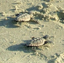
Turtle Watch Program – 2026
.
.
Holden Beach Turtle Patrol sees successful nesting season
More than 7,000 sea turtle hatchlings surfaced from their nests onto Holden Beach’s ocean shore this year, making it the second-highest nesting season in the local turtle patrol’s history. The Holden Beach Turtle Patrol on Monday announced the results of its 39th season, one in which 78 nests were laid with a success rate of 81%. New hatchlings included those that emerged from a recently vandalized nest, the last one laid this season. “This year’s nest success may have been due to the absence of foxes, severe storms, and extremely high tides,” according to a patrol release. “Nest success may also have benefited from the relocation of many nests laid below or in the middle of escarpments created by beach erosion.” The Holden Beach Turtle Patrol’s record-setting year was in 2019, when 52 female sea turtles laid 105 nests on the Brunswick County town’s ocean beach. The patrol was established in 1989. “That year, the nest success rate was 68%,” the group stated. Patrol officials are waiting to review the 2026 DNA results, which will be compiled later this year, to learn how many females laid nests on Holden Beach this season. Also this year, Steve McNeill was named the turtle patrol’s program director following the retirement of Pat Cusak, who devoted 19 years to the patrol. The patrol also has a new president, Deva Tucker, who this year succeeded John Cifelli.
Read more » click here
Sea turtles thrived on NC beaches in 2026. Climate change still looms
Sea turtles had their best nesting success on N.C. beaches in decades in 2026 thanks in part to a favorable lack of tropical storm activity in the Atlantic
North Carolina saw a banner year for sea turtle nests in 2026, with the state’s beaches recording more than 2,000 nests and hitting the second-highest number in nearly two decades. While nesting numbers can vary widely from year to year, officials said there’s no doubt this year was a good one for the endangered and threatened marine reptiles in the Tar Heel State. Several factors are likely to have played a role in helping boost nesting numbers, including aggressive educational outreach and volunteer watch programs along North Carolina’s 330 miles of beachfront along with an El Niño weather pattern that hindered the development of tropical weather systems in the Atlantic that can wash away and inundate nests.
Four species frequent N.C. beaches
Sea turtle nesting season in North Carolina occurs from May through September. Female sea turtles emerge from the ocean at night, and using their flippers, dig an 18-inch-deep hole that will serve as the nest where she will deposit 80 to 120 eggs. After laying the eggs, she covers the nest and returns to sea. After about a 60-day incubation period, the hatchlings emerge and make their way to the ocean. Only about one in 1,000 hatchlings will live to reproduce. North Carolina sees four species of sea turtles lumber ashore to nest, with the vast majority being loggerheads and the rarest the highly endangered Kemp’s Ridley.
How good was the 2026 nesting season?
In short, very good. North Carolina recorded 2,042 nests, with the first one in late April in Atlantic Beach and the last one − laid by a giant green sea turtle − spotted in late September in Oak Island, according to statistics compiled by the N.C. Wildlife Resources Commission. The “Top 5” N.C. beaches for nests were Cape Hatteras (409), Cape Lookout (328), Oak Island (167), Topsail Island (152), and Bald Head Island (129). Loggerheads represented 1,970 nests, with greens coming in next with 64 nests. In all, researchers believe more than 226,000 eggs were laid on N.C. beaches, with roughly 163,000 hatchlings emerging from the nests. Egg losses were mostly due to predation by coyotes and tidal/storm damage. In 2025 North Carolina recorded 1,088 nests, with the first one recorded on Topsail Island on May 8, 2025. The state saw 1,385 sea turtle nests in 2004 and 1,723 nests in 2023, according to wildlife resources.
Range of threats
Both in the water and on land, sea turtles face a range of threats. In the ocean, dangers range from entanglement in fishing gear to boat strikes to ingesting plastics and other trash. But that’s if the hatchlings even make it off the beach to have a life at sea. Turtle experts say artificial lighting is by far the biggest threats facing both nesting sea turtles and hatchlings after they emerge. Lights can not only disorientate the nesting female as she comes ashore, but also hatchlings as they move toward the brightest light they see when they come out of their nest. In a perfect world, that’s the moon or the stars as they make their way toward the ocean. Predators like foxes and raccoons along with overanxious tourists eager to see and get selfies with a giant marine reptile that predates the dinosaurs are other challenges nesting sea turtles and their hatchlings can face.
Climate pros and cons
Climate change also is a growing concern. On the beach, the warming weather is increasing sand temperatures, which helps determine the sex of hatchlings as the buried eggs incubate. If the beach is warmer than 89 degrees, most of the hatchlings will be female; if it’s cooler more will be male. For a long time, researchers have believed that the cooler beaches in the Carolinas produced males to mate with the female-heavy hatchlings produced by the warmer beaches in Florida and along the Gulf Coast. But what will happen if all the country’s beaches get so warm that the vast majority of hatchlings are female? A warming climate, which scientists are predicting for North Carolina in the coming years, also could impact when sea turtles nest, prompting turtles to lumber ashore earlier than the traditional May start date. The North Carolina coast has seen increasingly warm years, a trend that has continued into fall 2026. According to the N.C. State Climate Office, Wilmington this fall has recorded 11 days hitting at least 90 degrees, tying 2026 for the third most ever. The Port City in October 2026 also had seven days with highs of 85 or more and didn’t record its first morning in the 40s until Oct. 17 − nine days later than the historical average. El Niño, a natural climate pattern characterized by the warming of ocean surface temperatures in the central and Pacific Ocean, also could have helped sea turtles have a good nesting year. In the Atlantic, the weather pattern tends to reduce activity in the tropical Atlantic by bringing on stronger upper-level wind shear and sinking air, hindering the formation of tropical weather systems, while having the opposite affect and boosting activity in the Pacific. The Atlantic basin didn’t see its first hurricane of the 2026 season until Isaias formed in the Gulf of Mexico in early October, marking the latest date for a season’s first hurricane since 1905. While the N.C. coast, particularly the Outer Banks, have seen some strong and persistent nor’easters in recent weeks, those storms came after most turtle nests had already hatched, limiting their potential loss from beach erosion and inundation from heavy tides.
Read more » click here
Fauna & Flora –

NC State Native Plant Resources » click here
NC Native Plants for Pollinators » click here
NC Sea Grant Coastal Landscapes » click here
New Hanover County Arboretum Native Plant Garden » click here
Audubon Native Plant Database » click here
North Carolina Extension Gardener Plant Toolbox » click here
Fauna & Flora » click here
Holden Beach recommended plant list – deer resistant & salt tolerant
Factoid That May Interest Only Me
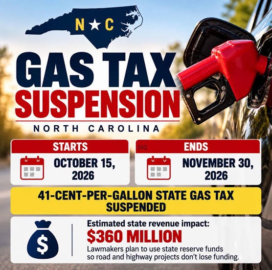
North Carolina is now home to the cheapest gas in the U.S.
The cost of a gallon of gas has dropped so sharply across North Carolina following Gov. Josh Stein’s signing of House Bill 3 that the Tar Heel State is now home to the cheapest gas in the nation. “Rising grocery, utility, and gas prices are making the costs too high for people across our state,” said Stein in a news release on the bill’s signing. “I am signing this bill to keep more money in people’s wallets, but this temporary relief is just one step. I remain committed to continuing to work with anyone who wants to make everyday living more affordable all year long – not just during election season.” Following the signing of the “Relief at the Pump” law, an Oct. 15 report from the American Automobile Association confirmed that North Carolina is now home to the cheapest gas in the nation. Here’s how much fuel costs in the state and just how long relief measures will last.
Why did gas prices drop so much in North Carolina?
On Friday, Oct. 9, Stein signed N.C.’s House Bill 3, also known as the “Relief at the Pump” bill, into law. The law temporarily eliminates the state’s motor fuel tax, replacing the lost revenue with reserve funds. HB 3 made gas 41 cents cheaper by the gallon in the state through Nov. 30.
What is the average price of gas in North Carolina? In the U.S.?
In North Carolina on Oct. 19, the average price for regular gas was $3.61 per gallon, according to AAA. The average price of regular gas countrywide was $4.29 per gallon.
What are gas prices like in Asheville, Western NC?
In the Asheville area, the average price for a gallon of regular gas was $3.73 as of Oct. 19, according to AAA. One month ago on the same date, before the bill’s signing, the price was $4.173.
Where are the lowest gas prices in NC? Highest gas prices in NC?
The Goldsboro area ranked lowest for gas prices in the state on Oct. 19, with the average cost for a gallon of regular gas placed at $3.453. The Norfolk-Virginia Beach-Newport News area was home to the highest prices, with an average of $3.745 per gallon.
What states have the highest gas prices?
As of an Oct. 15 AAA report, the five most expensive gas markets in the U.S. included:
-
-
- No. 1 – California ($6.23)
- No. 2 – Hawaii ($5.63)
- No. 3 – Washington ($5.42)
- No. 4 – Nevada ($5.42)
- No. 5 – Oregon ($4.97)
-
What states have the lowest gas prices? Does North Carolina have the cheapest gas in the U.S.?
Following the passing of HB 3, North Carolina is officially the state with the cheapest gas prices in the U.S. The nation’s least expensive gas can be found in the following states:
-
-
- No. 46 – Indiana ($3.89)
- No. 47 – Tennessee ($3.88)
- No. 48 – Texas ($3.83)
- No. 49 – Georgia ($3.77)
- No. 50 – North Carolina ($3.70)
-
Read more » click here
Storm Events
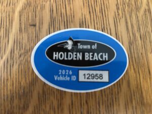 Hurricane Vehicle Decals
Property owners were provided with four (4) decals that were included in there water bill. It is important that you place your decals in your vehicle or in a safe place. A $10 fee will be assessed to anyone who needs to obtain either additional or replacement decals. Decals will not be issued in the 24-hour period before an anticipated order of evacuation.
The decals are your passes to get back onto the island to check your property in the event that an emergency would necessitate restricting access to the island. Decals must be displayed in the driver side lower left-hand corner of the windshield, where they are not obstructed by any other items. Officials must be able to clearly read the decal from outside the vehicle.
Property owners without a valid decal will not be allowed on the island during restricted access. No other method of identification is accepted in an emergency situation. Click here to visit the Town website to find out more information regarding decals and emergency situations.
NC General Statute 166A-19.22
Power of municipalities and counties to enact ordinances to deal with states of emergency.
Synopsis – The governing body may impose by declaration or enacted ordinance, prohibitions, and restrictions during a state of emergency. This includes the prohibition and restriction of movements of people in public places, including imposing a curfew; directing or compelling the voluntary or mandatory evacuation of all or part of the population, controlling ingress and egress of an emergency area, and providing for the closure of streets, roads, highways, bridges, public vehicular areas. All prohibitions and restrictions imposed by declaration or ordinance shall take effect immediately upon publication of the declaration unless the declaration sets a later time. The prohibitions and restrictions shall expire when they are terminated by the official or entity that imposed them, or when the state of emergency terminates.
Violation – Any person who violates any provisions of an ordinance or a declaration enacted or declared pursuant to this section shall be guilty of a Class 2 misdemeanor.
Hot Button Issues
Subjects that are important to people and about which they have strong opinions

Climate
For more information » click here.
There’s something happening here
What it is ain’t exactly clear
Flood Insurance Program
For more information » click here
National Flood Insurance Program: Reauthorization
Congress must periodically renew the NFIP’s statutory authority to operate. On September 30, 2026, the president signed legislation passed by Congress that extends the National Flood Insurance Program’s (NFIP’s) authorization to December 11, 2026.
Congress must now reauthorize the NFIP
by no later than 11:59 pm on December 11, 2026.

GenX
For more information » click here

Homeowners Insurance
For more information » click here
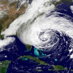
Hurricane Season
For more information » click here
Hurricane season runs from June 1 through November 30
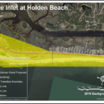
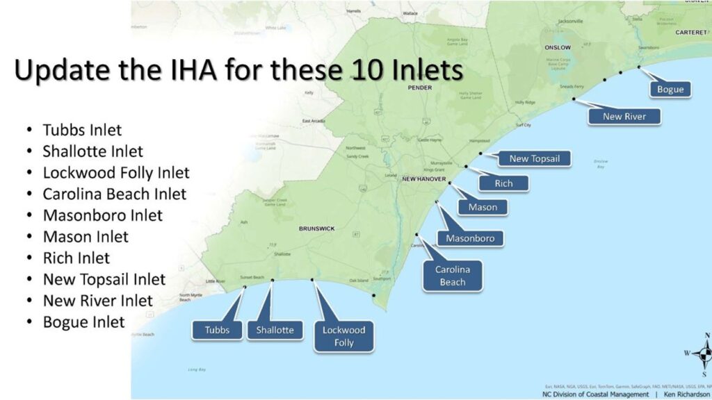
Inlet Hazard Areas
For more information » click here
.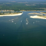
Lockwood Folly Inlet
For more information » click here.

Seismic Testing / Offshore Drilling
For more information » click here.

Offshore Wind Farms
For more information » click here
Things I Think I Think
 Eating out is one of the great little joys of life.
Restaurant Review:
Ratings reflect the reviewer’s reaction to food, ambience, and service, with price taken into consideration.
///// September 2026
Name: La Cucina Italian Grill
Cuisine: Italian
Location: 1780 Chandlers Lane, Sunset Beach NC
Contact: 910.579.9777 / https://www.lacucinasunsetbeach.com/
Food: Average / Very Good / Excellent / Exceptional
Service: Efficient / Proficient / Professional / Expert
Ambience: Drab / Plain / Distinct / Elegant
Cost: $25 Inexpensive <=20 / Moderate <=26 / Expensive <=35 / Exorbitant <=60
Rating: Three Stars
La Cucina is a local classic Italian restaurant, serving traditional Italian cuisine with a broad-based menu that offers something for everyone. It’s a comfortable, friendly, casual environment, nothing fancy, but very welcoming and the wait staff are very accommodating. Since it’s a small busy place, with seating for only fifty (50) people, if you want to eat there making reservations is advisable. We have always enjoyed the dining experience there. They are serving some of the best Italian cuisine in the area, it’s as good as it gets here. The food is very good, the portions are generous, and the prices for both the food and wine are reasonable. It’s an exceptional value, what’s not to like?
Dining Guide – Local * Lou’s Views
Dining Guide – North * Lou’s Views
Dining Guide – South * Lou’s Views
Restaurant Reviews – North * Lou’s Views
Restaurant Reviews – South * Lou’s Views
Book Review:
Read several books from The New York Times best sellers fiction list monthly
Selection represents this month’s pick of the litter
A blast from the past
The common thread running through Quinn’s historical novels is her focus on courageous women who challenge conventions and defy societal expectations.
 THE ALICE NETWORK by Kate Quinn / 2017
This historical fiction novel follows two women shaped by two world wars and linked across dual timelines by one profiteering villain. Charlie St. Clair, an unmarried pregnant American socialite, searches for her missing cousin after World War II, while Eve Gardiner, a traumatized World War I spy, belonged to a real-life female spy ring. When the two women meet, they join forces on a shared mission. Their intertwined stories alternate chapters: Charlie pursues the truth about her cousin Rose, presumed dead after the war, as Eve’s role in the Alice Network unfolds.
 THE HUNTRESS by Kate Quinn / 2019
This historical fiction novel follows three individuals united by a shared mission to bring Nazi war criminals to justice. Nina Markova, a Soviet pilot serving in the Red Army’s all-female bomber regiment. Ian Graham, a British war correspondent turned a Nazi hunter. Jordan McBride an aspiring photographer, in postwar Boston, becomes wary when her widowed father falls for an Austrian woman. As their paths converge, the three join forces and embark on a quest to uncover the true identity of the Huntress, a Nazi war criminal, and ensure that she is held accountable for her crimes.
 THE ROSE CODE by Kate Quinn / 2021
This historical fiction mystery unfolds in England during and after World War II. Three women, recruited as codebreakers at Bletchley Park, navigate the dangers of wartime intelligence across two timelines: the height of the conflict and its aftermath. United by secrecy, friendship, and betrayal, their intertwined lives are forever shaped by the demands of their covert work. Years later, unexpected circumstances force them to confront their past, reconcile their differences, and reunite to uncover a traitor hidden among their former colleagues.
That’s it for this newsletter
See you next month
Lou’s Views . HBPOIN
-
-
-
-
-
-
-
-
-
- Gather and disseminate information
- Identify the issues and determine how they affect you
- Act as a watchdog
- Grass roots monthly newsletter since 2008
-
-
-
-
-
-
-
-